
Beginner Off-Road Trails
Near Prescott Valley, Arizona
Explore All Beginner Trails Near Prescott Valley, Arizona
Beginner Off-Road Trails Near Prescott Valley, Arizona
Discover the best beginner-friendly off-road trails near you. These easier, lower-rated trails are a great place to start — browse trail maps, check difficulty ratings, and find your next adventure.
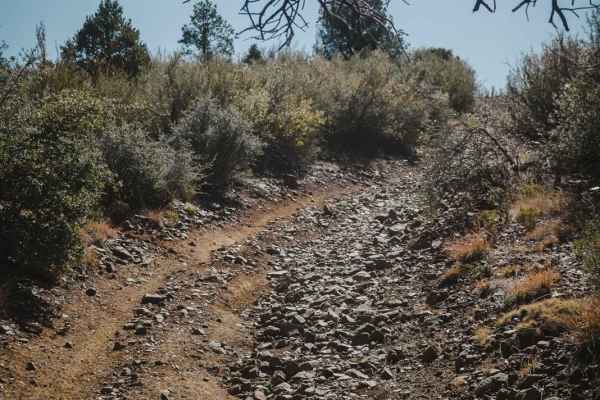
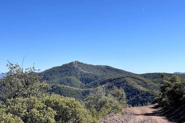
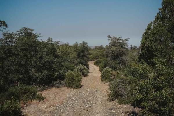
White Horse Tank
White Horse Tank is an easy 50-inch trail near Prescott, Arizona, that has some easy challenges such as loose rocks, loose dirt, and one long hill climb/descent that is full of chunky loose rock. This trail has fewer sections of rocks than the surrounding trails such as Nemo Spring, Salida, and Char...
Learn more about White Horse Tank
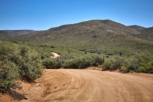
Ruins & Gold Pans
If you are looking for a short and easy dirt road with lots of outdoor activities, Ruins & Gold Pans offers just that. The start of this dirt road is just off of Walker Road and is before Lynx Lake. The road is a semi-maintained dirt road with washboards, small bumps, and little precipitation run-of...
Learn more about Ruins & Gold Pans
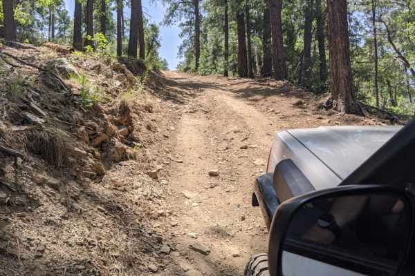
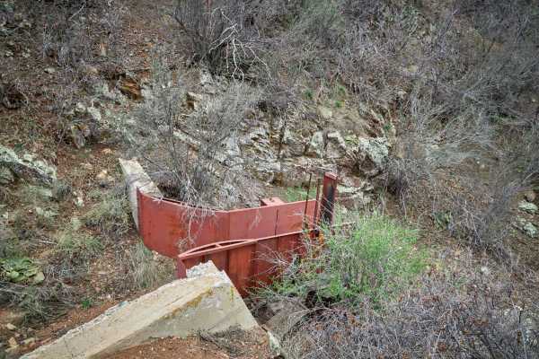
Bannie and Amulet Mine
This drive through ponderosa pines leads to two historic mine remains. Drivers may miss Bannie Mine, as it has little evidence left, but Amulet Mine features historic foundations and metal materials just off the side of the trail. Most of the trail is easy-going, but there is one steep hill climb. T...
Learn more about Bannie and Amulet Mine
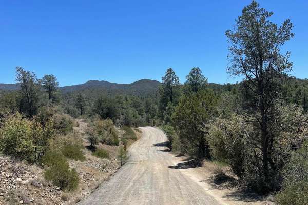
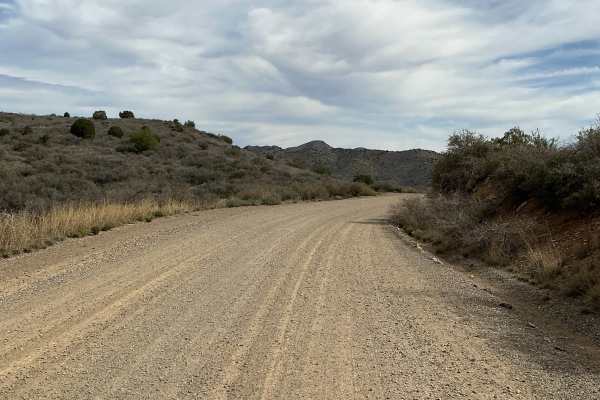
Pasture Blast
Pasture Blast is a wide rolling dirt road that cuts through the beautiful grassland of the Black Hills area outside of Prescott, AZ. Antelope, coyotes, and deer make this area their grazing ground due to the numerous water tanks in the area, as well as the abundance of food. Stunning views of the Mo...
Learn more about Pasture Blast
151 Spring Shelf
151 Spring Shelf is a road carved into the side of numerous hills in Prescott Valley. A shelf road, erosion hasn't claimed this trail just yet, though it is overgrown with vegetation. At pinch points, paint damage is all but guaranteed. Single lane, with little to no room to turn around, this trail ...
Learn more about 151 Spring Shelf
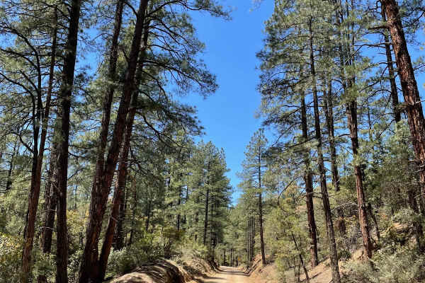
Exit Off Spruce Mountain Road
This dirt road is a route that branches off Spruce Mountain Lookout guided trail. The road starts off pretty mellow then starts to get steep and there are several sharp turns with loose rock scattered all over the surface of the trail. As you traverse down this trail, the road is very narrow so slow...
Learn more about Exit Off Spruce Mountain Road
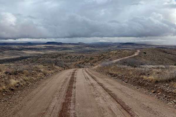
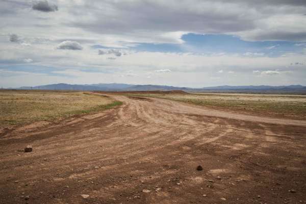
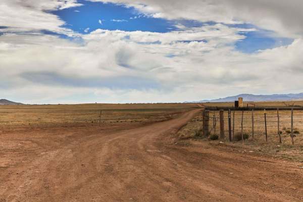
Orme Bypass
This route starts on the south side of Highway 169 and ends close to I-17. In dry conditions, this is a maintained dirt road that stretches 12.2 miles which any vehicle can make. If there has been moderate precipitation, parts of this road turn into very slippery clay-based mud with some slight uphi...
Learn more about Orme Bypass
Little Coyote
Dirt trail with lots of technical turns, rocks, ledges, and views of Prescott Valley and the Mingus Mountain area. Coyote Spring near the end, plus a charcoal Rock Kiln that was possibly used for Copper production. Traces of Native American habitation. Feeder trail to the Smiley Rock trail. Designat...
Learn more about Little Coyote
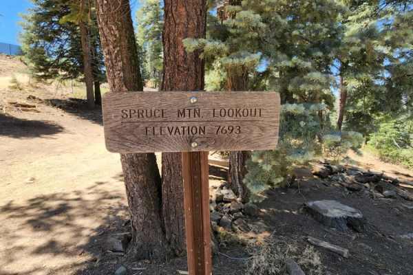
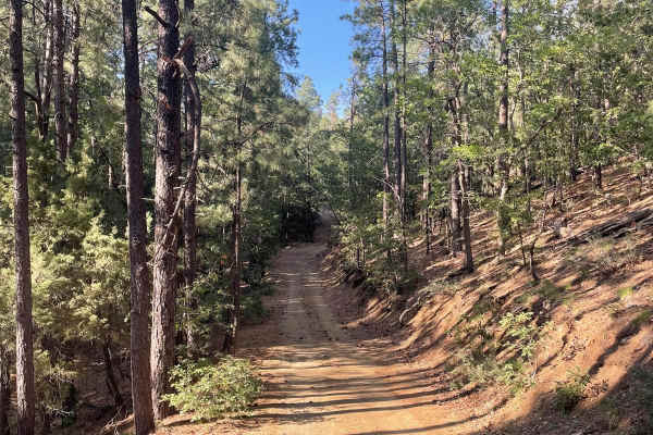
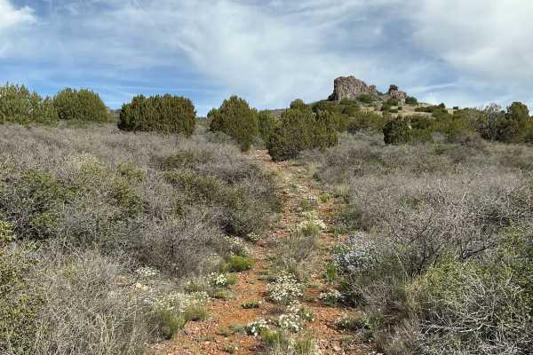
Spruce Mountain Lookout
This trail leads up to a fire lookout and a couple of awesome hikes. Picnic tables and a small restroom are at the top. There is a gate; it was open when this trail was run (June 2022), but may be closed. No camping on this road or at the lookout. This road is rocky with some dirt and gentle grades....
Learn more about Spruce Mountain Lookout
Breezy Pines Road
Breezy Pines Road climbs over 2,000 feet of elevation through Prescott National Forest's Bradshaw Mountains. The total mileage for this trail is just under 10 miles long and ends at the junction with the Mount Union Overlook trail. The majority of this trail is a maintained and dusty dirt road. You ...
Learn more about Breezy Pines Road
FS 105
Forest Service Road 105 is a well-maintained gravel road that branches off Forest Service Road 132. The surface of this trail looks to be maintained by road base frequency. There are a few small bumps and small uneven areas along the trail, but nothing to be concerned about. Use caution on this shor...
Learn more about FS 105
Jack Pine Road
This trail gives you access to hiking trails and provides great views of the valley down below. There is spotty cell phone service along the trail, better at the top. If you want a more challenging line, then choose the road to the right when you come to a "V". Unsure of camping regulations, but the...
Learn more about Jack Pine Road
Mingus to Cherry Vista FSR 132
This trail will take you from Mingus to the quaint little town of Cherry. Cherry is an old still inhabited ghost town established in the 1880's. It is worth checking out, as many of the original buildings still exist. There is no food or gas in Cherry so be aware of that. The trail is 12 miles of th...
Learn more about Mingus to Cherry Vista FSR 132
Uncle Sam Road
Uncle Sam Road is a gem in the land of overgrown underbrush and paint damage. This trail is wide and beautiful, with no obstacles whatsoever. A couple of beautiful wash crossings could prove challenging during monsoon season or after storms, but the ride is gorgeous, and the crossings have campsites...
Learn more about Uncle Sam Road
Bc1211 & Bc1212 Hill Climb
This short but rewarding trail is only 0.4 miles long. You will start on a fairly easy trail that has some small bumps accompanied by small loose rocks. You will travel a short distance to the East. After the eastern leg of the trail, the trail's direction then turns due North and starts to climb in...
Learn more about Bc1211 & Bc1212 Hill Climb
Schoolhouse Gulch
Schoolhouse Gulch is a multi-use trail in Prescott, Arizona, and is probably the easiest ATV trail in the area. It's a road-width trail that goes straight and flat through a forest floor. It starts at a staging area with parking for several vehicles right off Highway 89. There is a pinch point for 5...
Learn more about Schoolhouse Gulch
Ponderosa
Ponderosa is an easy ATV trail near Prescott, Arizona that starts at the Schoolhouse Gulch Trailhead on the north end and connects to Maripai Road on the south end. Going south to north, it starts out on top of the mountain on a ridge line, as a two-track full of rocks and gravel, in between lots of...
Learn more about Ponderosa
Bc1014
Bc1014 is a well-maintained gravel road that stretches just over a mile long. The northern part of this road is fairly steep with a few turns as you descend down towards private property. The trail will continue until you reach a locked gate that will not let you travel any farther. This road is ext...
Learn more about Bc1014
Woodchute Mtn/Smiley Rock Connector PART 2
This trail provides a wide gentle drive through the beautiful rolling pastures outside of Prescott, AZ. A mellow backway into the nearby Smiley Rock Loop, this trail is two lanes wide, gradually narrowing as you head East. Wildlife can be viewed along this trail, most commonly horses and antelope. T...
Learn more about Woodchute Mtn/Smiley Rock Connector PART 2

Woodchute Mtn/Smiley Rock Connector
This trail provides a wide gentle drive through the beautiful rolling pastures outside of Prescott, AZ. A mellow backway into the nearby Smiley Rock Loop, this trail is two lanes wide, gradually narrowing as you head East, but not to worry, dear traveler, it stays wide enough to drive comfortably. W...
Learn more about Woodchute Mtn/Smiley Rock Connector
Beginner ATV trails near Prescott Valley, Arizona
Explore ATV-friendly trails near you. These trails are accessible for vehicles up to 50 inches wide, perfect for ATVs and smaller off-road machines.
White Horse Tank
White Horse Tank is an easy 50-inch trail near Prescott, Arizona, that has some easy challenges such as loose rocks, loose dirt, and one long hill climb/descent that is full of chunky loose rock. This trail has fewer sections of rocks than the surrounding trails such as Nemo Spring, Salida, and Char...
Learn more about White Horse Tank
Ruins & Gold Pans
If you are looking for a short and easy dirt road with lots of outdoor activities, Ruins & Gold Pans offers just that. The start of this dirt road is just off of Walker Road and is before Lynx Lake. The road is a semi-maintained dirt road with washboards, small bumps, and little precipitation run-of...
Learn more about Ruins & Gold Pans
Bannie and Amulet Mine
This drive through ponderosa pines leads to two historic mine remains. Drivers may miss Bannie Mine, as it has little evidence left, but Amulet Mine features historic foundations and metal materials just off the side of the trail. Most of the trail is easy-going, but there is one steep hill climb. T...
Learn more about Bannie and Amulet Mine
Pasture Blast
Pasture Blast is a wide rolling dirt road that cuts through the beautiful grassland of the Black Hills area outside of Prescott, AZ. Antelope, coyotes, and deer make this area their grazing ground due to the numerous water tanks in the area, as well as the abundance of food. Stunning views of the Mo...
Learn more about Pasture Blast
Beginner UTV/side-by-side trails near Prescott Valley, Arizona
Find UTV and side-by-side trails near you. These trails accommodate vehicles up to 60 inches wide, ideal for UTVs, side-by-sides, and wider off-road rigs.
Ruins & Gold Pans
If you are looking for a short and easy dirt road with lots of outdoor activities, Ruins & Gold Pans offers just that. The start of this dirt road is just off of Walker Road and is before Lynx Lake. The road is a semi-maintained dirt road with washboards, small bumps, and little precipitation run-of...
Learn more about Ruins & Gold Pans
Bannie and Amulet Mine
This drive through ponderosa pines leads to two historic mine remains. Drivers may miss Bannie Mine, as it has little evidence left, but Amulet Mine features historic foundations and metal materials just off the side of the trail. Most of the trail is easy-going, but there is one steep hill climb. T...
Learn more about Bannie and Amulet Mine
Pasture Blast
Pasture Blast is a wide rolling dirt road that cuts through the beautiful grassland of the Black Hills area outside of Prescott, AZ. Antelope, coyotes, and deer make this area their grazing ground due to the numerous water tanks in the area, as well as the abundance of food. Stunning views of the Mo...
Learn more about Pasture Blast
151 Spring Shelf
151 Spring Shelf is a road carved into the side of numerous hills in Prescott Valley. A shelf road, erosion hasn't claimed this trail just yet, though it is overgrown with vegetation. At pinch points, paint damage is all but guaranteed. Single lane, with little to no room to turn around, this trail ...
Learn more about 151 Spring Shelf
The onX Offroad Difference
onX Offroad combines trail photos, descriptions, difficulty ratings, width restrictions, seasonality, and more in a user-friendly interface. Available on all devices, with offline access and full compatibility with CarPlay and Android Auto. Discover what you're missing today!
Open Trail Map