
Beginner Off-Road Trails
Near Dewey-Humboldt, Arizona
Explore All Beginner Trails Near Dewey-Humboldt, Arizona
Beginner Off-Road Trails Near Dewey-Humboldt, Arizona
Discover the best beginner-friendly off-road trails near you. These easier, lower-rated trails are a great place to start — browse trail maps, check difficulty ratings, and find your next adventure.
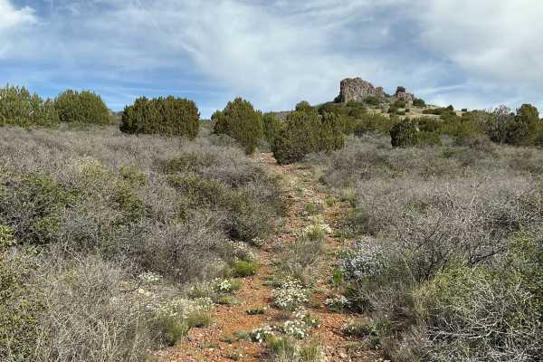
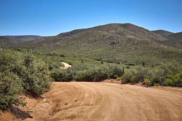
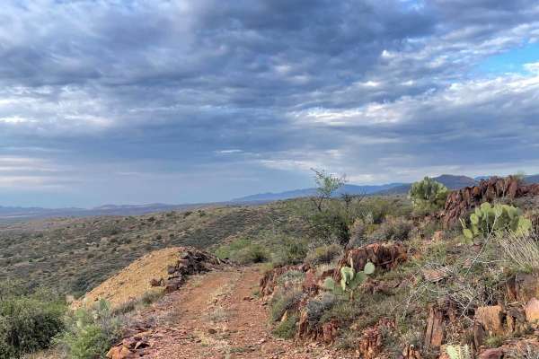
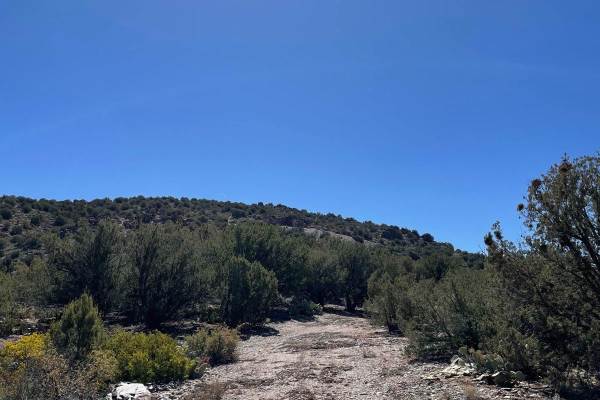
Bc1211 & Bc1212 Hill Climb
This short but rewarding trail is only 0.4 miles long. You will start on a fairly easy trail that has some small bumps accompanied by small loose rocks. You will travel a short distance to the East. After the eastern leg of the trail, the trail's direction then turns due North and starts to climb in...
Learn more about Bc1211 & Bc1212 Hill Climb
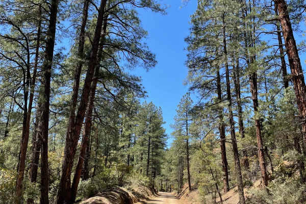
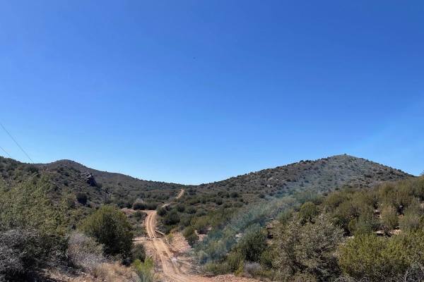
Breezy Pines Road
Breezy Pines Road climbs over 2,000 feet of elevation through Prescott National Forest's Bradshaw Mountains. The total mileage for this trail is just under 10 miles long and ends at the junction with the Mount Union Overlook trail. The majority of this trail is a maintained and dusty dirt road. You ...
Learn more about Breezy Pines Road
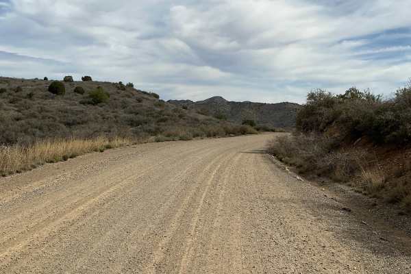
Bc1014
Bc1014 is a well-maintained gravel road that stretches just over a mile long. The northern part of this road is fairly steep with a few turns as you descend down towards private property. The trail will continue until you reach a locked gate that will not let you travel any farther. This road is ext...
Learn more about Bc1014
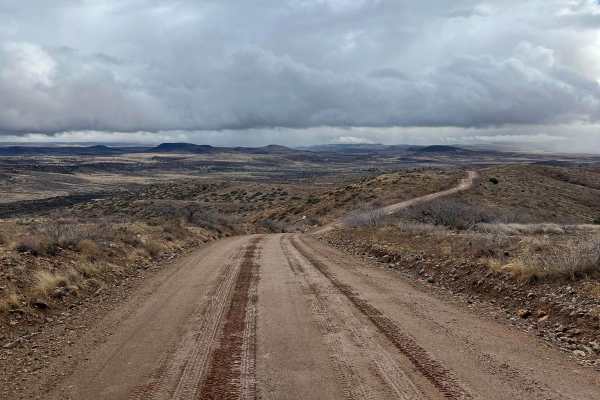
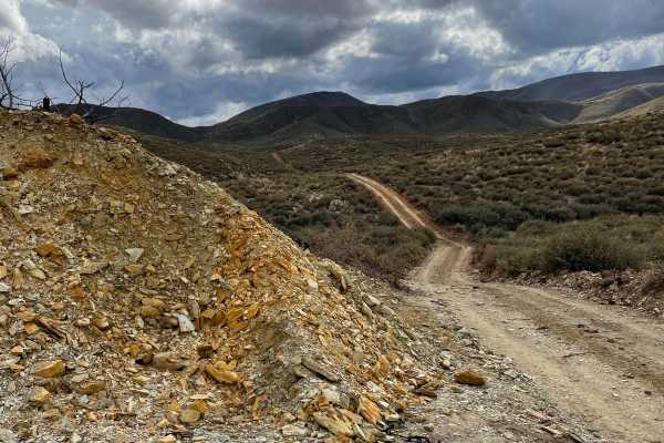
Orme Bypass
This route starts on the south side of Highway 169 and ends close to I-17. In dry conditions, this is a maintained dirt road that stretches 12.2 miles which any vehicle can make. If there has been moderate precipitation, parts of this road turn into very slippery clay-based mud with some slight uphi...
Learn more about Orme Bypass
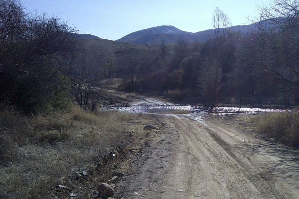
Grapevine
Grapevine road is a rocky, sandy, and gravel mixed surface road that runs through Prescott National Forest. There is a gate about the middle of the trail, please remember to close it behind you. The first section runs through private property. There are two water crossings that change depending on t...
Learn more about Grapevine
9211A to Buckhorn Trail
This trail starts on the south side of FS Road 87a and immediately crosses Grapevine Creek which is the biggest obstacle on this trail. The trail then leads to a green gate that you need to open and close behind you. As you climb into the Prescott National Forest foothills, there is an old building ...
Learn more about 9211A to Buckhorn Trail
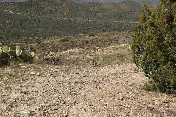
White Horse Tank
White Horse Tank is an easy 50-inch trail near Prescott, Arizona, that has some easy challenges such as loose rocks, loose dirt, and one long hill climb/descent that is full of chunky loose rock. This trail has fewer sections of rocks than the surrounding trails such as Nemo Spring, Salida, and Char...
Learn more about White Horse Tank
Pipeline Rollercoaster
This trail lives up to its name with sharp, steep hills that dive into dry washes. As you pass over these washes, you quickly ascend back up another mountain. This trail follows a natural gas line, so be aware of signs on the trail. The hills in the Northwest section are steeped, consisting of small...
Learn more about Pipeline Rollercoaster
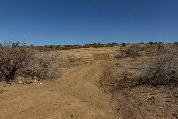
Uncle Sam Road
Uncle Sam Road is a gem in the land of overgrown underbrush and paint damage. This trail is wide and beautiful, with no obstacles whatsoever. A couple of beautiful wash crossings could prove challenging during monsoon season or after storms, but the ride is gorgeous, and the crossings have campsites...
Learn more about Uncle Sam Road
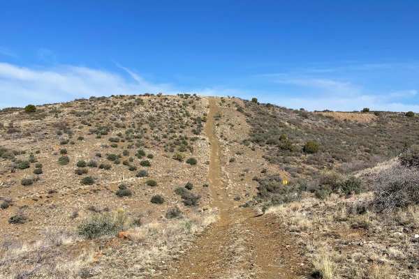
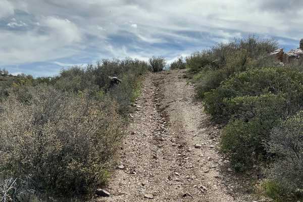
Quarried Hilltop # 2
Quarried Hilltop # 2 is a very short but fun trail. The entire way is a hill climb with a few sharp switchbacks. As you climb, the trail's surface has small loose rocks accompanied by a few uneven sections. While climbing this trail, there is a fairly sharp switchback on a short, steep grade. After ...
Learn more about Quarried Hilltop # 2
Mystery Tank
Mystery Tank trail is just a mile long, and one of the starting points is off of Copper Road. The trail is fairly rutted in this area, with erosion present. The trail will then drop down to a tank that is unnamed on the map, hence the name Mystery Tank. From this tank, the trail horseshoes to the so...
Learn more about Mystery Tank
Bc1036
BC1036 is a rocky trail featuring erosion, loose hills, and washouts along the route. The terrain requires careful navigation, especially on climbs where loose rock can affect traction. While the trail presents some challenges, it remains manageable for those comfortable with uneven surfaces. One ba...
Learn more about Bc1036
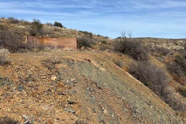
Tri-Metals Mine
Tri-Metals Mine is a very short trail just over a quarter mile long. This guided trail takes you to the old mine site, which can be easily missed from other trails in the area. The trail is fairly easy, with a dirt surface and small scattered loose rocks. You can drive up to the edge of the tailings...
Learn more about Tri-Metals Mine
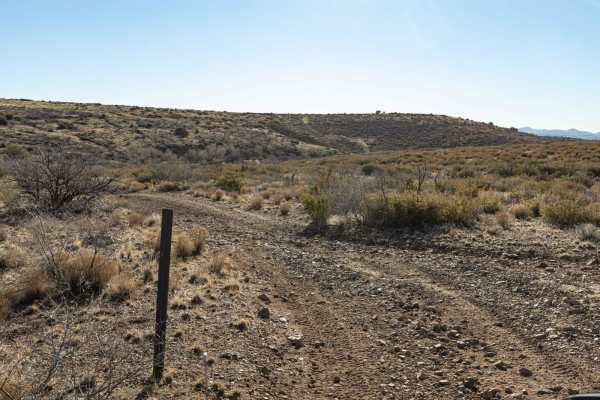
Copper Road Connector #3
This trail is described as laid-back and easy-going. It is well-maintained, with some small bumpy areas. As you travel northeast, you will pass a tank that is under construction. You will pass two gates, one of which has a sign stating "Do Not Enter." The trail was halted from being mapped any furth...
Learn more about Copper Road Connector #3
Bannie and Amulet Mine
This drive through ponderosa pines leads to two historic mine remains. Drivers may miss Bannie Mine, as it has little evidence left, but Amulet Mine features historic foundations and metal materials just off the side of the trail. Most of the trail is easy-going, but there is one steep hill climb. T...
Learn more about Bannie and Amulet Mine
Copper Road Connector
This trail is a well-maintained dirt road that connects to Copper Road and travels to the East. There are several somewhat steep parts while traversing this trail but nothing too serious. The trail is pretty maintained the entire way and ends at a locked gate to private property.
Learn more about Copper Road Connector
Stoddard Mine
The road to Stoddard Mine is a short trail but very steep in areas. The beginning of this trail starts off of Copper Road Connector and quickly starts to climb through junipers. As you are passing through the junipers, the trail starts to traverse sharply uphill. The hill climb will turn to the left...
Learn more about Stoddard Mine
Yarbo Mine
The trail to the remains of the Yarbo Mine is just shy of two miles long. This trail is very rocky when descending into Yarber Wash and the last 250 yards to the Yarbo Mine. The biggest obstacle you will encounter is right at the beginning of the trail, which is a decent uneven rut. Use 4WD and lock...
Learn more about Yarbo Mine
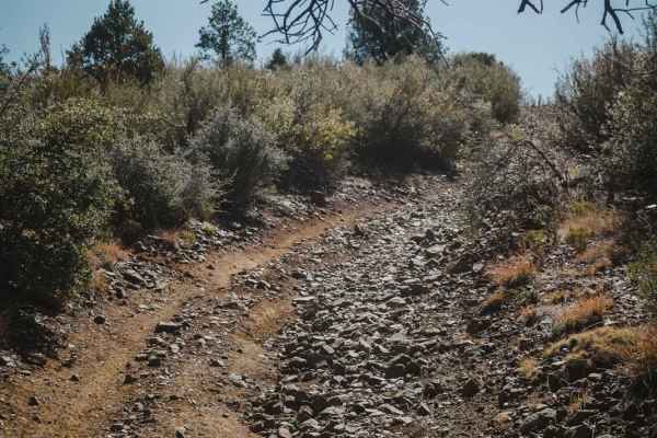
9602W
9602W is a rugged, rocky one-lane trail that weaves through hills and multiple wash crossings. Erosion has shaped much of the route, creating uneven terrain that requires careful driving. The trail does not follow a marked path, so route-finding skills are essential. With no cell service in the area...
Learn more about 9602W
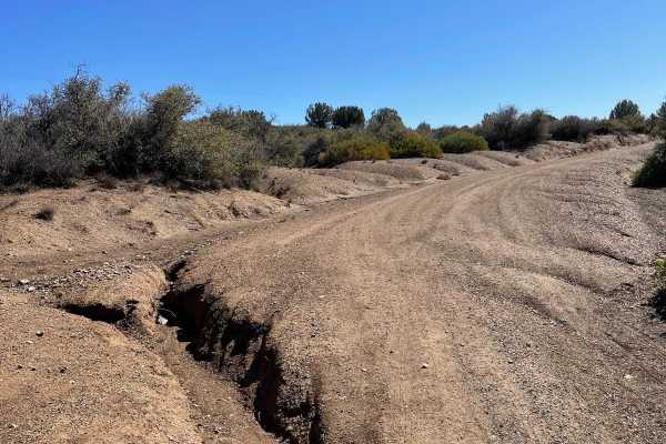
Copper Road Connector #2
This short semi-circle is a fun and somewhat maintained dirt trail. The road is fairly even but looks to be a muddy mess if there has been any moderate moisture. Use caution; there are lots of small ruts that run across the road's surface. These ruts are fairly deep and could blow a tire if you are ...
Learn more about Copper Road Connector #2
Beginner ATV trails near Dewey-Humboldt, Arizona
Explore ATV-friendly trails near you. These trails are accessible for vehicles up to 50 inches wide, perfect for ATVs and smaller off-road machines.
Bc1211 & Bc1212 Hill Climb
This short but rewarding trail is only 0.4 miles long. You will start on a fairly easy trail that has some small bumps accompanied by small loose rocks. You will travel a short distance to the East. After the eastern leg of the trail, the trail's direction then turns due North and starts to climb in...
Learn more about Bc1211 & Bc1212 Hill Climb
Breezy Pines Road
Breezy Pines Road climbs over 2,000 feet of elevation through Prescott National Forest's Bradshaw Mountains. The total mileage for this trail is just under 10 miles long and ends at the junction with the Mount Union Overlook trail. The majority of this trail is a maintained and dusty dirt road. You ...
Learn more about Breezy Pines Road
Bc1014
Bc1014 is a well-maintained gravel road that stretches just over a mile long. The northern part of this road is fairly steep with a few turns as you descend down towards private property. The trail will continue until you reach a locked gate that will not let you travel any farther. This road is ext...
Learn more about Bc1014
Orme Bypass
This route starts on the south side of Highway 169 and ends close to I-17. In dry conditions, this is a maintained dirt road that stretches 12.2 miles which any vehicle can make. If there has been moderate precipitation, parts of this road turn into very slippery clay-based mud with some slight uphi...
Learn more about Orme Bypass
Beginner UTV/side-by-side trails near Dewey-Humboldt, Arizona
Find UTV and side-by-side trails near you. These trails accommodate vehicles up to 60 inches wide, ideal for UTVs, side-by-sides, and wider off-road rigs.
Bc1211 & Bc1212 Hill Climb
This short but rewarding trail is only 0.4 miles long. You will start on a fairly easy trail that has some small bumps accompanied by small loose rocks. You will travel a short distance to the East. After the eastern leg of the trail, the trail's direction then turns due North and starts to climb in...
Learn more about Bc1211 & Bc1212 Hill Climb
Breezy Pines Road
Breezy Pines Road climbs over 2,000 feet of elevation through Prescott National Forest's Bradshaw Mountains. The total mileage for this trail is just under 10 miles long and ends at the junction with the Mount Union Overlook trail. The majority of this trail is a maintained and dusty dirt road. You ...
Learn more about Breezy Pines Road
Bc1014
Bc1014 is a well-maintained gravel road that stretches just over a mile long. The northern part of this road is fairly steep with a few turns as you descend down towards private property. The trail will continue until you reach a locked gate that will not let you travel any farther. This road is ext...
Learn more about Bc1014
Orme Bypass
This route starts on the south side of Highway 169 and ends close to I-17. In dry conditions, this is a maintained dirt road that stretches 12.2 miles which any vehicle can make. If there has been moderate precipitation, parts of this road turn into very slippery clay-based mud with some slight uphi...
Learn more about Orme Bypass
The onX Offroad Difference
onX Offroad combines trail photos, descriptions, difficulty ratings, width restrictions, seasonality, and more in a user-friendly interface. Available on all devices, with offline access and full compatibility with CarPlay and Android Auto. Discover what you're missing today!
Open Trail Map