
Beginner Off-Road Trails
Near Poso Park, California
Explore All Beginner Trails Near Poso Park, California
Beginner Off-Road Trails Near Poso Park, California
Discover the best beginner-friendly off-road trails near you. These easier, lower-rated trails are a great place to start — browse trail maps, check difficulty ratings, and find your next adventure.
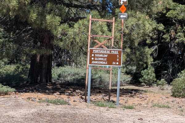
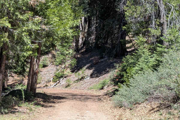
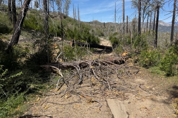
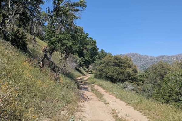
Sugarloaf
Sugarloaf departs from the village of Sugarloaf and climbs over 1,400 feet in just under 4 miles up to Portuguese Pass and Portuguese Meadows Road, serving as a key artery providing access to numerous trails in the surrounding network. The trail winds along the canyon with beautiful views of the for...
Learn more about Sugarloaf
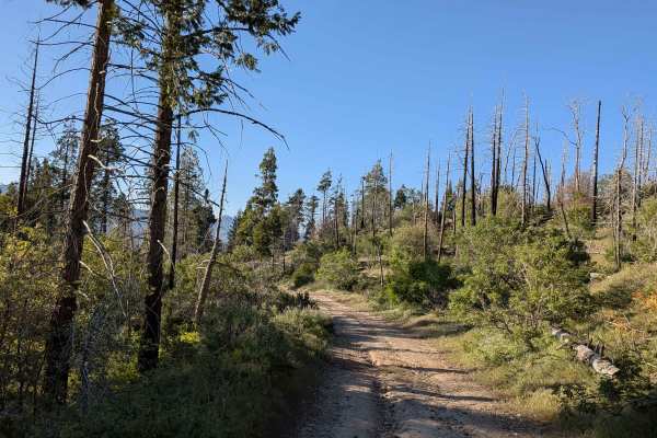
Jack Ranch - FS 24S05
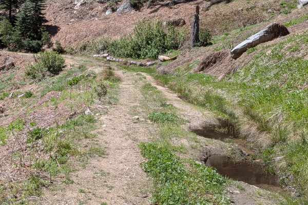
Jack Ranch FS24S05 departs from Capinero and climbs 366 feet in just over 3 miles along a shelf road tracing the White River through Dark Canyon. The route is enclosed by very thick pine trees within Sequoia National Forest throughout. Small waterfalls appear along the trail, and the White River Cam...
Learn more about Jack Ranch - FS 24S05
Capinero - FS 23S05
Despite the significant elevation loss of 1,100 feet, the hard-packed dirt and gravel surface is well managed and the switchbacks are gradual enough to keep this accessible to street legal vehicles. The single vehicle width and shelf road character require steady attention, particularly through the ...
Learn more about Capinero - FS 23S05
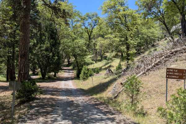
Pine Flat - FS 23S05
Pine Flat FS23S05 departs from Pine Flat and climbs its way toward the White River, gaining over 700 feet and dropping over 300 feet across 3 miles along a shelf road above Capinero Creek. The trail is lined with oak trees and some pine trees throughout, giving it a warmer and more open character th...
Learn more about Pine Flat - FS 23S05
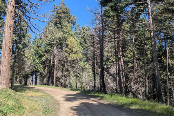
Fir Camp - FS 24S22
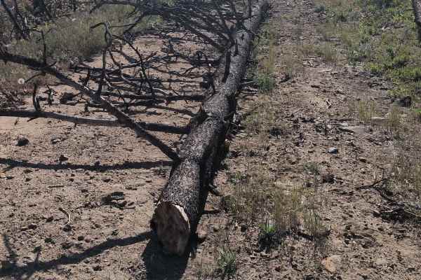
Fir Camp FS 24S22 is a short trail climbing to Fir Camp Saddle while also serving as a useful cutoff connector between Sugarloaf Road and Guernsey FS 24S29. The trail runs along a shelf road lined with large pine trees, with remnants of the 2016 Cedar Forest Fire visible throughout. Nice views of th...
Learn more about Fir Camp - FS 24S22
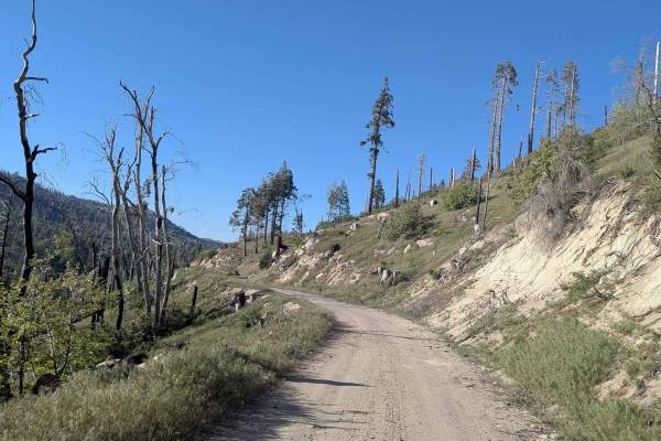
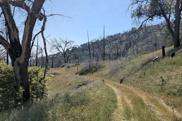
Portuguese Meadow - FS 24S15
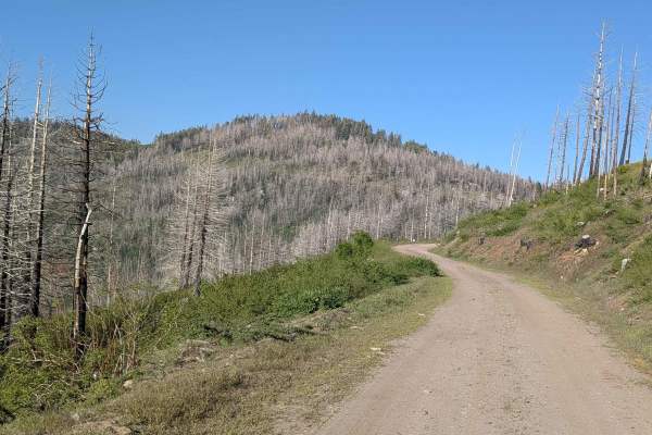
Portuguese Meadow FS 24S15 departs from Highway 155 and runs along a shelf road through green brush, grasses, and tall pine trees within Sequoia National Forest. Evidence of the 2021 French Fire is very evident throughout the route. Beautiful views of the valleys below and mountains in the distance ...
Learn more about Portuguese Meadow - FS 24S15
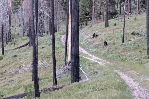
Sunday Peak Trail
Sunday Peak Trail is a short out-and-back departing from Portuguese Meadow Road into a beautiful and remote corner of Sequoia National Forest near Sunday Peak. The trail runs along a shelf road through pine trees, with the heavy aftermath of the 2021 French Fire visible in the form of numerous burne...
Learn more about Sunday Peak Trail
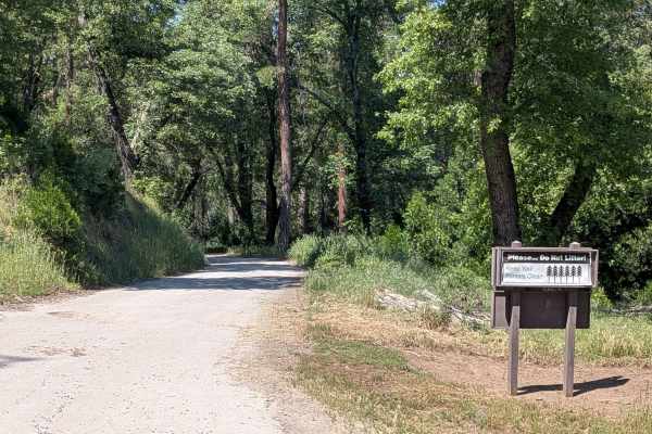
Deer Creek Mill - FS 23S04
Deer Creek FS 23S04 departs from Pine Flat Road through grassy meadows and rolling hills lined with oak trees. Power lines run parallel to the trail and serve as a useful navigation reference along the route. The trail is currently closed approximately 1 mile in with a posted closure sign. Do not pr...
Learn more about Deer Creek Mill - FS 23S04
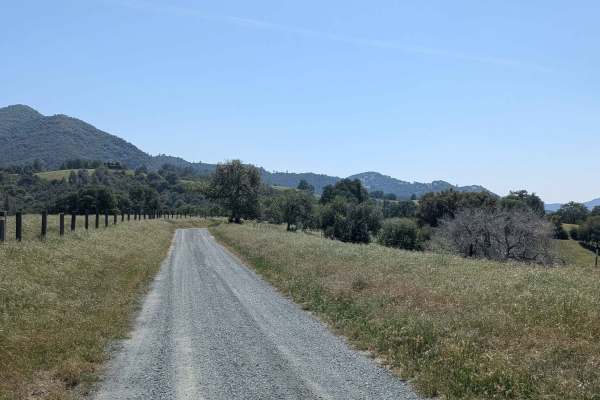
Green for Greenhorn
This is a great, flowy dirt road that offers some of the best views overlooking the Kern River Valley area. The path follows the natural curves of the mountainside, giving you plenty of chances to look out over the landscape as you ride. It’s a smooth and scenic stretch that feels very open, though ...
Learn more about Green for Greenhorn
Calf Creek - FS 25516
Calf Creek (FS 25S16) departs from Portuguese Meadow and climbs near Black Mountain Saddle at 6,250 feet in elevation. It is a 8.5 miles of out-and-back travel through dense pine forest. The trail is lined with numerous old, dead trees that have been pushed to the sides of the road, requiring occasi...
Learn more about Calf Creek - FS 25516

Wendy Gap - FS 25S17
Wendy Gap FS 25S17 departs from Rancheria Road near the Summit Forest Service Ranger Station and loops back to the same road through the heart of Sequoia National Forest. The trail runs along a shelf road for the majority of its length, delivering canyon and valley views below and forested mountain ...
Learn more about Wendy Gap - FS 25S17
Rancheria Spur - FS 25S15C
Rancheria Spur FS 25S15C is a smooth, well-maintained shelf road spur off Rancheria Road that cuts through a pine forest still bearing visible signs of the 2021 French Fire. Glimpses of the canyon below, the surrounding mountains, and Lake Isabella appear through the trees as the trail progresses. T...
Learn more about Rancheria Spur - FS 25S15C
Black Mountain Saddle - FS 32E59
Black Mountain Saddle (FS 32E59) branches off Calf Creek and pushes through a grass and pine forest corridor within Sequoia National Forest, much of which bears heavy evidence of the 2021 French Fire. The trail is now a 3-mile out-and-back as the connecting trail at the far end no longer exists, mak...
Learn more about Black Mountain Saddle - FS 32E59

Black Mountain - FS 32E360
Black Mountain FS 32E360 winds through grass and tall pine trees within Sequoia National Forest, climbing over 500 feet and dropping over 200 feet in just under 2 miles. Evidence of the 2021 French Fire is visible throughout. Views of the surrounding hillsides and mountains open up as the trail gain...
Learn more about Black Mountain - FS 32E360
Chute Springs - FS 23S68
Chute Springs FS 23S68 departs from Highway M504 and runs along a shelf road high above the valley and canyon below through Sequoia National Forest. The trail is lined with oak and pine trees, green grass, and other bushes, with overgrown grass encroaching on the trail in sections. Evidence of the 2...
Learn more about Chute Springs - FS 23S68
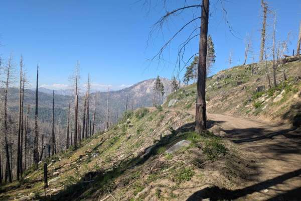
Starvation Creek - FS 23S65
Starvation Creek FS 23S65 winds through rolling hills within Sequoia National Forest through what was once a mature forest, now heavily impacted by the 2021 Windy Fire. Most of the trees along the route are burned, giving the landscape an open and stark character. Overgrown grass has taken over much...
Learn more about Starvation Creek - FS 23S65
Cookes Peak - FS 25S21
Cookes Peak (FS 25S21) departs and returns to Rancheria Road North, running along a shelf road with consistent views down into Lake Isabella, the valley below, and the mountains across the way. The dirt and sand surface narrows to as little as one vehicle wide in places. Evidence of the 2021 French ...
Learn more about Cookes Peak - FS 25S21
Shirley Meadows - FS 25S31
Shirley Meadows FS 25S31 departs from Rancheria Road and pushes into a thick stand of tall pine trees within Sequoia National Forest. The dense forest canopy and shelf road character give this trail a different feel from the more open desert and lakeshore routes in the surrounding network. Note that...
Learn more about Shirley Meadows - FS 25S31
Frank - FS 26S07
Frank FS 26S07 departs from Rancheria Road and runs along a narrow shelf road through grass and pine forest, much of which shows significant burn damage from the 2021 French Fire. Views of the valley and canyons below appear along the shelf sections. The trail currently ends earlier than its full ex...
Learn more about Frank - FS 26S07
Rhymes - FS 26S19
Rhymes FS 26S19 branches off Rancheria Road North and runs along a shelf road for the majority of its length, with a significant drop off into the canyon below throughout. The hard-packed dirt surface is consistent, and the trail is open to all vehicle types. Evidence of the 2021 French Fire is visi...
Learn more about Rhymes - FS 26S19
Beginner ATV trails near Poso Park, California
Explore ATV-friendly trails near you. These trails are accessible for vehicles up to 50 inches wide, perfect for ATVs and smaller off-road machines.
Sugarloaf
Sugarloaf departs from the village of Sugarloaf and climbs over 1,400 feet in just under 4 miles up to Portuguese Pass and Portuguese Meadows Road, serving as a key artery providing access to numerous trails in the surrounding network. The trail winds along the canyon with beautiful views of the for...
Learn more about Sugarloaf
Jack Ranch - FS 24S05
Jack Ranch FS24S05 departs from Capinero and climbs 366 feet in just over 3 miles along a shelf road tracing the White River through Dark Canyon. The route is enclosed by very thick pine trees within Sequoia National Forest throughout. Small waterfalls appear along the trail, and the White River Cam...
Learn more about Jack Ranch - FS 24S05
Fir Camp - FS 24S22
Fir Camp FS 24S22 is a short trail climbing to Fir Camp Saddle while also serving as a useful cutoff connector between Sugarloaf Road and Guernsey FS 24S29. The trail runs along a shelf road lined with large pine trees, with remnants of the 2016 Cedar Forest Fire visible throughout. Nice views of th...
Learn more about Fir Camp - FS 24S22
Sunday Peak Trail
Sunday Peak Trail is a short out-and-back departing from Portuguese Meadow Road into a beautiful and remote corner of Sequoia National Forest near Sunday Peak. The trail runs along a shelf road through pine trees, with the heavy aftermath of the 2021 French Fire visible in the form of numerous burne...
Learn more about Sunday Peak Trail
Beginner UTV/side-by-side trails near Poso Park, California
Find UTV and side-by-side trails near you. These trails accommodate vehicles up to 60 inches wide, ideal for UTVs, side-by-sides, and wider off-road rigs.
Sugarloaf
Sugarloaf departs from the village of Sugarloaf and climbs over 1,400 feet in just under 4 miles up to Portuguese Pass and Portuguese Meadows Road, serving as a key artery providing access to numerous trails in the surrounding network. The trail winds along the canyon with beautiful views of the for...
Learn more about Sugarloaf
Jack Ranch - FS 24S05
Jack Ranch FS24S05 departs from Capinero and climbs 366 feet in just over 3 miles along a shelf road tracing the White River through Dark Canyon. The route is enclosed by very thick pine trees within Sequoia National Forest throughout. Small waterfalls appear along the trail, and the White River Cam...
Learn more about Jack Ranch - FS 24S05
Fir Camp - FS 24S22
Fir Camp FS 24S22 is a short trail climbing to Fir Camp Saddle while also serving as a useful cutoff connector between Sugarloaf Road and Guernsey FS 24S29. The trail runs along a shelf road lined with large pine trees, with remnants of the 2016 Cedar Forest Fire visible throughout. Nice views of th...
Learn more about Fir Camp - FS 24S22
Sunday Peak Trail
Sunday Peak Trail is a short out-and-back departing from Portuguese Meadow Road into a beautiful and remote corner of Sequoia National Forest near Sunday Peak. The trail runs along a shelf road through pine trees, with the heavy aftermath of the 2021 French Fire visible in the form of numerous burne...
Learn more about Sunday Peak Trail
The onX Offroad Difference
onX Offroad combines trail photos, descriptions, difficulty ratings, width restrictions, seasonality, and more in a user-friendly interface. Available on all devices, with offline access and full compatibility with CarPlay and Android Auto. Discover what you're missing today!
Open Trail Map