
Beginner Off-Road Trails
Near Penn Valley, California
Explore All Beginner Trails Near Penn Valley, California
Beginner Off-Road Trails Near Penn Valley, California
Discover the best beginner-friendly off-road trails near you. These easier, lower-rated trails are a great place to start — browse trail maps, check difficulty ratings, and find your next adventure.
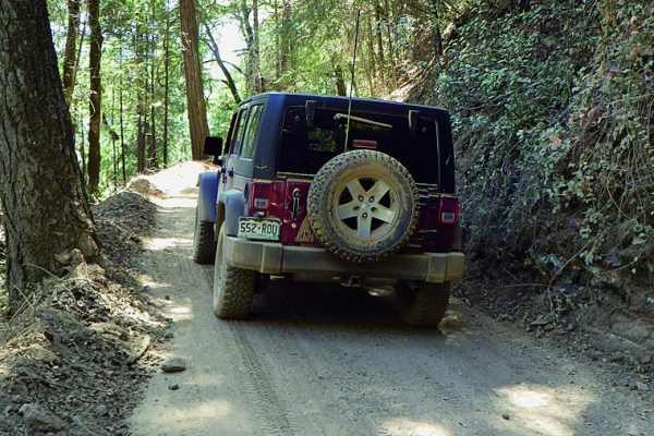
Shirttail Canyon
Shirttail Canyon is an easy, scenic loop ideal for stock four-wheel-drive vehicles and high-clearance SUVs looking for a relaxed journey through California's gold country. Starting just off Interstate 80 in Colfax, the route begins as a winding paved road that climbs into the Sierra foothills, passi...
Learn more about Shirttail Canyon
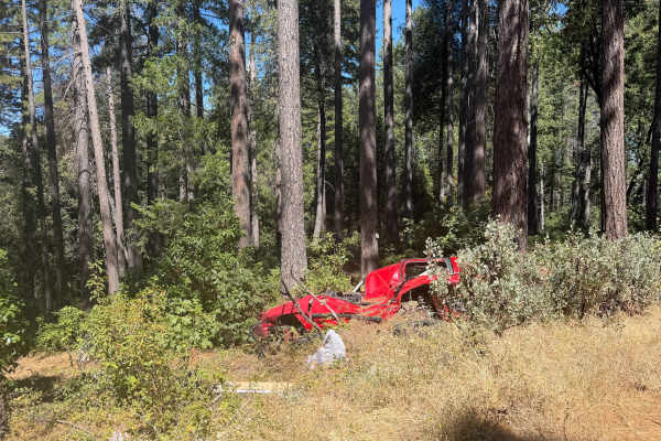
Milk Ranch - FS 19N04
Milk Ranch - FS 19N04 serves as an essential backcountry connector linking Plantation Road - FS 19N16 to Forest Service Road 21, providing dependable throughput across the undulating foothill ridges. Situated in Plumas National Forest, the track winds through a lush, vibrant canopy of towering ponde...
Learn more about Milk Ranch - FS 19N04
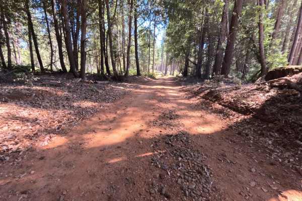
Milk - FS 19N00
Milk - FS 19N00 is a peaceful woodland connector branching off Plantation Road - FS 19N16 and descending through the hills toward lower Forest Service corridors near Bullards Bar Reservoir. Managed by Plumas National Forest, the track traverses a lush, dense mountain environment sheltered beneath to...
Learn more about Milk - FS 19N00
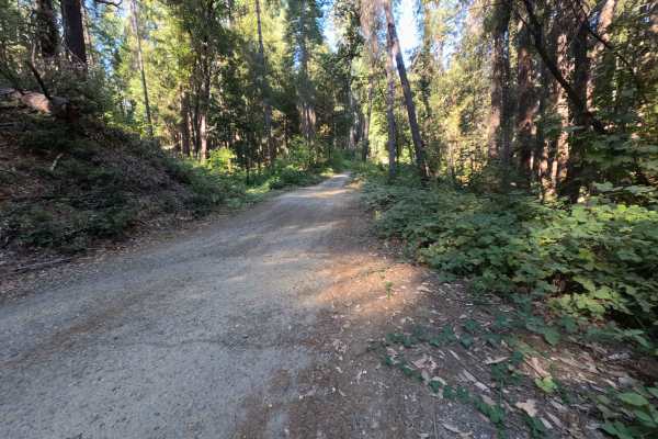
Dry Creek - FS 19N25
Dry Creek - FS 19N25 is a peaceful connector route linking Oregon Hill Road to Indiana-New York Road, offering convenient passage deeper into the surrounding backcountry. Set within the lush, mature conifer and hardwood canopy of Plumas National Forest, the corridor travels beneath towering ponderos...
Learn more about Dry Creek - FS 19N25
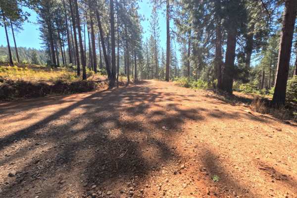
Plantation - FS 19N16
Plantation - FS 19N16 is a scenic connector loop that branches off Forest Service Road 21, circumnavigates a sprawling tract of backcountry timber, and rejoins Road 21 at an established paved junction. Situated within Plumas National Forest, the corridor traverses a lush woodland environment dominat...
Learn more about Plantation - FS 19N16
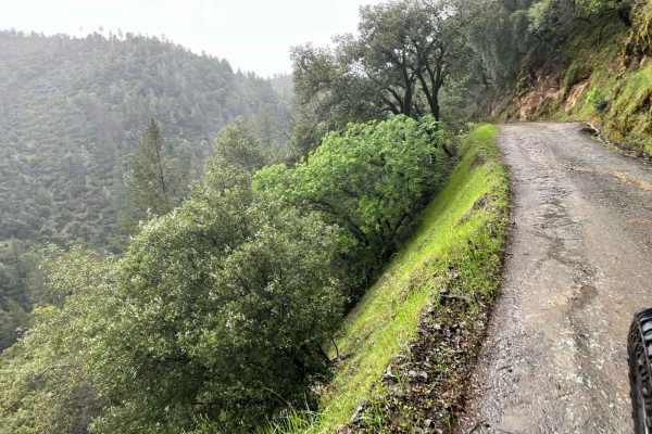
Yankee Jims
This is a secondary entrance to the Shirttail Canyon trail. This trail meanders down the canyon, surrounded by mossy trees and waterfalls during certain times of the year. If coming from the Foresthill side, this is a great day venture down to the river. You can even take it out to the other side, H...
Learn more about Yankee Jims
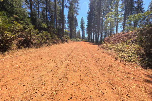
Pike CO Peak - FS 19N17
Pike CO Peak - FS 19N17 functions as a scenic mountain connector linking Forest Service Road 21 with Plantation - FS 19N16, offering elevated throughput across the forested crest of Pike County Peak. Situated in Plumas National Forest, the route travels through a lush, dense woodland of towering pon...
Learn more about Pike CO Peak - FS 19N17
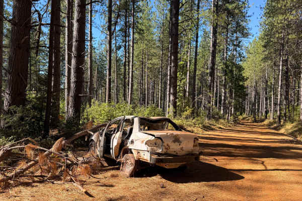
North Loop - FS 19N22
North Loop - FS 19N22 serves as a scenic woodland connector branching off Forest Road 21 and threading westward through the timbered foothills toward the small mountain community of Challenge. Set across the gently rolling terrain of Plumas National Forest, the corridor winds through a lush mixed-co...
Learn more about North Loop - FS 19N22
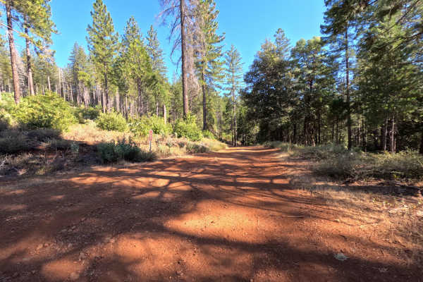
Dodge - FS 19N53
Dodge (Forest Service Road 19N53) is a tranquil out-and-back dirt spur accessed directly off Indian Road. Winding along a timbered ridgeline within the Feather River Ranger District of Plumas National Forest, the trail travels through mixed pine and oak woodland recovering from the 2015 Lumpkin Fire...
Learn more about Dodge - FS 19N53
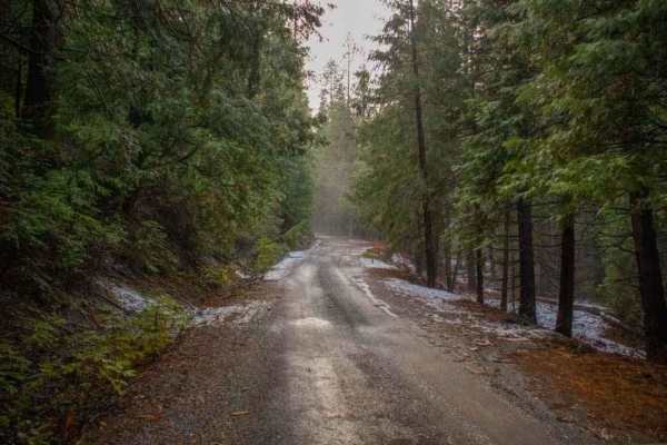
Elliot Ranch Road
Elliot Ranch Road in Foresthill, California, is a rugged, unpaved route in the Tahoe National Forest, offering access to various recreational activities. It serves as the starting point for challenging trails like the Green Valley Trail, which descends steeply to the North Fork of the American River...
Learn more about Elliot Ranch Road
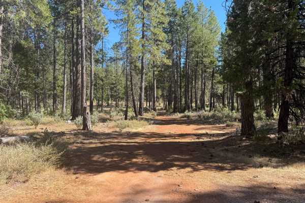
Indian - FS 19N03
Forest Service Road 19N03 (Indian) is an engaging backcountry connector branching off Forest Service Road 21 and tracing the scenic drainage of Indian Creek to an established junction with adjoining woodland routes. Nestled within the lush, canopy-rich evergreen forest of Plumas National Forest, the...
Learn more about Indian - FS 19N03
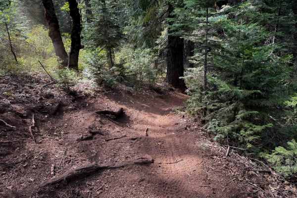
Towle Mill (#66)
Towle Mill is a 10 mile long tight and winding singletrack loop in the Burlington Trail System. It is easily accessed south of the Skillman Campground off of FS 20-012. The terrain is very similar throughout the entire route, as it continuously winds throughout the rolling forest floor, curving arou...
Learn more about Towle Mill (#66)
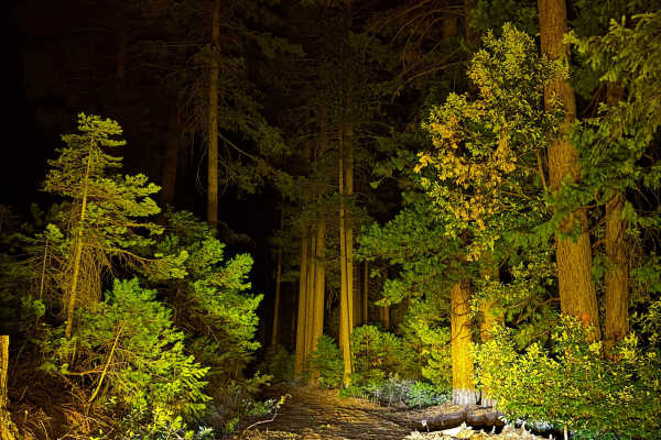
Indian Hill South
This trail is a wide, single-wide path that has been freshly cleared. There are a few dispersed camp areas along the trail. Along the way, you’ll encounter a few washes and drainage ditches. Additionally, the trail takes you through some tall, magnificent trees. Watch out for logging trucks; there a...
Learn more about Indian Hill South
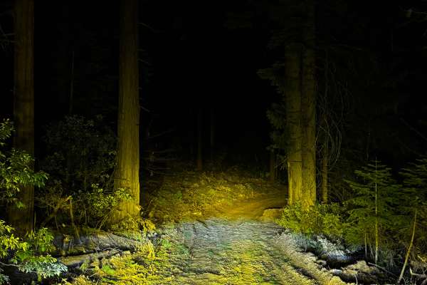
Ditch Road
This wide, single-wide trail is freshly cleared and offers a scenic journey through tall, beautiful trees. There is a small, tight area where you may touch overgrown brush. Along the trail, there are several dispersed camping spots. There are also a few smaller washes and drainage ditches to cross. ...
Learn more about Ditch Road
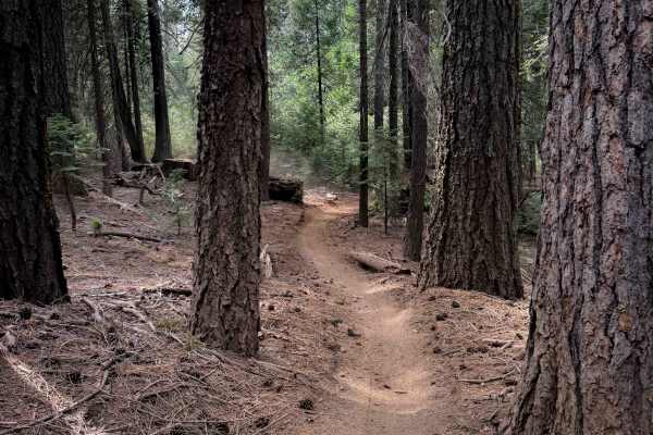
Omega Overlook (#54)
This easy singletrack runs along the north side of the Burlington Trail System, north of Highway 20. The west end crosses the highway to access the rest of the Burlington Trail System, while the east end connects to the singletrack Last Chance #55. The Omega Observation Site/Scenic View Area is a gr...
Learn more about Omega Overlook (#54)
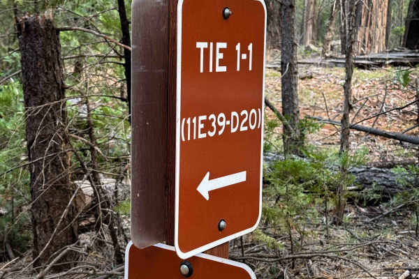
Tie 1-1
Tie 1-1 is a short 0.6 mile long ATV connector that links sections of Loop 1 and cuts off about a mile from the northwest corner of Loop 1. The route is straightforward and very easy, with mostly smooth ground and only a little bit of loose rock and sticks scattered along the way. The trail is gradu...
Learn more about Tie 1-1
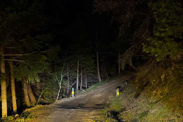
Indian Creek
The trail is a wide single-wide path that meanders alongside a creek for a portion of its length. Along the creek’s edge, there are several dispersed camping sites. There’s even an area beyond the end of the marked trail where you can disperse camp, but the trail ends slightly prematurely. If you co...
Learn more about Indian Creek
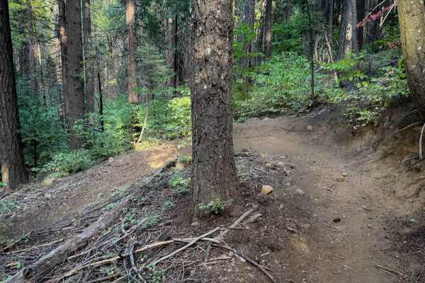
Deer Creek (#25)
This is a long route that winds through the forest on a smooth dirt path with constant sharp turns. The terrain is very similar through the majority of the route, as the trail winds through the tall pine trees, constantly doubling back on itself with big switchbacks and hairpins like a turn track. S...
Learn more about Deer Creek (#25)
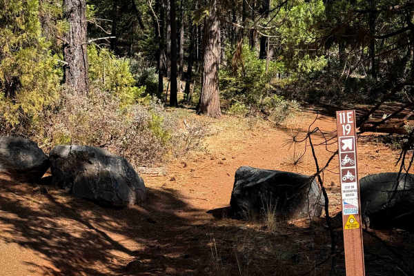
11E19
11E19 is a 0.7-mile-long ATV trail with a red dirt surface winding through a forest of sugar pines. The route is wide and mostly gradual, with only a couple of very small rolling hills. It includes a straight section along with a few twisting turns through the trees. The trail is obstacle-free aside...
Learn more about 11E19
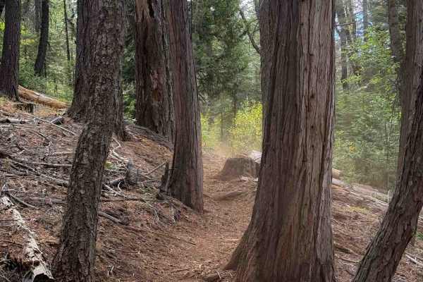
Stanton (#9)
The majority of this trail is a tight and winding singletrack through a dry pine forest on dusty loose dirt. Some of the sections are tighter between the leafy dogwoods, and other sections are more open and sparsely lined with big pines and cedars. There was a lot of stick debris in the trail and lo...
Learn more about Stanton (#9)
Beginner ATV trails near Penn Valley, California
Explore ATV-friendly trails near you. These trails are accessible for vehicles up to 50 inches wide, perfect for ATVs and smaller off-road machines.
Milk Ranch - FS 19N04
Milk Ranch - FS 19N04 serves as an essential backcountry connector linking Plantation Road - FS 19N16 to Forest Service Road 21, providing dependable throughput across the undulating foothill ridges. Situated in Plumas National Forest, the track winds through a lush, vibrant canopy of towering ponde...
Learn more about Milk Ranch - FS 19N04
Milk - FS 19N00
Milk - FS 19N00 is a peaceful woodland connector branching off Plantation Road - FS 19N16 and descending through the hills toward lower Forest Service corridors near Bullards Bar Reservoir. Managed by Plumas National Forest, the track traverses a lush, dense mountain environment sheltered beneath to...
Learn more about Milk - FS 19N00
Dry Creek - FS 19N25
Dry Creek - FS 19N25 is a peaceful connector route linking Oregon Hill Road to Indiana-New York Road, offering convenient passage deeper into the surrounding backcountry. Set within the lush, mature conifer and hardwood canopy of Plumas National Forest, the corridor travels beneath towering ponderos...
Learn more about Dry Creek - FS 19N25
Plantation - FS 19N16
Plantation - FS 19N16 is a scenic connector loop that branches off Forest Service Road 21, circumnavigates a sprawling tract of backcountry timber, and rejoins Road 21 at an established paved junction. Situated within Plumas National Forest, the corridor traverses a lush woodland environment dominat...
Learn more about Plantation - FS 19N16
Beginner UTV/side-by-side trails near Penn Valley, California
Find UTV and side-by-side trails near you. These trails accommodate vehicles up to 60 inches wide, ideal for UTVs, side-by-sides, and wider off-road rigs.
Milk Ranch - FS 19N04
Milk Ranch - FS 19N04 serves as an essential backcountry connector linking Plantation Road - FS 19N16 to Forest Service Road 21, providing dependable throughput across the undulating foothill ridges. Situated in Plumas National Forest, the track winds through a lush, vibrant canopy of towering ponde...
Learn more about Milk Ranch - FS 19N04
Milk - FS 19N00
Milk - FS 19N00 is a peaceful woodland connector branching off Plantation Road - FS 19N16 and descending through the hills toward lower Forest Service corridors near Bullards Bar Reservoir. Managed by Plumas National Forest, the track traverses a lush, dense mountain environment sheltered beneath to...
Learn more about Milk - FS 19N00
Dry Creek - FS 19N25
Dry Creek - FS 19N25 is a peaceful connector route linking Oregon Hill Road to Indiana-New York Road, offering convenient passage deeper into the surrounding backcountry. Set within the lush, mature conifer and hardwood canopy of Plumas National Forest, the corridor travels beneath towering ponderos...
Learn more about Dry Creek - FS 19N25
Plantation - FS 19N16
Plantation - FS 19N16 is a scenic connector loop that branches off Forest Service Road 21, circumnavigates a sprawling tract of backcountry timber, and rejoins Road 21 at an established paved junction. Situated within Plumas National Forest, the corridor traverses a lush woodland environment dominat...
Learn more about Plantation - FS 19N16
The onX Offroad Difference
onX Offroad combines trail photos, descriptions, difficulty ratings, width restrictions, seasonality, and more in a user-friendly interface. Available on all devices, with offline access and full compatibility with CarPlay and Android Auto. Discover what you're missing today!
Open Trail Map