
Beginner Off-Road Trails
Near Patagonia, Arizona
Explore All Beginner Trails Near Patagonia, Arizona
Beginner Off-Road Trails Near Patagonia, Arizona
Discover the best beginner-friendly off-road trails near you. These easier, lower-rated trails are a great place to start — browse trail maps, check difficulty ratings, and find your next adventure.

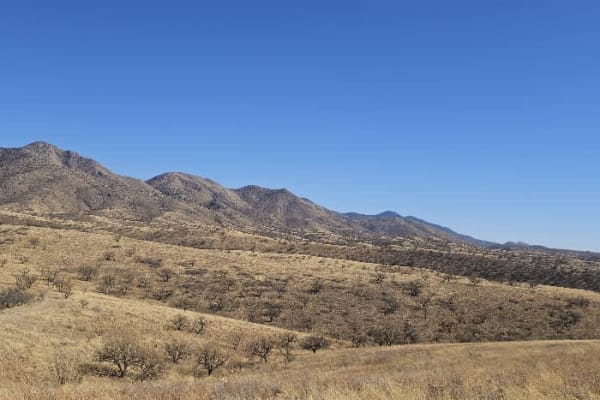
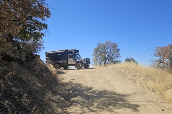
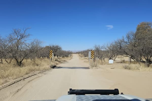
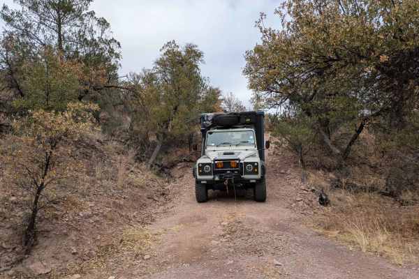
FR215 Three Canyon
The FR215 Three Canyon trail leads to an abandoned mine and has two two-track trails that lead to dead ends and private land. The trail surface is dry, dusty, and rocky, with occasional off-camber sections. The abandoned mine at the head of the two-track trail to private land offers a haunting but f...
Learn more about FR215 Three Canyon
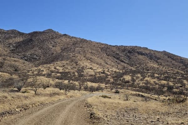
Grande Forest Road
This is a pleasant trail with great views. It is dry and dusty, with rocky sections and occasional moderate inclines and descents. The trail has a locked gate at the end, but dispersed camping is available. It is windy, and the road is not maintained or graded.
Learn more about Grande Forest Road
Palomas Mesa
This track is an easy drive but can only be driven as a return route unless you drive a very capable 4WD. The track itself is dry and dusty, with rocky sections and occasional moderate inclines and descents. Old mines dot the area, and there are abandoned open shafts, so exercise caution when explor...
Learn more about Palomas Mesa
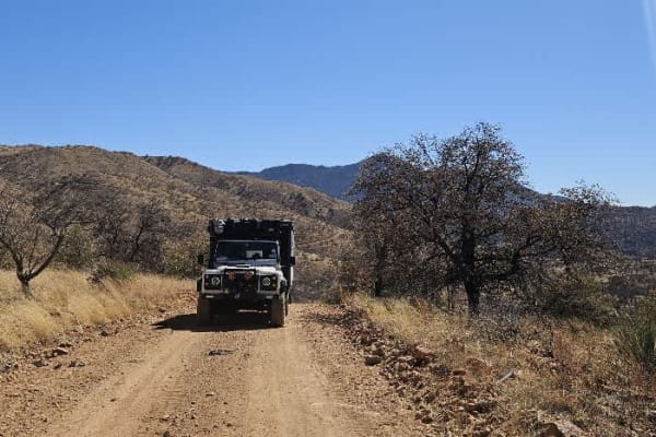
North Harshaw Road
North Harshaw Road is a well-traveled double-track route that winds into the upper grasslands, eventually connecting with the Patagonia Loop Trail. The road is generally well-maintained, with a flat and mostly straight path, making it accessible to a variety of vehicles. However, drivers should proc...
Learn more about North Harshaw Road
Apache Tank 214
The Apache Tank Road is a pleasant, easy drive through grassland and undulating hills. The trail drops down from the grassland into a forested area that is prone to flash flooding. There are a number of smaller trails branching off from the main trail, and there are many campsites to choose from, mo...
Learn more about Apache Tank 214
North Harshaw Road
The pavement ends at the junction of South Harshaw Road and North Harshaw Road, and you will cross the first of two streams running across the trail. A broad and well-traveled trail, the North Harshaw trail offers multiple campsites with fire rings, and most campsites are large enough to accommodate...
Learn more about North Harshaw Road
Flying R Ranch/Guajalote Flat Loop - FR 4695 - 4695A
This loop trail is accessed through a closed gate. There are private ranches along the trail, and it is imperative that travelers close all gates securely behind them. After the second gate, and beside a well-maintained ranch house, we met an elderly cowboy who stopped to chat, toothlessly thanked u...
Learn more about Flying R Ranch/Guajalote Flat Loop - FR 4695 - 4695A
Upper Providencia
At the start of this trail is a large campsite with fire rings in an area passed often by border patrol. At first, the trail is well-maintained and flat, but that changes as you climb into more mountainous areas. The trail leads to a steep climb that ideally requires a low range, immediately followe...
Learn more about Upper Providencia
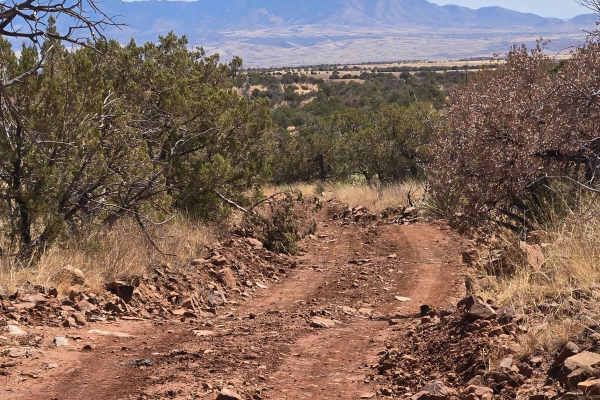
Hog Ridge - Trail 4859
This trail is a bit rocky, it rides the ridge above Hog Canyon. You will have views of the town and the mountains in the distance. You will be riding through grassy fields dotted with Mesquite and Oak trees, along with yucca, ocotillo cactus. This is a typical trail not requiring 4-wheel drive or hi...
Learn more about Hog Ridge - Trail 4859
Hog Canyon Side Trail
This was a fun and engaging side trail off of Hog Canyon Trail. It meanders down the hill until you reach a gate. Be sure to close the gate if it's closed when you get there. Follow this trail to the end at a large watering pond in the trees. You may or nmay ot find cows at the end of the pond.
Learn more about Hog Canyon Side Trail
FR4740 Williamson Tank
Williamson Tank Trail is a scenic off-road trail that begins on private land, meandering through rolling grasslands and past a quiet farmstead, where travelers may receive a friendly wave. The trail starts as a single-track route with a mostly smooth surface, though occasional bumps and rocky patche...
Learn more about FR4740 Williamson Tank
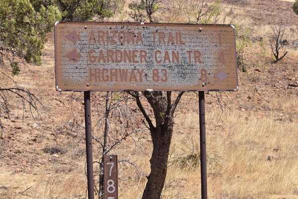
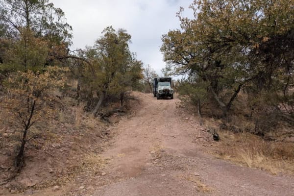
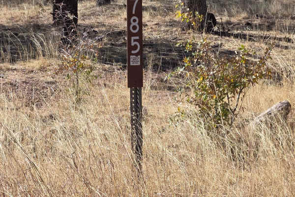
FSR 785 to trailhead
FSR 785 is a scenic drive to the trailhead in the wilderness area. You will drive through a canyon with dispersed camping areas. The ride is under sycamore, Alligator Juniper, and oak trees. There are several wash crossings, and many hiking trailheads off this trail. You may see an abundance of wild...
Learn more about FSR 785 to trailhead
Hog Canyon- BLM 4111
From Gardner Canyon Road, turn left on 785 to the intersection, then go left on 4111. Follow this trail to the T intersection, turn right on 4088, follow this to another T intersection. This trail is passable by most vehicles. 4 wheel drive is recommended during inclement weather. The day we rode th...
Learn more about Hog Canyon- BLM 4111
Piedragrosa - Forest Road 4667
This is a well-maintained and undulating trail that allows you to travel to where the border wall abruptly ends. In parts, there is loose sand along the trail, and there are many areas to camp, further away from the border wall, as well as a restricted area. This trail loops back to Washington Monte...
Learn more about Piedragrosa - Forest Road 4667
Washington Montezuma Pass
The Montezuma pass is well maintained but corrugated in sections due to high traffic, mostly border patrol vehicles. The views are excellent. You reach the top of the trail overlooking the border with Mexico, and there is a little campsite with a fire ring before the lookout. We camped in the flats ...
Learn more about Washington Montezuma Pass
FSR 4104 to Hog Ridge
Start at State Route 83, head west on Santa Rita Road, riding past cattle ranches and wonderful western-style homes. Take the left at the fork in the road, which is FS 4104. Continue to follow this trail until you reach the intersection with FSR 785. You may see deer, antelope, and rabbits. We saw a...
Learn more about FSR 4104 to Hog Ridge
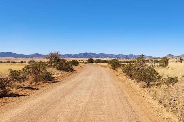
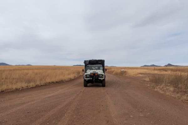
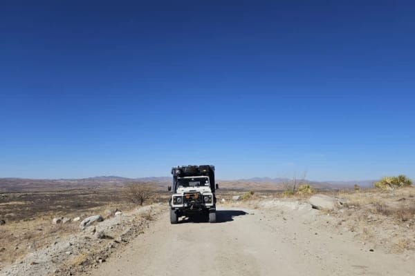
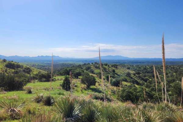
Patagonia Loop
This trail will take you through the Sonoita area's 4,970-foot elevation, featuring high-rolling grasslands surrounded by spectacular mountains and canyons. This region offers some of Arizona's most beautiful weather and landscapes. Mount Wrightson, one of the tallest peaks in Arizona, dominates the...
Learn more about Patagonia Loop
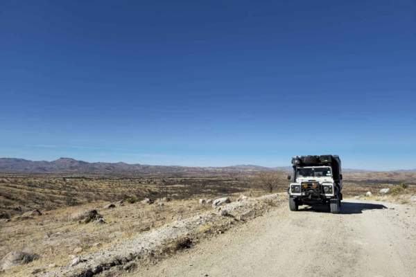
Border Road
Border Road is a well-maintained dirt road that runs along the southern edge of the Coronado National Forest, paralleling the U.S.- Mexico border. This route is frequently patrolled by Border Patrol vehicles, and travelers should expect to encounter agents along the way. The presence of law enforcem...
Learn more about Border Road
Pauline Ridge - FR4892
Pauline Ridge begins with a steep, winding, and off-camber entrance, making four-wheel drive preferable for a safe and controlled ascent. Once past this initial climb, the trail levels out and follows a ranch fence along the ridge, offering expansive views of the surrounding landscape. Despite the r...
Learn more about Pauline Ridge - FR4892
Kentucky Gulch - FR 163
Kentucky Gulch provides a gentle ascent through undulating hill terrain, with the trail meandering amidst grassy hills dotted with oak, juniper, agave, and other distinctive plant species. Be sure to check the weather conditions before heading out, as rain or snow could affect the road. Traveling on...
Learn more about Kentucky Gulch - FR 163
Beginner ATV trails near Patagonia, Arizona
Explore ATV-friendly trails near you. These trails are accessible for vehicles up to 50 inches wide, perfect for ATVs and smaller off-road machines.
FR215 Three Canyon
The FR215 Three Canyon trail leads to an abandoned mine and has two two-track trails that lead to dead ends and private land. The trail surface is dry, dusty, and rocky, with occasional off-camber sections. The abandoned mine at the head of the two-track trail to private land offers a haunting but f...
Learn more about FR215 Three Canyon
Grande Forest Road
This is a pleasant trail with great views. It is dry and dusty, with rocky sections and occasional moderate inclines and descents. The trail has a locked gate at the end, but dispersed camping is available. It is windy, and the road is not maintained or graded.
Learn more about Grande Forest Road
Palomas Mesa
This track is an easy drive but can only be driven as a return route unless you drive a very capable 4WD. The track itself is dry and dusty, with rocky sections and occasional moderate inclines and descents. Old mines dot the area, and there are abandoned open shafts, so exercise caution when explor...
Learn more about Palomas Mesa
North Harshaw Road
North Harshaw Road is a well-traveled double-track route that winds into the upper grasslands, eventually connecting with the Patagonia Loop Trail. The road is generally well-maintained, with a flat and mostly straight path, making it accessible to a variety of vehicles. However, drivers should proc...
Learn more about North Harshaw Road
Beginner UTV/side-by-side trails near Patagonia, Arizona
Find UTV and side-by-side trails near you. These trails accommodate vehicles up to 60 inches wide, ideal for UTVs, side-by-sides, and wider off-road rigs.
FR215 Three Canyon
The FR215 Three Canyon trail leads to an abandoned mine and has two two-track trails that lead to dead ends and private land. The trail surface is dry, dusty, and rocky, with occasional off-camber sections. The abandoned mine at the head of the two-track trail to private land offers a haunting but f...
Learn more about FR215 Three Canyon
Grande Forest Road
This is a pleasant trail with great views. It is dry and dusty, with rocky sections and occasional moderate inclines and descents. The trail has a locked gate at the end, but dispersed camping is available. It is windy, and the road is not maintained or graded.
Learn more about Grande Forest Road
Palomas Mesa
This track is an easy drive but can only be driven as a return route unless you drive a very capable 4WD. The track itself is dry and dusty, with rocky sections and occasional moderate inclines and descents. Old mines dot the area, and there are abandoned open shafts, so exercise caution when explor...
Learn more about Palomas Mesa
North Harshaw Road
North Harshaw Road is a well-traveled double-track route that winds into the upper grasslands, eventually connecting with the Patagonia Loop Trail. The road is generally well-maintained, with a flat and mostly straight path, making it accessible to a variety of vehicles. However, drivers should proc...
Learn more about North Harshaw Road
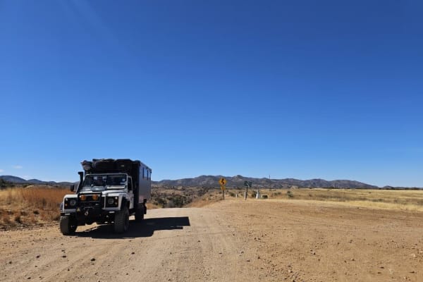
The onX Offroad Difference
onX Offroad combines trail photos, descriptions, difficulty ratings, width restrictions, seasonality, and more in a user-friendly interface. Available on all devices, with offline access and full compatibility with CarPlay and Android Auto. Discover what you're missing today!
Open Trail Map