
Beginner Off-Road Trails
Near Paradise, Montana
Explore All Beginner Trails Near Paradise, Montana
Beginner Off-Road Trails Near Paradise, Montana
Discover the best beginner-friendly off-road trails near you. These easier, lower-rated trails are a great place to start — browse trail maps, check difficulty ratings, and find your next adventure.
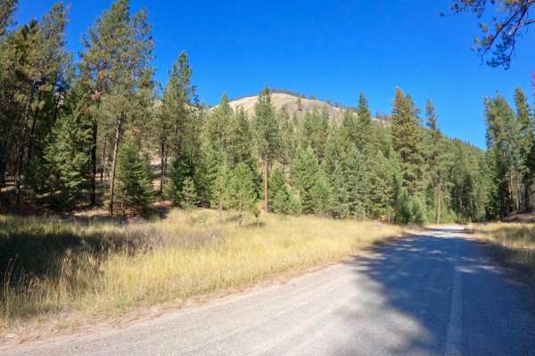
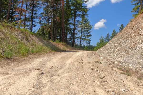
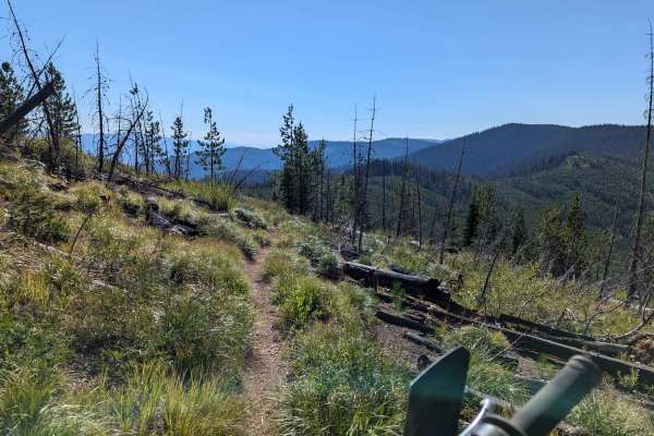
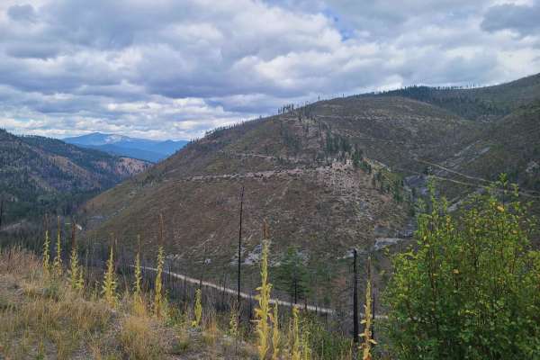
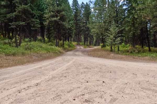
Sloway Gulch Road-Keystone Peak
The route is mainly two-lane gravel, but there are narrow parts where it would be hard to pass another vehicle. The route is a gradual climb from 2,600 to 5,800 feet. There are sharp blind curves along the route with steep embankments. Cell service is limited in parts of the route, and traffic along...
Learn more about Sloway Gulch Road-Keystone Peak
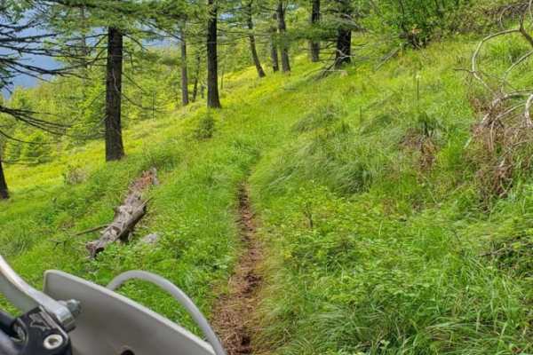
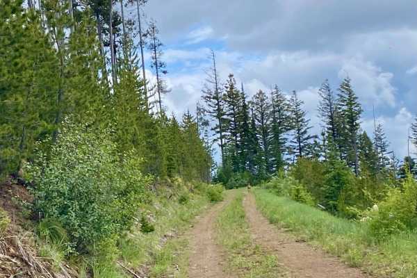
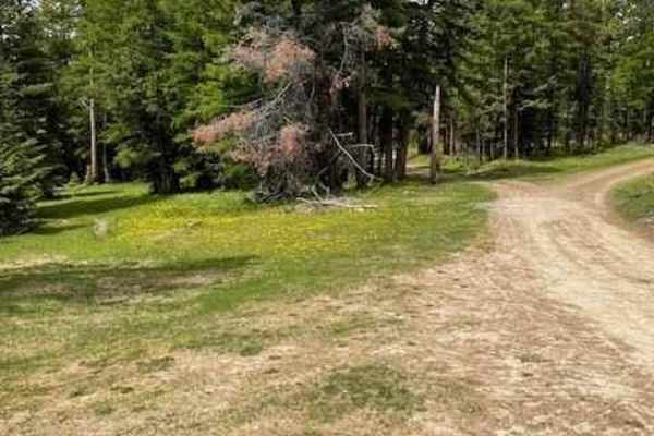
Olson Peak Singletrack
This is a singletrack, two-way trail that is slightly overgrown. It is fairly easy, but there are a few log hops and side hills, and there may be blown down trees blocking your way. The trail is mostly marked with colored tape and trail signs. The Olson Peak Trail connects with the CC Divide Trail ...
Learn more about Olson Peak Singletrack
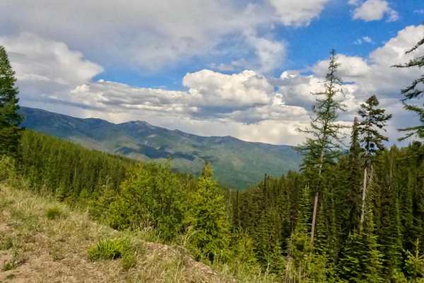
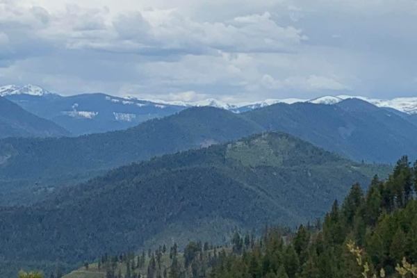
Flat Creek Hwy 135
The route is gravel, stone, and loose rock in different areas along the route. The route is very scenic along the way as you make your climb from 2700' up to 6200'. The route might be dusty or damp depending on the weather. Snow could make it impassible, if going too early in the spring or summer. B...
Learn more about Flat Creek Hwy 135
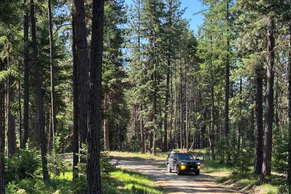
West Side Pardee Creek Road - Old Hwy 10
The route is made up of gravel and loose rock. The route climbs from 2600'-5800' along the Lolo Forest and some private land. There are many sharp turns with steep embankments along the route. Offline Maps will be needed to navigate some parts of the route. The route has both single and two-lane par...
Learn more about West Side Pardee Creek Road - Old Hwy 10
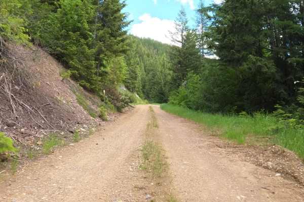
Flat Creek Road - Pardee Creek Road
The route is mainly gravel and loose rock passing thru government lands. There are sharp corners with steep embankments along part of the route. Ponderosa Pine & Tamarack line most of the route. Offline Maps will be needed to navigate parts of the route. You will pass through openings where you can ...
Learn more about Flat Creek Road - Pardee Creek Road
Upper Idaho Gulch
The trail begins at a gate just past Johnson Creek FS 540. The trail is mainly one lane throughout its length, with very steep embankments and loose, sharp rock in places. There are areas to get past another vehicle if encountered. The route is mainly dense forest with beautiful views of the Nine Mi...
Learn more about Upper Idaho Gulch
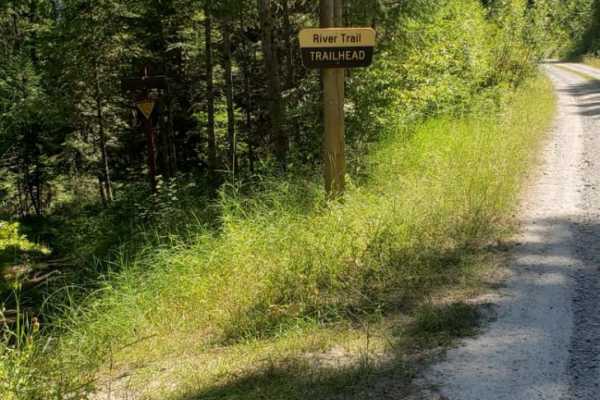
River Trail
This is a fun, well-maintained singletrack that follows the Clark Fork River. There are some technical rock/root features, very small water crossings and a few switchbacks. The trail is shared, trail so you may encounter the occasional hiker/biker. You'll end at the Ferry Landing Fishing Access whic...
Learn more about River Trail
Second Creek 283 - East Fork Johnson 7882
The route begins on a two-lane gravel road that turns into an area of forest that has been logged off for several miles. There is still an active part of the route that is being logged, which is only passable from 05/16-10/14. Logging trucks could be on the route with little room to pass. The route ...
Learn more about Second Creek 283 - East Fork Johnson 7882
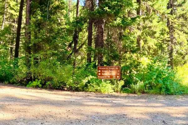
Ninemile Divide Trail
Ninemile Divide Trail is a narrow single-track dirt trail that starts and ends at dirt roads. This is only a portion of the entire Ninemile Divide Trail, which continues south of where this track ends. This trail appears to be lightly maintained, with all logs and trees cut out from the trail. There...
Learn more about Ninemile Divide Trail
W. Nine Mile Rd (5520)-First Cr Rd (5475)
The route begins at the 3400' elevation of Nine Mile Rd and ends at the 5400' elevation of First Cr. Rd. The route passes over Nine Mile Cr. and makes its way through some private property, but mostly forest land. The route is mostly made up of dirt and gravel with many curves and embankments. The r...
Learn more about W. Nine Mile Rd (5520)-First Cr Rd (5475)
West Side Nine Mile Road
This Forest Service Route continues from FS 5520 and the intersection of FS 5475, ending at the intersection of Siegel Road. The route is mainly made up of dirt, gravel, and loose rock. It has some long straight aways and sharp blind curves. The majority of the route is two lanes with wide spaces to...
Learn more about West Side Nine Mile Road

West Fork of Swamp Creek
West Fork of Swamp Creek- FS 217 is a lightly traveled gravel road through Lolo National Forest west of Plains, Montana. Lower sections of the road have many ATV and motorcycle pathways from the main road. Be aware of private or prohibited activities and do not trespass. The road has received little...
Learn more about West Fork of Swamp Creek
Pardee Cr. Rd-Ninemile Rd (97)
The route begins at the W. end of Mullan Rd. just outside Superior, MT. The route begins as a gradual climb from 2800'' through winding gravel and dirt roads. Sharp turns and steep embankments will be encountered along the route. The route is wide enough for two vehicles to pass, but there are areas...
Learn more about Pardee Cr. Rd-Ninemile Rd (97)
Bemish Ridge - FS 7583
Bemish Ridge- USFS 7583 is a moderately traveled gravel road through Lolo National Forest north of St. Regis, Montana. There is significant deadfall from a recent fire in the area. Take a saw with you to be prepared. It is easily traveled by all vehicles except when snow or ice covered. The roadway ...
Learn more about Bemish Ridge - FS 7583
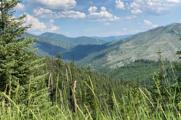
Divide Cutoff Road
From the Plains and Hot Springs intersection cutoff, this gravel road takes you along the high ridge running in a north/south direction. There are several offshoots from this section if one is willing to explore and spend a day driving around. Along the way, there is a beautiful small meadow that of...
Learn more about Divide Cutoff Road
Johnson-First Creek Road-W.Side Ninemile Road
The route begins on a gravel road that is plenty wide for two vehicles to pass. The route will make a gradual climb from 4800'-6400'. Some areas of the route have been recently logged with large areas of new growth. There is a large flora of Bear Grass in the higher elevations in the early summer. T...
Learn more about Johnson-First Creek Road-W.Side Ninemile Road
Johnson Creek to Superior
This route can only be taken from the months 05/16 - 10/14. The route is mostly gravel with some loose rock. The route climbs from 2800' to an elevation of 5000'. The first few miles from Johnson Creek are on a wide road, where you could run into a logging truck or piece of logging equipment. Gettin...
Learn more about Johnson Creek to Superior
Cold Peak Trail (FSR 3803)
The Route Starts at an elevation of 2980 feet and climbs to 3200 feet along a mostly gravel and loose rock roadbed. It has many curves with steep embankments that you need to be aware of. The route can be pretty dusty in dry weather. Places to pass other vehicles are along the route. The route sees ...
Learn more about Cold Peak Trail (FSR 3803)
Mayo Gulch
Turn off I-90 and go north on 135 through Saint Regis, Montana. FS 4227 road will be on the West side and begin in the state of Montana land and quickly enter Lolo National Forest. Stay on the main road. There are some pull-outs but no notable spurs. The road will continue a bit past the quarry to ...
Learn more about Mayo Gulch
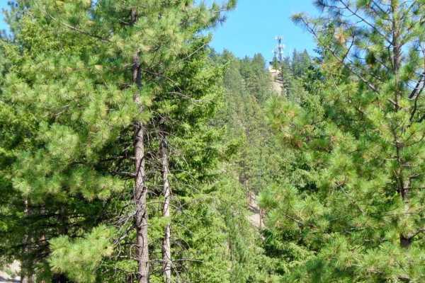
Thompson Peak Lookout Tower
The route is mostly a two-lane gravel road with some loose rock in place. The route is a very scenic climb from an elevation of 2900'-4100'. The route ends at a locked gate, which is a 1-mile hike to the Lookout Tower. Parking is available at the closed gate. The route can be dusty in dry weather.
Learn more about Thompson Peak Lookout Tower
Beginner ATV trails near Paradise, Montana
Explore ATV-friendly trails near you. These trails are accessible for vehicles up to 50 inches wide, perfect for ATVs and smaller off-road machines.
Sloway Gulch Road-Keystone Peak
The route is mainly two-lane gravel, but there are narrow parts where it would be hard to pass another vehicle. The route is a gradual climb from 2,600 to 5,800 feet. There are sharp blind curves along the route with steep embankments. Cell service is limited in parts of the route, and traffic along...
Learn more about Sloway Gulch Road-Keystone Peak
Flat Creek Hwy 135
The route is gravel, stone, and loose rock in different areas along the route. The route is very scenic along the way as you make your climb from 2700' up to 6200'. The route might be dusty or damp depending on the weather. Snow could make it impassible, if going too early in the spring or summer. B...
Learn more about Flat Creek Hwy 135
West Side Pardee Creek Road - Old Hwy 10
The route is made up of gravel and loose rock. The route climbs from 2600'-5800' along the Lolo Forest and some private land. There are many sharp turns with steep embankments along the route. Offline Maps will be needed to navigate some parts of the route. The route has both single and two-lane par...
Learn more about West Side Pardee Creek Road - Old Hwy 10
Flat Creek Road - Pardee Creek Road
The route is mainly gravel and loose rock passing thru government lands. There are sharp corners with steep embankments along part of the route. Ponderosa Pine & Tamarack line most of the route. Offline Maps will be needed to navigate parts of the route. You will pass through openings where you can ...
Learn more about Flat Creek Road - Pardee Creek Road
Beginner UTV/side-by-side trails near Paradise, Montana
Find UTV and side-by-side trails near you. These trails accommodate vehicles up to 60 inches wide, ideal for UTVs, side-by-sides, and wider off-road rigs.
Sloway Gulch Road-Keystone Peak
The route is mainly two-lane gravel, but there are narrow parts where it would be hard to pass another vehicle. The route is a gradual climb from 2,600 to 5,800 feet. There are sharp blind curves along the route with steep embankments. Cell service is limited in parts of the route, and traffic along...
Learn more about Sloway Gulch Road-Keystone Peak
Flat Creek Hwy 135
The route is gravel, stone, and loose rock in different areas along the route. The route is very scenic along the way as you make your climb from 2700' up to 6200'. The route might be dusty or damp depending on the weather. Snow could make it impassible, if going too early in the spring or summer. B...
Learn more about Flat Creek Hwy 135
West Side Pardee Creek Road - Old Hwy 10
The route is made up of gravel and loose rock. The route climbs from 2600'-5800' along the Lolo Forest and some private land. There are many sharp turns with steep embankments along the route. Offline Maps will be needed to navigate some parts of the route. The route has both single and two-lane par...
Learn more about West Side Pardee Creek Road - Old Hwy 10
Flat Creek Road - Pardee Creek Road
The route is mainly gravel and loose rock passing thru government lands. There are sharp corners with steep embankments along part of the route. Ponderosa Pine & Tamarack line most of the route. Offline Maps will be needed to navigate parts of the route. You will pass through openings where you can ...
Learn more about Flat Creek Road - Pardee Creek Road
The onX Offroad Difference
onX Offroad combines trail photos, descriptions, difficulty ratings, width restrictions, seasonality, and more in a user-friendly interface. Available on all devices, with offline access and full compatibility with CarPlay and Android Auto. Discover what you're missing today!
Open Trail Map