
Beginner Off-Road Trails
Near Ouray, Colorado
Explore All Beginner Trails Near Ouray, Colorado
Beginner Off-Road Trails Near Ouray, Colorado
Discover the best beginner-friendly off-road trails near you. These easier, lower-rated trails are a great place to start — browse trail maps, check difficulty ratings, and find your next adventure.
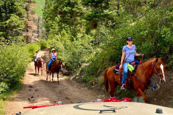
Culver Creek - County Road 14A
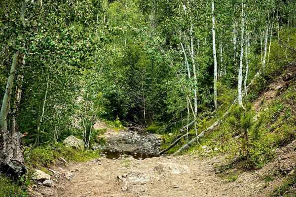
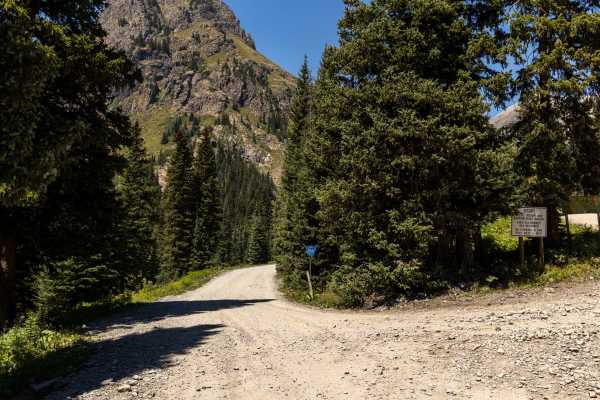
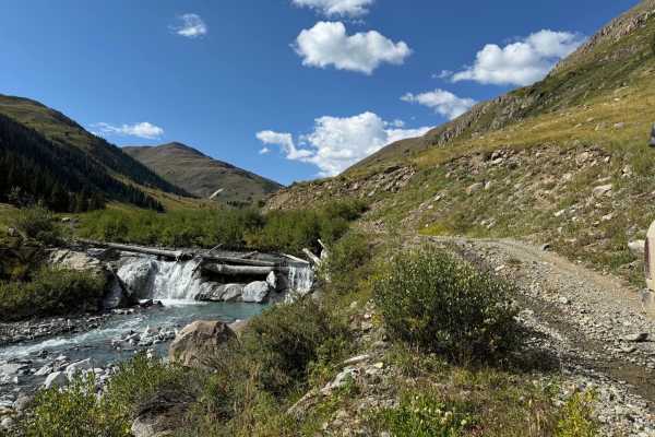
Culver Creek, County Road 14A, branches off Dexter Creek, County Road 14. The first part of the road is graded gravel to a parking area where you can park and hike. From there, the road changes to a rutted road with some rocks and stream crossings. It leads to a beautiful meadow, referred to as This...
Learn more about Culver Creek - County Road 14A
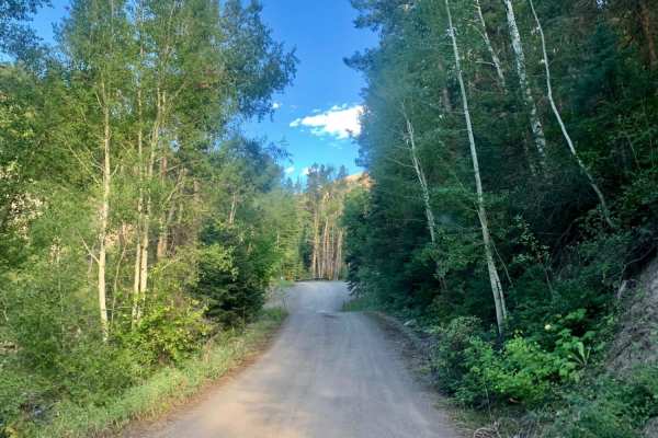
Cty Rd 14. - Dexter Creek Rd
Dexter Creek Road leads you to national forest land with a few dispersed camping sites starting about one mile in. The road starts out a graded, gravel road which very quickly gets to a steep hill with a one-lane road. Uphill traffic has the right-of-way. The road passes through residential areas i...
Learn more about Cty Rd 14. - Dexter Creek Rd
Baldy Spur Trail
Baldy Trail branches to the left off of Culver Creek Trail at Thistle Park meadow. It will take you to a meadow with primitive camping. Then, it travels farther up to the Baldy hiking trail and another camp spot. The road does continue past the Baldy trailhead, however, be forewarned it ends abruptl...
Learn more about Baldy Spur Trail
Camp Bird Mining Road - Cr 361
Camp Bird Mining Rd - Cr 361 is an easy, scenic historical route near Ouray, Colorado, perfect for beginner offroaders and history buffs looking to explore the region's rich mining heritage. This short 1-mile trail branches off Imogine Pass Road and descends into the historic Camp Bird Mine area. Th...
Learn more about Camp Bird Mining Road - Cr 361
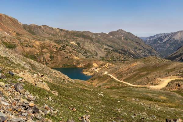
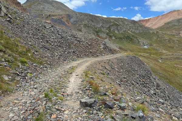
Governors Basin
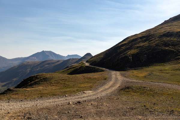
The Governors Basin Trail is a rugged alpine route that climbs steadily into the high country above Ouray. The road is narrow and primarily one lane, with uphill shelf-road exposure for roughly 90% of its length. Conditions are rocky throughout, with some rougher sections that demand careful tire pl...
Learn more about Governors Basin
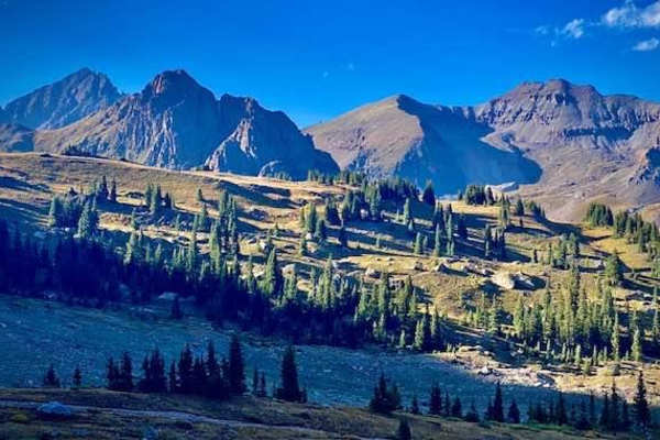
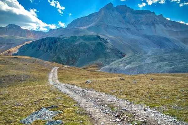
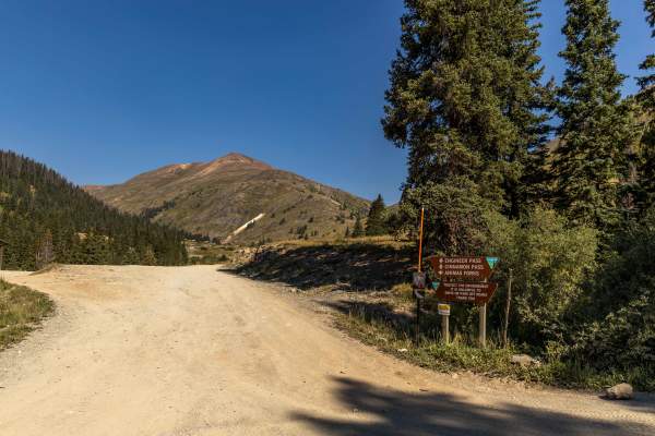
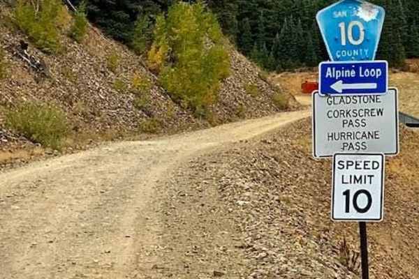
Hurricane Pass and Corkscrew Gulch
The Hurricane Pass and Corkscrew Gulch Trail is a well-traveled high-country route that offers a mix of terrain and conditions. The lower sections wind through forested areas where the trail can be bumpy, wet, and rutted, with dust common in drier stretches. As the route climbs, it becomes steeper a...
Learn more about Hurricane Pass and Corkscrew Gulch
Sidney Basin
Short trail off of Governors Basin trail in Ouray. It leads to some open meadows, some nice views and an old abandoned mine. Be aware there is another trail to the east on the map indicated with dotted lines. It is a VERY narrow trail with no areas to pass another vehicle and areas washing out, so b...
Learn more about Sidney Basin
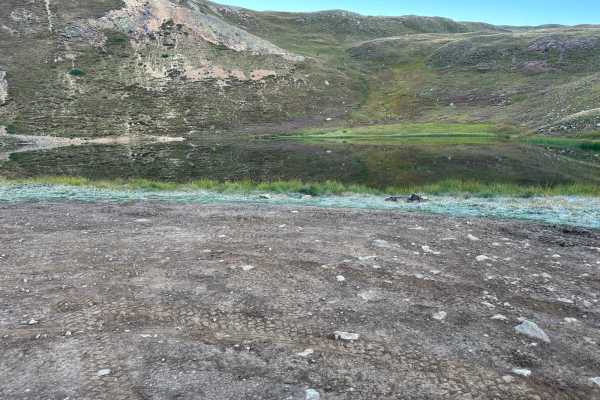
Wrights Lake Trail
This is a short fun trail connected to the end of Yankee Boy Basin Trail. If you've come to the end of Yankee Boy, you owe it to yourself to do this trail as well. It is a short fun loop with a couple of nice climbs and views. From the right angle, the beautiful blue lake looks heart-shaped.
Learn more about Wrights Lake Trail
Denver Lake
Nestled at the base of Denver Hill, the Denver Lake Trail offers a delightful excursion for nature enthusiasts. The trail, though short, is packed scenic highlights that make it well worth the visit. The first notable sight is an old building that has remarkably withstood the test of time. This stru...
Learn more about Denver Lake
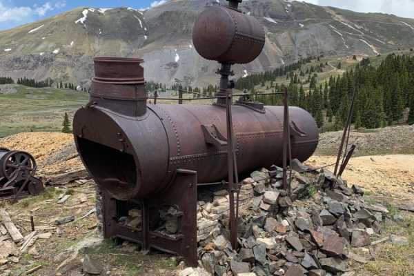
Mineral Point
This in-and-out trail is a short, 3.5-mile round-trip trail with views and history. You will see a sign indicating the road is a dead end. At the very end of the trail are some ruins and old mining equipment. If you feel like hiking, there are some cool mines to see. Roads may still be snow cove...
Learn more about Mineral Point
North Henson Creek Road
North Henson Creek Road is one of the many spurs roads off Engineer Pass on the Alpine loop and offers numerous good dispersed camping sites including some larger sites. It is accessible for medium-sized RVs and trailers. This road is mild and semi-maintained and suitable for vehicles with the excep...
Learn more about North Henson Creek Road
Cow Creek
County Road 12 turns into the rutted dirt trail of Cow Creek. It is a narrow trail with few places for passing vehicles. There is a stretch of shelf road as it ascends and parallels the Ramshorn Ridge with Cow Creek running along the bottom of several gulches. You will encounter several creek crossi...
Learn more about Cow Creek

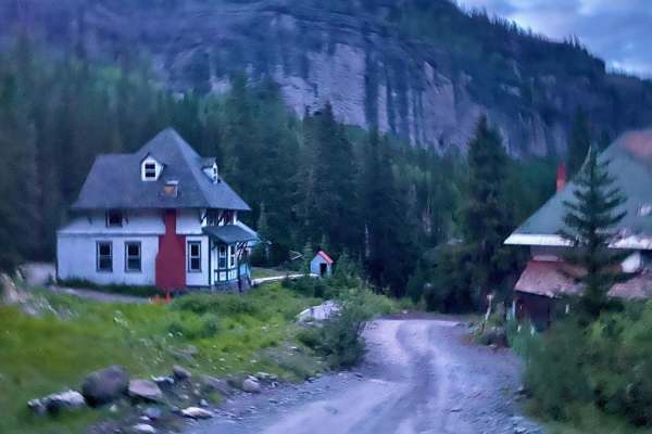
Sound Democrat Mill
The journey to the Sound Democrat Mill is indeed steeped in history, offering a fascinating glimpse into the past. Nestled at the bottom of a picturesque valley, the mill stands as a testament to the industrious spirit of a bygone era. This historic mill, once a bustling hub of activity, played a cr...
Learn more about Sound Democrat Mill
Silver Queen
This out-and-back trail may be brief, but it is rich with stories of ambition, perseverance, and the enduring human spirit. Situated off of Picayune/Placer Gulch, it leads you directly to the legendary Silver Queen and Sound Democrat Mines. Along the way, you'll encounter remnants of a bygone era, w...
Learn more about Silver Queen
California Gulch
The California Gulch Trail is a bumpy, rocky route that weaves its way through the high country with sections of exposed bedrock and occasional slickrock. Despite the rough surface, there are no major obstacles, making it suitable for most high-clearance vehicles. Drivers should expect some water al...
Learn more about California Gulch
Stealey Mountain ATV
This 3.7-mile long ATV trail starts on Owl Creek Pass and zig-zags south through the Uncompahgre National Forest. The south nd accesses the non-motorized Stealey Mountain North hiking trail. The trail's north end is wide and smooth, like an old road. Most of the rest of the trail is an easy two-trac...
Learn more about Stealey Mountain ATV
County Road 10 to Hurricane Pass
County Road 10 is a short narrow trail from the end of City Road 110 and the Sunnyside Mine ruins to Hurricane Pass/Corkscrew Gulch. It is an alternate way to get to the Alpine Loop over County Rd 3 which leads to Animas Forks and Engineer Pass. The trail is narrow in places which may make it diffi...
Learn more about County Road 10 to Hurricane Pass
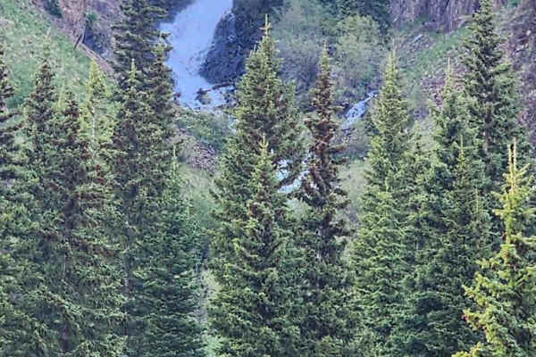
Grouse Gulch
Grouse Gulch is a charming and brief offshoot of County Road 2. Despite its short length, this trail boasts a stunning view of the Animas River, making it a must-visit for nature enthusiasts and photographers alike. Grouse Gulch offers a delightful experience that captures the scenic beauty of the r...
Learn more about Grouse Gulch
Placer and Picayne Gulch
This historic and scenic off-road route travels between two high alpine gulches just outside Silverton, climbing through wildflower-speckled meadows, past century-old mining ruins, and into panoramic high-country views. The trail begins with a steep, rocky ascent over the first two miles—expect care...
Learn more about Placer and Picayne Gulch
Stealey Mountain Spur ATV
From the Stealey Mountain ATV trail, this spur branches off and heads east, making big wide switchbacks on an easy trail through fir trees and aspens. It comes to an intersection to either go northeast to the Old Owl Creek ATV trail, or continue southeast on the spur. From this intersection, it con...
Learn more about Stealey Mountain Spur ATV
Beginner ATV trails near Ouray, Colorado
Explore ATV-friendly trails near you. These trails are accessible for vehicles up to 50 inches wide, perfect for ATVs and smaller off-road machines.
Camp Bird Mining Road - Cr 361
Camp Bird Mining Rd - Cr 361 is an easy, scenic historical route near Ouray, Colorado, perfect for beginner offroaders and history buffs looking to explore the region's rich mining heritage. This short 1-mile trail branches off Imogine Pass Road and descends into the historic Camp Bird Mine area. Th...
Learn more about Camp Bird Mining Road - Cr 361
Governors Basin
The Governors Basin Trail is a rugged alpine route that climbs steadily into the high country above Ouray. The road is narrow and primarily one lane, with uphill shelf-road exposure for roughly 90% of its length. Conditions are rocky throughout, with some rougher sections that demand careful tire pl...
Learn more about Governors Basin
Hurricane Pass and Corkscrew Gulch
The Hurricane Pass and Corkscrew Gulch Trail is a well-traveled high-country route that offers a mix of terrain and conditions. The lower sections wind through forested areas where the trail can be bumpy, wet, and rutted, with dust common in drier stretches. As the route climbs, it becomes steeper a...
Learn more about Hurricane Pass and Corkscrew Gulch
Sidney Basin
Short trail off of Governors Basin trail in Ouray. It leads to some open meadows, some nice views and an old abandoned mine. Be aware there is another trail to the east on the map indicated with dotted lines. It is a VERY narrow trail with no areas to pass another vehicle and areas washing out, so b...
Learn more about Sidney Basin
Beginner UTV/side-by-side trails near Ouray, Colorado
Find UTV and side-by-side trails near you. These trails accommodate vehicles up to 60 inches wide, ideal for UTVs, side-by-sides, and wider off-road rigs.
Governors Basin
The Governors Basin Trail is a rugged alpine route that climbs steadily into the high country above Ouray. The road is narrow and primarily one lane, with uphill shelf-road exposure for roughly 90% of its length. Conditions are rocky throughout, with some rougher sections that demand careful tire pl...
Learn more about Governors Basin
Hurricane Pass and Corkscrew Gulch
The Hurricane Pass and Corkscrew Gulch Trail is a well-traveled high-country route that offers a mix of terrain and conditions. The lower sections wind through forested areas where the trail can be bumpy, wet, and rutted, with dust common in drier stretches. As the route climbs, it becomes steeper a...
Learn more about Hurricane Pass and Corkscrew Gulch
Sidney Basin
Short trail off of Governors Basin trail in Ouray. It leads to some open meadows, some nice views and an old abandoned mine. Be aware there is another trail to the east on the map indicated with dotted lines. It is a VERY narrow trail with no areas to pass another vehicle and areas washing out, so b...
Learn more about Sidney Basin
Wrights Lake Trail
This is a short fun trail connected to the end of Yankee Boy Basin Trail. If you've come to the end of Yankee Boy, you owe it to yourself to do this trail as well. It is a short fun loop with a couple of nice climbs and views. From the right angle, the beautiful blue lake looks heart-shaped.
Learn more about Wrights Lake Trail
The onX Offroad Difference
onX Offroad combines trail photos, descriptions, difficulty ratings, width restrictions, seasonality, and more in a user-friendly interface. Available on all devices, with offline access and full compatibility with CarPlay and Android Auto. Discover what you're missing today!
Open Trail Map