
Beginner Off-Road Trails
Near Ridgway, Colorado
Explore All Beginner Trails Near Ridgway, Colorado
Beginner Off-Road Trails Near Ridgway, Colorado
Discover the best beginner-friendly off-road trails near you. These easier, lower-rated trails are a great place to start — browse trail maps, check difficulty ratings, and find your next adventure.
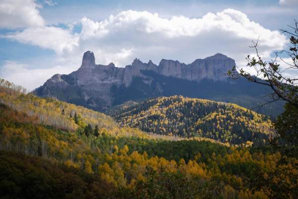
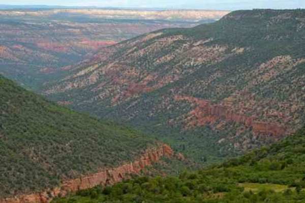
Owl Creek Pass
This is an enjoyable and easy 45-mile trip over Owl Creek Pass between the Uncompahgre and Cimarron Rivers. There can be a few water-filled potholes, but nothing that would stop a passenger car with reasonable clearance. Perhaps it would be muddier early in the year. John Wayne filmed scenes from bo...
Learn more about Owl Creek Pass
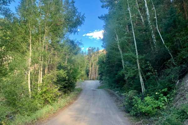
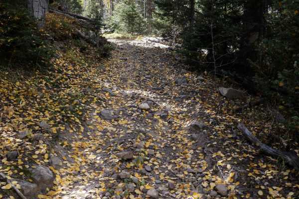
East Dallas Trail
Easy wide dirt trail mostly through private property with access to National Forest land and dispersed camping at the end. The first third of the trail is a smooth dirt road that can get muddy and slick when wet after a rain storm. Higher up, the trail gets bumpy with a more rocky road surface, but ...
Learn more about East Dallas Trail
Box Factory Park
This trail begins at the entrance to Double RL ranch, which is owned by Ralph Lauren. It is a great option if many of the passes are closed in the area, since the road stays at a relatively low elevation. There is an overlook that reveals a gorgeous, mostly hidden canyon. Keep a safe distance, as th...
Learn more about Box Factory Park
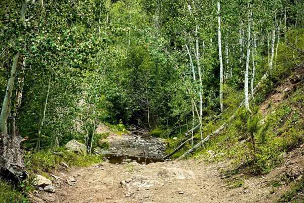
Cow Creek
County Road 12 turns into the rutted dirt trail of Cow Creek. It is a narrow trail with few places for passing vehicles. There is a stretch of shelf road as it ascends and parallels the Ramshorn Ridge with Cow Creek running along the bottom of several gulches. You will encounter several creek crossi...
Learn more about Cow Creek
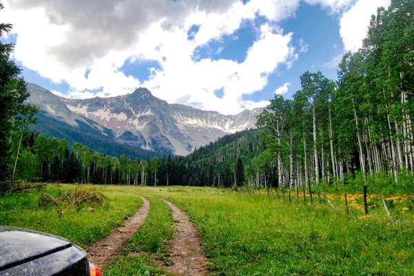
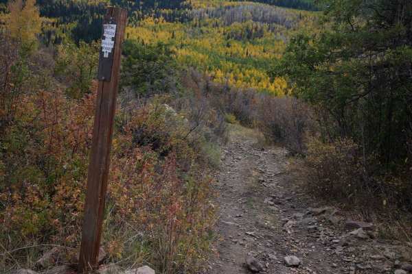
Baldy Spur Trail
Baldy Trail branches to the left off of Culver Creek Trail at Thistle Park meadow. It will take you to a meadow with primitive camping. Then, it travels farther up to the Baldy hiking trail and another camp spot. The road does continue past the Baldy trailhead, however, be forewarned it ends abruptl...
Learn more about Baldy Spur Trail
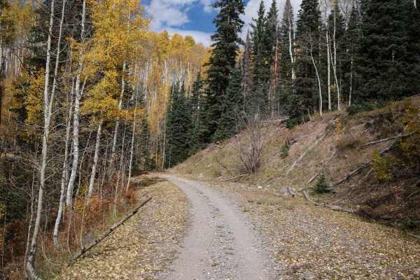
Cty Rd 14. - Dexter Creek Rd
Dexter Creek Road leads you to national forest land with a few dispersed camping sites starting about one mile in. The road starts out a graded, gravel road which very quickly gets to a steep hill with a one-lane road. Uphill traffic has the right-of-way. The road passes through residential areas i...
Learn more about Cty Rd 14. - Dexter Creek Rd
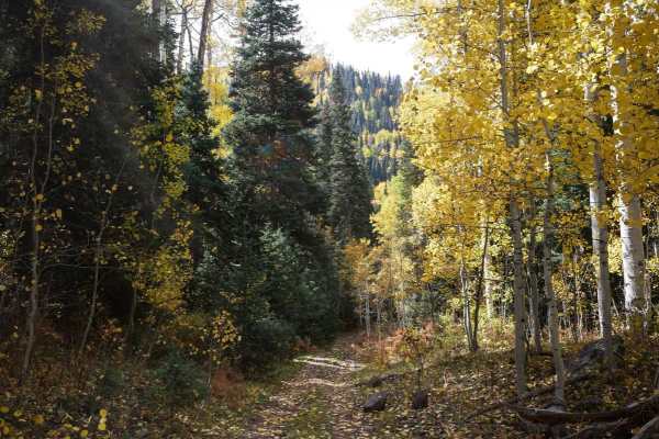
Culver Creek - County Road 14A
Culver Creek, County Road 14A, branches off Dexter Creek, County Road 14. The first part of the road is graded gravel to a parking area where you can park and hike. From there, the road changes to a rutted road with some rocks and stream crossings. It leads to a beautiful meadow, referred to as This...
Learn more about Culver Creek - County Road 14A
A Spur
The .8-mile long Spur A is an easy flat two-track that goes along the edge of a hillside, on a shelfy path between scrub oak and tall grass. You'll be overlooking the valley as you ride west, and have a view of Pinnacle Ridge as you ride back east. It has some small dips and big rollers over water b...
Learn more about A Spur
Spalding Park ATV
Spalding Park is a short ATV trail through the Uncompahgre National Park in the Owl Creek Pass area. From the north end, it goes through the flat valley below the Old Owl Creek trail, between scrub oak and aspen trees. When riding south, you have an amazing view of the Pinnacle Ridge almost the whol...
Learn more about Spalding Park ATV
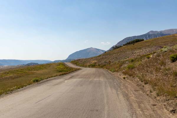
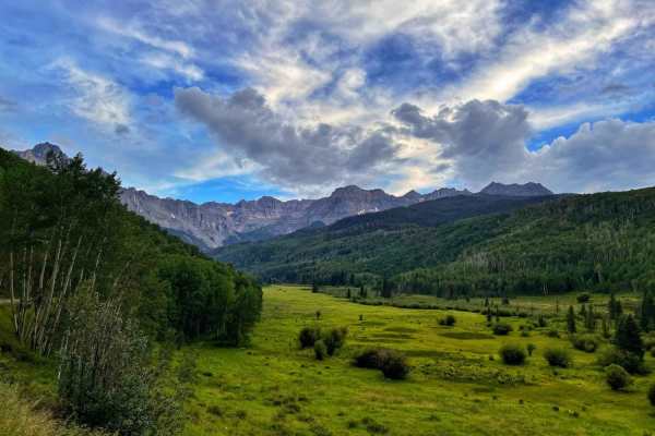
Last Dollar Road
Bumpy, colorful, vast, and adventurous, this hidden dirt road in historic ranching country gives stunning rewards for those willing the take the time to get around the bend. As Last Dollar Road winds through a low valley surrounded by jagged peaks and deep-blue skies, each bend delivers jaw-dropping...
Learn more about Last Dollar Road
Stealey Mountain ATV
This 3.7-mile long ATV trail starts on Owl Creek Pass and zig-zags south through the Uncompahgre National Forest. The south nd accesses the non-motorized Stealey Mountain North hiking trail. The trail's north end is wide and smooth, like an old road. Most of the rest of the trail is an easy two-trac...
Learn more about Stealey Mountain ATV
Stealey Mountain Spur ATV
From the Stealey Mountain ATV trail, this spur branches off and heads east, making big wide switchbacks on an easy trail through fir trees and aspens. It comes to an intersection to either go northeast to the Old Owl Creek ATV trail, or continue southeast on the spur. From this intersection, it con...
Learn more about Stealey Mountain Spur ATV
B Spur
The B Spur starts at the intersection with the Old Owl Creek ATV trail and goes south for 1.3 miles, curving through the pine forest on a shelfy and rocky trail. It has big wide sweeping corners as it zig zags up the mountain. The trail is covered in small embedded and loose rocks. The trail was cle...
Learn more about B Spur
Old Owl Creek ATV
The Old Owl Creek ATV trail is 4 miles long, riding below the Spruce Ridge and Owl Creek Pass through the Owl Creek drainage. The trail's east end starts at a pinch point between two boulders off of Owl Creek Pass and descends the mountainside on a loose, rocky two-track. It has loose rock filling i...
Learn more about Old Owl Creek ATV
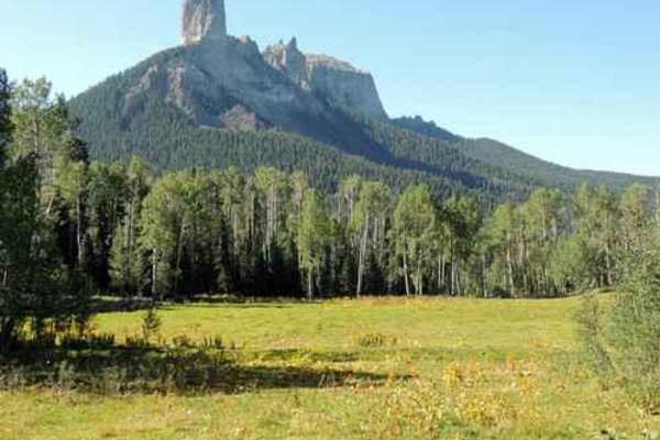
West Fork Cimarron Road
This beautifully scenic route takes you past Chimney Rock and up into the Uncompahgre Wilderness/National Forest. There are scattered primitive campgrounds all along the way. The first mile and a half (or so) of this trail is easy enough for 2WD (lower clearance vehicles) and would rate 1 or 2 on di...
Learn more about West Fork Cimarron Road
Wrights Lake Trail
This is a short fun trail connected to the end of Yankee Boy Basin Trail. If you've come to the end of Yankee Boy, you owe it to yourself to do this trail as well. It is a short fun loop with a couple of nice climbs and views. From the right angle, the beautiful blue lake looks heart-shaped.
Learn more about Wrights Lake Trail
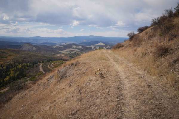
South Divide
This is a series of well-graded or slightly bumpy roads that will take you from Ridgway to Olathe over the Uncompaghre Plateau. The south part has vast views of open ranchland, the center is in the Uncompaghre National Forest, and the north part is on a high desert mesa above Robideau Creek. All roa...
Learn more about South Divide
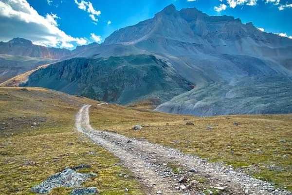
Governors Basin
The Governors Basin Trail is a rugged alpine route that climbs steadily into the high country above Ouray. The road is narrow and primarily one lane, with uphill shelf-road exposure for roughly 90% of its length. Conditions are rocky throughout, with some rougher sections that demand careful tire pl...
Learn more about Governors Basin
Sidney Basin
Short trail off of Governors Basin trail in Ouray. It leads to some open meadows, some nice views and an old abandoned mine. Be aware there is another trail to the east on the map indicated with dotted lines. It is a VERY narrow trail with no areas to pass another vehicle and areas washing out, so b...
Learn more about Sidney Basin
Fox Creek ATV
Fox Creek ATV trail is an easy two-track through a forest of pines, aspens, and blue spruce trees, crossing several muddy small stream crossings right away. It climbs up through the mountainside, with small loose pieces of rock in the trail, and wide curves through beautiful aspen groves. There's po...
Learn more about Fox Creek ATV
Beginner ATV trails near Ridgway, Colorado
Explore ATV-friendly trails near you. These trails are accessible for vehicles up to 50 inches wide, perfect for ATVs and smaller off-road machines.
Owl Creek Pass
This is an enjoyable and easy 45-mile trip over Owl Creek Pass between the Uncompahgre and Cimarron Rivers. There can be a few water-filled potholes, but nothing that would stop a passenger car with reasonable clearance. Perhaps it would be muddier early in the year. John Wayne filmed scenes from bo...
Learn more about Owl Creek Pass
East Dallas Trail
Easy wide dirt trail mostly through private property with access to National Forest land and dispersed camping at the end. The first third of the trail is a smooth dirt road that can get muddy and slick when wet after a rain storm. Higher up, the trail gets bumpy with a more rocky road surface, but ...
Learn more about East Dallas Trail
Cow Creek
County Road 12 turns into the rutted dirt trail of Cow Creek. It is a narrow trail with few places for passing vehicles. There is a stretch of shelf road as it ascends and parallels the Ramshorn Ridge with Cow Creek running along the bottom of several gulches. You will encounter several creek crossi...
Learn more about Cow Creek
A Spur
The .8-mile long Spur A is an easy flat two-track that goes along the edge of a hillside, on a shelfy path between scrub oak and tall grass. You'll be overlooking the valley as you ride west, and have a view of Pinnacle Ridge as you ride back east. It has some small dips and big rollers over water b...
Learn more about A Spur
Beginner UTV/side-by-side trails near Ridgway, Colorado
Find UTV and side-by-side trails near you. These trails accommodate vehicles up to 60 inches wide, ideal for UTVs, side-by-sides, and wider off-road rigs.
Owl Creek Pass
This is an enjoyable and easy 45-mile trip over Owl Creek Pass between the Uncompahgre and Cimarron Rivers. There can be a few water-filled potholes, but nothing that would stop a passenger car with reasonable clearance. Perhaps it would be muddier early in the year. John Wayne filmed scenes from bo...
Learn more about Owl Creek Pass
East Dallas Trail
Easy wide dirt trail mostly through private property with access to National Forest land and dispersed camping at the end. The first third of the trail is a smooth dirt road that can get muddy and slick when wet after a rain storm. Higher up, the trail gets bumpy with a more rocky road surface, but ...
Learn more about East Dallas Trail
Cow Creek
County Road 12 turns into the rutted dirt trail of Cow Creek. It is a narrow trail with few places for passing vehicles. There is a stretch of shelf road as it ascends and parallels the Ramshorn Ridge with Cow Creek running along the bottom of several gulches. You will encounter several creek crossi...
Learn more about Cow Creek
Last Dollar Road
Bumpy, colorful, vast, and adventurous, this hidden dirt road in historic ranching country gives stunning rewards for those willing the take the time to get around the bend. As Last Dollar Road winds through a low valley surrounded by jagged peaks and deep-blue skies, each bend delivers jaw-dropping...
Learn more about Last Dollar Road
The onX Offroad Difference
onX Offroad combines trail photos, descriptions, difficulty ratings, width restrictions, seasonality, and more in a user-friendly interface. Available on all devices, with offline access and full compatibility with CarPlay and Android Auto. Discover what you're missing today!
Open Trail Map