Last Dollar Road

Total Miles 18.5
Technical Rating
2 Easy
Best Time Spring, Summer, Fall
Trail Type Full-Width Road
Accessible By
Open Trail Map

Trail Overview

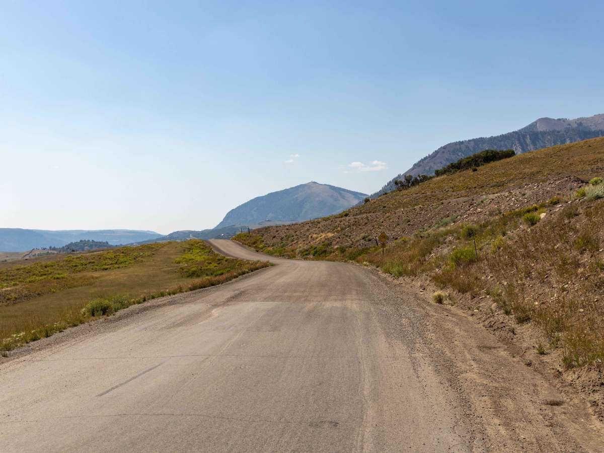
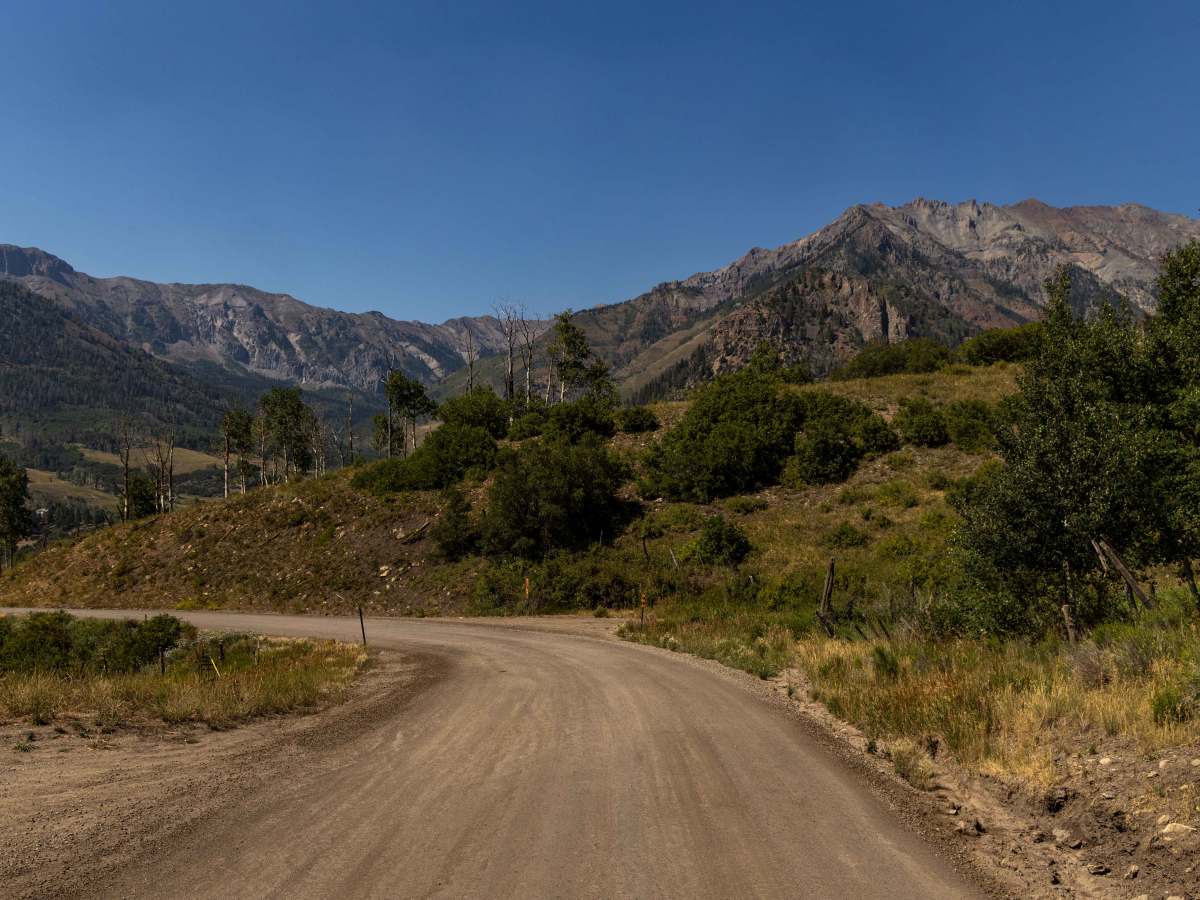
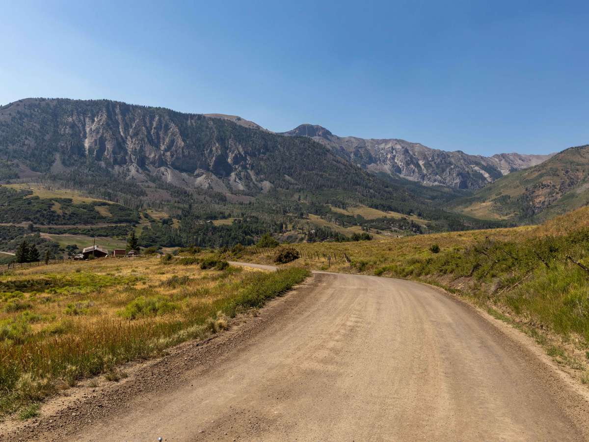
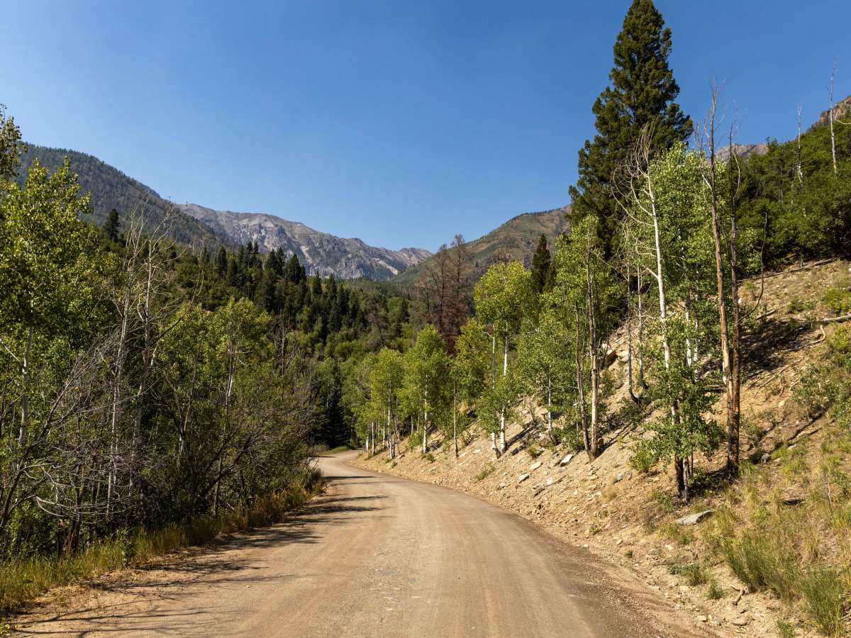
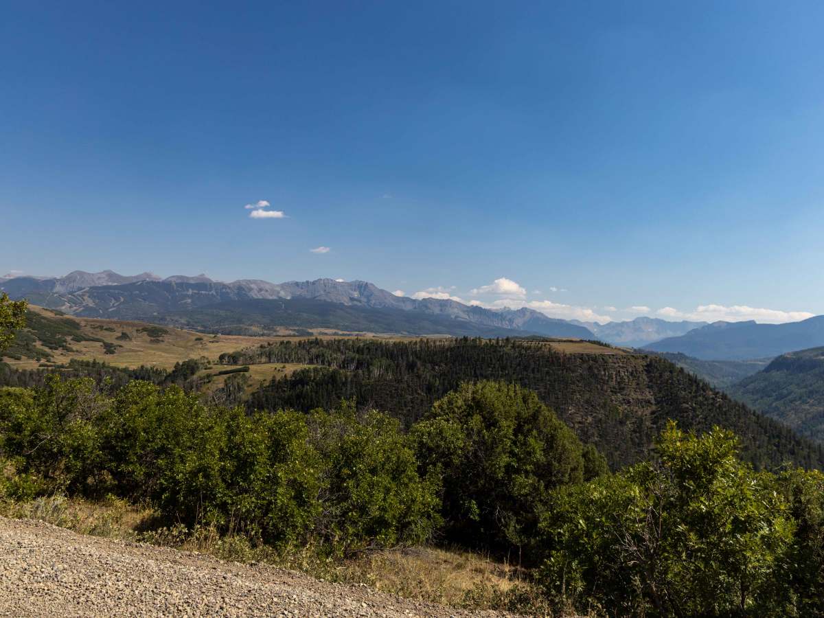
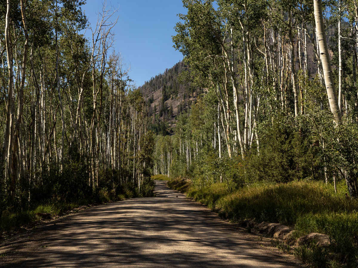
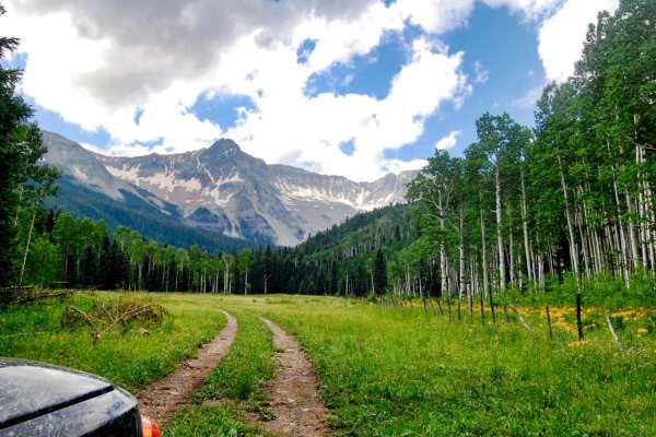
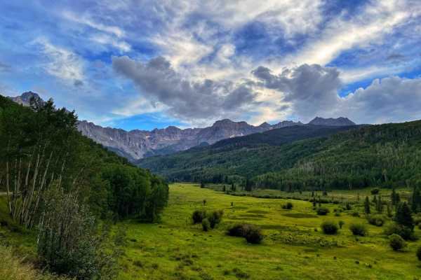
Bumpy, colorful, vast, and adventurous, this hidden dirt road in historic ranching country gives stunning rewards for those willing the take the time to get around the bend. As Last Dollar Road winds through a low valley surrounded by jagged peaks and deep-blue skies, each bend delivers jaw-dropping scenery. At one turn you'll find yourself in a cathedral of sun-bathed aspens; at another, a flat vista with views of a quilt-like terrain of furry pines and aspens; turn again, and you're in a wide-open grassy field, where pristine nature is the only thing between you and the San Juan Mountains.

Photos of Last Dollar Road

Difficulty

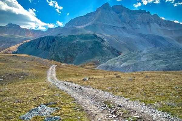
This road is well traveled, with the tree-lined and rocky middle section being the most challenging part of the trail. There are no major obstacles on this trail, though some of the rockier sections may become exacerbated with use, and the small water crossings may become more challenging during or after moisture events. Overall, this is a great trail.

History

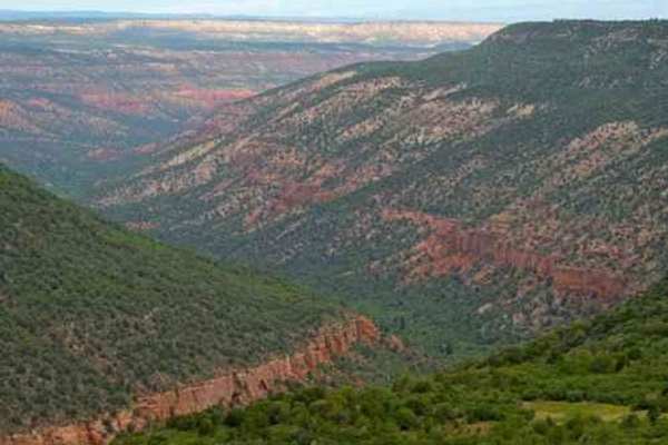
Historically, Last Dollar Road follows routes originally used for local ranching and mining access, linking small settlements and pastures throughout the area. Today, it offers a mix of pastoral scenery and alpine views, with open meadows and occasional forested sections. Wildlife sightings are common, including deer and small mammals, and the trail’s mix of wide-open stretches and narrow rocky sections gives a taste of Colorado’s varied backcountry landscape.

Technical Rating

2

Status Reports

Add Status Report
Rich Ophir Pass George
Nov 22, 2025
Open
Beautiful Fall color on early October trip with dry conditions. Basic driving skills were adequate for this route.
Omar Loera
Nov 07, 2025
Open
Very easy trail, well maintained.
Geoff T
Oct 29, 2025
Open
Drove South-North. Fairly easy trail and would actually rate as 2/10. The only challenge was a bit of frozen snow/ice on north side that resulted in a little slippage but still easy. Over all quite nice and wonderful views.
Darinn Mammeli
Oct 08, 2025
Open
East going trail. I’d give it a 3/10. Not many people today. A lot of dear and quail we saw.
Cris Schnacker
Oct 04, 2025
Open
JB Rancor
Sep 30, 2025
Open
Road Closed signage, plus construction equipment effectively blocking the road at the North end.
G 2
Sep 25, 2025
Open
Wide Open Roams
Sep 17, 2025
Open
We started the Last Dollar Road from the Ridgeway side, right off the highway. The beginning is an easy, wide fire road—smooth with plenty of room. After climbing, we came to a split marked with a backcountry sign warning of limited emergency response. From there, the trail grew rockier and steeper as the elevation picked up. Driving through the big aspen groves was gorgeous, with leaves just starting to change. We stopped at the first dispersed camping area for the night—sunset views were incredible. On day two, we dropped into Telluride, where the trail grew more challenging. In our EarthRoamer, one section had us edge to edge and needing a spotter. The road was fairly busy with two-way traffic, so plan for that. Overall, this trail is stunning with varied terrain, camping spots, and scenery that make it worth the drive. Beginner-friendly at the start, but large rigs should use caution in tighter sections. Watch: https://youtu.be/7P8rtnFNoXY
Rick Lamm
Jul 10, 2025
Open
very chill road. was kinda nervous about doing it because of posts I'd seen online about not running it after a rain and the trail rating/run time on here. slow, easy going and I was done in 90 min s-n. the muddiest bit was going up the hill to the pass, but a little extra gas and it was fine. the actual worst part was when you enter the ranchland area, Ridgway side.
Matt M
Jul 06, 2025
Open
This road is 25% graded gravel, 60% rutted/rocky dirt/hardpack and 15% narrow more "typical" CO trail. I made the run from S-N but I would STRONGLY suggest N-S finishing on the Telluride side. The views and general scenery are MUCH better coming down that way. A one and done for me. The best views are above the airport until you get up near the pass but not all the way there. A lot of the time you are in mixed Aspen/Pine forests with minimal views. This is a popular area for road side camping so if you want some good sites, worth the drive I suspect. I wouldn't want to commute back and forth into town daily however...
Robert Parks
Jun 30, 2025
Open
Trail is open and in decent shape.
Tony Rigiero
Jun 25, 2025
Open
John Griffin
Jun 17, 2025
Open
Aaron Chokbengboun
Jun 15, 2025
Open
Trail was accessible for AWD vehicles. No issues with a lifted 23 CRV!
Carson Rogers
Jun 03, 2025
Open
Great views at the top of the trail, no snow just a little bit of mud

Last Dollar Road Trail can be accessed by the following ride types:

  • Single Track
  • 50 Inch
  • 60 Inch
  • High Clearance
  • Full Width

Last Dollar Road Map

The onX Offroad Difference

onX Offroad combines trail photos, descriptions, difficulty ratings, width restrictions, seasonality, and more in a user-friendly interface. Available on all devices, with offline access and full compatibility with CarPlay and Android Auto. Discover what you're missing today!

Open Trail Map