California Gulch

Total Miles 5
Technical Rating
2 Easy
Best Time Summer, Fall, Spring
Trail Type Full-Width Road
Accessible By
Open Trail Map

Trail Overview

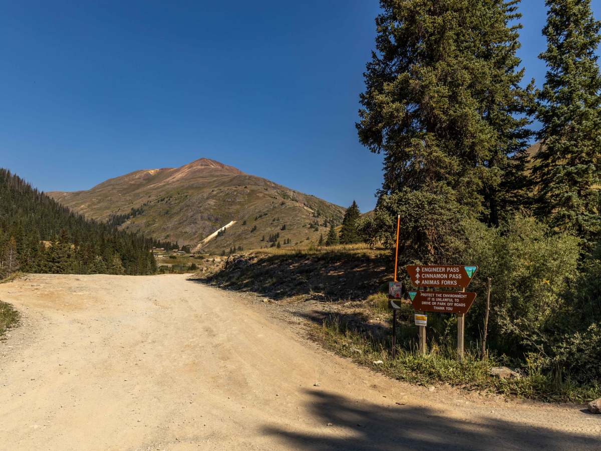
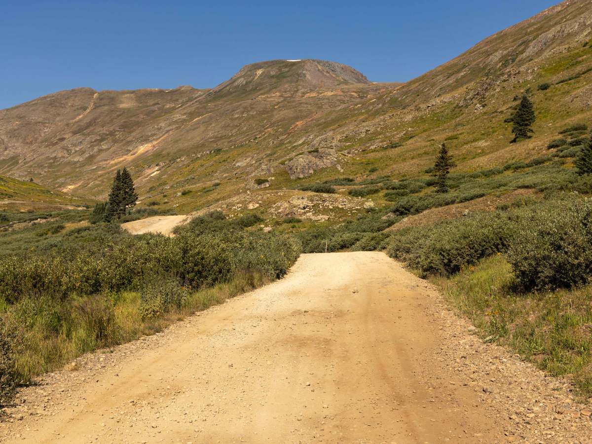
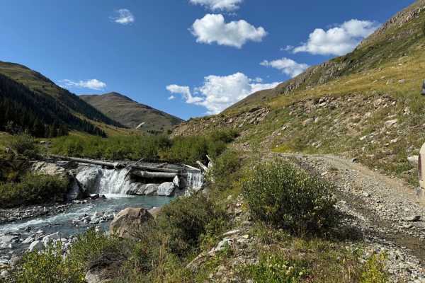
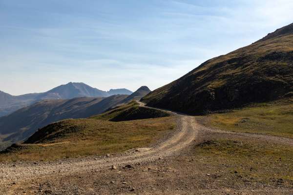
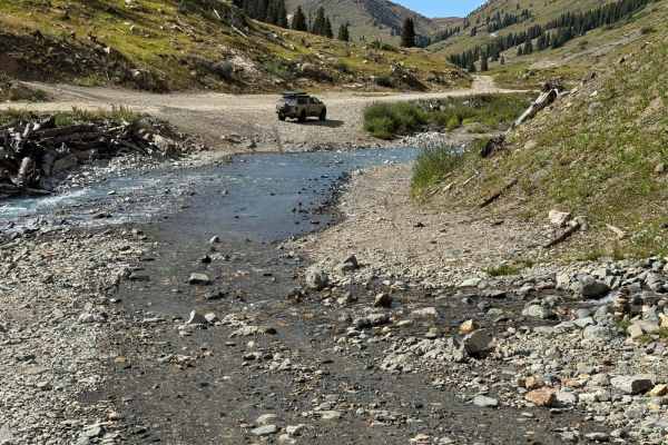
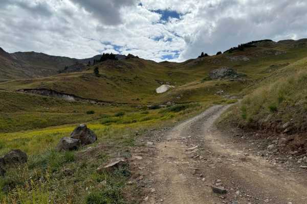
The California Gulch Trail is a bumpy, rocky route that weaves its way through the high country with sections of exposed bedrock and occasional slickrock. Despite the rough surface, there are no major obstacles, making it suitable for most high-clearance vehicles. Drivers should expect some water along the route, including small crossings and streams near the bottom of the gulch. The trail includes tight switchbacks and narrow shelf roads, requiring careful navigation in places. Cell service is nonexistent throughout, so offline navigation is recommended. A highlight of the drive is the viewpoint near the top, while a small alpine lake awaits at the lower end of the gulch, making for a rewarding start or finish to the journey.

Photos of California Gulch

Difficulty

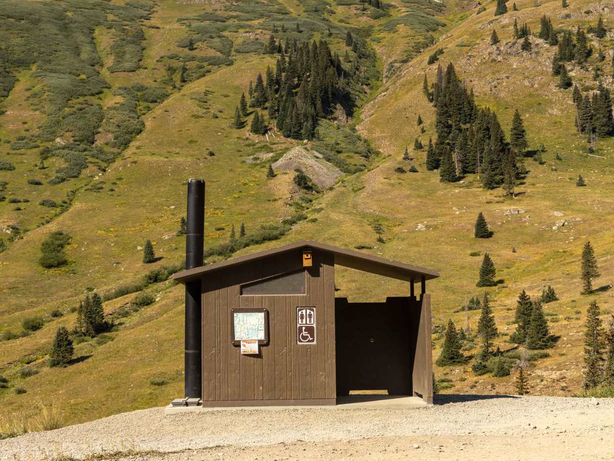
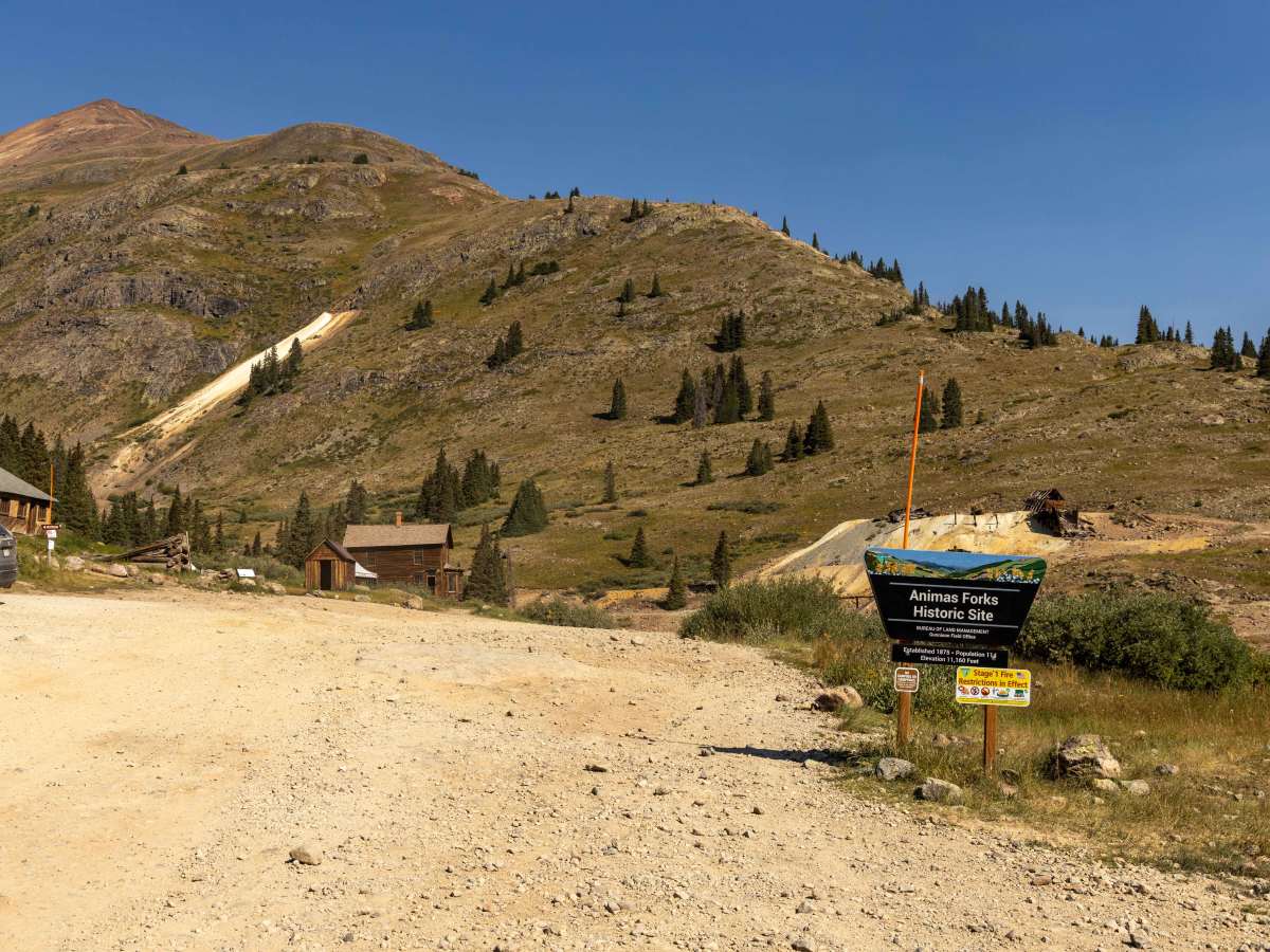
This is an unmaintained trail that is well traveled. It is wide enough for room to pass, though it does narrow at some points on the shelf road sections that may require parties to reverse to pass. There is some water runoff near the bottom, as well as a preserved mining area, restrooms, and parking.

History

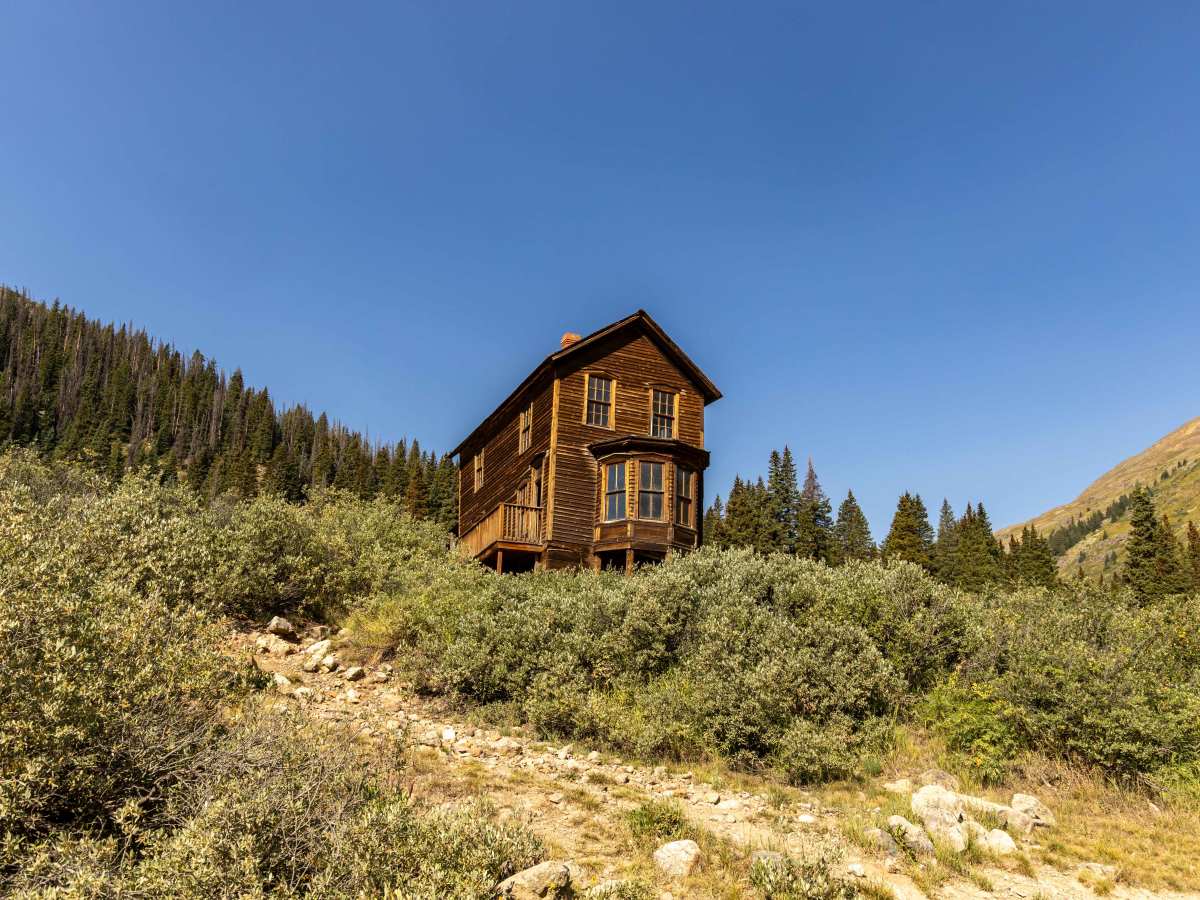
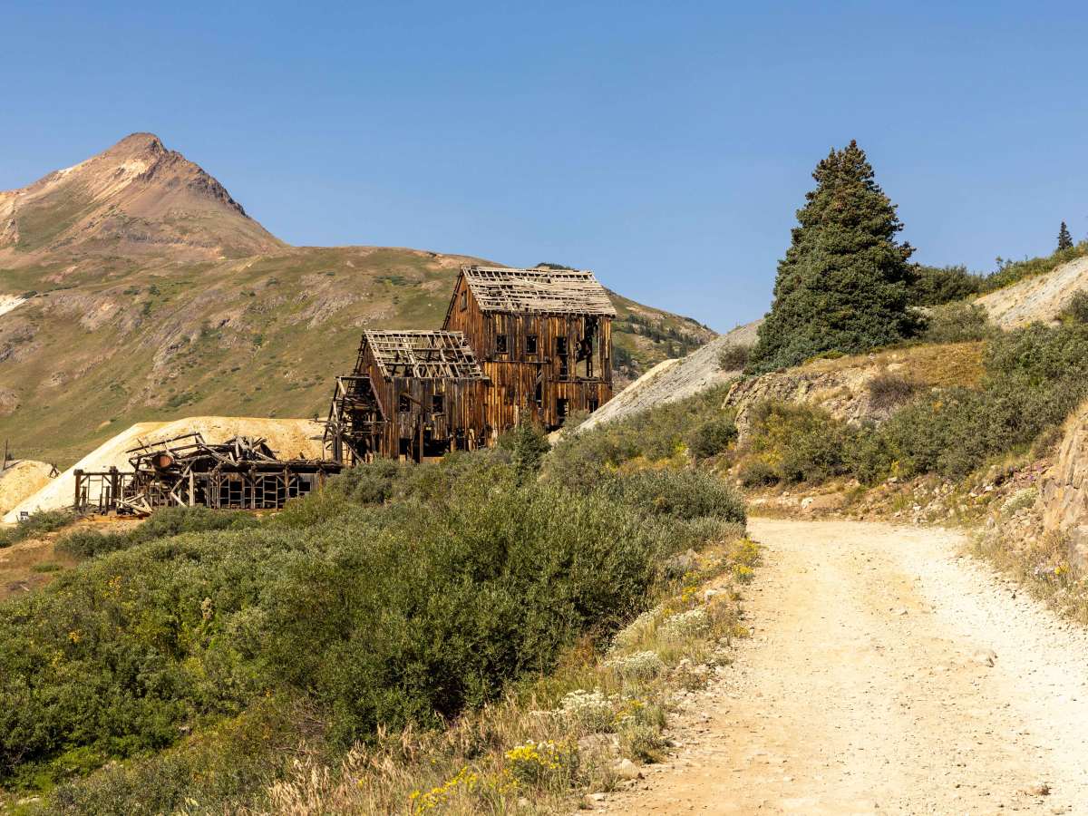
Historically, California Gulch was a center of early mining activity in the San Juan Mountains. Silver and gold discoveries in the mid-to-late 1800s brought prospectors to this rugged area, and remnants of that past can still be spotted along the route. Today, instead of ore wagons and mining camps, travelers encounter high alpine scenery—lush meadows, patches of wildflowers in the summer, and sweeping mountain views. Wildlife such as marmots and pikas are commonly seen among the rocks, while the lake at the bottom offers a peaceful reminder of the gulch’s glacial origins. The mix of mining history and alpine beauty makes California Gulch a memorable exploration of Colorado’s backcountry.

Technical Rating

2

Status Reports

Add Status Report
Matt Stephens
Oct 18, 2025
Open
Deep snow and could not see path.
Ashley Cook
Oct 05, 2025
Open
Icy and snow packed on top of California Pass!
Jared Simpkins
Aug 30, 2025
Open
This was one of my favorite trails that I went on in the whole area. It was very fun and the hill climbs were entertaining.
Larry Lengner
Aug 30, 2025
Open
Easy road for MX bike or Jeep. Nothing out of ordinary today. Did see some adventure bikes having trouble around hurricane pass due to the rocks and steepness.. Normal dual sport would have no problem.
John P
Aug 12, 2025
Open
Beautiful trail! Had no problem driving through and had more than enough opportunity to allow traffic to pass. This is one of my new favorite drives.
Kyle Bacon
Aug 07, 2025
Open
First time on the trail lots of fun was expecting it to be rougher went with 4 people in a Jeep JKU, 4 people in Polaris side side, 1 on Polaris ATV, 2 people in Polaris RZR, 4 people in a Toyota Tacoma, 3 people in a Jeep JLU.
Steven Farr
Jul 29, 2025
Open
Clean pass today. Trail going down to the lake is smooth. traffic at the lake, wish people would park respectfully and not block everyone in, but its a public trail and still nice.
Alex A
Jul 04, 2025
Open
Easy and dry. Lots of traffic on the 4th. Steep climb to the summit
Logan Hopson
Jul 02, 2025
Open
Overall, pretty easy trail. There are some spots, especially at California Pass, where it’s very steep and slick from snowmelt. The views are incredible. Steep shelf roads on either side of the pass. The view of Lake Como at the top is amazing.
Kenny Galloway
Jun 24, 2025
Open
It’s open There was very light traffic at the time I passed through.
Rafael Rendon
Jun 22, 2025
Open
Still closed due to snow, there is a dozer sitting there that looks like it came from the east end and was able to get to and plow to the west side of the snow. Tried to get over the area that was plowed from the west but it’s still too deep and gets deeper towards the east end prob about 40 -50 yards of snow the get over.
Troy Mohrland
Jun 02, 2025
Open
Deep snow just up from Animas. Not getting through workout something with tracks.
Ethan Francis
May 30, 2025
Open
Broke through 2 deep snow banks to get to this impassable one. Lots of snow from here to summit. Snow still 4’ deep easily.
Levi Perrine
May 14, 2025
Open
Deep snow blocking trail at Animas Forks.
Andy Wickham
Sep 07, 2024
Open
A fair amount of traffic but nothing bad. I wouldn't want to run it without low-range 4x4. Otherwise clear and dry. Great scenery!

California Gulch Trail can be accessed by the following ride types:

  • Single Track
  • 50 Inch
  • 60 Inch
  • High Clearance
  • Full Width

California Gulch Map

The onX Offroad Difference

onX Offroad combines trail photos, descriptions, difficulty ratings, width restrictions, seasonality, and more in a user-friendly interface. Available on all devices, with offline access and full compatibility with CarPlay and Android Auto. Discover what you're missing today!

Open Trail Map