
Beginner Off-Road Trails
Near North Las Vegas, Nevada
Explore All Beginner Trails Near North Las Vegas, Nevada
Beginner Off-Road Trails Near North Las Vegas, Nevada
Discover the best beginner-friendly off-road trails near you. These easier, lower-rated trails are a great place to start — browse trail maps, check difficulty ratings, and find your next adventure.
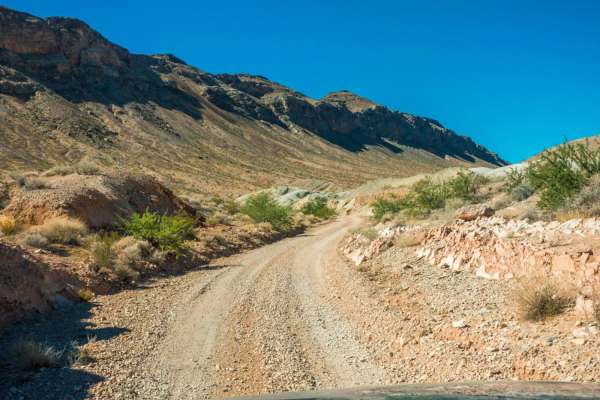
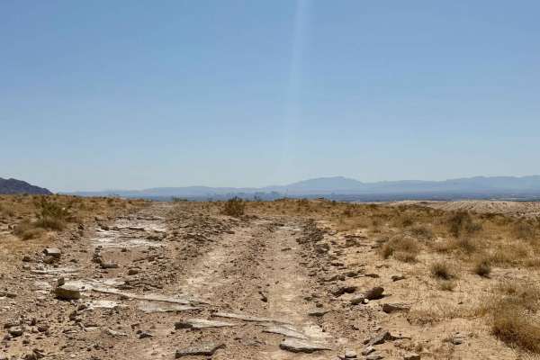
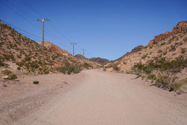
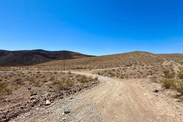
Kodachrome Road
Kodachrome Road is an easy trail and is suitable for any type of vehicle. Along the way, you will see many colorful geological formations. The colorful landscape inspired the trail's name. Along the way, you will pass by Frenchman Mountain, which makes up the eastern boundary of the Las Vegas Valley...
Learn more about Kodachrome Road
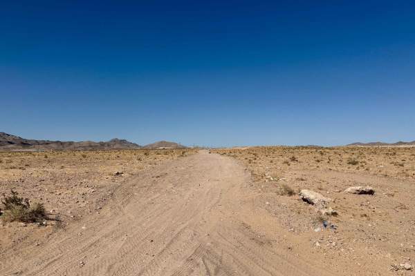
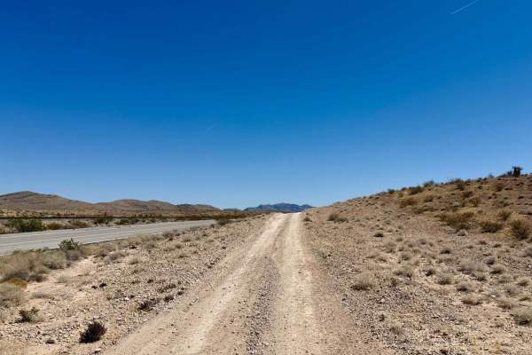
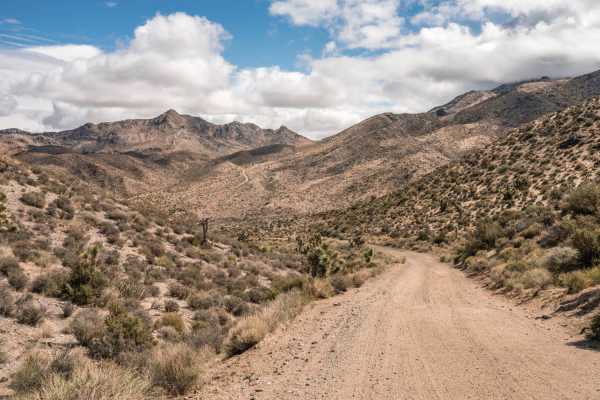
The 604 Parallel
The 604 Parallel is a well-known trail that offers an easy off-roading experience characterized by generally rocky terrain and longer stretches of whoops. This trail is versatile, featuring sections wide enough to accommodate oncoming traffic, making it suitable for larger vehicles. However, you'll ...
Learn more about The 604 Parallel
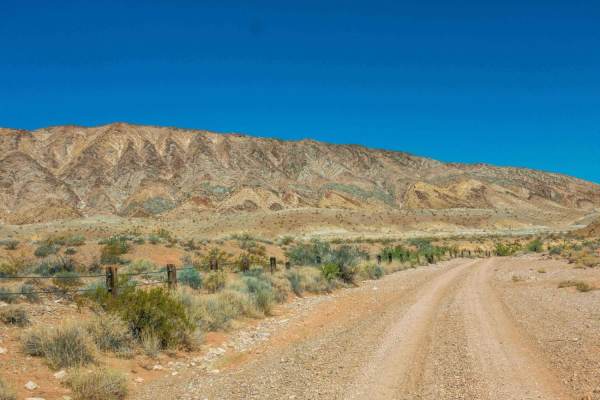
Lava Butte Loop
Rainbow Gardens and Lava Butte form this loop trail. It is an easy trail suitable for any 4x4 truck or SUV, as well as off road vehicles and mountain bikes. Red, tan and white hills make up the colorful Rainbow Gardens loop while a dark volcanic ridge forms the Lava Butte side. Views of the Las V...
Learn more about Lava Butte Loop
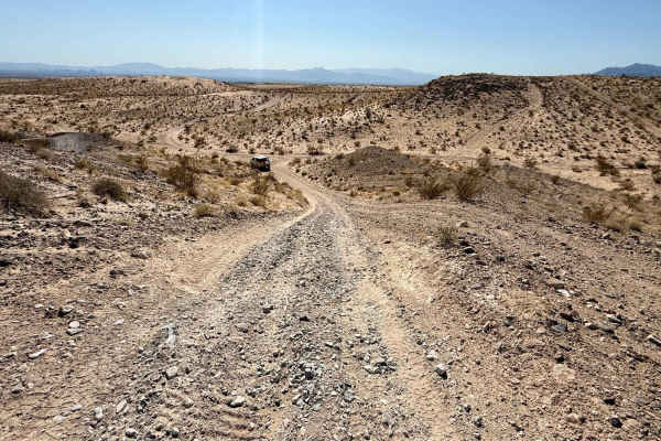
Fish Hook
Fish Hook is an exciting trail that begins just south of the Apex staging area, offering a pleasant ride along a ridge before transitioning into a loose hill that descends into a sandy wash. This route provides an adventurous opportunity for off-road enthusiasts, featuring a series of blind and loos...
Learn more about Fish Hook
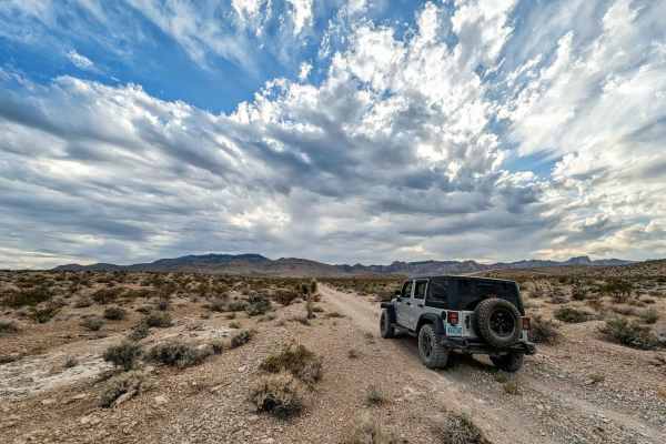
Nellis Bypass to Vegas View Ridge
The Nellis Bypass to Vegas View Ridge is an adventurous and scenic trail that weaves through rocky ridgelines and picturesque canyons. This route offers a balanced mix of challenging rocky sections alongside easier stretches, providing a "choose your own adventure" experience that caters to various ...
Learn more about Nellis Bypass to Vegas View Ridge
Pabco Frontage Trail
Pabco Frontage Trail runs alongside the private Pabco Mine road. This route provides essential access to the vast network of trails in the area. This trail is predominantly easy to navigate, making it suitable for various vehicles and a great way to explore the desert landscape. As you travel along ...
Learn more about Pabco Frontage Trail
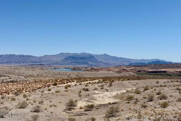
Gypsum Point
Gypsum Point is an easy, washboard gravel route leading to a scenic viewpoint overlooking the area. You can catch glimpses of the lake at higher watermarks, making this a nice spot for a quick stop to take in the views. This trail features plenty of day-use pullouts and spurs, allowing for easy park...
Learn more about Gypsum Point
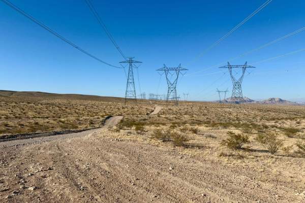
High Voltage
High Voltage is a fun and fast trail connecting the Color Rock Quarry Trail in the north to the Nellis Bypass in the south. This trail primarily consists of a compacted gravel surface, with ample space to pull over and allow oncoming traffic to pass. As you navigate High Voltage, you'll encounter an...
Learn more about High Voltage
Bootleg Canyon
This is a scenic trail that takes you to several viewpoints high above Boulder City and the Las Vegas Valley. The trailhead is accessed just outside of downtown Boulder City, Nevada. The trail is well-maintained and easily accessible to any high-clearance vehicle. There are several mountain bike tra...
Learn more about Bootleg Canyon
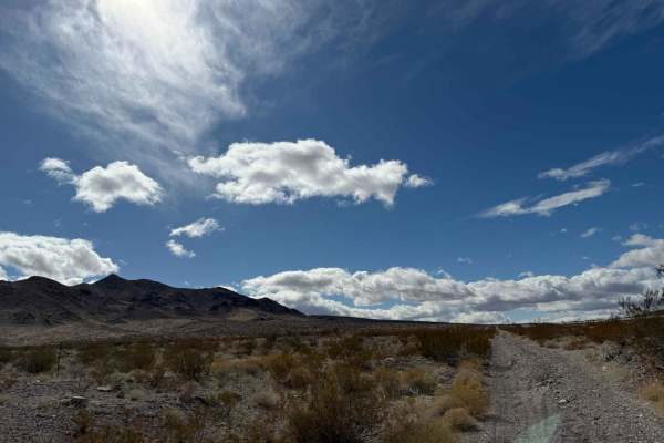
Bird Spring Pass
This is an easy, scenic trail through the Nevada desert. Although the trail lacks any large trees, you do get to experience the natural offerings of the desert as well as great views of the Spring Mountains to the west. The elevation gain provides views of Mount Potosi, Mount Charleston, and the Las...
Learn more about Bird Spring Pass
Wilson Tank Trail
The trail starts just outside of Las Vegas by one of the last housing communities before BLM land. At first glance, it doesn't look great, but about a mile into the trail, the populated world drops away and the scenery is gorgeous. The first few miles are a fun wash (note, this wash will flood in a ...
Learn more about Wilson Tank Trail
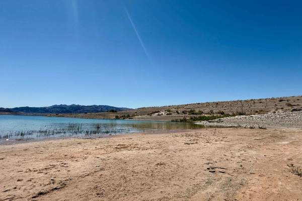
Boxcar Cove
Boxcar Cove offers a nice, short, and easy washboarded ride that leads you down to the tranquil waters' edge at Boxcar Cove. This route is perfect for those looking to escape for a relaxing day by the lake, with plenty of places to park and enjoy the serene environment while dipping your feet in the...
Learn more about Boxcar Cove
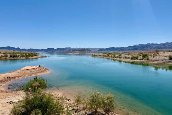
Crawdad Cove
Crawdad Cove is a delightful offshoot of Boxcar Cove. It offers visitors a fresh and enjoyable experience as it winds down to the low water line with ample access points for enjoying the water. This trail invites you to explore its scenic surroundings, where you'll discover several flat spots and fi...
Learn more about Crawdad Cove

Seven Magic Mountains
Seven Magic Mountains is one of the most recognizable roadside stops outside Las Vegas, but this route adds an off-road twist to the experience. Instead of taking the standard paved-road approach to the colorful desert art installation, this trail follows a more adventurous route through open Mojave...
Learn more about Seven Magic Mountains
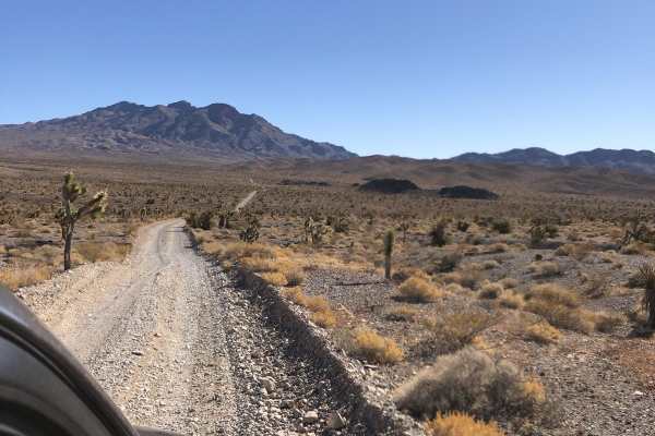
Gass Peak Rd
This out and back trail has great views of the city and surrounding mountains. Most of the trail is wide enough for two vehicles to pass. Very little in terms of obstacles, but still a great day trip to explore the mines and caves along the trails. At the end you are greeted with an incredible view ...
Learn more about Gass Peak Rd
Blue Diamond Cut-off
This is just a cut-off route from Blue Diamond BLM Access to Restless Road that takes you back to State Highway 160 or over to Cottonwood Pass Trail. It's only a bit over half a mile with pleasant desert views. A high-clearance vehicle is needed for this cut-off.
Learn more about Blue Diamond Cut-off
Lucky Strike Road
The trail starts off of Kyle Canyon Rd (Highway 157) and takes you into Grapevine Canyon in Mount Charleston. 4WD is recommended. The first part of the trail is pretty easy with some sandy areas that lead to Grapevine Springs. This is a beautiful canyon with a lot of greenery, as you continue past t...
Learn more about Lucky Strike Road
West End Wash South 93
West End Wash South 93 offers a short and sweet out-and-back adventure, making it a convenient option for those exploring the area. A sign at the beginning indicates that the trail officially ends at one mile, and there's evidence of an old gate or fence approximately at the 1.2-mile mark. As you jo...
Learn more about West End Wash South 93
Shock Test Alley
This well-known roadside "send-it" spot is a go-to destination for shock testing and tuning. It features a mix of tight, loose whoops that challenge suspension setups, along with brutally choppy washboard sections that will put any vehicle to the test. Whether you're dialing in your rig or just out ...
Learn more about Shock Test Alley
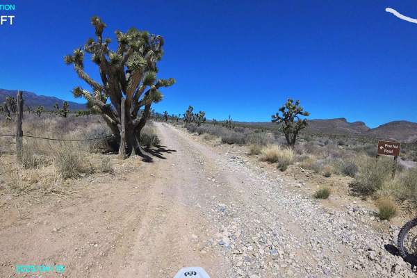
Pine Nut Road
This road starts at Mormon Well Road and heads Northwest to a dead end at a campsite. It is an easy road with no real obstacles. It starts in a Joshua tree forest and ends at the base of the Sheep Mountains with evergreens. The camp at the end is overlooking a canyon. This road and all roads in the ...
Learn more about Pine Nut Road
Beginner ATV trails near North Las Vegas, Nevada
Explore ATV-friendly trails near you. These trails are accessible for vehicles up to 50 inches wide, perfect for ATVs and smaller off-road machines.
Kodachrome Road
Kodachrome Road is an easy trail and is suitable for any type of vehicle. Along the way, you will see many colorful geological formations. The colorful landscape inspired the trail's name. Along the way, you will pass by Frenchman Mountain, which makes up the eastern boundary of the Las Vegas Valley...
Learn more about Kodachrome Road
The 604 Parallel
The 604 Parallel is a well-known trail that offers an easy off-roading experience characterized by generally rocky terrain and longer stretches of whoops. This trail is versatile, featuring sections wide enough to accommodate oncoming traffic, making it suitable for larger vehicles. However, you'll ...
Learn more about The 604 Parallel
Lava Butte Loop
Rainbow Gardens and Lava Butte form this loop trail. It is an easy trail suitable for any 4x4 truck or SUV, as well as off road vehicles and mountain bikes. Red, tan and white hills make up the colorful Rainbow Gardens loop while a dark volcanic ridge forms the Lava Butte side. Views of the Las V...
Learn more about Lava Butte Loop
Fish Hook
Fish Hook is an exciting trail that begins just south of the Apex staging area, offering a pleasant ride along a ridge before transitioning into a loose hill that descends into a sandy wash. This route provides an adventurous opportunity for off-road enthusiasts, featuring a series of blind and loos...
Learn more about Fish Hook
Beginner UTV/side-by-side trails near North Las Vegas, Nevada
Find UTV and side-by-side trails near you. These trails accommodate vehicles up to 60 inches wide, ideal for UTVs, side-by-sides, and wider off-road rigs.
Kodachrome Road
Kodachrome Road is an easy trail and is suitable for any type of vehicle. Along the way, you will see many colorful geological formations. The colorful landscape inspired the trail's name. Along the way, you will pass by Frenchman Mountain, which makes up the eastern boundary of the Las Vegas Valley...
Learn more about Kodachrome Road
The 604 Parallel
The 604 Parallel is a well-known trail that offers an easy off-roading experience characterized by generally rocky terrain and longer stretches of whoops. This trail is versatile, featuring sections wide enough to accommodate oncoming traffic, making it suitable for larger vehicles. However, you'll ...
Learn more about The 604 Parallel
Lava Butte Loop
Rainbow Gardens and Lava Butte form this loop trail. It is an easy trail suitable for any 4x4 truck or SUV, as well as off road vehicles and mountain bikes. Red, tan and white hills make up the colorful Rainbow Gardens loop while a dark volcanic ridge forms the Lava Butte side. Views of the Las V...
Learn more about Lava Butte Loop
Fish Hook
Fish Hook is an exciting trail that begins just south of the Apex staging area, offering a pleasant ride along a ridge before transitioning into a loose hill that descends into a sandy wash. This route provides an adventurous opportunity for off-road enthusiasts, featuring a series of blind and loos...
Learn more about Fish Hook
The onX Offroad Difference
onX Offroad combines trail photos, descriptions, difficulty ratings, width restrictions, seasonality, and more in a user-friendly interface. Available on all devices, with offline access and full compatibility with CarPlay and Android Auto. Discover what you're missing today!
Open Trail Map