
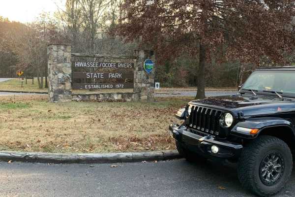
Beginner Off-Road Trails
Near Niota, Tennessee
Explore All Beginner Trails Near Niota, Tennessee
Beginner Off-Road Trails Near Niota, Tennessee
Discover the best beginner-friendly off-road trails near you. These easier, lower-rated trails are a great place to start — browse trail maps, check difficulty ratings, and find your next adventure.
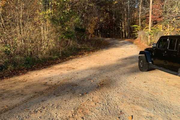
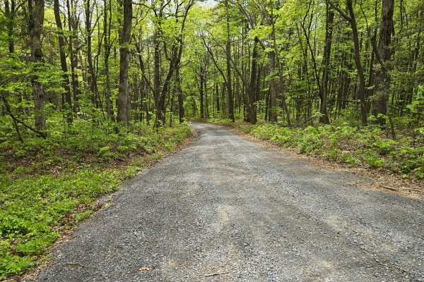
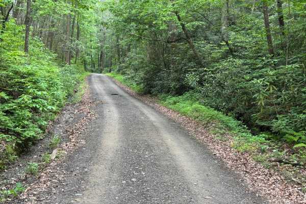
Starr Mountain Road 297
This is a relatively easy gravel road to navigate. There are a few rocky areas and some ruts that may require some vehicle clearance. The road is two-way traffic, so watch as you go around curves. The views that you get while climbing are stunning. There are a few places to camp along the road and o...
Learn more about Starr Mountain Road 297
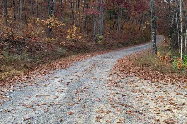
Starr Mountain Road 220
This is a well-maintained gravel Forest Service road. You do not need anything special to drive this road. You may see some deer. There is a bridge close to the end of the road that crosses a creek. There are a few spots where you can look out over the valleys and mountains, but you will need to vis...
Learn more about Starr Mountain Road 220
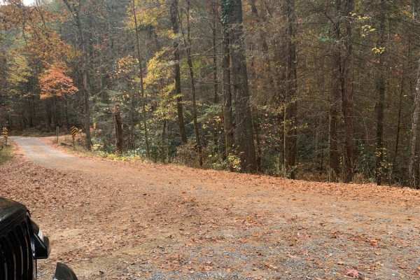
Bullet Creek Ellis Creek 44
This is an easy trail that can be driven by any vehicle. There are a few places on the road to see some great views. Very peaceful drive through the woods. There are several places to disperse camp on this road. There is a bridge across a fairly large creek about 3/4 way to the end of the trail.
Learn more about Bullet Creek Ellis Creek 44
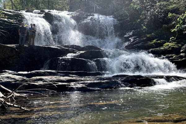
Conasauga Creek Falls Trailhead
Conasauga Spur A is off of Conasauga Creek Off-road Trail. It is a nice forest service road that is a nicely maintained road to the trailhead of Conasauga Waterfall. Along the road, there are some over looks of the valley below. There is a short hike down to the falls that is well worth your time to...
Learn more about Conasauga Creek Falls Trailhead
Spring Creek FSR 27
This gravel road runs beside the Hiwassee River for the first 2.25 miles, which is stunning. At mile 1.25, there is a place to park for a hike to what some people call Lookout Rock. The hiking trail is not marked, but it is easy to follow the worn path that everyone has followed. Although this is a ...
Learn more about Spring Creek FSR 27
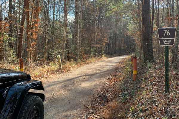
Old Furnace Road FSR 76
This road begins right across from Tellico Beach, which is a great place to eat if you're in the Tellico area. The road starts with an easy climb with great views of the surrounding mountains and valleys. There are several level pull-offs along the road where you can disperse camp. There's cell sign...
Learn more about Old Furnace Road FSR 76
FR126 Waucheesi Bald
The trail to Waucheesi Bald is a gravel trail. The trail has been recently re-graveled. It is a two-way road so make sure you watch for oncoming traffic. The road will take you along Bald River and at the top of Waucheesi Bald is spectacular views, where we had lunch and spent the afternoon. For th...
Learn more about FR126 Waucheesi Bald
Fingerboard Road
This trail is a gravel trail to the trailhead to some pretty cool hikes. With a few spots to camp down next to a quiet little stream. Along the way, you will find some washouts with some hidden culverts that can be uncovered after storms so just be on the watch. This is an out-and-back trail that wi...
Learn more about Fingerboard Road
Oswald Dome Road
Oswald Dome Road - FS 77C is a well-maintained 1/10 gravel forest road that offers a smooth, easy drive along the side of Chilhowee Mountain. It winds through pleasant forest scenery before ending at a closed gate. From the gate, you can park and continue on foot to reach Oswald Bald, with its nice ...
Learn more about Oswald Dome Road
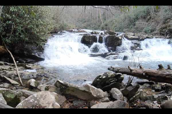
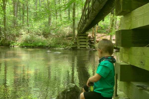
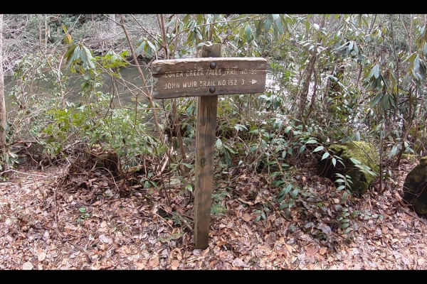
Coker Creek Falls
The trail is off Fingerboard Road. It is mostly gravel with a few washouts along the way. This is a short ride off Fingerboard Road. However, the destination makes this short ride well worth your time. After you make it to the small parking lot get out and hike a short hike down the trail to see the...
Learn more about Coker Creek Falls
Duckett Ridge FSR #22B
The trail winds off the side of the mountain down to the historic Coker Creek River. This is known as the Lower Coker Creek trailhead. You will find a few very secluded camp spots along the river at the end of this trail. Many people use this as a base camp to hike the surrounding trails along the r...
Learn more about Duckett Ridge FSR #22B
Rafter Road
Rafter Road is a well-maintained 2-vehicle-wide gravel road with several residences throughout. There are some beautiful views of the mountains on the west end, and a nice creek crossing about halfway on this section. You may encounter potholes or downed trees while traveling this road, but most veh...
Learn more about Rafter Road
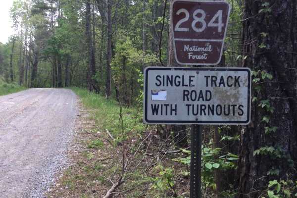
Joe Brown Highway
Joe Brown Highway is a 5.7-mile point-to-point route that follows a generously sized single-lane gravel road with places to pass. The road is well maintained and provides an easy drive through heavily forested terrain. Much of the route offers straightforward travel, with the broad road width and we...
Learn more about Joe Brown Highway
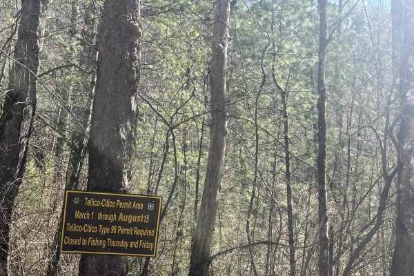
Citico Creek South
Citico CRreekNorth (FSR 35-1) is a well-traveled gravel/ rocky road. This trail will take you down to the beautiful Citico Creek. Citico Creek is well known for its fishing, However, if you want a scenic easy trail, it makes a peaceful afternoon drive. Cell service is hard to come by so make sure yo...
Learn more about Citico Creek South
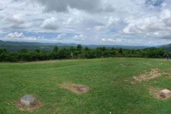
Buck Bald
Gravel road to a beautiful bald that overlooks the mountains of North Carolina, Georgia, and Tennessee. Part of the Cherokee National Forests. To the north, you will see the Nantahala and Yellow Creek mountains of North Carolina. To the south, you will be looking at the North Georgia mountains of bl...
Learn more about Buck Bald
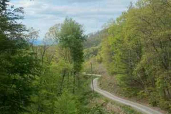
Lowry Top - Tieskee Road
Lowry Top - Tieskee Road is a partially graveled, easy 2/10 forest route that starts nice and smooth but gradually gets more rugged and degraded the farther you go. It winds through a beautiful stretch of Appalachian canopy, with lush trees arching overhead for a really scenic, shaded drive. At the ...
Learn more about Lowry Top - Tieskee Road

Clear Creek (FSR 185)
Clear Creek is located in the Ocoee Ranger District of the Cherokee National Forrest. This trail travels over rolling hills with views of the surrounding mountains to the soft flowing water of Clear Creek. The trail is a single-lane trail with a few ruts and potholes. However, it is safe for most 4W...
Learn more about Clear Creek (FSR 185)
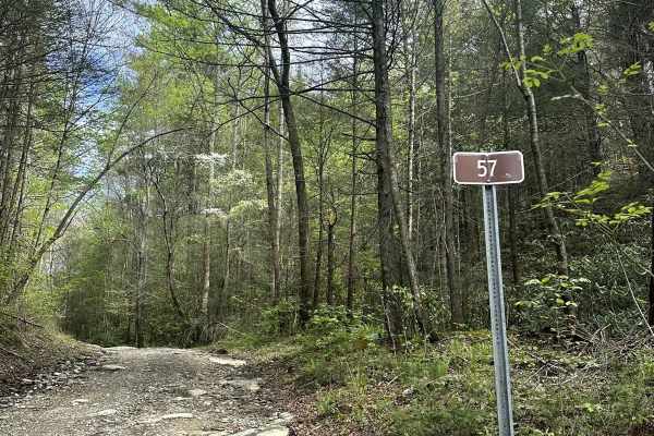
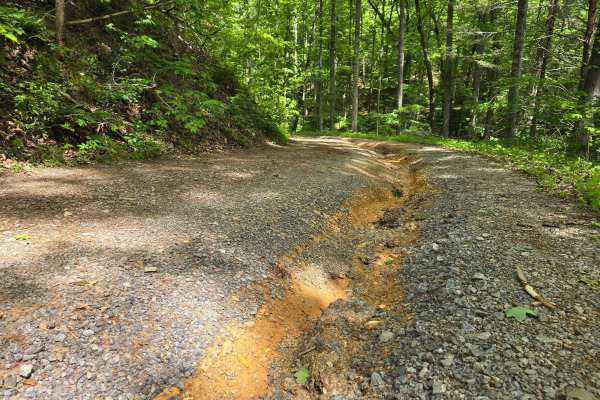
Cane Creek Road - FS 57
FS Road 57 is a gravel route suitable for high-clearance 2WD or 4WD vehicles. While there are some potholes and muddy spots along the way, they shouldn't pose significant issues for capable vehicles. The road can be accessed from the south via the Cherohala Skyway, connecting to Hemlock Road and the...
Learn more about Cane Creek Road - FS 57
Waucheesi Mountain Overlook
This trail is to the top of Waucheesi Mountain. Truly a beautiful sight to behold. The trail stems off of Bald river road in the Tellico Mountains. The trail starts on a nice gravel path that is a single-line road with steep slopes on one side. Be very careful while meeting oncoming traffic. Closer ...
Learn more about Waucheesi Mountain Overlook
Chilhowee Ridge (Oswald-77)
This trail is a service road across Chilhowee mountain that is approximately 10 miles and will take about an hour to travel without stops. The road is well maintained with some rocky surfaces with potential low-hanging trees. An easy route for a day drive through the mountains. Under typical conditi...
Learn more about Chilhowee Ridge (Oswald-77)
Beginner ATV trails near Niota, Tennessee
Explore ATV-friendly trails near you. These trails are accessible for vehicles up to 50 inches wide, perfect for ATVs and smaller off-road machines.
Starr Mountain Road 297
This is a relatively easy gravel road to navigate. There are a few rocky areas and some ruts that may require some vehicle clearance. The road is two-way traffic, so watch as you go around curves. The views that you get while climbing are stunning. There are a few places to camp along the road and o...
Learn more about Starr Mountain Road 297
Starr Mountain Road 220
This is a well-maintained gravel Forest Service road. You do not need anything special to drive this road. You may see some deer. There is a bridge close to the end of the road that crosses a creek. There are a few spots where you can look out over the valleys and mountains, but you will need to vis...
Learn more about Starr Mountain Road 220
Bullet Creek Ellis Creek 44
This is an easy trail that can be driven by any vehicle. There are a few places on the road to see some great views. Very peaceful drive through the woods. There are several places to disperse camp on this road. There is a bridge across a fairly large creek about 3/4 way to the end of the trail.
Learn more about Bullet Creek Ellis Creek 44
Spring Creek FSR 27
This gravel road runs beside the Hiwassee River for the first 2.25 miles, which is stunning. At mile 1.25, there is a place to park for a hike to what some people call Lookout Rock. The hiking trail is not marked, but it is easy to follow the worn path that everyone has followed. Although this is a ...
Learn more about Spring Creek FSR 27
Beginner UTV/side-by-side trails near Niota, Tennessee
Find UTV and side-by-side trails near you. These trails accommodate vehicles up to 60 inches wide, ideal for UTVs, side-by-sides, and wider off-road rigs.
Starr Mountain Road 297
This is a relatively easy gravel road to navigate. There are a few rocky areas and some ruts that may require some vehicle clearance. The road is two-way traffic, so watch as you go around curves. The views that you get while climbing are stunning. There are a few places to camp along the road and o...
Learn more about Starr Mountain Road 297
Starr Mountain Road 220
This is a well-maintained gravel Forest Service road. You do not need anything special to drive this road. You may see some deer. There is a bridge close to the end of the road that crosses a creek. There are a few spots where you can look out over the valleys and mountains, but you will need to vis...
Learn more about Starr Mountain Road 220
Bullet Creek Ellis Creek 44
This is an easy trail that can be driven by any vehicle. There are a few places on the road to see some great views. Very peaceful drive through the woods. There are several places to disperse camp on this road. There is a bridge across a fairly large creek about 3/4 way to the end of the trail.
Learn more about Bullet Creek Ellis Creek 44
Spring Creek FSR 27
This gravel road runs beside the Hiwassee River for the first 2.25 miles, which is stunning. At mile 1.25, there is a place to park for a hike to what some people call Lookout Rock. The hiking trail is not marked, but it is easy to follow the worn path that everyone has followed. Although this is a ...
Learn more about Spring Creek FSR 27
The onX Offroad Difference
onX Offroad combines trail photos, descriptions, difficulty ratings, width restrictions, seasonality, and more in a user-friendly interface. Available on all devices, with offline access and full compatibility with CarPlay and Android Auto. Discover what you're missing today!
Open Trail Map