
Beginner Off-Road Trails
Near Metropolis, Illinois
Explore All Beginner Trails Near Metropolis, Illinois
Beginner Off-Road Trails Near Metropolis, Illinois
Discover the best beginner-friendly off-road trails near you. These easier, lower-rated trails are a great place to start — browse trail maps, check difficulty ratings, and find your next adventure.
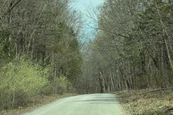
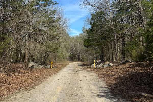
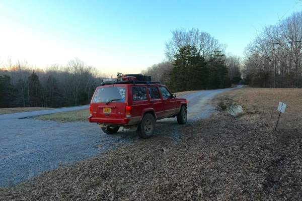
Millstone Bluffs Trailhead
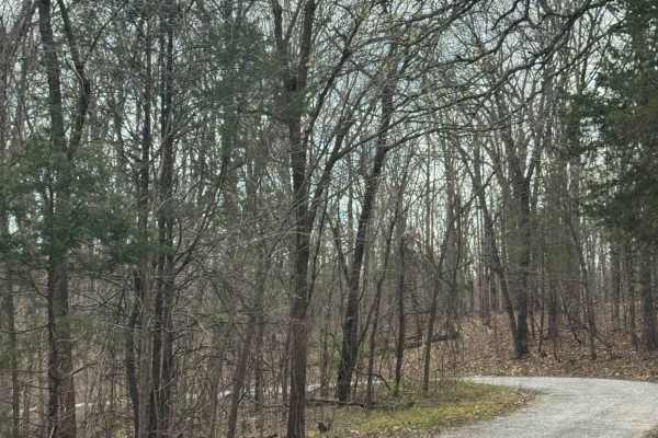
Millstone Bluffs Trailhead is accessed by a maintained gravel road within Shawnee National Forest that leads to a large parking area for hikers. The route is easy to follow and provides straightforward access to one of the area’s popular trail systems. At the end of the road, visitors will find a sp...
Learn more about Millstone Bluffs Trailhead

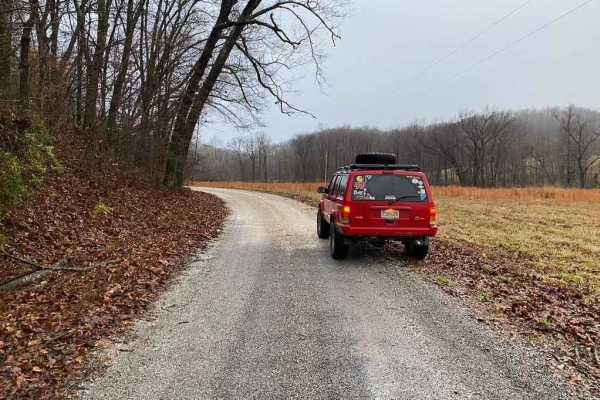
Taylor Ridge Road
Taylor Ridge Road is a gravel route within Shawnee National Forest that leads to a designated trailhead parking area for nearby hiking trails. The road is generally easy to navigate, with occasional ruts that may form after heavy rainfall. At the start of the route, signage indicates a dead end, whi...
Learn more about Taylor Ridge Road
Dutchman Lake Trail
Dutchman Lake Trail is a short gravel road within Shawnee National Forest that leads to a quiet access point at Dutchman Lake. The route is easy to navigate with minimal obstacles, though ruts may develop after periods of heavy rainfall. The boat access area consists of a gravel and grass launch on ...
Learn more about Dutchman Lake Trail

Grandpa's Getaway
Grandpa’s Getaway is a short gravel road that leads to a quiet access point at Little Cache Number 1 Reservoir, also known locally as Bowman Bottoms Fishing Hole. The route is easy to follow and ends at a small gravel and grass parking area near the water. The launch area consists of a natural grave...
Learn more about Grandpa's Getaway
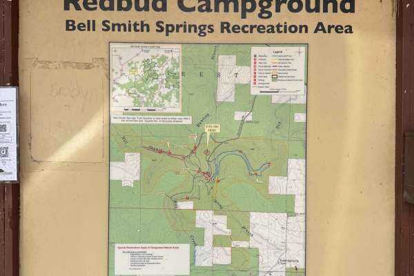
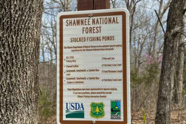
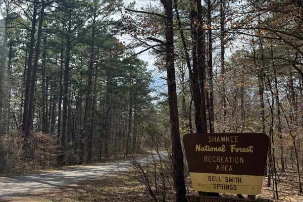
Bell Smith Spring Hiking Area
Bell Smith Springs Trailhead Access is a gravel and partially paved road within Shawnee National Forest that leads to the main hiking trailhead and campground area at Bell Smith Springs. The route is easy to navigate and suitable for most vehicles, making it a primary access point for visitors to th...
Learn more about Bell Smith Spring Hiking Area
Bell Smith Spring Rope Swing Trail
Bell Smith Spring Rope Swing Trail is a gravel road within Shawnee National Forest that leads to a spring-fed swimming area known for its rope swings and deep water access. The route is easy to navigate and follows a typical forest gravel surface with minimal obstacles. At the end of the trail, visi...
Learn more about Bell Smith Spring Rope Swing Trail
Burden Falls Road
Burden Falls Road is a gravel route within Shawnee National Forest that connects the small community of McCormick to Burden Falls Road (402). The road is generally easy to follow and consists of typical forest gravel terrain with occasional uneven sections. This route provides a quieter, more scenic...
Learn more about Burden Falls Road
One Horse Gap Lake Trail
One Horse Gap Lake Trail is a gravel road within Shawnee National Forest that leads to a quiet lakeside access point with several primitive camping opportunities along the way. The route is easy to follow and suitable for most 2WD vehicles, though sections of tree overhang may limit clearance for ta...
Learn more about One Horse Gap Lake Trail
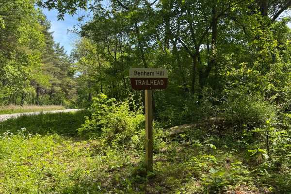
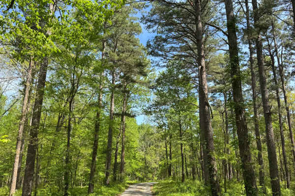
Benham Hill Trail
Benham Hill Trail is a gravel route within Shawnee National Forest that provides access to both recreational driving and nearby equestrian and hiking trail systems. The route begins at a large parking area designed for equestrian use, offering space for trailers and staging before entering the trail...
Learn more about Benham Hill Trail

Dutton Chapel Road
Dutton Chapel Road is a gravel route within Shawnee National Forest that serves as a connector to other trails in the area, including Benham Hill Trail and One Horse Gap Lake Trail. The road is generally easy to follow and consists of typical forest gravel terrain. Along the route, drivers may encou...
Learn more about Dutton Chapel Road
Burden Falls Trail
Burden Falls Trail is a gravel road within Shawnee National Forest that provides access to multiple hiking points leading to Burden Falls. The route is easy to follow and consists of typical forest gravel terrain with minimal obstacles. Along the trail, visitors will find several access points for h...
Learn more about Burden Falls Trail

Shelby Cemetery Trail
Shelby Cemetery Trail is a route within Shawnee National Forest that begins as a gravel road before transitioning into a narrower path with mud, grass, and increasing vegetation overgrowth. At the beginning of the trail, there is an old cemetery along with access to hiking trails and a small primiti...
Learn more about Shelby Cemetery Trail
Lake Of Egypt Campground Drive - FS 871A
This route leads to a primitive campground area within Shawnee National Forest overlooking Lake of Egypt. The trail follows a partially maintained gravel road with frequent tree limbs overhanging that may limit access for larger vehicles. Due to tight clearances, this route is best suited for truck ...
Learn more about Lake Of Egypt Campground Drive - FS 871A
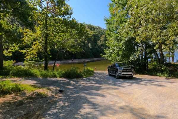
Hickory Point Boat Ramp - FS 871
This route follows a gravel road within Shawnee National Forest and leads to the Hickory Point Boat Ramp at Lake of Egypt. At the Y-intersection, this route branches away from the campground access and continues toward the water. The road surface is similar throughout, consisting of gravel with some...
Learn more about Hickory Point Boat Ramp - FS 871
Nickell Branch - FS 102
Nickell Branch FS 102 is a gravel forestry road through the northwest corner of the Kentucky section, Lake Barkley side, of the Land Between the Lakes National Recreation Area. The road is graceful and a perfect place to visit if coming into LBL from the northern entrance and seeking a quick and rel...
Learn more about Nickell Branch - FS 102
Burner Hill FSR 620
Burner Hill FSR 620 is an old gravel forestry road in the southern area of the Mississippi Bluffs sector of Shawnee National Forest. The road seems near-forgotten, and shows little signs of use or maintenance. Fallen trees add to the fun and challenge of weaving your way to the top of the road. The ...
Learn more about Burner Hill FSR 620
Benberry Cemetery Road - FS 301
Benberry Cemetery Road FS 301 is a gravel Forest Service road through the northwest corner of the Kentucky section, Lake Barkley side, of the Land Between the Lakes National Recreation Area. The Benberry Cemetery Road (also known as Mount Pleasant Cemetery) features a generally easy ride over the ri...
Learn more about Benberry Cemetery Road - FS 301
East Delta Road
East Detla Road, is the eastern section of the road going through Shawnee National Forest connecting the Opossum Trot Trail System to Elco, IL. The road is a steady uphill climb when headed west, gaining 275 feet over it's trek. The gravel road is mild and only shows slight rutting, washing, and mou...
Learn more about East Delta Road
Twin Lakes South - FS 105
Twin Lakes South FS 105 is a gravel forest service road in the northwest corner of the Kentucky section, Kentucky Lake side, of the Land Between the Lakes National Recreation Area. It features a track from one Kentucky Lake cove-side campsite to another cove-side campsite only separated by a single ...
Learn more about Twin Lakes South - FS 105

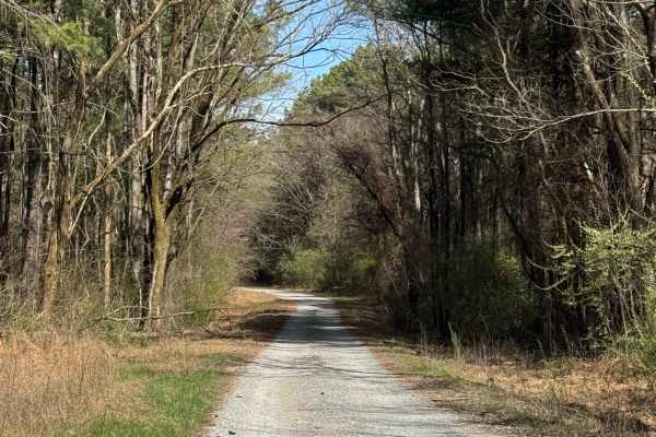
Goose Ridge Trail
Goose Ridge Trail is a gravel route within Shawnee National Forest that offers a straightforward out-and-back drive through forest terrain. The road is generally easy to follow, with some ruts that may develop after rainfall and occasional tree limbs overhanging the route. This trail provides a rela...
Learn more about Goose Ridge Trail
Beginner ATV trails near Metropolis, Illinois
Explore ATV-friendly trails near you. These trails are accessible for vehicles up to 50 inches wide, perfect for ATVs and smaller off-road machines.
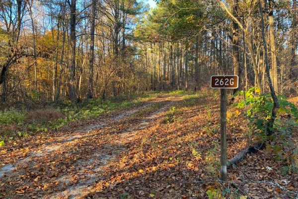
Slick Ridge FSR 262G
The Slick Ridge FSR 262G is a mildly challenging natural fire road that has the reward of a great view of Shawnee National Forest. It features an off-camber eroded section that will test your articulation and clearances. It runs you through several small mud holes and a small grade with tree roots. ...
Learn more about Slick Ridge FSR 262G

FSR 119
Forest Service Road 119 is a semi-maintained dirt and gravel road that connects FSR 112 and FSR 117 within the Land Between the Lakes National Recreation Area. It is on the northern portion of the park in the area known as 'Tornado Valley' after two tornadoes hit the park in 2021. The road is easily...
Learn more about FSR 119
McCraven SFR 220
McCraven SFR 220 is a very scenic nature-viewing gravel road in Shawnee National Forest. It is a very easy trail with a minimal challenge, but there are a few muddy crossings and water collection spots within its medium-grade graveled hills. It also features a couple of branch trails, the SFR 504 an...
Learn more about McCraven SFR 220
Stephens Chapel Road - FSR 415
Stephens Chapel Road--415 is an extremely historic route that navigates directly to one of the last original standing structures within Land Between the Lakes National Recreation Area. The Road is a mix of dirt and gravel and is somewhat maintained. The church remains despite the 2021 tornadoes rava...
Learn more about Stephens Chapel Road - FSR 415
Beginner UTV/side-by-side trails near Metropolis, Illinois
Find UTV and side-by-side trails near you. These trails accommodate vehicles up to 60 inches wide, ideal for UTVs, side-by-sides, and wider off-road rigs.
Lingle Creek Road
Lingle Creek Road is a road through the Southern Central Illinois landscape. Clocking in at 3.6 miles the road parallels Lingle Creek as it etches into the country hillsides and farmland of the area. The road features two low-water bridges that could see flash flooding during heavy rain. The road al...
Learn more about Lingle Creek Road
Opossum Trot Road SFR 628
Opossum Trot Road SFR 628 is a scenic well-maintained gravel road through Shawnee National Forest. The trail features great views and ease of driving, but if you are looking for a thrill, it has a few branch trails that lead off it with some medium to hard challenges. Overall, the Opossum Trot is yo...
Learn more about Opossum Trot Road SFR 628
Slick Ridge FSR 262G
The Slick Ridge FSR 262G is a mildly challenging natural fire road that has the reward of a great view of Shawnee National Forest. It features an off-camber eroded section that will test your articulation and clearances. It runs you through several small mud holes and a small grade with tree roots. ...
Learn more about Slick Ridge FSR 262G
FSR 119
Forest Service Road 119 is a semi-maintained dirt and gravel road that connects FSR 112 and FSR 117 within the Land Between the Lakes National Recreation Area. It is on the northern portion of the park in the area known as 'Tornado Valley' after two tornadoes hit the park in 2021. The road is easily...
Learn more about FSR 119
The onX Offroad Difference
onX Offroad combines trail photos, descriptions, difficulty ratings, width restrictions, seasonality, and more in a user-friendly interface. Available on all devices, with offline access and full compatibility with CarPlay and Android Auto. Discover what you're missing today!
Open Trail Map