
Beginner Off-Road Trails
Near Mendota, California
Explore All Beginner Trails Near Mendota, California
Beginner Off-Road Trails Near Mendota, California
Discover the best beginner-friendly off-road trails near you. These easier, lower-rated trails are a great place to start — browse trail maps, check difficulty ratings, and find your next adventure.
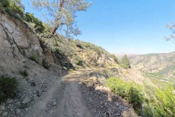
New Idria Dam to Ghost Town
Beginning at the BLM gate southwest of New Idria Dam, this trail winds around the westerly side of the lake and canyon above the former mining town of New Idria. Descending 1,200 feet in elevation, the route will take you along an unpaved dirt path through several areas of switchbacks and narrow she...
Learn more about New Idria Dam to Ghost Town
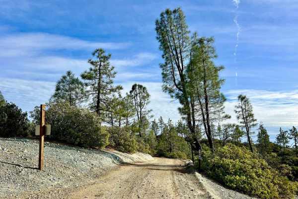
Aurora Cutoff R14
Aurora Cutoff R14 is a narrow two-track trail that traces the top of a ridge, leading you toward the historic Aurora Mine. This scenic route offers plenty of opportunities to explore single-track trails branching off to either side, inviting you to venture deeper into the area's rugged beauty. The m...
Learn more about Aurora Cutoff R14
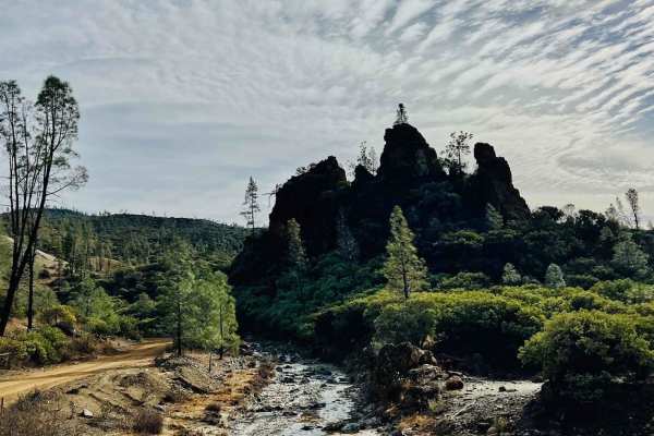
R1 Clear Creek Road
R1 Clear Creek Road lives up to its namesake by following the crisp, flowing waters of Clear Creek as it twists and winds through the canyon toward the hills. This trail provides an enjoyable adventure, rated as a 2, making it accessible for many vehicles. Be aware that there is no cell service alon...
Learn more about R1 Clear Creek Road
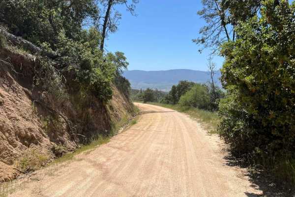
La Gloria Road
La Gloria Road is a graded, well-maintained dirt road that connects the Salinas Valley and US-101 with SR-25 in San Benito County. It is the closest connecting road between Eastern and Western Pinnacles (there is no road through Pinnacles). Access starts at the intersection with Camphora-Gloria Road...
Learn more about La Gloria Road
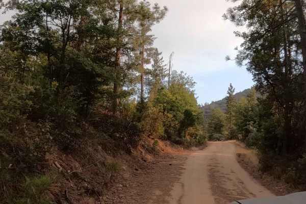
Annex Sale - FS 7S062Y
Annex Sale (FS 7S062Y) is a short, sweet, and incredibly useful out-and-back trail for anyone looking to escape the crowds near Bass Lake. Branching off the paved Highland Drive, this easy dirt two-track climbs gently through a mixed conifer forest, serving essentially as a mile-long driveway to som...
Learn more about Annex Sale - FS 7S062Y
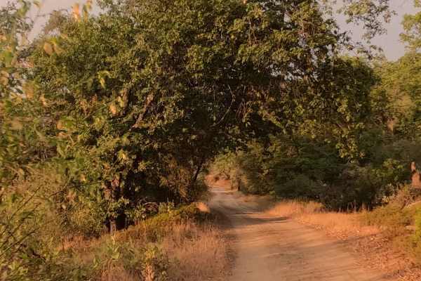
West Malum Ridge - FS 7S075
West Malum Ridge (FS 7S075) is a relaxed, scenic cruiser that invites you to roll down the windows and breathe in the Sierra air. This easy dirt road serves primarily as an access route to some prime real estate for dispersed campers. The trail meanders through a mixed forest of oak and pine, offeri...
Learn more about West Malum Ridge - FS 7S075
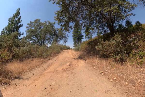
Sonny Meadow - FS 5S016
Sonny Meadow (FS 5S016) acts as a rugged "sampler platter" of Sierra road conditions, serving as a key access point into the National Forest from the west side. The trail begins with a long, slow climb that winds its way up through the timber, immediately establishing that this isn't your average gr...
Learn more about Sonny Meadow - FS 5S016
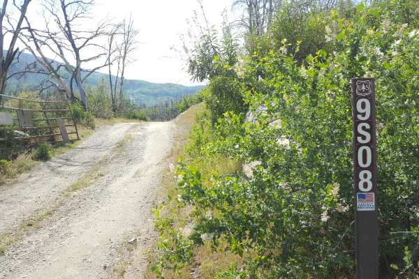
Sugarloaf - FS 9S08
This is a point-to-point single vehicle-width trail in the Jose Creek Basin area. The surface is primarily packed dirt with short stretches of gravel. There can also be shallow ruts and mud holes frequently along the route. This trail will pass through both a section of forest with fire damage and a...
Learn more about Sugarloaf - FS 9S08
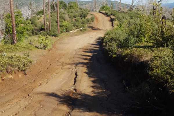
Jose Basin
This is the primary dirt road running through the Jose Creek Basin in the Sierra National Forest and connects the north end of Jose Basin Road to Auberry Road/Highway 168. It is wide enough in most places to allow vehicles to pass each other. Depending on the weather, there could be occasional muddy...
Learn more about Jose Basin
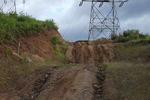
Rector Line 9S006
Rector Line (Forest Service Road 9S006) is a rugged backcountry route in the Sierra National Forest, best suited for high-clearance 4x4 rigs and seasoned drivers looking for a remote challenge near Shaver Lake. This trail stands out for its mix of decomposed granite, embedded rock, and steep, off-ca...
Learn more about Rector Line 9S006
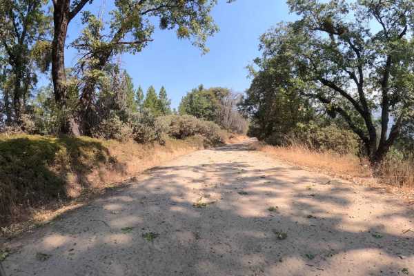
China Wells - FS 6S015
China Wells (FS 6S015) serves as the primary "spinal cord" of the Miami Mountain OHV system. This wide, well-graded forest service road runs north-south through the network, connecting the popular Kamook Staging Area to the southern reaches of the trail system. Unlike the tight, twisty spurs that br...
Learn more about China Wells - FS 6S015
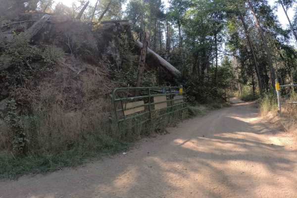
Ponderosa Fire Line - Lower - FS 6S017
Ponderosa Fire Line - Lower (FS 6S017) is the friendly, welcoming face of a trail with a split personality. Situated below the junction with Hugh Ryan, this section behaves like a civilized forest boulevard compared to its rowdier upper half. It’s a wide and easy one-lane road that invites you to ro...
Learn more about Ponderosa Fire Line - Lower - FS 6S017
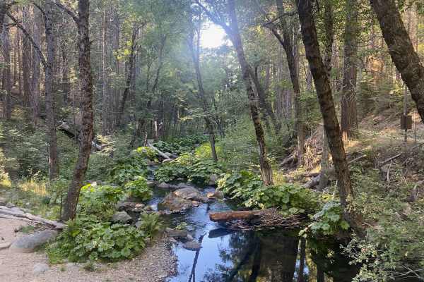
Chowchilla Mountain Road - FS 5S090
Chowchilla Mountain Road (FS 5S09) is the legendary "backdoor" into Yosemite National Park that every overland explorer dreams of finding. Starting from Harris Cut Off Road, the trail begins deceptively tame as a well-graded double-track. About two miles in, you'll experience a brief return to civil...
Learn more about Chowchilla Mountain Road - FS 5S090
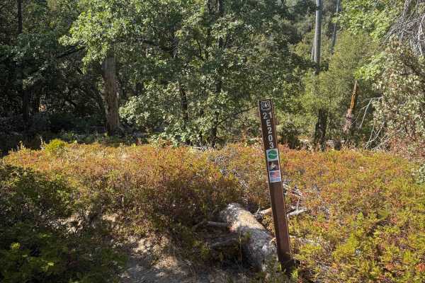
21E203
This is a short segment of single track, less than half a mile long, that weaves through a scenic forest of oak trees, Jeffrey pine, manzanita, and scrub oak. It is a narrow and winding trail, but it remains smooth and flowy the whole way, making it fun and approachable for less experienced riders. ...
Learn more about 21E203
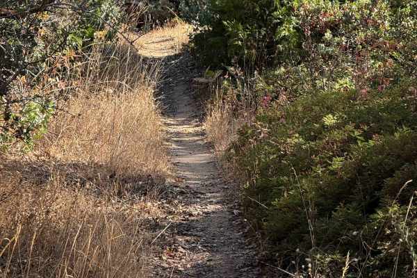
21E201
This is a short segment of single track that connects dirt bike trails 21E338 and 21E203. It is an easy segment of trail that weaves underneath a canopy of black oak trees and manzanita, tightly lined with scraggly bushes and scrub oak that encroach into the trail at times. The trail should be ideal...
Learn more about 21E201
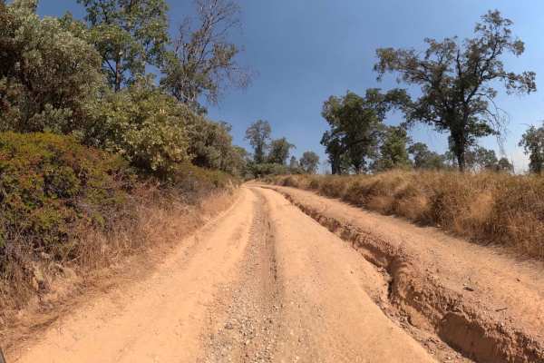
Ponderosa Fire Line - Upper - FS 6S017
Ponderosa Fire Line - Upper (FS 6S017) is the rowdy, untamed sibling of the gentle lower road. While the section below Hugh Ryan is a smooth cruise, crossing that junction acts like a portal to a much rougher reality. This upper 1.2-mile stretch immediately sheds its civilized veneer, transforming i...
Learn more about Ponderosa Fire Line - Upper - FS 6S017
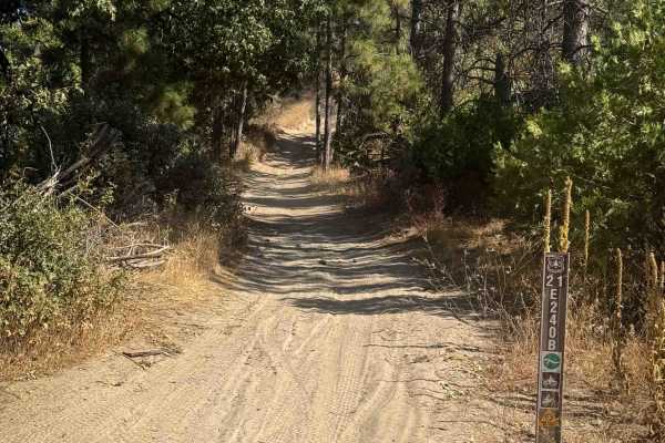
21E240B
This short ATV trail is a wide, silty path lined with scrub oak, in a dry forest terrain in the Sierra National Forest north of Oakhurst, California. The north end of the trail climbs up steeply from its intersection with 21E250. This is the steepest part of the trail, as it continues with a gradual...
Learn more about 21E240B
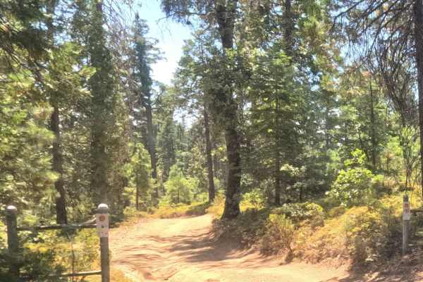
Ten Mile Spur - FS 5S062
This is a short connector route and bypass for the nearby portion of Ten Mile Grade that passes through the private property of the adjacent Yosemite Mountain Ranch. This is a fast, single-lane dirt Forest Service road through a dense mid-elevation forest. The road is not maintained and features num...
Learn more about Ten Mile Spur - FS 5S062
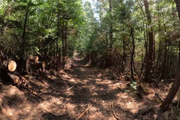
Pilot Cutoff - FS 6S063A
Pilot Cutoff (FS 6S063A) is a trail that comes with a serious warning label: "Horribly Tight." While it appears on the map as a useful connector within the Silver Knob/Miami network, in reality, it is a claustrophobic tunnel of vegetation that feels less like a road and more like a hiking path. The ...
Learn more about Pilot Cutoff - FS 6S063A
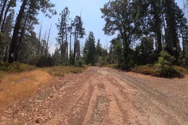
Pilot Peak - Lower - FS 5S012
Pilot Peak - Lower (FS 5S012A) serves as the appetizer to the main Pilot Peak experience. This section is a tight and twisty affair that winds its way through a mix of oak and conifer forest. Unlike its rowdier upper sibling, this lower leg is more about rhythm than technical driving. The tread is a...
Learn more about Pilot Peak - Lower - FS 5S012
Beginner ATV trails near Mendota, California
Explore ATV-friendly trails near you. These trails are accessible for vehicles up to 50 inches wide, perfect for ATVs and smaller off-road machines.
Aurora Cutoff R14
Aurora Cutoff R14 is a narrow two-track trail that traces the top of a ridge, leading you toward the historic Aurora Mine. This scenic route offers plenty of opportunities to explore single-track trails branching off to either side, inviting you to venture deeper into the area's rugged beauty. The m...
Learn more about Aurora Cutoff R14
R1 Clear Creek Road
R1 Clear Creek Road lives up to its namesake by following the crisp, flowing waters of Clear Creek as it twists and winds through the canyon toward the hills. This trail provides an enjoyable adventure, rated as a 2, making it accessible for many vehicles. Be aware that there is no cell service alon...
Learn more about R1 Clear Creek Road
Sugarloaf - FS 9S08
This is a point-to-point single vehicle-width trail in the Jose Creek Basin area. The surface is primarily packed dirt with short stretches of gravel. There can also be shallow ruts and mud holes frequently along the route. This trail will pass through both a section of forest with fire damage and a...
Learn more about Sugarloaf - FS 9S08
Jose Basin
This is the primary dirt road running through the Jose Creek Basin in the Sierra National Forest and connects the north end of Jose Basin Road to Auberry Road/Highway 168. It is wide enough in most places to allow vehicles to pass each other. Depending on the weather, there could be occasional muddy...
Learn more about Jose Basin
Beginner UTV/side-by-side trails near Mendota, California
Find UTV and side-by-side trails near you. These trails accommodate vehicles up to 60 inches wide, ideal for UTVs, side-by-sides, and wider off-road rigs.
Aurora Cutoff R14
Aurora Cutoff R14 is a narrow two-track trail that traces the top of a ridge, leading you toward the historic Aurora Mine. This scenic route offers plenty of opportunities to explore single-track trails branching off to either side, inviting you to venture deeper into the area's rugged beauty. The m...
Learn more about Aurora Cutoff R14
R1 Clear Creek Road
R1 Clear Creek Road lives up to its namesake by following the crisp, flowing waters of Clear Creek as it twists and winds through the canyon toward the hills. This trail provides an enjoyable adventure, rated as a 2, making it accessible for many vehicles. Be aware that there is no cell service alon...
Learn more about R1 Clear Creek Road
Sugarloaf - FS 9S08
This is a point-to-point single vehicle-width trail in the Jose Creek Basin area. The surface is primarily packed dirt with short stretches of gravel. There can also be shallow ruts and mud holes frequently along the route. This trail will pass through both a section of forest with fire damage and a...
Learn more about Sugarloaf - FS 9S08
Jose Basin
This is the primary dirt road running through the Jose Creek Basin in the Sierra National Forest and connects the north end of Jose Basin Road to Auberry Road/Highway 168. It is wide enough in most places to allow vehicles to pass each other. Depending on the weather, there could be occasional muddy...
Learn more about Jose Basin
The onX Offroad Difference
onX Offroad combines trail photos, descriptions, difficulty ratings, width restrictions, seasonality, and more in a user-friendly interface. Available on all devices, with offline access and full compatibility with CarPlay and Android Auto. Discover what you're missing today!
Open Trail Map