
Beginner Off-Road Trails
Near Manassa, Colorado
Explore All Beginner Trails Near Manassa, Colorado
Beginner Off-Road Trails Near Manassa, Colorado
Discover the best beginner-friendly off-road trails near you. These easier, lower-rated trails are a great place to start — browse trail maps, check difficulty ratings, and find your next adventure.
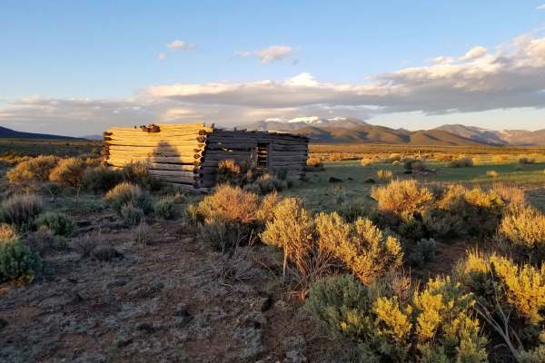
Taos Valley Road 5030 North
If quiet and solitude are what you're looking for, you've found the right trail. This is one of the most remote sections of trail in the San Luis Valley. The stunning scenery of the vast Rio Grande Del Norte National Monument, wildlife (deer, elk, antelope, bighorn sheep) viewing opportunities, and...
Learn more about Taos Valley Road 5030 North
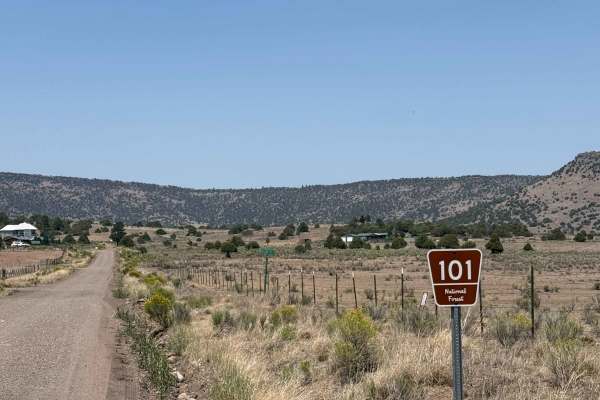
FS 101
FR 101 is approximately 17 miles long from its start at the intersection of SH 17 to where it dead-ends at the border between the La Jara State Trust Land and the Rio Grande National Forest. It begins as a well-maintained two-lane dirt road with some washboarding. At approximately 9.3 miles in, the ...
Learn more about FS 101

San Antonio Mountain Loop
This is an easy route around the base of the San Antonio Mountain. The ride was pretty with grand vistas, an easy trail, and some wildlife. Not recommended for passenger cars, no winter maintenance. That being said a nice stock 4x4 should have no problem on this scenic loop around the base of the mo...
Learn more about San Antonio Mountain Loop
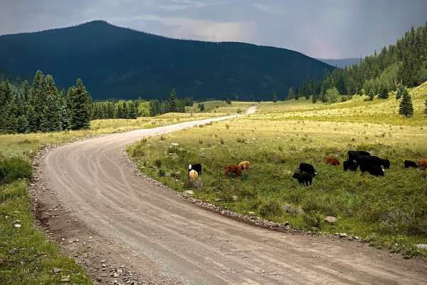
Alamosa Conjeos-Fr Rd 250
Alamosa Conejos Forest Road 250 is a scenic 29-mile overland route following the Conejos River in the Rio Grande National Forest. Beginning off Highway 17, the road heads north along the river, providing access to developed campgrounds and popular trout fishing spots. The first section to the histor...
Learn more about Alamosa Conjeos-Fr Rd 250

Trujillo Meadows
This is a short route out to a man-made alpine lake. You will want to spend some time hiking or fishing around the picturesque lake. The west end of the trail is very well graded and easy, passing through some developed camping areas. The east end is narrower and less maintained. There is primitive ...
Learn more about Trujillo Meadows
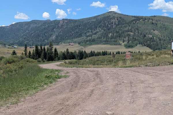
FS 105
FS 105 is approximately 10 miles long from its start at the intersection of FS 250 to where it dead ends. It begins as a well-graded two-lane dirt road with some washboarding, exposed rocks embedded in the road, and shelf sections. The further you travel up the road (past the intersection with FS 10...
Learn more about FS 105
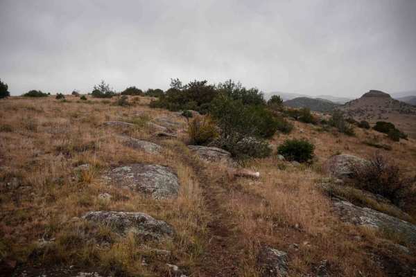
Fata Morgana
From the north end, Fata Morgana starts as a narrow single track over the rolling hills, with small dips into ravines and gradual curves up the mesas. The trail has a bit of infrequent embedded rock surfaces on the top of the mesa, but it's all easy to ride over. It gradually climbs up a couple hund...
Learn more about Fata Morgana
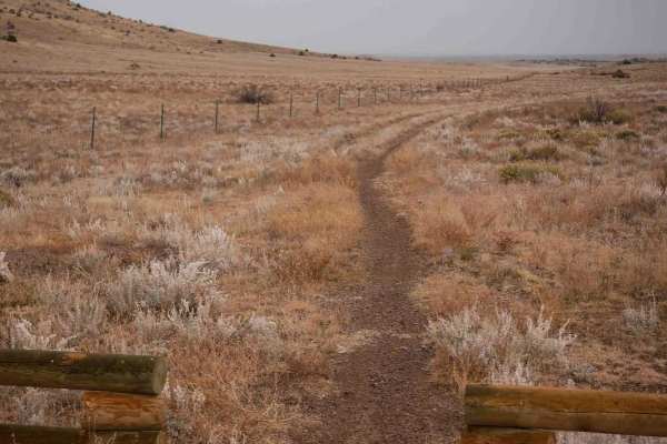
SPF50
The south end of this single track starts at the intersection with Valley View, and it heads through a flat grassy valley on a wide trail along a fence. It goes really fast and straight, then makes a sharp northern left turn at a fence and trail marker. The portion going north is also really wide, m...
Learn more about SPF50
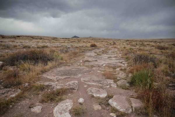
Chillax
Chillax starts at the end of the Loma de San Jose trail and heads west for almost 2 miles until it connects with Valley View. It starts out as a wider track, more like a two-track, with more flat embedded rock surfaces. It's very easy to ride over the rock, and then it's smooth dirt for most of the ...
Learn more about Chillax
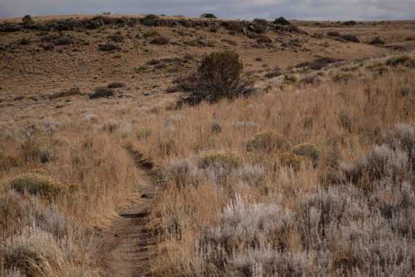
Popsico
This is a short trail off of Chillax that is fast and flowy through the rolling hills and valleys. This is one of the easier trails in the area and is great for beginners learning to ride singletrack, as it has almost zero rocks, and just weaves gradually through the flat terrain. This is a good way...
Learn more about Popsico
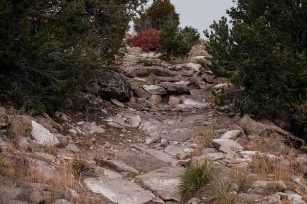
Valley View
Valley View starts at the west end of Chillax, and heads south through a flat and barren valley of sage brush, riding directly towards the mesas. It goes through a fence and continues straight and fast until it starts curving up the mesa. The trail gets a bit rockier as it climbs up the mesa, with b...
Learn more about Valley View
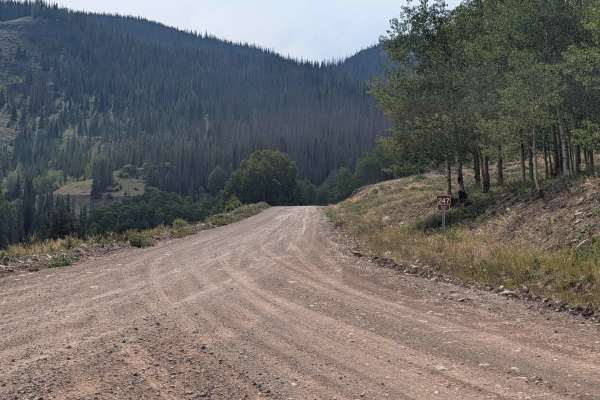
Three Forks Road - FS 247
Three Forks Road FS 247 is approximately six miles long from its start at the intersection with FS 250 to where it dead ends at the Three Forks Trailhead. It is a well-maintained two-lane dirt road with gentle grades and suitable for passenger cars.
The MVUM states that FS 247 is open to all highw...
Learn more about Three Forks Road - FS 247
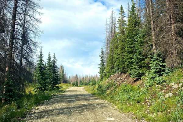
Kerr Road #257-1A
Kerr Road #257-1A is a short, scenic spur ideal for campers and offroaders seeking a quiet alpine escape with stunning valley views near Lily Pond. Branching off the maintained gravel of Kerr Lake Road (Forest Service Road 257), this 0.65-mile route transitions into a less-maintained rut road as it ...
Learn more about Kerr Road #257-1A
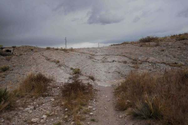
Loma de San Jose
This 2-mile-long single track starts right next to the staging area for the Limekiln area right off Highway 160. It's a skinny trail through the flat sagebrush valley along the base of the mesa. It's very fast and flowy, with wide gradual curves, but mostly straight. It goes on a road for a moment b...
Learn more about Loma de San Jose
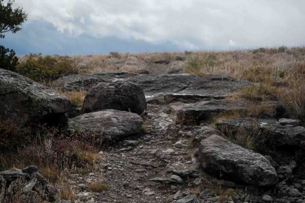
Limekiln Peak
Limekiln Peak is the most scenic of the trails in the Limekiln area. From the east end, this singletrack starts climbing up the mesa on an easy trail and comes up to a pinch between two small boulders that you can either ride between or pop over the 1-foot tall boulder. There are more trees on the m...
Learn more about Limekiln Peak
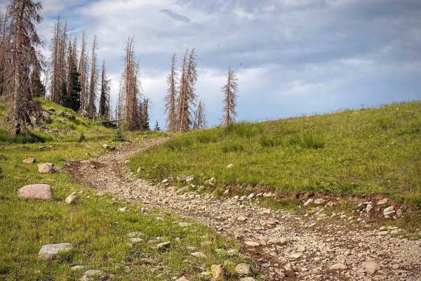
Kerr Lake Road #257
The Kerr Lake Road (#257) will lead you first to a lily pond, then farther to an alpine lake with fishing and disturbed, primitive campsites. The road branches off of the Alamosa Conjeos road (#250) just to the South of Stunner Pass. From here it is 2 miles to the Lily Pond and 4 miles to Kerr Lake ...
Learn more about Kerr Lake Road #257
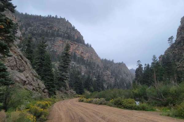
Valle Vidal - FR 1950
This route is a beautiful forest road that takes you into the Carson National Forest/Sangre De Christo Mountains. The beginning of the trail immediately kicks off with stunning, towering rock cliffs on either side as you follow the Costilla Creek up the canyon. For the first few miles, you'll pass t...
Learn more about Valle Vidal - FR 1950
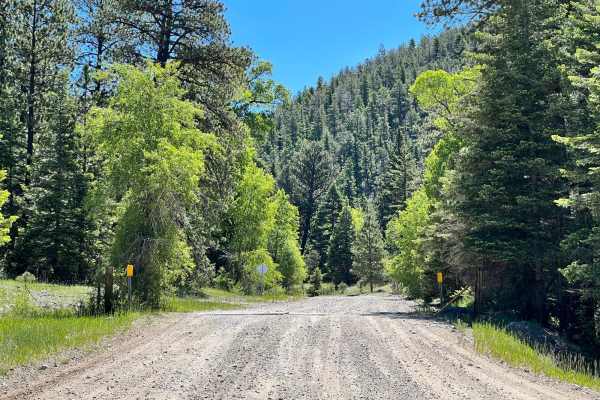
Cabresto Canyon - FS 134
Forest Service Road 134 is a rocky, relatively flat road that traverses down the Cabresto Canyon in Carson National Forest. This mostly gravel and dirt trail doesn't have any difficult obstacles and can be driven by any AWD vehicle. The 15-mile valley road is full of wildflowers, water-flowing creek...
Learn more about Cabresto Canyon - FS 134
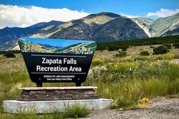
Zapata Falls
This is a short drive over a well-maintained gravel road to Zapata Falls which are really cool to hike to and enjoy. The falls have about a 30' drop, but the section you walk to inside of a cave is much shorter. The walk is about a half mile up the rocks and rapids flowing out of the cave. You ca...
Learn more about Zapata Falls
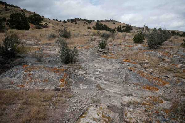
Pura Vida
The south end of this single track starts on a dirt road and heads north towards the intersection with Limekiln Peak. It gets more interesting than some of the surrounding trails in the area, as it has larger slabs of embedded rock that you ride over, sometimes like a ramp up the mesa. It weaves thr...
Learn more about Pura Vida
Beginner ATV trails near Manassa, Colorado
Explore ATV-friendly trails near you. These trails are accessible for vehicles up to 50 inches wide, perfect for ATVs and smaller off-road machines.
FS 101
FR 101 is approximately 17 miles long from its start at the intersection of SH 17 to where it dead-ends at the border between the La Jara State Trust Land and the Rio Grande National Forest. It begins as a well-maintained two-lane dirt road with some washboarding. At approximately 9.3 miles in, the ...
Learn more about FS 101
San Antonio Mountain Loop
This is an easy route around the base of the San Antonio Mountain. The ride was pretty with grand vistas, an easy trail, and some wildlife. Not recommended for passenger cars, no winter maintenance. That being said a nice stock 4x4 should have no problem on this scenic loop around the base of the mo...
Learn more about San Antonio Mountain Loop
Alamosa Conjeos-Fr Rd 250
Alamosa Conejos Forest Road 250 is a scenic 29-mile overland route following the Conejos River in the Rio Grande National Forest. Beginning off Highway 17, the road heads north along the river, providing access to developed campgrounds and popular trout fishing spots. The first section to the histor...
Learn more about Alamosa Conjeos-Fr Rd 250
Three Forks Road - FS 247
Three Forks Road FS 247 is approximately six miles long from its start at the intersection with FS 250 to where it dead ends at the Three Forks Trailhead. It is a well-maintained two-lane dirt road with gentle grades and suitable for passenger cars.
The MVUM states that FS 247 is open to all highw...
Learn more about Three Forks Road - FS 247
Beginner UTV/side-by-side trails near Manassa, Colorado
Find UTV and side-by-side trails near you. These trails accommodate vehicles up to 60 inches wide, ideal for UTVs, side-by-sides, and wider off-road rigs.
FS 101
FR 101 is approximately 17 miles long from its start at the intersection of SH 17 to where it dead-ends at the border between the La Jara State Trust Land and the Rio Grande National Forest. It begins as a well-maintained two-lane dirt road with some washboarding. At approximately 9.3 miles in, the ...
Learn more about FS 101
San Antonio Mountain Loop
This is an easy route around the base of the San Antonio Mountain. The ride was pretty with grand vistas, an easy trail, and some wildlife. Not recommended for passenger cars, no winter maintenance. That being said a nice stock 4x4 should have no problem on this scenic loop around the base of the mo...
Learn more about San Antonio Mountain Loop
Alamosa Conjeos-Fr Rd 250
Alamosa Conejos Forest Road 250 is a scenic 29-mile overland route following the Conejos River in the Rio Grande National Forest. Beginning off Highway 17, the road heads north along the river, providing access to developed campgrounds and popular trout fishing spots. The first section to the histor...
Learn more about Alamosa Conjeos-Fr Rd 250
Three Forks Road - FS 247
Three Forks Road FS 247 is approximately six miles long from its start at the intersection with FS 250 to where it dead ends at the Three Forks Trailhead. It is a well-maintained two-lane dirt road with gentle grades and suitable for passenger cars.
The MVUM states that FS 247 is open to all highw...
Learn more about Three Forks Road - FS 247
The onX Offroad Difference
onX Offroad combines trail photos, descriptions, difficulty ratings, width restrictions, seasonality, and more in a user-friendly interface. Available on all devices, with offline access and full compatibility with CarPlay and Android Auto. Discover what you're missing today!
Open Trail Map