
Beginner Off-Road Trails
Near Lostine, Oregon
Explore All Beginner Trails Near Lostine, Oregon
Beginner Off-Road Trails Near Lostine, Oregon
Discover the best beginner-friendly off-road trails near you. These easier, lower-rated trails are a great place to start — browse trail maps, check difficulty ratings, and find your next adventure.
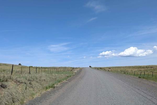
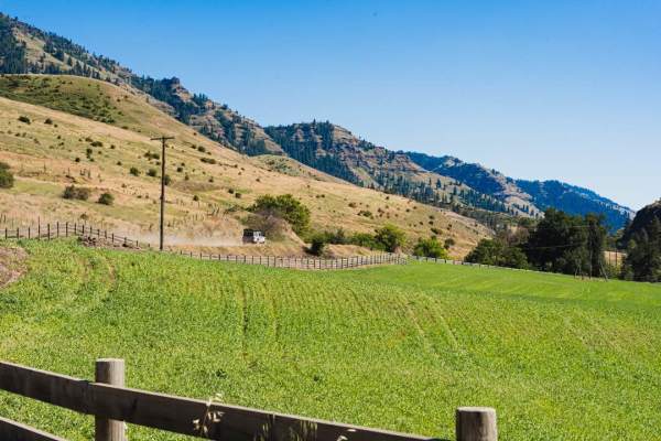
Endless Prarie Road 697
Endless Prairie Road stretches across vast open prairie lands, offering an iconic high-desert driving experience where you can literally see for miles and miles in every direction. This graded gravel road cuts through active cattle grazing country, with mountain ranges looming faintly in the far dis...
Learn more about Endless Prarie Road 697
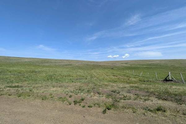
Duckett Road 716
Duckett Road 716 begins at the entrance to the Zenwelt Prairie Preserve, a protected stretch of historic grassland prairie that showcases the wide-open beauty and rich ranching heritage of the region. This area has been preserved to protect native grasses, wildlife habitats, and cultural landmarks--...
Learn more about Duckett Road 716
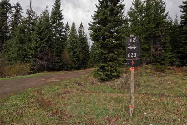
Palmer Junction - FS 6231
Palmer Junction is a 4.6-mile point-to-point, well-maintained, single-lane gravel road. Starting at an intersection with FS 62, Palmer Junction provides access to several spur trails, along with the Fry Meadows Guard Station, before ending at the border between the Umatilla National Forest and priva...
Learn more about Palmer Junction - FS 6231
Wellamockin Road South NF46
Wellamockin Road South NF46 is a gravel route that offers a peaceful ride through open meadows, dense pine forest, and scenic riparian corridors. Though somewhat graded, expect typical washboards and potholes along the way. The road runs parallel to Chestnut Creek and leads you through the beautiful...
Learn more about Wellamockin Road South NF46
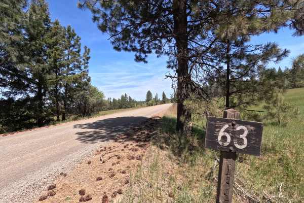
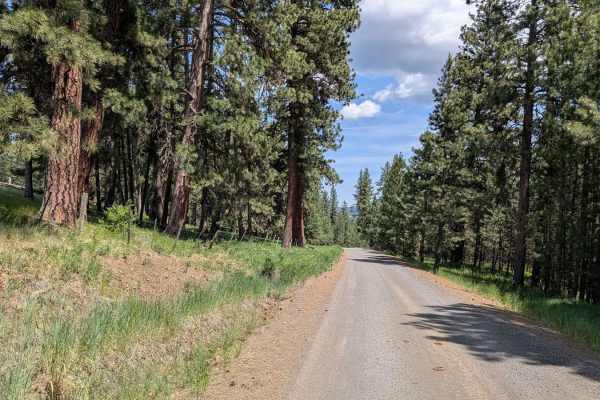
Looking Glass - FS 63
Looking Glass is a 10.2-mile point-to-point route that begins at the end of the highway, descending early into a canyon as a wide gravel road before reaching Looking Glass Creek. The first 5.3 miles follow a Forest Service right-of-way through several parcels of private property. Beyond this section...
Learn more about Looking Glass - FS 63
Phillips Creek
Phillips Creek Trail is approximately 10 miles long. It is worth noting that the first 2 miles of this trail are private property owned by CHANDLER GRANDE RONDE RANCH LLC. We were able to drive (slowly and cautiously) through without issue however I am not sure if the gated areas are ever closed. It...
Learn more about Phillips Creek
FS 6234
FS 6234 is a 3.4-mile out-and-back single-lane gravel road. The route features some potholes and passes several parcels of private property. Multiple gates are present along the road, though no closure dates are posted. Numerous spur trails branch off the main route, all of which are subject to seas...
Learn more about FS 6234
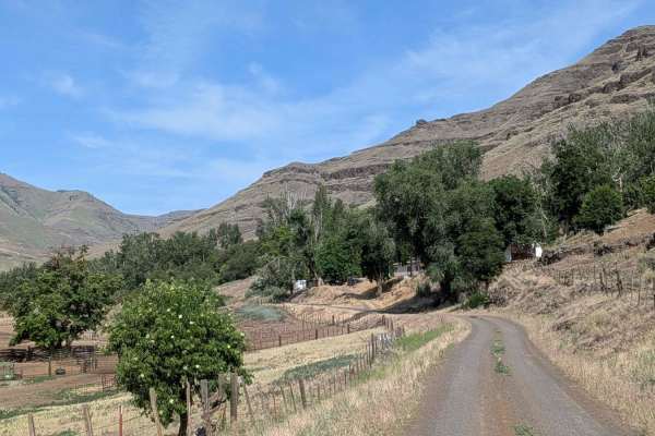
Imnaha 676 South
Imnaha 676 is a scenic backcountry route that begins near Imnaha and winds north through a narrow canyon, eventually reaching the gate to the Zumwelt Prairie Preserve. The gravel road starts relatively smooth, passing cattle farms and open country before narrowing into a brush-lined corridor surroun...
Learn more about Imnaha 676 South
Imnaha to Wallowa Mountain Loop
This route traces the Imnaha River between the scenic Wallowa Mountain Loop road and the small town of Imnaha. The road is wide in all but a few places and is pretty well maintained. This route passes trough a handful of scenic small ranches and farms but the main attraction is really the river itse...
Learn more about Imnaha to Wallowa Mountain Loop
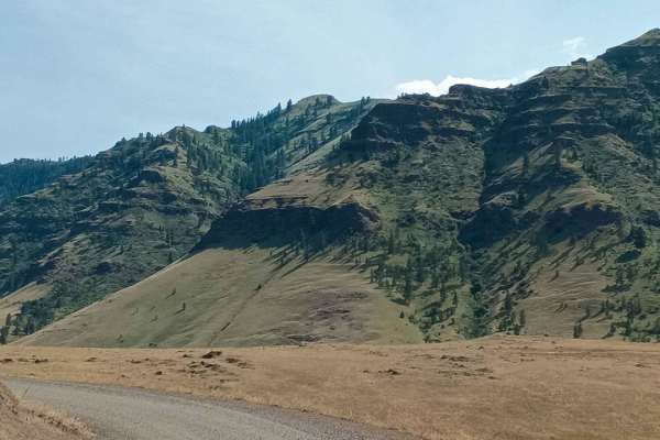
Hat Point
Hat Point is a scenic, graded road that climbs along cliff ledges overlooking vast valleys, ridges, and surrounding mountains. The route travels through lush pine forests and vibrant flora, especially spectacular in the spring when greenery flourishes. Along the way, the trail passes through several...
Learn more about Hat Point
Ruckel Road - FS 32
Ruckle Road is a 9.9-mile point-to-point route that begins as a wide gravel road before narrowing to a single-lane track. The first 4.3 miles pass through several parcels of private property, after which the route continues onto public land. As the road climbs, conditions become rougher toward the u...
Learn more about Ruckel Road - FS 32
FS 6222
FS 6222 is a 7.5-mile out-and-back gravel road that branches off FS 62. The road is single-lane and well-maintained for its entire length, ending at a downed tree. Beyond this point, evidence suggests the road once continued, though it is now heavily overgrown and blocked by rocks. Despite posing li...
Learn more about FS 6222
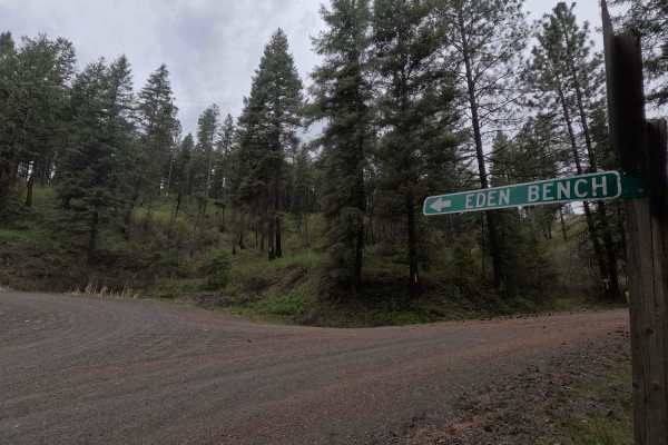
Eden Lane - FS 6212
Eden Lane is a 14.5-mile point-to-point gravel road. Starting at the eastern end near Troy, Eden Lane climbs out of a canyon before entering the Wenaha Wildlife Area. The road follows the top of Ward Canyon for 10 miles before crossing into the Umatilla National Forest and turning north, following a...
Learn more about Eden Lane - FS 6212
Looking Glass - Troy - FS 62
Looking Glass is a 33.9-mile point-to-point trail that serves as the main (and only) route through this section of the Umatilla National Forest, connecting the town of Troy to Looking Glass - FS 63. The trail is a winding, single-lane road that provides access to numerous spur trails, viewpoints, an...
Learn more about Looking Glass - Troy - FS 62
Craig's Cabin Road
Craig's Cabin Road is a just under 4-mile trail within Umatilla Forest. This trail is an offshoot of Phillips Creek. The primary trail material is dirt and small loose gravel. This route has a few run-off ruts that are easy to navigate. There is also a small washout section further down the trail. T...
Learn more about Craig's Cabin Road
FS 3120500
FS 3120500 is a 3.6-mile point-to-point single-lane dirt road that winds through areas of new forest growth within the Wallowa-Whitman National Forest. The route is narrow and rough in places, with a small creek crossing the road at several points. As with nearby routes in the area, up-to-date mappi...
Learn more about FS 3120500
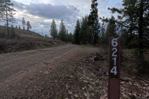
Hoodoo - FS 6214
Hoodoo is a 9.8-mile out-and-back gravel trail providing access to the Hoodoo trailhead. Winding its way through a burned area experiencing new growth, Hoodoo is a single-lane gravel road for its entire length. The trail becomes tight and brushy in some areas and features some potholes. The trail en...
Learn more about Hoodoo - FS 6214
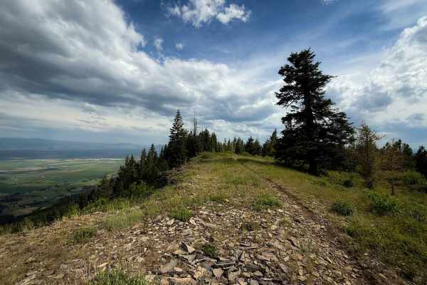
Ridgeline - Trail 320
Ridgeline is a short but very scenic dirt bike trail in the Mount Emily Recreation Area that rides along the edge of the mountain with views overlooking the rural valley below and towards the Wallowa Mountains to the east. The trail is a flowy dirt single track, not too narrow, that starts on the no...
Learn more about Ridgeline - Trail 320
Old Mill - Trail 207
Old Mill is a 1.2-mile point-to-point trail with a dirt surface and several rougher sections featuring large embedded rock. A couple of steep climbs are present along the route, including a steeper section near the middle of the trail with loose dirt that can make traction inconsistent, and a tight ...
Learn more about Old Mill - Trail 207
North Knob - Trail 319
Trail 319 is a fast and flowy dirt bike trail through the Mount Emily Recreation Area. It is mostly a smooth dirt trail, not too narrow, that winds through a scenic forest with open meadows and ponderosa pines. It has sweeping corners, mildly shelfy sections, a couple of embedded rocks to add some m...
Learn more about North Knob - Trail 319
Beginner ATV trails near Lostine, Oregon
Explore ATV-friendly trails near you. These trails are accessible for vehicles up to 50 inches wide, perfect for ATVs and smaller off-road machines.
Palmer Junction - FS 6231
Palmer Junction is a 4.6-mile point-to-point, well-maintained, single-lane gravel road. Starting at an intersection with FS 62, Palmer Junction provides access to several spur trails, along with the Fry Meadows Guard Station, before ending at the border between the Umatilla National Forest and priva...
Learn more about Palmer Junction - FS 6231
Phillips Creek
Phillips Creek Trail is approximately 10 miles long. It is worth noting that the first 2 miles of this trail are private property owned by CHANDLER GRANDE RONDE RANCH LLC. We were able to drive (slowly and cautiously) through without issue however I am not sure if the gated areas are ever closed. It...
Learn more about Phillips Creek
FS 6234
FS 6234 is a 3.4-mile out-and-back single-lane gravel road. The route features some potholes and passes several parcels of private property. Multiple gates are present along the road, though no closure dates are posted. Numerous spur trails branch off the main route, all of which are subject to seas...
Learn more about FS 6234
Imnaha to Wallowa Mountain Loop
This route traces the Imnaha River between the scenic Wallowa Mountain Loop road and the small town of Imnaha. The road is wide in all but a few places and is pretty well maintained. This route passes trough a handful of scenic small ranches and farms but the main attraction is really the river itse...
Learn more about Imnaha to Wallowa Mountain Loop
Beginner UTV/side-by-side trails near Lostine, Oregon
Find UTV and side-by-side trails near you. These trails accommodate vehicles up to 60 inches wide, ideal for UTVs, side-by-sides, and wider off-road rigs.
Palmer Junction - FS 6231
Palmer Junction is a 4.6-mile point-to-point, well-maintained, single-lane gravel road. Starting at an intersection with FS 62, Palmer Junction provides access to several spur trails, along with the Fry Meadows Guard Station, before ending at the border between the Umatilla National Forest and priva...
Learn more about Palmer Junction - FS 6231
Phillips Creek
Phillips Creek Trail is approximately 10 miles long. It is worth noting that the first 2 miles of this trail are private property owned by CHANDLER GRANDE RONDE RANCH LLC. We were able to drive (slowly and cautiously) through without issue however I am not sure if the gated areas are ever closed. It...
Learn more about Phillips Creek
FS 6234
FS 6234 is a 3.4-mile out-and-back single-lane gravel road. The route features some potholes and passes several parcels of private property. Multiple gates are present along the road, though no closure dates are posted. Numerous spur trails branch off the main route, all of which are subject to seas...
Learn more about FS 6234
Imnaha to Wallowa Mountain Loop
This route traces the Imnaha River between the scenic Wallowa Mountain Loop road and the small town of Imnaha. The road is wide in all but a few places and is pretty well maintained. This route passes trough a handful of scenic small ranches and farms but the main attraction is really the river itse...
Learn more about Imnaha to Wallowa Mountain Loop
The onX Offroad Difference
onX Offroad combines trail photos, descriptions, difficulty ratings, width restrictions, seasonality, and more in a user-friendly interface. Available on all devices, with offline access and full compatibility with CarPlay and Android Auto. Discover what you're missing today!
Open Trail Map