
Beginner Off-Road Trails
Near Enterprise, Oregon
Explore All Beginner Trails Near Enterprise, Oregon
Beginner Off-Road Trails Near Enterprise, Oregon
Discover the best beginner-friendly off-road trails near you. These easier, lower-rated trails are a great place to start — browse trail maps, check difficulty ratings, and find your next adventure.
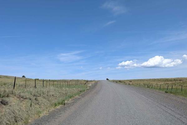
Endless Prarie Road 697
Endless Prairie Road stretches across vast open prairie lands, offering an iconic high-desert driving experience where you can literally see for miles and miles in every direction. This graded gravel road cuts through active cattle grazing country, with mountain ranges looming faintly in the far dis...
Learn more about Endless Prarie Road 697
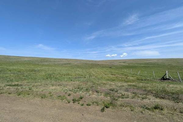
Duckett Road 716
Duckett Road 716 begins at the entrance to the Zenwelt Prairie Preserve, a protected stretch of historic grassland prairie that showcases the wide-open beauty and rich ranching heritage of the region. This area has been preserved to protect native grasses, wildlife habitats, and cultural landmarks--...
Learn more about Duckett Road 716
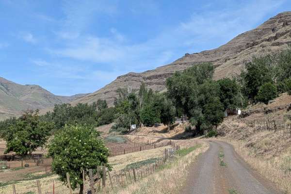
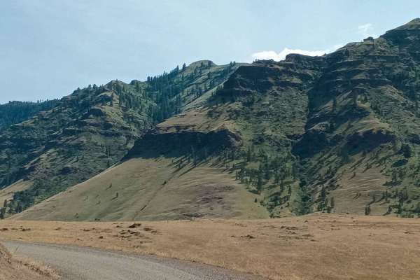
Imnaha 676 South
Imnaha 676 is a scenic backcountry route that begins near Imnaha and winds north through a narrow canyon, eventually reaching the gate to the Zumwelt Prairie Preserve. The gravel road starts relatively smooth, passing cattle farms and open country before narrowing into a brush-lined corridor surroun...
Learn more about Imnaha 676 South
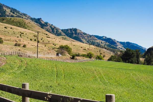
Imnaha to Wallowa Mountain Loop
This route traces the Imnaha River between the scenic Wallowa Mountain Loop road and the small town of Imnaha. The road is wide in all but a few places and is pretty well maintained. This route passes trough a handful of scenic small ranches and farms but the main attraction is really the river itse...
Learn more about Imnaha to Wallowa Mountain Loop
Hat Point
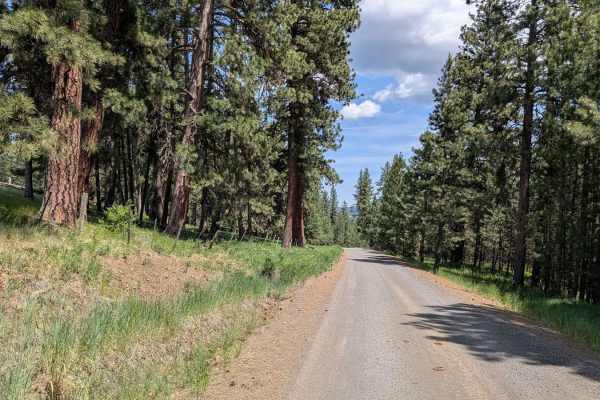
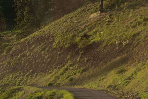
Hat Point is a scenic, graded road that climbs along cliff ledges overlooking vast valleys, ridges, and surrounding mountains. The route travels through lush pine forests and vibrant flora, especially spectacular in the spring when greenery flourishes. Along the way, the trail passes through several...
Learn more about Hat Point
Wellamockin Road South NF46
Wellamockin Road South NF46 is a gravel route that offers a peaceful ride through open meadows, dense pine forest, and scenic riparian corridors. Though somewhat graded, expect typical washboards and potholes along the way. The road runs parallel to Chestnut Creek and leads you through the beautiful...
Learn more about Wellamockin Road South NF46
Hells Canyon Overlook - Dirt Road Approach
The Hells Canyon overlook has both a paved and un paved approach. Both are very scenic, but we highly recommend the dirt route as it offers a number of camp sites and incredible views. Signs displayed at both ends of the trail warn that the road is rough and not recommended for passenger vehicles.
Learn more about Hells Canyon Overlook - Dirt Road Approach
McGraw Lookout Point
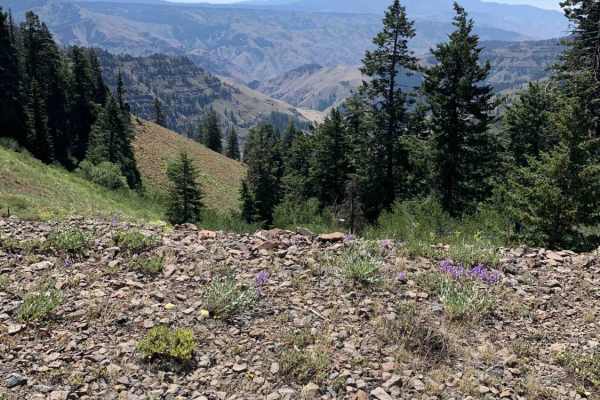
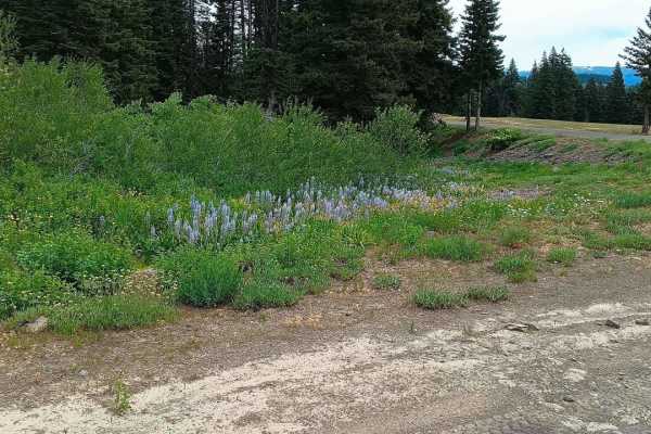
McGraw Lookout Point is a scenic dirt trail that runs along a cliff edge, winding through dense pine forest and offering stunning views of distant mountains. The trail comes alive in the spring with abundant mountain wildflowers that add vibrant color to the rugged landscape. Drivers will encounter ...
Learn more about McGraw Lookout Point
FS 3965000
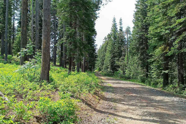
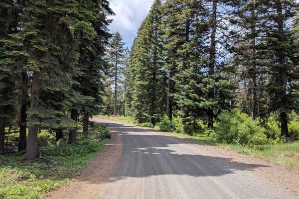
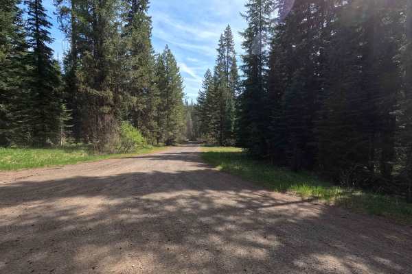
FS 3965000 is a well-maintained, double-wide gravel road that winds through a beautiful forested area lined with towering pine trees. This route offers dramatic views of canyons on both sides, creating a scenic drive filled with natural beauty and open spaces. The road is smooth and accessible, perf...
Learn more about FS 3965000
Wellamockin Road North NF46
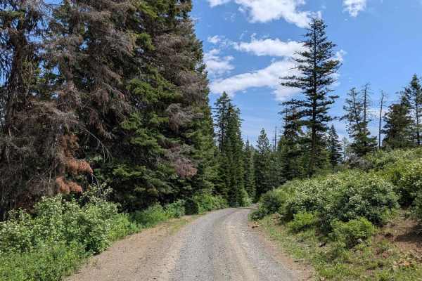
Wellamockin Road North NF46 is a well-graded gravel route that threads through a scenic forested area just north of the Duncorn Overlook Road. The trail is lined with pine trees and lush green vegetation, making it especially vibrant in the spring when wildflowers bloom abundantly. Travelers will fi...
Learn more about Wellamockin Road North NF46
Buckhorn Overlook Spur
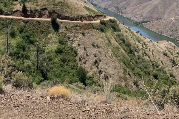
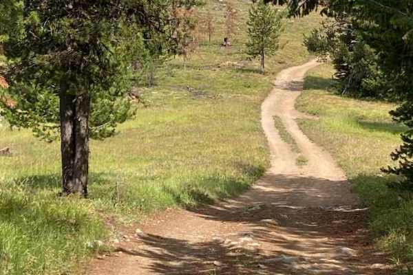
Buckhorn Overlook Spur is a short but rewarding 2-mile out-and-back trail that connects Forest Road 46 to one of the most breathtaking viewpoints in the region--Buckhorn Overlook, perched above the legendary Hells Canyon, the deepest river gorge in North America. The dirt road is mostly easy, but fe...
Learn more about Buckhorn Overlook Spur
Kleinschmidt Grade - NFD 105
Starting from Hells Canyon/Snake River, this route will take you up a winding single-lane track with great views and significant exposures. As you get higher, the terrain and flora will transform from rock to grass and brush-covered to forested. People do live along this remote route so please ravel...
Learn more about Kleinschmidt Grade - NFD 105
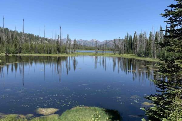
Fish Lake - Twin Lakes
This route takes you to a couple of beautiful small lakes while providing incredible views of the Whitman National Forest. Overall the route is very easy and straight forward, but there is a section that can be a little tight to navigate in larger vehicles. If the brush is too tight or the road is b...
Learn more about Fish Lake - Twin Lakes
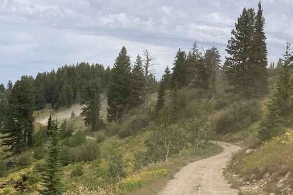
Sheep Rock
This trail is a mostly dirt and gravel, with sections that narrow quickly. Expect some washboard texture and occasional loose scree patches. The road isn’t deeply technical, but its tightness and erosion-prone features demand attentive driving. Not ideal for low-clearance vehicles, this route is bes...
Learn more about Sheep Rock
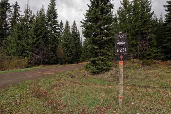
Palmer Junction - FS 6231
Palmer Junction is a 4.6-mile point-to-point, well-maintained, single-lane gravel road. Starting at an intersection with FS 62, Palmer Junction provides access to several spur trails, along with the Fry Meadows Guard Station, before ending at the border between the Umatilla National Forest and priva...
Learn more about Palmer Junction - FS 6231
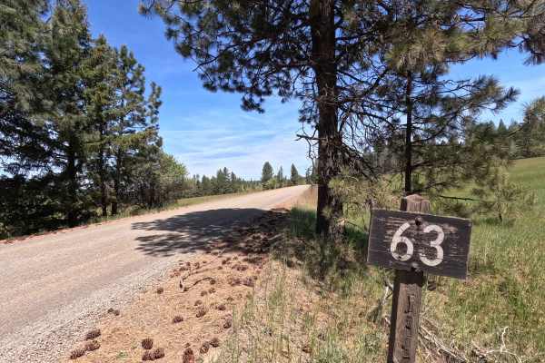
Looking Glass - FS 63
Looking Glass is a 10.2-mile point-to-point route that begins at the end of the highway, descending early into a canyon as a wide gravel road before reaching Looking Glass Creek. The first 5.3 miles follow a Forest Service right-of-way through several parcels of private property. Beyond this section...
Learn more about Looking Glass - FS 63
Phillips Creek
Phillips Creek Trail is approximately 10 miles long. It is worth noting that the first 2 miles of this trail are private property owned by CHANDLER GRANDE RONDE RANCH LLC. We were able to drive (slowly and cautiously) through without issue however I am not sure if the gated areas are ever closed. It...
Learn more about Phillips Creek
FS 6234
FS 6234 is a 3.4-mile out-and-back single-lane gravel road. The route features some potholes and passes several parcels of private property. Multiple gates are present along the road, though no closure dates are posted. Numerous spur trails branch off the main route, all of which are subject to seas...
Learn more about FS 6234
Kinney Point
Embark on a thrilling off-road adventure to Kinney Point Lookout via Forest Road 106 in Idaho's Payette National Forest. This trail offers a rugged journey through diverse terrains, culminating in panoramic views of Hells Canyon. The surface varies from packed dirt to loose gravel and occasional ro...
Learn more about Kinney Point
Eden Lane - FS 6212
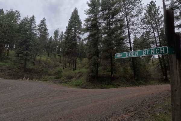
Eden Lane is a 14.5-mile point-to-point gravel road. Starting at the eastern end near Troy, Eden Lane climbs out of a canyon before entering the Wenaha Wildlife Area. The road follows the top of Ward Canyon for 10 miles before crossing into the Umatilla National Forest and turning north, following a...
Learn more about Eden Lane - FS 6212
Beginner ATV trails near Enterprise, Oregon
Explore ATV-friendly trails near you. These trails are accessible for vehicles up to 50 inches wide, perfect for ATVs and smaller off-road machines.
Imnaha to Wallowa Mountain Loop
This route traces the Imnaha River between the scenic Wallowa Mountain Loop road and the small town of Imnaha. The road is wide in all but a few places and is pretty well maintained. This route passes trough a handful of scenic small ranches and farms but the main attraction is really the river itse...
Learn more about Imnaha to Wallowa Mountain Loop
Hells Canyon Overlook - Dirt Road Approach
The Hells Canyon overlook has both a paved and un paved approach. Both are very scenic, but we highly recommend the dirt route as it offers a number of camp sites and incredible views. Signs displayed at both ends of the trail warn that the road is rough and not recommended for passenger vehicles.
Learn more about Hells Canyon Overlook - Dirt Road Approach
Kleinschmidt Grade - NFD 105
Starting from Hells Canyon/Snake River, this route will take you up a winding single-lane track with great views and significant exposures. As you get higher, the terrain and flora will transform from rock to grass and brush-covered to forested. People do live along this remote route so please ravel...
Learn more about Kleinschmidt Grade - NFD 105
Fish Lake - Twin Lakes
This route takes you to a couple of beautiful small lakes while providing incredible views of the Whitman National Forest. Overall the route is very easy and straight forward, but there is a section that can be a little tight to navigate in larger vehicles. If the brush is too tight or the road is b...
Learn more about Fish Lake - Twin Lakes
Beginner UTV/side-by-side trails near Enterprise, Oregon
Find UTV and side-by-side trails near you. These trails accommodate vehicles up to 60 inches wide, ideal for UTVs, side-by-sides, and wider off-road rigs.
Imnaha to Wallowa Mountain Loop
This route traces the Imnaha River between the scenic Wallowa Mountain Loop road and the small town of Imnaha. The road is wide in all but a few places and is pretty well maintained. This route passes trough a handful of scenic small ranches and farms but the main attraction is really the river itse...
Learn more about Imnaha to Wallowa Mountain Loop
Hells Canyon Overlook - Dirt Road Approach
The Hells Canyon overlook has both a paved and un paved approach. Both are very scenic, but we highly recommend the dirt route as it offers a number of camp sites and incredible views. Signs displayed at both ends of the trail warn that the road is rough and not recommended for passenger vehicles.
Learn more about Hells Canyon Overlook - Dirt Road Approach
Kleinschmidt Grade - NFD 105
Starting from Hells Canyon/Snake River, this route will take you up a winding single-lane track with great views and significant exposures. As you get higher, the terrain and flora will transform from rock to grass and brush-covered to forested. People do live along this remote route so please ravel...
Learn more about Kleinschmidt Grade - NFD 105
Fish Lake - Twin Lakes
This route takes you to a couple of beautiful small lakes while providing incredible views of the Whitman National Forest. Overall the route is very easy and straight forward, but there is a section that can be a little tight to navigate in larger vehicles. If the brush is too tight or the road is b...
Learn more about Fish Lake - Twin Lakes
The onX Offroad Difference
onX Offroad combines trail photos, descriptions, difficulty ratings, width restrictions, seasonality, and more in a user-friendly interface. Available on all devices, with offline access and full compatibility with CarPlay and Android Auto. Discover what you're missing today!
Open Trail Map