
Beginner Off-Road Trails
Near Kettleman City, California
Explore All Beginner Trails Near Kettleman City, California
Beginner Off-Road Trails Near Kettleman City, California
Discover the best beginner-friendly off-road trails near you. These easier, lower-rated trails are a great place to start — browse trail maps, check difficulty ratings, and find your next adventure.
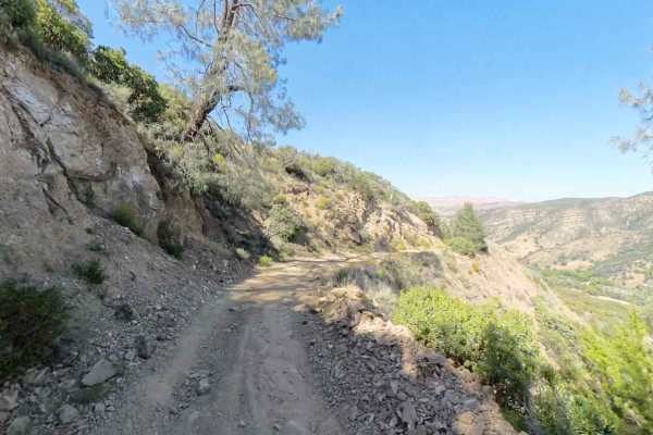
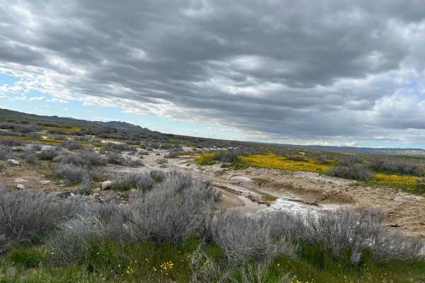
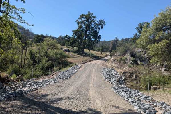
New Idria Dam to Ghost Town
Beginning at the BLM gate southwest of New Idria Dam, this trail winds around the westerly side of the lake and canyon above the former mining town of New Idria. Descending 1,200 feet in elevation, the route will take you along an unpaved dirt path through several areas of switchbacks and narrow she...
Learn more about New Idria Dam to Ghost Town
Aurora Cutoff R14
Aurora Cutoff R14 is a narrow two-track trail that traces the top of a ridge, leading you toward the historic Aurora Mine. This scenic route offers plenty of opportunities to explore single-track trails branching off to either side, inviting you to venture deeper into the area's rugged beauty. The m...
Learn more about Aurora Cutoff R14
R1 Clear Creek Road
R1 Clear Creek Road lives up to its namesake by following the crisp, flowing waters of Clear Creek as it twists and winds through the canyon toward the hills. This trail provides an enjoyable adventure, rated as a 2, making it accessible for many vehicles. Be aware that there is no cell service alon...
Learn more about R1 Clear Creek Road
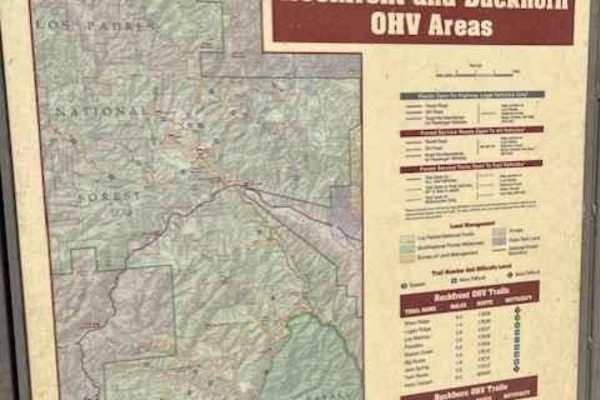
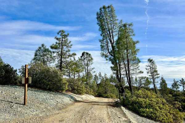
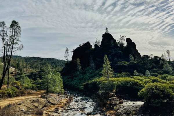
Ride around Rockfront
Fun loop around Rockfront OHV. This loop shows you everything Rockfront has to offer the Central Coast of California;steep climbs, jumpy fast double track, and lots of dust! This loop also brings you to Baja Campground. Enjoy the double track with anything from a moto to a full-sized 4x4.
Learn more about Ride around Rockfront
Elkhorn Road
The majority of the road is smooth and graded. However, there are sections that can have sticky mud, washed out from seasonal creeks that have a potential for high clearance. Carrizo Plain can get very hot in the summer and very cold in the winter. The best time to go in the spring to check out the ...
Learn more about Elkhorn Road
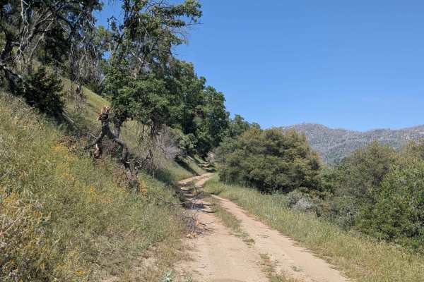
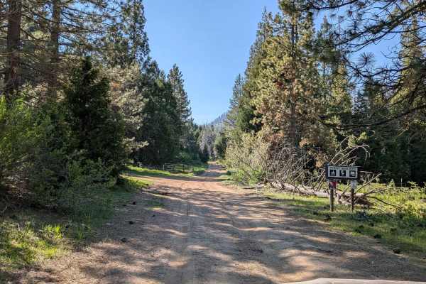
Chute Springs - FS 23S68
Chute Springs FS 23S68 departs from Highway M504 and runs along a shelf road high above the valley and canyon below through Sequoia National Forest. The trail is lined with oak and pine trees, green grass, and other bushes, with overgrown grass encroaching on the trail in sections. Evidence of the 2...
Learn more about Chute Springs - FS 23S68
Deer Creek Mill - FS 23S04
Deer Creek FS 23S04 departs from Pine Flat Road through grassy meadows and rolling hills lined with oak trees. Power lines run parallel to the trail and serve as a useful navigation reference along the route. The trail is currently closed approximately 1 mile in with a posted closure sign. Do not pr...
Learn more about Deer Creek Mill - FS 23S04
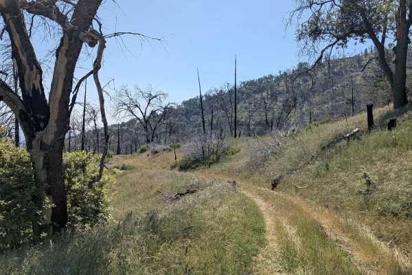
Starvation Creek - FS 23S65
Starvation Creek FS 23S65 winds through rolling hills within Sequoia National Forest through what was once a mature forest, now heavily impacted by the 2021 Windy Fire. Most of the trees along the route are burned, giving the landscape an open and stark character. Overgrown grass has taken over much...
Learn more about Starvation Creek - FS 23S65
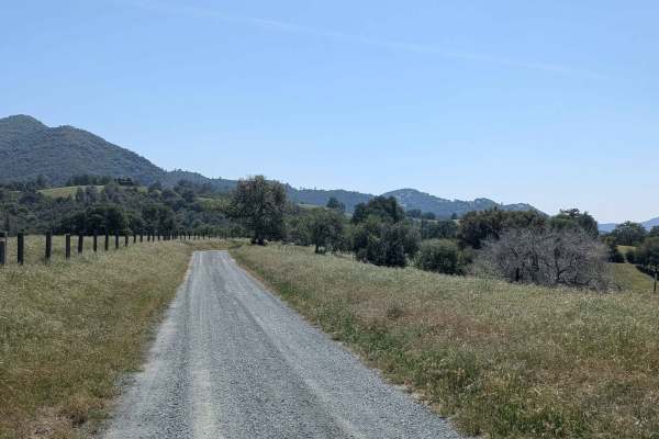
Poso Flat Road
Poso Flat Road climbs 1,300 feet and drops 400 feet over just over 3.3 miles before terminating at the paved road of the same name. The trail winds through a landscape of oak trees and open grass meadows, giving it a pastoral and open feel distinct from the denser pine forest trails in the surroundi...
Learn more about Poso Flat Road
Horse Meadow Creek - FS 22S04
Horse Meadow Creek FS 22S04 departs from Highway M504 and cuts through a large pine forest within Sequoia National Forest, reaching Horse Meadow a couple of miles in. The meadow provides a natural destination and a pleasant open contrast to the dense pine forest along the approach. Dispersed camping...
Learn more about Horse Meadow Creek - FS 22S04
Beginner ATV trails near Kettleman City, California
Explore ATV-friendly trails near you. These trails are accessible for vehicles up to 50 inches wide, perfect for ATVs and smaller off-road machines.
Aurora Cutoff R14
Aurora Cutoff R14 is a narrow two-track trail that traces the top of a ridge, leading you toward the historic Aurora Mine. This scenic route offers plenty of opportunities to explore single-track trails branching off to either side, inviting you to venture deeper into the area's rugged beauty. The m...
Learn more about Aurora Cutoff R14
R1 Clear Creek Road
R1 Clear Creek Road lives up to its namesake by following the crisp, flowing waters of Clear Creek as it twists and winds through the canyon toward the hills. This trail provides an enjoyable adventure, rated as a 2, making it accessible for many vehicles. Be aware that there is no cell service alon...
Learn more about R1 Clear Creek Road
Ride around Rockfront
Fun loop around Rockfront OHV. This loop shows you everything Rockfront has to offer the Central Coast of California;steep climbs, jumpy fast double track, and lots of dust! This loop also brings you to Baja Campground. Enjoy the double track with anything from a moto to a full-sized 4x4.
Learn more about Ride around Rockfront
Chute Springs - FS 23S68
Chute Springs FS 23S68 departs from Highway M504 and runs along a shelf road high above the valley and canyon below through Sequoia National Forest. The trail is lined with oak and pine trees, green grass, and other bushes, with overgrown grass encroaching on the trail in sections. Evidence of the 2...
Learn more about Chute Springs - FS 23S68
Beginner UTV/side-by-side trails near Kettleman City, California
Find UTV and side-by-side trails near you. These trails accommodate vehicles up to 60 inches wide, ideal for UTVs, side-by-sides, and wider off-road rigs.
Aurora Cutoff R14
Aurora Cutoff R14 is a narrow two-track trail that traces the top of a ridge, leading you toward the historic Aurora Mine. This scenic route offers plenty of opportunities to explore single-track trails branching off to either side, inviting you to venture deeper into the area's rugged beauty. The m...
Learn more about Aurora Cutoff R14
R1 Clear Creek Road
R1 Clear Creek Road lives up to its namesake by following the crisp, flowing waters of Clear Creek as it twists and winds through the canyon toward the hills. This trail provides an enjoyable adventure, rated as a 2, making it accessible for many vehicles. Be aware that there is no cell service alon...
Learn more about R1 Clear Creek Road
Ride around Rockfront
Fun loop around Rockfront OHV. This loop shows you everything Rockfront has to offer the Central Coast of California;steep climbs, jumpy fast double track, and lots of dust! This loop also brings you to Baja Campground. Enjoy the double track with anything from a moto to a full-sized 4x4.
Learn more about Ride around Rockfront
Chute Springs - FS 23S68
Chute Springs FS 23S68 departs from Highway M504 and runs along a shelf road high above the valley and canyon below through Sequoia National Forest. The trail is lined with oak and pine trees, green grass, and other bushes, with overgrown grass encroaching on the trail in sections. Evidence of the 2...
Learn more about Chute Springs - FS 23S68
The onX Offroad Difference
onX Offroad combines trail photos, descriptions, difficulty ratings, width restrictions, seasonality, and more in a user-friendly interface. Available on all devices, with offline access and full compatibility with CarPlay and Android Auto. Discover what you're missing today!
Open Trail Map