
Beginner Off-Road Trails
Near Jeannette, Pennsylvania
Explore All Beginner Trails Near Jeannette, Pennsylvania
Beginner Off-Road Trails Near Jeannette, Pennsylvania
Discover the best beginner-friendly off-road trails near you. These easier, lower-rated trails are a great place to start — browse trail maps, check difficulty ratings, and find your next adventure.

Greenlick Hollow
This is a compacted gravel super highway now that'll take you from the Mt. Pleasant area to the top of the ridge. This road has been totally rebuilt with drainage and grading. It passes through some pretty areas as you climb. As you near the top, large rocks scatter the hillsides, letting you kno...
Learn more about Greenlick Hollow

Old Mill Road
This is an easy trail which is the gravel section of Old Mill Road between Fox Chapel Road and Indianola Road in Fox Chapel and Indiana Township Pennsylvania in the Northern Greater Pittsburgh Suburbs. The section of Old Mill East of this track is paved. Rawlings Run is also gravel at a T intersecti...
Learn more about Old Mill Road
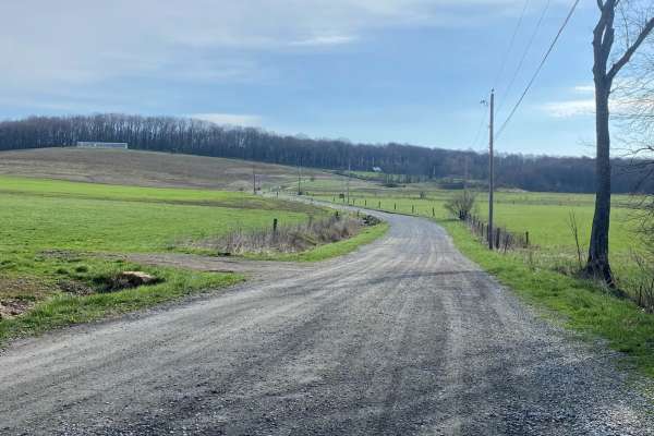
Wash Run
This is a wide-open trail for the first half, then when you crest the top, it becomes a nice wooded route with a long descent towards Melcroft. This is another sneak route on dirt to push you further into the Laurel Highlands. Expect the odd small mud hole now and then, but nothing too pressing. ...
Learn more about Wash Run

Middle Fork Road
This is definitely one of the rougher legal roads in the Laurel Highlands. This section definitely prefers a dual transfer case and high clearance, definitely at the time of posting. This is a steep and long hill climb if you start at the bottom. A considerable amount is straight up the fall line...
Learn more about Middle Fork Road

Senneth Cemetery Rd
This is one of the most technical of the trails in Laurel State Park/Forbes State Forest. The trail is mostly dirt and rough gravel. It is quite narrow in some sections and expects to be brushing some small branches but there are enough pull-offs in case you encounter any oncoming vehicles. There is...
Learn more about Senneth Cemetery Rd

John Henry Road
John Henry Road is found along 653 in Laurel Ridge State Park. This 2.5 mile trail is surrounded by the State Forest which is mostly a mix of dirt and gravel. A majority of the trail has locations to pull off, but there are narrow sections. Be mindful when traveling in groups and for oncoming vehicl...
Learn more about John Henry Road
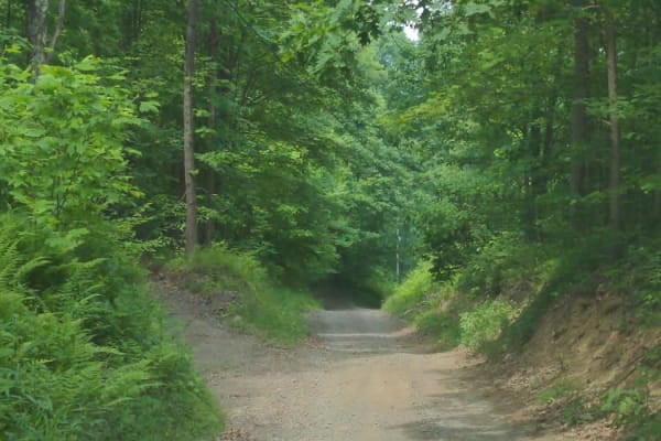
Brown Road
Obstacles under 12" on the trail, including small ledges. The trail is fairly well maintained and is mostly one vehicle wide but the trail has plenty of pull-offs if you encounter oncoming vehicles. There was active logging as of June 2023, so watch for trucks. Senneth Cemetary Rd branches off Brow...
Learn more about Brown Road
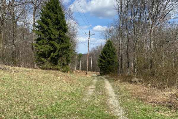
Blackberry Lane
This is a cool little through trail that'll connect you from Triple Creek, just off the backside of Seven Springs, up towards Gary Run, that'll drop you off in proximity to Cole Run Falls and Blue Hole. Like most trails in the Laurel Highlands, it's mostly directly in the fall line, and conditions ...
Learn more about Blackberry Lane
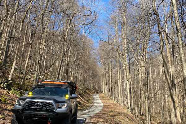
Bidwell Road Ghost Town
Bidwell Road is an out-and-back to the Ghost Town of Bidwell. Everything has been removed except the old steps to the courthouse. This route is a long, steep downhill road with several water crossings. Some entries to the water crossing can be steep. Otherwise, the trail is fairly tame and used by ...
Learn more about Bidwell Road Ghost Town
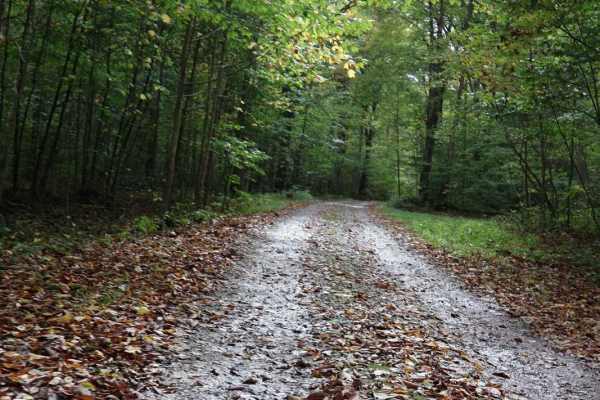
Cucumber Road Loop
Cucumber Road runs through the Picnic Area parallel to Cucumber Run Falls and can be completed as a loop. There are several picnic sites on both sides of the trail. It is one vehicle wide but there are plenty of places to pull to the side to allow others to pass or to stop.
Learn more about Cucumber Road Loop
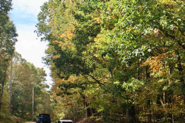
Sugarloaf to Flat Rock Trail
This 5.6 mi trail starts by turning off Sugarloaf Road and runs along the border of Ohiopyle State Park. It begins after turning onto Taylor Road and eventually transitions into Beaver Creek Road and New Beaver Creek Road. The trail consists of a nice mix of light gravel and dirt, with a few hills. ...
Learn more about Sugarloaf to Flat Rock Trail
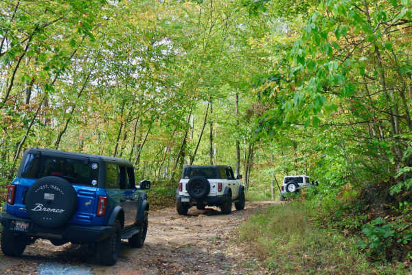
Dinner Bell to Sugarloaf Trail
This 5.2 mile trail starts by turning off U.S. Route 40. It runs along the border and then into Ohiopyle State Park. The trail begins after turning onto Dinner Bell - Ohioyple Road and turns to Pressley Ridge Road and Sarver Road. The trail consists of a nice mix of light gravel and dirt, with a f...
Learn more about Dinner Bell to Sugarloaf Trail
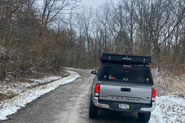
Harmon Creek Road
This is an easy and well-maintained gravel and dirt road route from the Burgettstown area towards Bavington, where you can link up with the other trails. Expect muddy roads if it's recently rained. The area tends to hold water and will keep things damp and muddy along the way!
Learn more about Harmon Creek Road
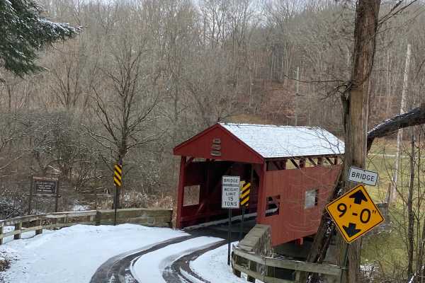
Kramer Road
The highlight of this trail is the short travel from Pittsburgh that lets you travel on some dirt in a reasonable amount of time. If it's rained in the past several days, expect to see some mud and some rutting. This route passes by some crown jewel mountain bike trails and a model airplane field, a...
Learn more about Kramer Road
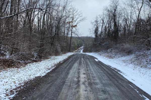
Knowlton Road
Knowlton is a compacted gravel road that is either muddy or dusty. The route passes through Hillman State Park and is a heavily wooded area passing through a reclaimed strip mine. The road accesses some nice piney hiking and mountain bike trails. Also, watch out for hunters while in season.
Learn more about Knowlton Road
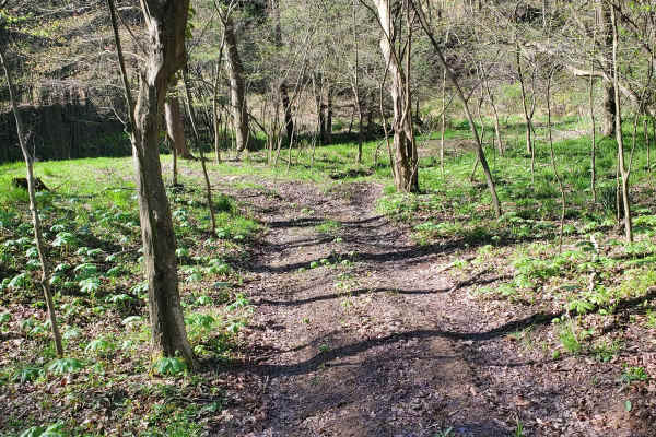
Sniper Ledge Connector Part 1
This is a standard green (easy) dirt and rock trail that is suitable for all vehicle types. It is mostly loose dirt and slight hills, but nothing major. It can get a little slick when it rains. It is mostly gravel, dirt rocks, and some small ruts. There are slight hill climbs and it's wide enough fo...
Learn more about Sniper Ledge Connector Part 1
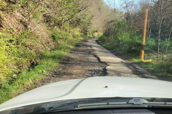
BFR Entrance
This is the entrance to the Ben Franklin Range. It's a little rough, but paved and easy enough to get trailers and RVs in and out as needed. The posted speed limit is 15 mph. Use caution as it's 2-way traffic in and out with a steep drop on one side.
Learn more about BFR Entrance
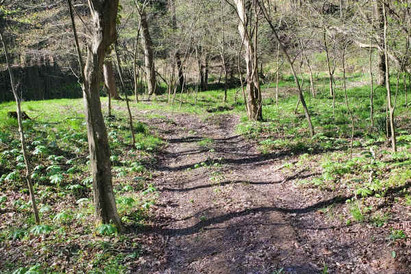
Sniper Ledge Bypass
This is a moderate trail with a decent hill climb that is mostly made of dirt and rocks. It's suitable for all offroad vehicle types. The hill climbs can be a bit steeper here, usually including some ruts and rocks. It can get a little slick when it rains. Expect mostly gravel, dirt rocks, and some ...
Learn more about Sniper Ledge Bypass
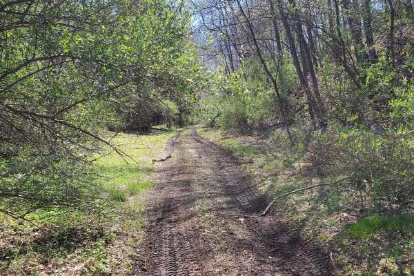
30
This is a standard green (easy) dirt and rock trail that is suitable for all vehicle types. It is mostly loose dirt and slight hills, but nothing major. It can get a little slick when it rains. It is mostly gravel, dirt rocks, and some small ruts. There are slight hill climbs and it's wide enough fo...
Learn more about 30
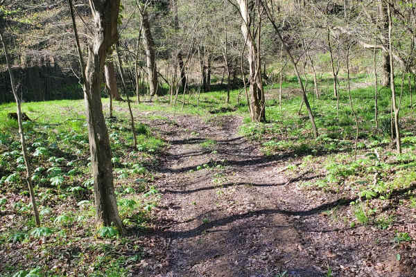
Ridge Top
This is a standard green (easy) dirt and rock trail that is suitable for all vehicle types. It is mostly loose dirt and slight hills, but nothing major. It can get a little slick when it rains. It is mostly gravel, dirt rocks, and some small ruts. There are slight hill climbs and it's wide enough fo...
Learn more about Ridge Top
Beginner ATV trails near Jeannette, Pennsylvania
Explore ATV-friendly trails near you. These trails are accessible for vehicles up to 50 inches wide, perfect for ATVs and smaller off-road machines.
Sniper Ledge Connector Part 1
This is a standard green (easy) dirt and rock trail that is suitable for all vehicle types. It is mostly loose dirt and slight hills, but nothing major. It can get a little slick when it rains. It is mostly gravel, dirt rocks, and some small ruts. There are slight hill climbs and it's wide enough fo...
Learn more about Sniper Ledge Connector Part 1
BFR Entrance
This is the entrance to the Ben Franklin Range. It's a little rough, but paved and easy enough to get trailers and RVs in and out as needed. The posted speed limit is 15 mph. Use caution as it's 2-way traffic in and out with a steep drop on one side.
Learn more about BFR Entrance
Sniper Ledge Bypass
This is a moderate trail with a decent hill climb that is mostly made of dirt and rocks. It's suitable for all offroad vehicle types. The hill climbs can be a bit steeper here, usually including some ruts and rocks. It can get a little slick when it rains. Expect mostly gravel, dirt rocks, and some ...
Learn more about Sniper Ledge Bypass
30
This is a standard green (easy) dirt and rock trail that is suitable for all vehicle types. It is mostly loose dirt and slight hills, but nothing major. It can get a little slick when it rains. It is mostly gravel, dirt rocks, and some small ruts. There are slight hill climbs and it's wide enough fo...
Learn more about 30
Beginner UTV/side-by-side trails near Jeannette, Pennsylvania
Find UTV and side-by-side trails near you. These trails accommodate vehicles up to 60 inches wide, ideal for UTVs, side-by-sides, and wider off-road rigs.
Sniper Ledge Connector Part 1
This is a standard green (easy) dirt and rock trail that is suitable for all vehicle types. It is mostly loose dirt and slight hills, but nothing major. It can get a little slick when it rains. It is mostly gravel, dirt rocks, and some small ruts. There are slight hill climbs and it's wide enough fo...
Learn more about Sniper Ledge Connector Part 1
BFR Entrance
This is the entrance to the Ben Franklin Range. It's a little rough, but paved and easy enough to get trailers and RVs in and out as needed. The posted speed limit is 15 mph. Use caution as it's 2-way traffic in and out with a steep drop on one side.
Learn more about BFR Entrance
Sniper Ledge Bypass
This is a moderate trail with a decent hill climb that is mostly made of dirt and rocks. It's suitable for all offroad vehicle types. The hill climbs can be a bit steeper here, usually including some ruts and rocks. It can get a little slick when it rains. Expect mostly gravel, dirt rocks, and some ...
Learn more about Sniper Ledge Bypass
30
This is a standard green (easy) dirt and rock trail that is suitable for all vehicle types. It is mostly loose dirt and slight hills, but nothing major. It can get a little slick when it rains. It is mostly gravel, dirt rocks, and some small ruts. There are slight hill climbs and it's wide enough fo...
Learn more about 30
The onX Offroad Difference
onX Offroad combines trail photos, descriptions, difficulty ratings, width restrictions, seasonality, and more in a user-friendly interface. Available on all devices, with offline access and full compatibility with CarPlay and Android Auto. Discover what you're missing today!
Open Trail Map