
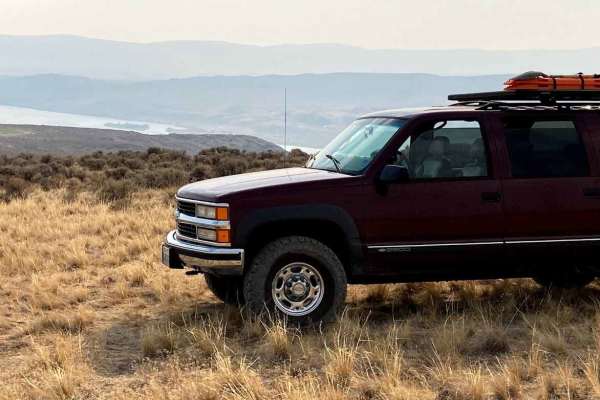
Beginner Off-Road Trails
Near Granger, Washington
Explore All Beginner Trails Near Granger, Washington
Beginner Off-Road Trails Near Granger, Washington
Discover the best beginner-friendly off-road trails near you. These easier, lower-rated trails are a great place to start — browse trail maps, check difficulty ratings, and find your next adventure.
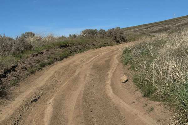
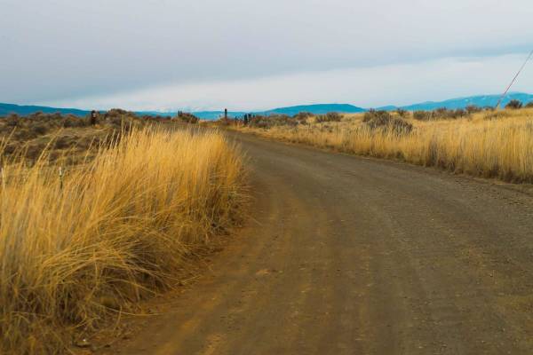
Double Track
Double Track is a very easy trail with views of the Tri-Cities, Washington. There are some small hill climbs along the way. This is a good trail for beginners. During the winter, you will encounter mud and snow, and it's very dry and dusty in the summer.
Learn more about Double Track
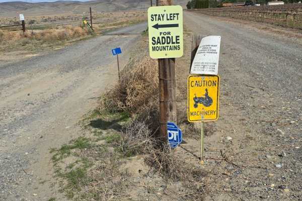
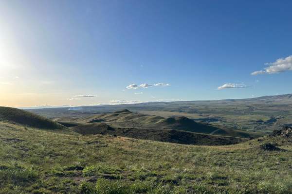
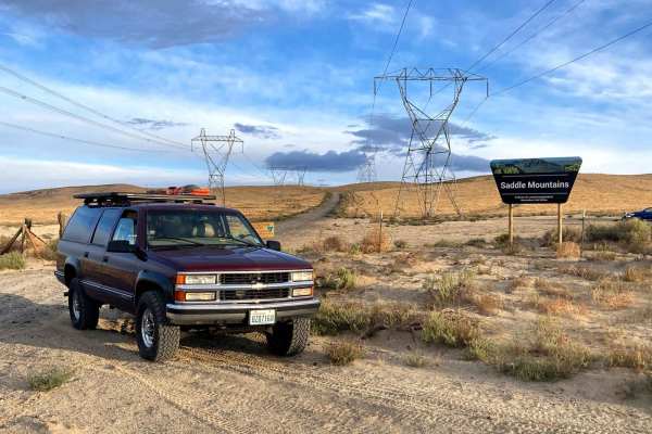
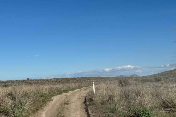
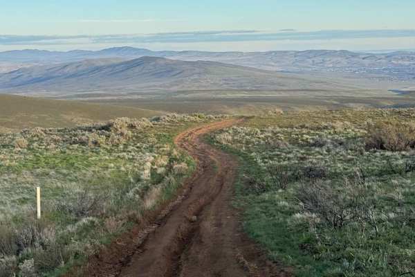
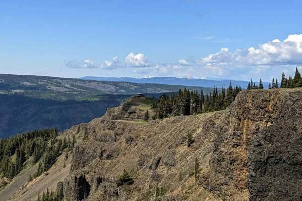
West Saddle Mountains Ridge
The trail features hard-packed dirt combined with fractured basalt gravel and runs along the ridge of the Saddle Mountains. It offers 360-degree views of the Columbia River to the west and the Hanford site to the east. The route consists of easy gravel roads with occasional whooped-out sections. Th...
Learn more about West Saddle Mountains Ridge
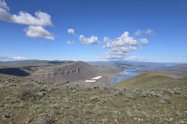
Saddle Mountain Northwest Trail
This is an out-and-back trail featuring a mix of dirt roads and fractured basalt gravel. In some areas, the road is narrow with no pullouts available. Below the cliffs, the Columbia River flows, while apple orchards and wineries are scattered throughout the valley of Columbia River and Crab Creek wa...
Learn more about Saddle Mountain Northwest Trail
Saddle Mountain Rim Tour
The Saddle Mountains Rim Tour trail offers a scenic off-road adventure with sweeping views of the Columbia Basin. This route features a mix of sandy washes, rocky climbs, and ridgeline trails, making it a fun challenge for high-clearance 4x4s. Spring brings vibrant wildflowers, while fall offers coo...
Learn more about Saddle Mountain Rim Tour
Roza Creek Road
This trail is on Washington Department of Fish and Wildlife-owned land, and a Discover Pass is required to travel in the area. This is a dirt trail that is extremely dusty when dry and a muddy slog when wet. There are ruts approximately 12-18 inches deep that you must straddle, and there are areas w...
Learn more about Roza Creek Road
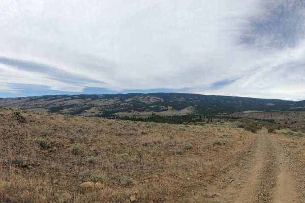
Buffalo Ridge Road
This trail is mostly dirt with some rock garden sections and minor wash/ruts. The trail steadily climbs to the top of a ridge with a 14 percent pitch at one point, but once you make it to the top of the ridge, the views are stunning. This trail ends at a fence row, and becomes the Skyline Trail, whi...
Learn more about Buffalo Ridge Road
Oak Creek FR 1400 to Bear Lake
From Washington State Highway 12, approximately 2.25 miles from the SR 410/Highway 12 junction, Oak Creek Road (FR 1400) begins traveling west. The road is primarily gravel with patches of larger rocks, potholes, and washboards. Travel speed ascending is slow-going due to the rough nature of the roa...
Learn more about Oak Creek FR 1400 to Bear Lake
Bethel Ridge Tie Road
Slow going over a rough road of basalt rock. This road rises steeply from roughly 1700' at the Oak Creek Wildlife office off of Highway 12 to over 4000'. There is a seasonal gate at the access point at the bottom. Bethel Ridge itself is snowbound from December to late June or early July. Check Fores...
Learn more about Bethel Ridge Tie Road
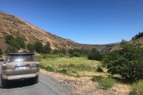
Durr Road to Umtanum Creek Camp
Although this trail is a fairly short drive from Ellensburg, you will soon feel like you've been transported to the old west. Once you leave the paved Umtanum Road and get onto Durr Road you will find that it is unmaintained dirt with loose rock. You will have some great views of the snow-capped mou...
Learn more about Durr Road to Umtanum Creek Camp
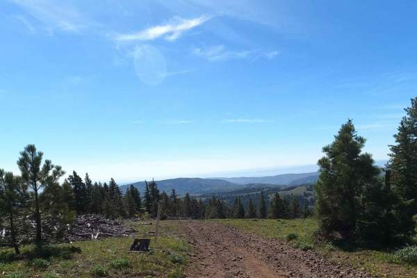
Kelley Hollow Road
This trail begins off the pavement of North Wenas Road, where you’ll find signage, a map, and posted rules. It climbs steadily into the hills, passing through a gate that must be closed behind you.
Wildflowers are often abundant along the route. The trail eventually meets and follows a canyon for a ...
Learn more about Kelley Hollow Road
Newlands Road
Newlands Road is a dusty roads with loose rocks. There are some uphill spots where loose rocks could be a problem, however for the most part it is just a dirt road. There are a few rutted areas that can be easily navigated.
Learn more about Newlands Road
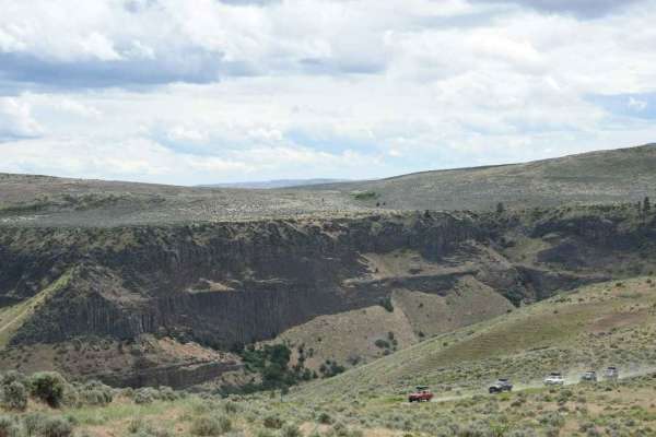
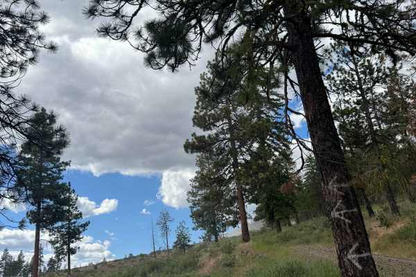
Jacknife Ridge Road
Jackknife Ridge Road is a 13.9-mile point-to-point dirt and rock route that winds through Ginkgo Petrified Forest State Park and the Whiskey Dick Wildlife Area, offering views of the Columbia River and multiple pull-offs along the way. Starting from the southern end, a locked gate requires a free pe...
Learn more about Jacknife Ridge Road
Reynolds Creek Tie - C1201
Reynolds Creek Tie is a 4.5-mile forest service road that drops down from 5,400' at Divide Ridge to 3,400' at Reynolds Creek Road and then follows the creek down into Cowiche, Washington. It is semi-maintained and rocky in places. This road is snowbound until mid-May to early June.
Learn more about Reynolds Creek Tie - C1201
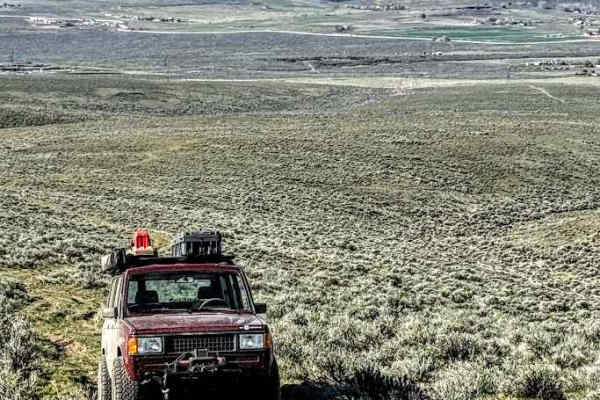
Wild Horse Monument
This is a relatively easy trail that takes you beyond the Wild Horse Monument and into BLM land. Overall, this is a GREAT trail to learn the basics of off-roading in a fun and safe environment. The beginning of the trail undulates through a narrow desert canyon, with a few twists and turns. At about...
Learn more about Wild Horse Monument
Manastash Ridge Observatory Adventure
The Wenatchee area in Central Washington offers a scenic and moderately challenging off-road experience using Hanson Road, Observatory Road, and Hudson Road. This trail network winds through a mix of pine forest, shrub steppe, and open ridgelines with expansive views of the Yakima Valley and Mount R...
Learn more about Manastash Ridge Observatory Adventure
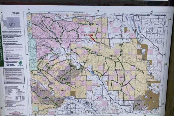
Garrett Canyon Road
This is a dirt-based road on State of Washington land in the Wenas unit. A Discover Pass is required to enjoy this area. The trail is narrow, one lane, and two-track in some areas. There are places to pass, and the road dead ends with no access to Highway 12, so you must backtrack to Mud Lake Road t...
Learn more about Garrett Canyon Road
Jump Off - NF1302
Jump Off road is a 12-mile Forest Service road that crosses the Tieton River at Windy Point and climbs quickly up onto and follows along Divide Ridge to reach Jump Off Lookout. The first 3-4 miles were freshly graded and compacted but then the road devolved into the teeth-rattling basalt rock roads ...
Learn more about Jump Off - NF1302
Green Gate Access - South Road
The south trail through the Colockum Wildlife Area, just west of Vantage, WA, is a great introduction to off-road driving with rewarding views throughout. The route is mostly dirt and gravel, with sections of loose rock on the hill climbs that keep things interesting without being overly technical. ...
Learn more about Green Gate Access - South Road
Jones Road
Jones road has a few small obstacles, most of which have been cleared, but may require caution. For the most part, this trail is pretty easy going despite the incline. Snow would make it more difficult. It is a two-way trail, but it's very narrow and only one vehicle wide, so watch out for oncoming ...
Learn more about Jones Road
Umptatum Ridge Road
Umtanum ridge road is a dirt road with a few deep rutted sections. There are multiple switchbacks as you continue up the hills and as you come down. There is a small bridge crossing with an excellent camping spot both to the right and the left of the bridge. Continuing up the mountains involves some...
Learn more about Umptatum Ridge Road
Beginner ATV trails near Granger, Washington
Explore ATV-friendly trails near you. These trails are accessible for vehicles up to 50 inches wide, perfect for ATVs and smaller off-road machines.
Double Track
Double Track is a very easy trail with views of the Tri-Cities, Washington. There are some small hill climbs along the way. This is a good trail for beginners. During the winter, you will encounter mud and snow, and it's very dry and dusty in the summer.
Learn more about Double Track
West Saddle Mountains Ridge
The trail features hard-packed dirt combined with fractured basalt gravel and runs along the ridge of the Saddle Mountains. It offers 360-degree views of the Columbia River to the west and the Hanford site to the east. The route consists of easy gravel roads with occasional whooped-out sections. Th...
Learn more about West Saddle Mountains Ridge
Saddle Mountain Northwest Trail
This is an out-and-back trail featuring a mix of dirt roads and fractured basalt gravel. In some areas, the road is narrow with no pullouts available. Below the cliffs, the Columbia River flows, while apple orchards and wineries are scattered throughout the valley of Columbia River and Crab Creek wa...
Learn more about Saddle Mountain Northwest Trail
Saddle Mountain Rim Tour
The Saddle Mountains Rim Tour trail offers a scenic off-road adventure with sweeping views of the Columbia Basin. This route features a mix of sandy washes, rocky climbs, and ridgeline trails, making it a fun challenge for high-clearance 4x4s. Spring brings vibrant wildflowers, while fall offers coo...
Learn more about Saddle Mountain Rim Tour
Beginner UTV/side-by-side trails near Granger, Washington
Find UTV and side-by-side trails near you. These trails accommodate vehicles up to 60 inches wide, ideal for UTVs, side-by-sides, and wider off-road rigs.
Double Track
Double Track is a very easy trail with views of the Tri-Cities, Washington. There are some small hill climbs along the way. This is a good trail for beginners. During the winter, you will encounter mud and snow, and it's very dry and dusty in the summer.
Learn more about Double Track
West Saddle Mountains Ridge
The trail features hard-packed dirt combined with fractured basalt gravel and runs along the ridge of the Saddle Mountains. It offers 360-degree views of the Columbia River to the west and the Hanford site to the east. The route consists of easy gravel roads with occasional whooped-out sections. Th...
Learn more about West Saddle Mountains Ridge
Saddle Mountain Northwest Trail
This is an out-and-back trail featuring a mix of dirt roads and fractured basalt gravel. In some areas, the road is narrow with no pullouts available. Below the cliffs, the Columbia River flows, while apple orchards and wineries are scattered throughout the valley of Columbia River and Crab Creek wa...
Learn more about Saddle Mountain Northwest Trail
Saddle Mountain Rim Tour
The Saddle Mountains Rim Tour trail offers a scenic off-road adventure with sweeping views of the Columbia Basin. This route features a mix of sandy washes, rocky climbs, and ridgeline trails, making it a fun challenge for high-clearance 4x4s. Spring brings vibrant wildflowers, while fall offers coo...
Learn more about Saddle Mountain Rim Tour
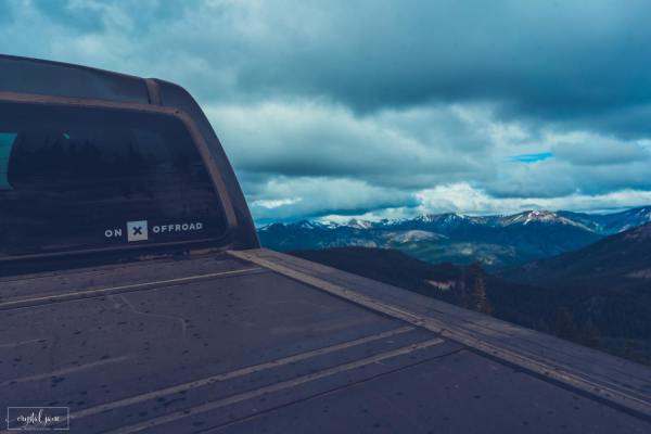
The onX Offroad Difference
onX Offroad combines trail photos, descriptions, difficulty ratings, width restrictions, seasonality, and more in a user-friendly interface. Available on all devices, with offline access and full compatibility with CarPlay and Android Auto. Discover what you're missing today!
Open Trail Map