
Beginner Off-Road Trails
Near Glenville, North Carolina
Explore All Beginner Trails Near Glenville, North Carolina
Beginner Off-Road Trails Near Glenville, North Carolina
Discover the best beginner-friendly off-road trails near you. These easier, lower-rated trails are a great place to start — browse trail maps, check difficulty ratings, and find your next adventure.
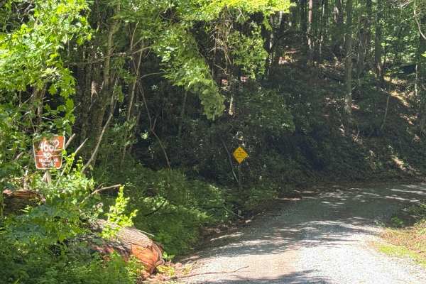
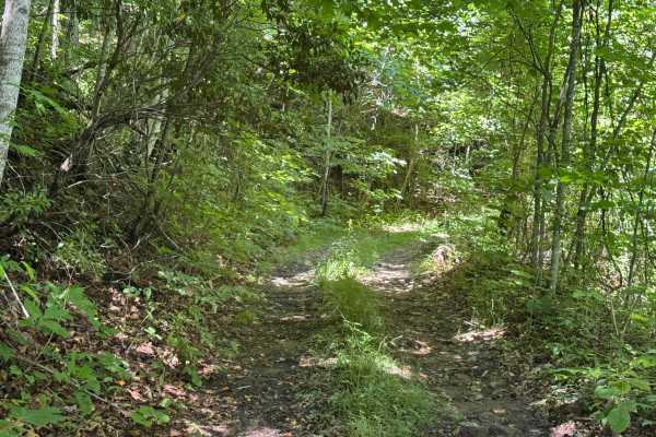
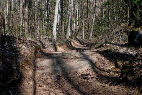
Flat Creek - FS 4662
Flat Creek - FS 4662 is a 2.2-mile out-and-back route that follows a single-lane road with few places to pass over a packed dirt and gravel surface. The road is lightly maintained and travels through heavily forested terrain, providing an easy drive with a smooth surface and no significant obstacles...
Learn more about Flat Creek - FS 4662

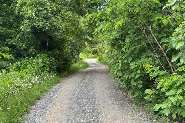
Rock Bridge Road - SR 1140
Rock Bridge Road - SR 1140 is a 1.7-mile point-to-point route that follows a single-lane road with places to pass over a well-maintained, packed dirt and gravel surface. Passing through heavily forested terrain, the route is rated easy and provides a smooth drive with no significant obstacles, makin...
Learn more about Rock Bridge Road - SR 1140
Sugar Creek Gap - FS 4665
Sugar Creek Gap - FS 4665 is a 7.2-mile out-and-back route that follows a generously sized single-lane gravel road with places to pass. The road is well maintained and travels through heavily forested terrain, providing an easy drive with a smooth surface and few obstacles throughout its length. Its...
Learn more about Sugar Creek Gap - FS 4665
Lower Moses Creek - FS 4651
Lower Moses Creek - FS 4651 is a 3.2-mile point-to-point route that follows a single-lane road with places to pass over a lightly maintained, packed dirt and gravel surface. Passing through heavily forested terrain, the route is rated easy and features a smooth driving surface with no significant ob...
Learn more about Lower Moses Creek - FS 4651
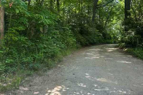
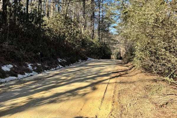
Big Creek Road - FS 4567
FS 4567 Big Creek Road is a well-maintained gravel road that has the very nice Secret Falls Hiking trail directly off of it. This road was 2 miles long and took us about 12 minutes to travel. There was room for 2 vehicles to pass one another comfortably. The Secret Falls hike is closer to the south...
Learn more about Big Creek Road - FS 4567

Old Bald Ridge - FS 4652
Old Bald Ridge Trail is a mildly used out-and-back two-track through the Nantahala National Forest. The trail is accessed from Moses Creek Road, which is asphalt up to the entry into the National Forest, where its designation changes to FS4651. 3.2 miles up Moses Creek Road, the Old Bald Ridge trail...
Learn more about Old Bald Ridge - FS 4652
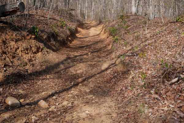
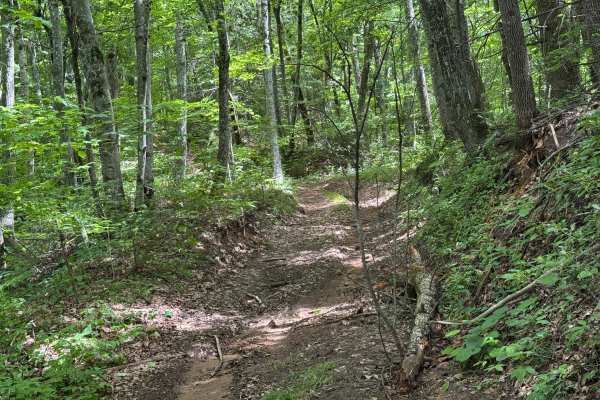
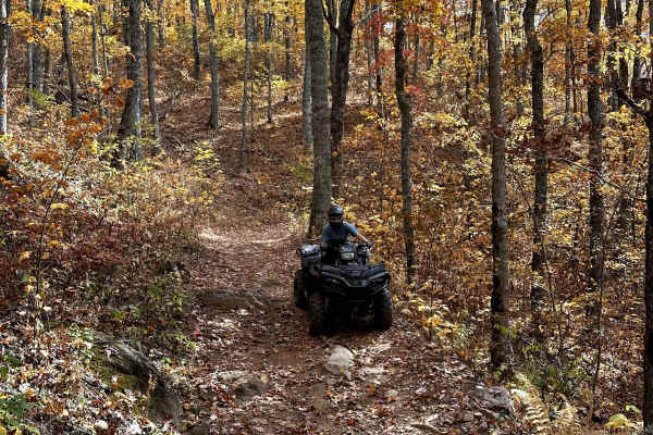
Black Mountain Trail 3
Trail 3 is a frequently used, rocky trail that winds through a beautifully forested section of the Nantahala. The surface includes small loose rocks and moderate curves, and the trail is noticeably worn and troughed below the forest floor. The route hugs the hillside along a narrow shelf trail lined...
Learn more about Black Mountain Trail 3
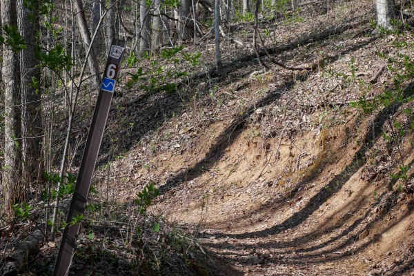
Sunset Ridge Trail 6
Trail 6 is more moderate compared to the challenging 6A. It still features some steeper climbing with embedded roots and small rocks scattered along the way, and it hugs the mountainside on a shelfy path. Leaf litter can obscure the trail surface, so watch for rocks and roots. Going counter-clockwis...
Learn more about Sunset Ridge Trail 6
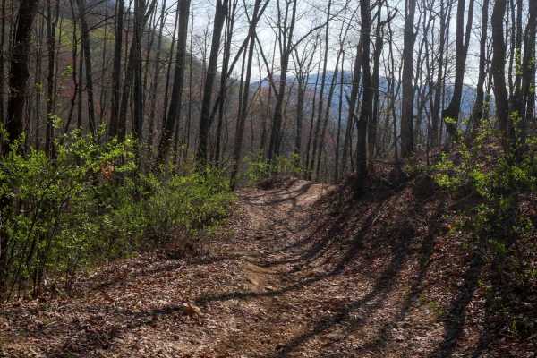
Locust Gap Trail 2
Trail 2 features a shelfy route that contours the mountainside, with mild exposure and sweeping views at higher elevations. Starting at the northern end, it descends gently for a quarter mile before climbing steeply over the next 3/4 mile to reach a peak elevation of approximately 4,200 feet. The ...
Learn more about Locust Gap Trail 2
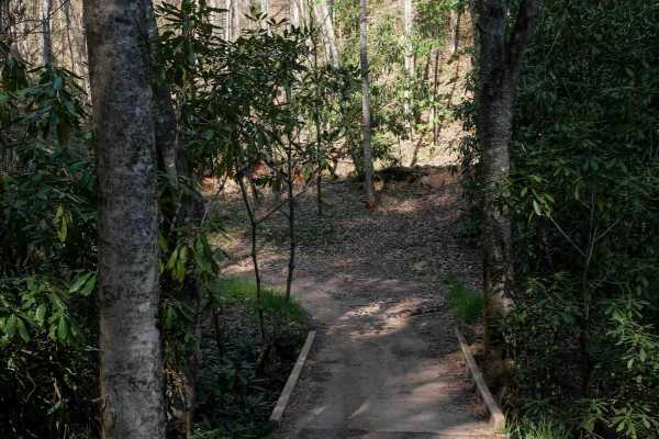
Hemlock Ridge Trail 7
Rated as moderate by the Forest Service, Trail 7 is a wide route that begins on Wayehutta Road just south of the staging area, crossing a small bridge before climbing steadily up the mountain. Riders encounter a sweeping corner followed by a sharp, easy-to-miss hairpin switchback that quickly gains ...
Learn more about Hemlock Ridge Trail 7
Piney Mountain Flats - FS 4666 (Rough Butt)
Piney Mountain Flats (FS 4666), part of the Rough Butt trail complex, is a 0.6-mile point-to-point route that follows a single-lane forest road with few places to pass. The packed dirt and rock surface is not maintained and travels through heavily forested terrain with an easy difficulty rating. Com...
Learn more about Piney Mountain Flats - FS 4666 (Rough Butt)
Hunt Cabin - FS 4666A
Hunt Cabin (FS 4666A) is a 0.8-mile out-and-back route that follows a single-lane forest road with few places to pass. The packed dirt and gravel surface is not maintained as it travels through heavily forested terrain with an easy difficulty rating. A quiet forest setting, some erosion, and several...
Learn more about Hunt Cabin - FS 4666A
Blue Valley Road
Blue Valley Road winds through the scenic Blue Valley Experimental Forest near Highlands, North Carolina. Starting with a brief stretch of pavement, the road quickly transitions to gravel, passing scattered homes before opening into a serene stretch of dispersed campsites. From here, the road offers...
Learn more about Blue Valley Road
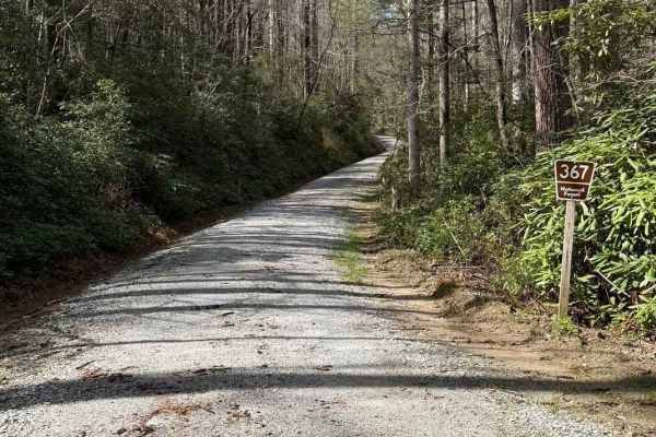
Little Yellow Mountain - FS 367
Little Yellow Mountain is a well-maintained gravel road that branches off of Blue Valley Road and connects to Clear Creek Road. It is wide enough for two vehicles most of the way. There are several campsites and minimal cell service. About halfway through, you will be treated to Brook Creek Falls vi...
Learn more about Little Yellow Mountain - FS 367
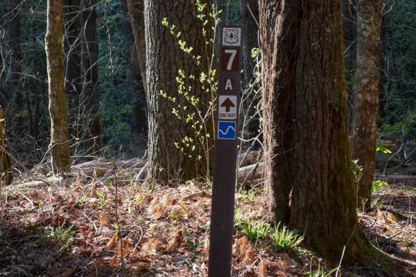
Rail Line Way 7A (One-Way)
Trail 7A is an easy access connector back to the main staging area from Trail 7. Starting at its intersection with Trail 7, it crosses a wide bridge over a small creek and continues along a wide, shelfy path at the base of the hillside. The trail surface includes small loose rocks, sticks, and minor...
Learn more about Rail Line Way 7A (One-Way)
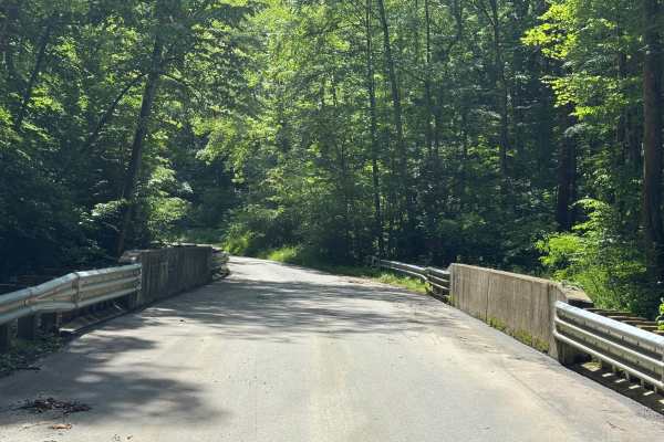
Musterground Road - Part 1
This road is seasonally open during the fall and offers unmatched views of the Blue Ridge Mountains. The first part of this route is very easy to drive and crosses countless bridges over small mountain streams, eventually concluding at a large open campsite along the river. Along the route there is ...
Learn more about Musterground Road - Part 1
Buck Knob Trail 11
Trail 11 features a shelfy traverse up the mountainside with a mix of small rocks, embedded rock layers, sticks, small roots, and occasional moisture. Multiple flat embedded rock slabs make it more interesting without adding difficulty. The upper loop of the trail is indicated for one-way travel in ...
Learn more about Buck Knob Trail 11
Sunset Connector Trail 9 (One-Way)
Trail 9 is a 1.3-mile, wide path that traces the side of the mountain, offering a mellow and scenic ride. Mostly descending from north to south, it's generally easygoing with leaf cover hiding loose rocks, sticks, and roots here and there. A short section next to a trickling mossy waterfall is fun t...
Learn more about Sunset Connector Trail 9 (One-Way)
Sawmill Bottoms Trail 8
This segment of Trail 8 runs for 0.7 miles between Trail 7 and Trail 2, climbing nearly 400 feet in elevation. The route is mostly an uphill grind with several narrow shelfy traverses hugging the hillside, offering mild exposure in spots. While some sections widen out, the trail overall follows the ...
Learn more about Sawmill Bottoms Trail 8
Trail 1 - Wayehutta Loop
Wayehutta is a public OHV trail system in the Nantahala National Forest. Most of the trails in this system are accessible with anything from a dirt bike to a SxS. No 4x4s are allowed on Wayehutta trails. The Trail 1 loop is a fantastic sampler of Wayehutta. It winds and weaves its way up ridges and ...
Learn more about Trail 1 - Wayehutta Loop
Beginner ATV trails near Glenville, North Carolina
Explore ATV-friendly trails near you. These trails are accessible for vehicles up to 50 inches wide, perfect for ATVs and smaller off-road machines.
Black Mountain Trail 3
Trail 3 is a frequently used, rocky trail that winds through a beautifully forested section of the Nantahala. The surface includes small loose rocks and moderate curves, and the trail is noticeably worn and troughed below the forest floor. The route hugs the hillside along a narrow shelf trail lined...
Learn more about Black Mountain Trail 3
Sunset Ridge Trail 6
Trail 6 is more moderate compared to the challenging 6A. It still features some steeper climbing with embedded roots and small rocks scattered along the way, and it hugs the mountainside on a shelfy path. Leaf litter can obscure the trail surface, so watch for rocks and roots. Going counter-clockwis...
Learn more about Sunset Ridge Trail 6
Locust Gap Trail 2
Trail 2 features a shelfy route that contours the mountainside, with mild exposure and sweeping views at higher elevations. Starting at the northern end, it descends gently for a quarter mile before climbing steeply over the next 3/4 mile to reach a peak elevation of approximately 4,200 feet. The ...
Learn more about Locust Gap Trail 2
Hemlock Ridge Trail 7
Rated as moderate by the Forest Service, Trail 7 is a wide route that begins on Wayehutta Road just south of the staging area, crossing a small bridge before climbing steadily up the mountain. Riders encounter a sweeping corner followed by a sharp, easy-to-miss hairpin switchback that quickly gains ...
Learn more about Hemlock Ridge Trail 7
Beginner UTV/side-by-side trails near Glenville, North Carolina
Find UTV and side-by-side trails near you. These trails accommodate vehicles up to 60 inches wide, ideal for UTVs, side-by-sides, and wider off-road rigs.
Old Bald Ridge - FS 4652
Old Bald Ridge Trail is a mildly used out-and-back two-track through the Nantahala National Forest. The trail is accessed from Moses Creek Road, which is asphalt up to the entry into the National Forest, where its designation changes to FS4651. 3.2 miles up Moses Creek Road, the Old Bald Ridge trail...
Learn more about Old Bald Ridge - FS 4652
Black Mountain Trail 3
Trail 3 is a frequently used, rocky trail that winds through a beautifully forested section of the Nantahala. The surface includes small loose rocks and moderate curves, and the trail is noticeably worn and troughed below the forest floor. The route hugs the hillside along a narrow shelf trail lined...
Learn more about Black Mountain Trail 3
Sunset Ridge Trail 6
Trail 6 is more moderate compared to the challenging 6A. It still features some steeper climbing with embedded roots and small rocks scattered along the way, and it hugs the mountainside on a shelfy path. Leaf litter can obscure the trail surface, so watch for rocks and roots. Going counter-clockwis...
Learn more about Sunset Ridge Trail 6
Locust Gap Trail 2
Trail 2 features a shelfy route that contours the mountainside, with mild exposure and sweeping views at higher elevations. Starting at the northern end, it descends gently for a quarter mile before climbing steeply over the next 3/4 mile to reach a peak elevation of approximately 4,200 feet. The ...
Learn more about Locust Gap Trail 2
The onX Offroad Difference
onX Offroad combines trail photos, descriptions, difficulty ratings, width restrictions, seasonality, and more in a user-friendly interface. Available on all devices, with offline access and full compatibility with CarPlay and Android Auto. Discover what you're missing today!
Open Trail Map