
Beginner Off-Road Trails
Near Furnace Creek, California
Explore All Beginner Trails Near Furnace Creek, California
Beginner Off-Road Trails Near Furnace Creek, California
Discover the best beginner-friendly off-road trails near you. These easier, lower-rated trails are a great place to start — browse trail maps, check difficulty ratings, and find your next adventure.
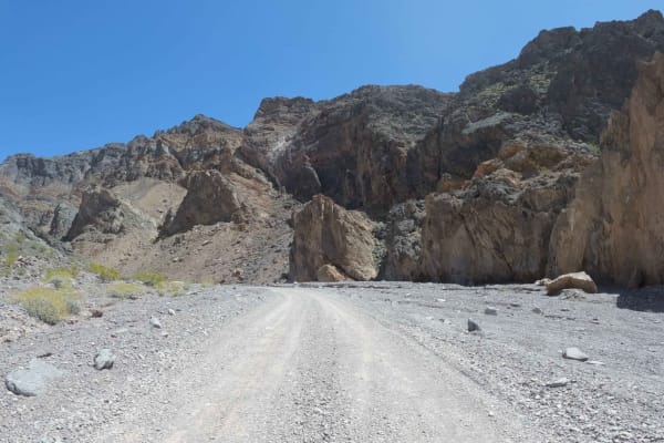
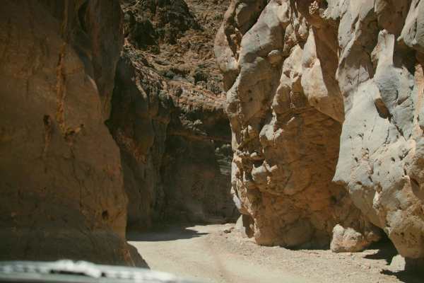
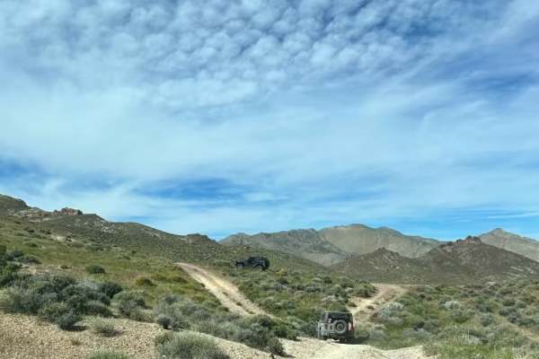
Echo Canyon Road
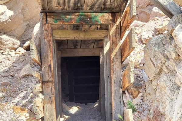
An easy rock road accessing the Inyo Mine from Hwy 190 in Death Valley National Park. The Death Valley Backcountry and Wilderness Access Map describes Echo Canyon as high clearance the first three miles and 4x4 required beyond. In April 2023, this road was flat and smooth and did not require either ...
Learn more about Echo Canyon Road
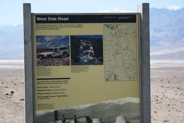
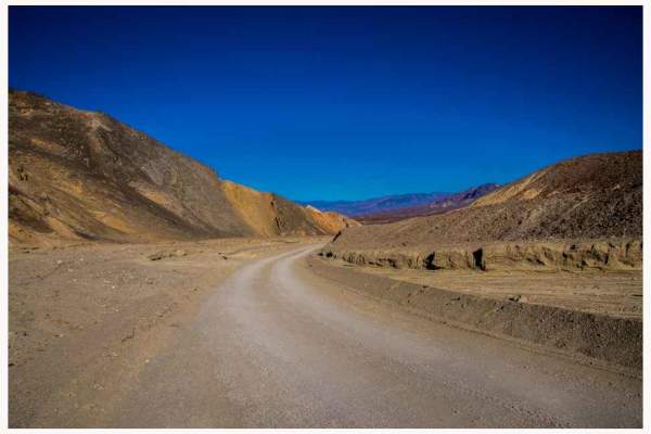
West Side Road - DVNP
Easy route around the west side of the dry lake bed in Death Valley. This route offers a different, and remote, perspective of the Devil's Golf Course and Badwater Basin. The route starts about 11 miles north of Badwater Basin and continues for 40 miles ending near Ashford Mill Ruins. Eagle Borax ...
Learn more about West Side Road - DVNP
Twenty Mule Team Canyon Road
Twenty Mule Team Canyon is a 2.7-mile one-way, unpaved dirt road loop located within Death Valley National Park. The trail traverses vibrant, eroded badlands and is situated near Zabriskie Point. Renowned for its picturesque and dramatic desert landscape, the trail also holds historical significance...
Learn more about Twenty Mule Team Canyon Road
Hole in the Wall Canyon
This out-and-back trail rises almost 1,600 feet in just over 6.5 miles into the Hole in the Wall Canyon. You will encounter stunning rock formations throughout the trail. You will go through the actual "Hole In the Wall" between miles 3 and 4. Although the road is graded, it can be very rough and bu...
Learn more about Hole in the Wall Canyon
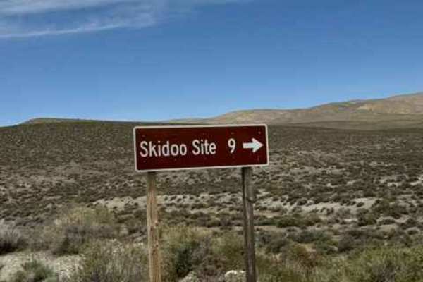
Skidoo Road
This easy trail leads to the mining town of Skidoo. The trail is wide enough for vehicles to pass and is not technical. Along the trail, explorers are treated to an old miner's cabin, rundown mining structures, amazing views of Badwater Basin, and the stamp mill at the Skidoo site proper. This trail...
Learn more about Skidoo Road
Wood Canyon Road
Wood Canyon Road is situated off Emigrant Canyon Road. It is an “out and back” trail; it is a rarely visited mining area, the Argenta mine is from the early mining area of Death Valley. Because of its remote location, many of the items were left behind by the miners. There are abandoned cars slowly ...
Learn more about Wood Canyon Road
Nemo Canyon Road
Nemo Canyon Road is an easy two-track that runs about 2.5 miles to two mine sites. The trail has minor ruts and rocks and follows the canyon to an old mining area where the route splits. Continuing straight a short distance leads to the Christmas Mine, a filled-in shaft that was worked for silver an...
Learn more about Nemo Canyon Road
Tucki Mountain Road
Tucki Mountain Road is situated off Emigrant Canyon Road. The trailhead is not marked, so proceed cautiously and scan to your left for the trail. This is an out-and-back trail that is 10 miles one way. Initially, the trail is a smooth dirt and gravel road that appears to have been groomed. Throughou...
Learn more about Tucki Mountain Road
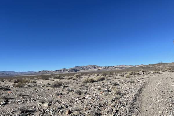
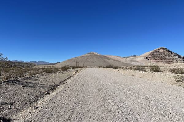
Dunes Poll Line Road
A pretty straight, pretty flat rip from the Amargosa Dunes over to the access trail to get to Blackmarble Mountain and other trails in the area. There are a few spots where it gets rutted out and silty, and a few sections of choosing your own adventure that meets up to the same track. The trail is g...
Learn more about Dunes Poll Line Road
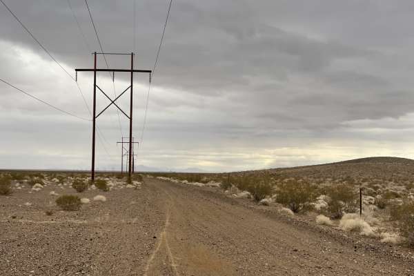
Pole Line Road
This trail is the main Pole line heading south out of town from Beatty and its more local dirt trails. This road takes you along the power lines and down toward two interesting abandoned mining complex trails. At one point, the trail is very tricky as it passes asphalt. You will want to follow their...
Learn more about Pole Line Road
Black Marble Mountain Truck Route
The first half of the trail is relatively easy;most high clearance 4x4 will have no issues. There are a few dispersed camping spots and a few old mining areas to explore with a vast elevated view of the canyon below. The trail narrows to a single track on the mountain's south side. No cell service o...
Learn more about Black Marble Mountain Truck Route
Queen of Sheba Mine
This trail branches off West Side Road and leads to an old mining site, Queen of Sheba. The trail itself is not technical, but it is rocky and only one vehicle wide. Be sure to carry a spare on this trail and others in Death Valley. At the mine site, there are a few old structures to explore. This i...
Learn more about Queen of Sheba Mine
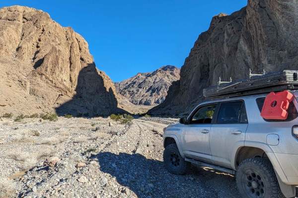
Titus Canyon
Titus Canyon is a scenic one way dirt road from East to West, doable in any stock SUV. In just 26 easy miles you will drive through mountains, a ghost town, along petroglyphs and through the Narrows before being dumped into Death Valley itself. While not a challenging trail, it is one of the most be...
Learn more about Titus Canyon
Spring Meadows Road
This graded, gravel trail takes you through the northern area of Ash Meadow National Wildlife Refuge. There are many attractions to explore, including: Peterson Reservoir, Crystal Reservoir, Lower Crystal Marsh and Wetlands, Devil's Hole, the Ash Meadow's Visitor Center, Longstreet Spring and Histor...
Learn more about Spring Meadows Road
Gold Bar Road
This trail starts out easy with a graded two-lane washboard dirt road by the private Big Red Art Barn. Look, but please don't touch. It also appears people camp in the parking lot by the many fire rings scattered about. Technically it's BLM land, so It could be allowed. Always e sure to check with t...
Learn more about Gold Bar Road
Old Railroad Grade Road
The western section of the road is well-graded and more than two cars wide. Once you transition onto the two-track near the airport, the trail gets rocky, with a few washout transitions. One specifically is a little larger than the others. The main trail passes near the airport and right past the Ne...
Learn more about Old Railroad Grade Road
Gold Valley Road - Willow Spring Spur
If you’re looking for a relaxed off-road outing with big views, this trail is a great choice. It’s an easy, scenic route that feels more like a desert cruise than a technical drive—ideal for a low-stress day or for bringing along newer drivers.
The route is about 13 miles and takes roughly 2 hours ...
Learn more about Gold Valley Road - Willow Spring Spur
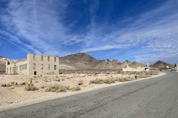
Rainbow Mountain Road
A mostly east trail that begins or ends at the Rhyolite ghost town on the western end of the trail. The ghost town is somewhat preserved with many structures still standing and lots to explore, including many informational Kiosks to spend your time learning about the town. There are also pit toilets...
Learn more about Rainbow Mountain Road
BLM 927827
This sandy and rocky trail connects Devil's Hole Road to the south side of the little village of Crystal. It takes you just south of the Amagrosa Flats, where you can see the mining operation. The trail changes surfaces various times, but the uneven, bumpy surfaces make it a very uncomfortable ride....
Learn more about BLM 927827
Rhyolite Ghost Town Loop
This is a fairly easy trail with the exception of Secret Pass, which can be bypassed easily with other trails nearby. Secret Pass has short, steep grades that are rocky and tight in various sections. Pinstripes, tire sidewall damage and water crossings up to a foot during the wet months are likely. ...
Learn more about Rhyolite Ghost Town Loop
Beginner ATV trails near Furnace Creek, California
Explore ATV-friendly trails near you. These trails are accessible for vehicles up to 50 inches wide, perfect for ATVs and smaller off-road machines.
Dunes Poll Line Road
A pretty straight, pretty flat rip from the Amargosa Dunes over to the access trail to get to Blackmarble Mountain and other trails in the area. There are a few spots where it gets rutted out and silty, and a few sections of choosing your own adventure that meets up to the same track. The trail is g...
Learn more about Dunes Poll Line Road
Pole Line Road
This trail is the main Pole line heading south out of town from Beatty and its more local dirt trails. This road takes you along the power lines and down toward two interesting abandoned mining complex trails. At one point, the trail is very tricky as it passes asphalt. You will want to follow their...
Learn more about Pole Line Road
Black Marble Mountain Truck Route
The first half of the trail is relatively easy;most high clearance 4x4 will have no issues. There are a few dispersed camping spots and a few old mining areas to explore with a vast elevated view of the canyon below. The trail narrows to a single track on the mountain's south side. No cell service o...
Learn more about Black Marble Mountain Truck Route
Gold Bar Road
This trail starts out easy with a graded two-lane washboard dirt road by the private Big Red Art Barn. Look, but please don't touch. It also appears people camp in the parking lot by the many fire rings scattered about. Technically it's BLM land, so It could be allowed. Always e sure to check with t...
Learn more about Gold Bar Road
Beginner UTV/side-by-side trails near Furnace Creek, California
Find UTV and side-by-side trails near you. These trails accommodate vehicles up to 60 inches wide, ideal for UTVs, side-by-sides, and wider off-road rigs.
Dunes Poll Line Road
A pretty straight, pretty flat rip from the Amargosa Dunes over to the access trail to get to Blackmarble Mountain and other trails in the area. There are a few spots where it gets rutted out and silty, and a few sections of choosing your own adventure that meets up to the same track. The trail is g...
Learn more about Dunes Poll Line Road
Pole Line Road
This trail is the main Pole line heading south out of town from Beatty and its more local dirt trails. This road takes you along the power lines and down toward two interesting abandoned mining complex trails. At one point, the trail is very tricky as it passes asphalt. You will want to follow their...
Learn more about Pole Line Road
Black Marble Mountain Truck Route
The first half of the trail is relatively easy;most high clearance 4x4 will have no issues. There are a few dispersed camping spots and a few old mining areas to explore with a vast elevated view of the canyon below. The trail narrows to a single track on the mountain's south side. No cell service o...
Learn more about Black Marble Mountain Truck Route
Gold Bar Road
This trail starts out easy with a graded two-lane washboard dirt road by the private Big Red Art Barn. Look, but please don't touch. It also appears people camp in the parking lot by the many fire rings scattered about. Technically it's BLM land, so It could be allowed. Always e sure to check with t...
Learn more about Gold Bar Road
The onX Offroad Difference
onX Offroad combines trail photos, descriptions, difficulty ratings, width restrictions, seasonality, and more in a user-friendly interface. Available on all devices, with offline access and full compatibility with CarPlay and Android Auto. Discover what you're missing today!
Open Trail Map