
Beginner Off-Road Trails
Near Amargosa Valley, Nevada
Explore All Beginner Trails Near Amargosa Valley, Nevada
Beginner Off-Road Trails Near Amargosa Valley, Nevada
Discover the best beginner-friendly off-road trails near you. These easier, lower-rated trails are a great place to start — browse trail maps, check difficulty ratings, and find your next adventure.
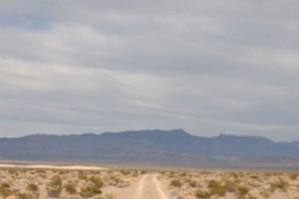
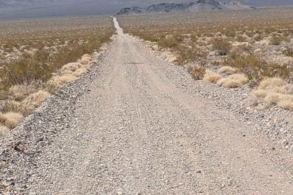
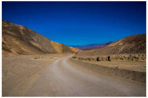
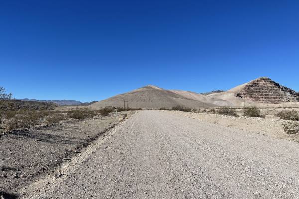
Dunes Poll Line Road
A pretty straight, pretty flat rip from the Amargosa Dunes over to the access trail to get to Blackmarble Mountain and other trails in the area. There are a few spots where it gets rutted out and silty, and a few sections of choosing your own adventure that meets up to the same track. The trail is g...
Learn more about Dunes Poll Line Road
BLM 927827
This sandy and rocky trail connects Devil's Hole Road to the south side of the little village of Crystal. It takes you just south of the Amagrosa Flats, where you can see the mining operation. The trail changes surfaces various times, but the uneven, bumpy surfaces make it a very uncomfortable ride....
Learn more about BLM 927827
Spring Meadows Road
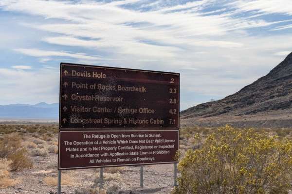
This graded, gravel trail takes you through the northern area of Ash Meadow National Wildlife Refuge. There are many attractions to explore, including: Peterson Reservoir, Crystal Reservoir, Lower Crystal Marsh and Wetlands, Devil's Hole, the Ash Meadow's Visitor Center, Longstreet Spring and Histor...
Learn more about Spring Meadows Road
Crystal Road Alternate
Crystal Road Alternate is the most direct route from the intersection of Highways 95 and 160. It travels from southwest to the northeast. It offers pretty views of the surrounding mountain ranges. The track is less travelled. Although it is mostly gravel, there are sandy sections as well as off-camb...
Learn more about Crystal Road Alternate
Devil's Hole Road
This fairly well graded gravel trail connects the Amagrosa Flat to the Ash Meadows National Wildlife Refuge. The first section takes you into a Mars-like area of Amagrosa Flats. Amargosa Flats material is primarily composed of a complex mix of geologic materials, including coarse-to-fine-grained all...
Learn more about Devil's Hole Road
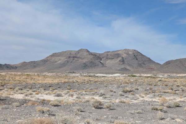
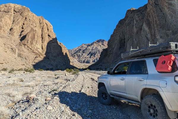
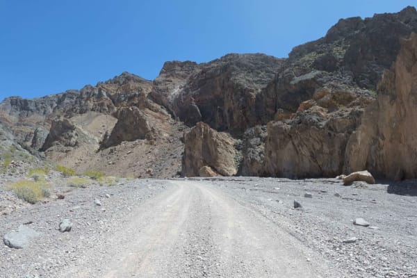
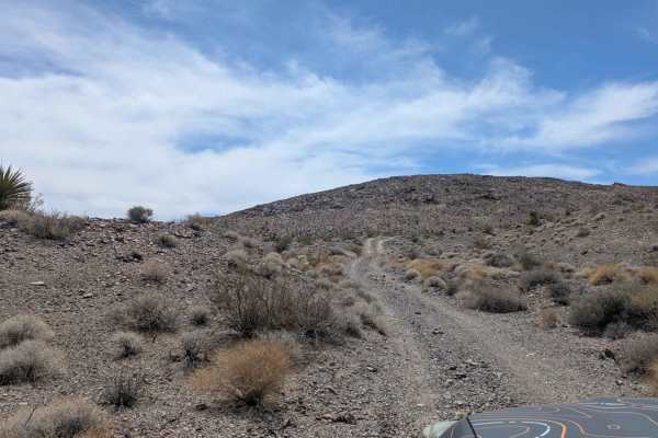
Black Marble Mountain Truck Route
The first half of the trail is relatively easy;most high clearance 4x4 will have no issues. There are a few dispersed camping spots and a few old mining areas to explore with a vast elevated view of the canyon below. The trail narrows to a single track on the mountain's south side. No cell service o...
Learn more about Black Marble Mountain Truck Route
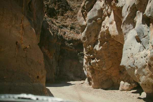
Hole in the Wall Canyon
This out-and-back trail rises almost 1,600 feet in just over 6.5 miles into the Hole in the Wall Canyon. You will encounter stunning rock formations throughout the trail. You will go through the actual "Hole In the Wall" between miles 3 and 4. Although the road is graded, it can be very rough and bu...
Learn more about Hole in the Wall Canyon
BLM 927692
This is a gravel trail that has nice open views of the surrounding mountains in all directions. Parts of the track are pretty wide open and allow you to pick up some speed. But be aware that not all tracks are graded. Seasonal grading can make some side banks uneven on side trails.
Learn more about BLM 927692
Twenty Mule Team Canyon Road
Twenty Mule Team Canyon is a 2.7-mile one-way, unpaved dirt road loop located within Death Valley National Park. The trail traverses vibrant, eroded badlands and is situated near Zabriskie Point. Renowned for its picturesque and dramatic desert landscape, the trail also holds historical significance...
Learn more about Twenty Mule Team Canyon Road
Echo Canyon Road
An easy rock road accessing the Inyo Mine from Hwy 190 in Death Valley National Park. The Death Valley Backcountry and Wilderness Access Map describes Echo Canyon as high clearance the first three miles and 4x4 required beyond. In April 2023, this road was flat and smooth and did not require either ...
Learn more about Echo Canyon Road
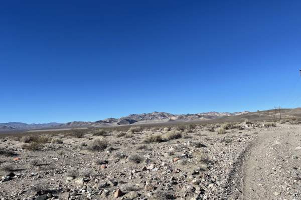
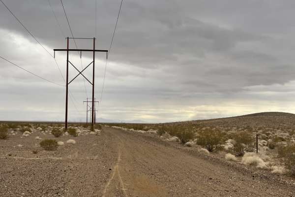
Pole Line Road
This trail is the main Pole line heading south out of town from Beatty and its more local dirt trails. This road takes you along the power lines and down toward two interesting abandoned mining complex trails. At one point, the trail is very tricky as it passes asphalt. You will want to follow their...
Learn more about Pole Line Road
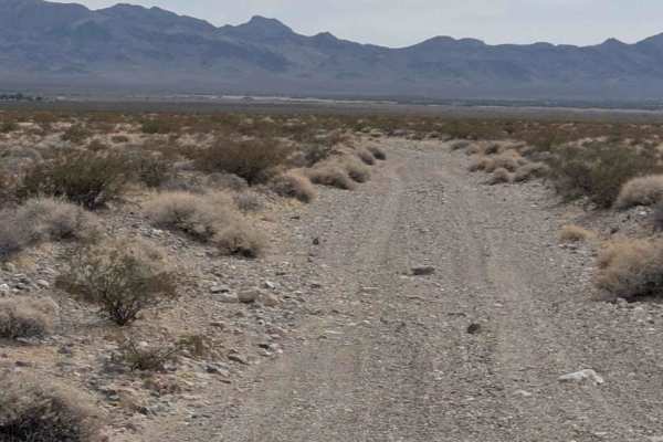
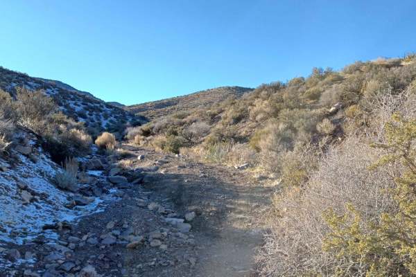
Rocky Wash
The Rocky Wash trail starts in the lower valley just west of the little village of Crystal, Nevada, on the south side of the Amargosa Flat. It climbs almost 700 feet into the hills, giving you dramatic views of the surrounding area. The wash is mostly gravel. The trail can have deep ruts in some spo...
Learn more about Rocky Wash
The Squeeze
This very rocky trail is one of the challenging tracks in this area. There are a few rocky sections created from heavy rain run-off and a couple of drop-offs. There is a very tight squeeze right before a tight 90-degree turn, which will take some careful driving and smart tire placement. High cleara...
Learn more about The Squeeze
Canyon Overlook
Canyon Overlook trail is a beautiful trail that climbs 300 feet above the canyons. Mountains can be viewed around this trail. The track is compacted sand with small gravel on the upper layer. It runs through a few washes with steep ramps. A 4x4 with high clearance is highly recommended.
Learn more about Canyon Overlook
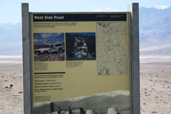
West Side Road - DVNP
Easy route around the west side of the dry lake bed in Death Valley. This route offers a different, and remote, perspective of the Devil's Golf Course and Badwater Basin. The route starts about 11 miles north of Badwater Basin and continues for 40 miles ending near Ashford Mill Ruins. Eagle Borax ...
Learn more about West Side Road - DVNP
Last Chance Road
Last Chance Road is a long dirt road covered with small rocks and gravel. The trail slowly climbs in elevation. It is a slow moving, bumpy track offers some beauty of the surrounding mountains and secluded setting of the high desert. There are a few off-camber sections and various small wash crossin...
Learn more about Last Chance Road
Old Railroad Grade Road
The western section of the road is well-graded and more than two cars wide. Once you transition onto the two-track near the airport, the trail gets rocky, with a few washout transitions. One specifically is a little larger than the others. The main trail passes near the airport and right past the Ne...
Learn more about Old Railroad Grade Road
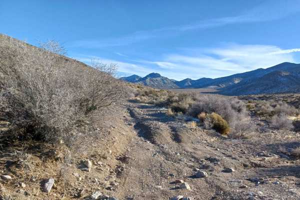
Noides Road
Noides Road drives through the Humboldt-Toiyabe National Forest and Bureau of Land Management Government Lands. It is a semi-easy road with sections that take a 4x4 vehicle and good line placement to navigate loose rocky washouts. You will find a large camp area at the lower open desert area right u...
Learn more about Noides Road
Titus Canyon
Titus Canyon is a scenic one way dirt road from East to West, doable in any stock SUV. In just 26 easy miles you will drive through mountains, a ghost town, along petroglyphs and through the Narrows before being dumped into Death Valley itself. While not a challenging trail, it is one of the most be...
Learn more about Titus Canyon
552 Mining Entry Road
552 Mining Entry Road drives through the Humboldt-Toiyabe National Forest and Bureau of Land Management Government Lands, it is a easy gravel road with sections of loose rock, and spots that have been washed out a 4x4 vechile is recommended. This area can have possible floods, there is a camp spot a...
Learn more about 552 Mining Entry Road
Beginner ATV trails near Amargosa Valley, Nevada
Explore ATV-friendly trails near you. These trails are accessible for vehicles up to 50 inches wide, perfect for ATVs and smaller off-road machines.
Dunes Poll Line Road
A pretty straight, pretty flat rip from the Amargosa Dunes over to the access trail to get to Blackmarble Mountain and other trails in the area. There are a few spots where it gets rutted out and silty, and a few sections of choosing your own adventure that meets up to the same track. The trail is g...
Learn more about Dunes Poll Line Road
Black Marble Mountain Truck Route
The first half of the trail is relatively easy;most high clearance 4x4 will have no issues. There are a few dispersed camping spots and a few old mining areas to explore with a vast elevated view of the canyon below. The trail narrows to a single track on the mountain's south side. No cell service o...
Learn more about Black Marble Mountain Truck Route
Pole Line Road
This trail is the main Pole line heading south out of town from Beatty and its more local dirt trails. This road takes you along the power lines and down toward two interesting abandoned mining complex trails. At one point, the trail is very tricky as it passes asphalt. You will want to follow their...
Learn more about Pole Line Road
Old Railroad Grade Road
The western section of the road is well-graded and more than two cars wide. Once you transition onto the two-track near the airport, the trail gets rocky, with a few washout transitions. One specifically is a little larger than the others. The main trail passes near the airport and right past the Ne...
Learn more about Old Railroad Grade Road
Beginner UTV/side-by-side trails near Amargosa Valley, Nevada
Find UTV and side-by-side trails near you. These trails accommodate vehicles up to 60 inches wide, ideal for UTVs, side-by-sides, and wider off-road rigs.
Dunes Poll Line Road
A pretty straight, pretty flat rip from the Amargosa Dunes over to the access trail to get to Blackmarble Mountain and other trails in the area. There are a few spots where it gets rutted out and silty, and a few sections of choosing your own adventure that meets up to the same track. The trail is g...
Learn more about Dunes Poll Line Road
Black Marble Mountain Truck Route
The first half of the trail is relatively easy;most high clearance 4x4 will have no issues. There are a few dispersed camping spots and a few old mining areas to explore with a vast elevated view of the canyon below. The trail narrows to a single track on the mountain's south side. No cell service o...
Learn more about Black Marble Mountain Truck Route
Pole Line Road
This trail is the main Pole line heading south out of town from Beatty and its more local dirt trails. This road takes you along the power lines and down toward two interesting abandoned mining complex trails. At one point, the trail is very tricky as it passes asphalt. You will want to follow their...
Learn more about Pole Line Road
Old Railroad Grade Road
The western section of the road is well-graded and more than two cars wide. Once you transition onto the two-track near the airport, the trail gets rocky, with a few washout transitions. One specifically is a little larger than the others. The main trail passes near the airport and right past the Ne...
Learn more about Old Railroad Grade Road
The onX Offroad Difference
onX Offroad combines trail photos, descriptions, difficulty ratings, width restrictions, seasonality, and more in a user-friendly interface. Available on all devices, with offline access and full compatibility with CarPlay and Android Auto. Discover what you're missing today!
Open Trail Map