
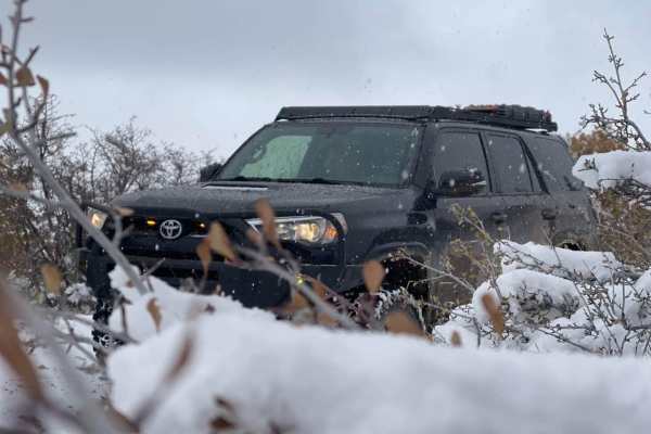
Beginner Off-Road Trails
Near Fairview, Utah
Explore All Beginner Trails Near Fairview, Utah
Beginner Off-Road Trails Near Fairview, Utah
Discover the best beginner-friendly off-road trails near you. These easier, lower-rated trails are a great place to start — browse trail maps, check difficulty ratings, and find your next adventure.
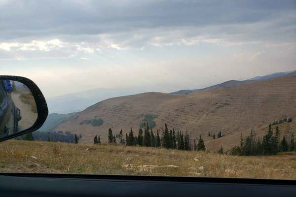
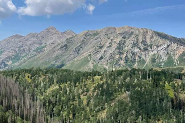
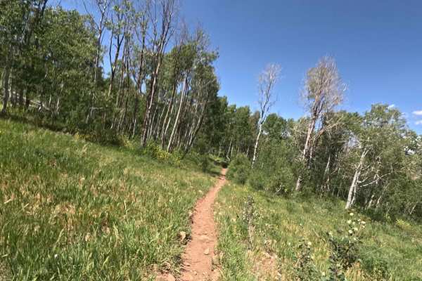
Skyline Drive North
Towering above the valley floor, this section of the Skyline Drive trail is around 10,000' in elevation and offers some incredible views for miles around. Gates are closed for the winter/early spring months. Still expect to find snow and muddy conditions into the early summer months. Being a high mo...
Learn more about Skyline Drive North

North Skyline Drive
North Skyline Drive is a maintained trail from Fairview Canyon to US-6. Fairview Canyon is the popular entrance to this canyon and is maintained better. There are many boondocking options along the whole trail. This trail is good for all levels of off-roading vehicles as it is wide for a majority of...
Learn more about North Skyline Drive
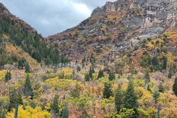
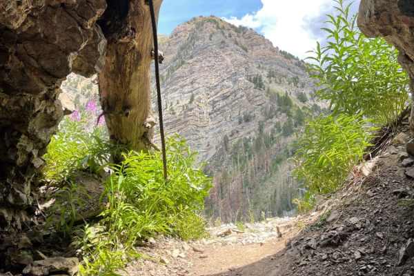
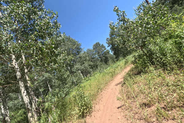
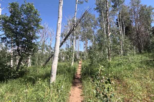
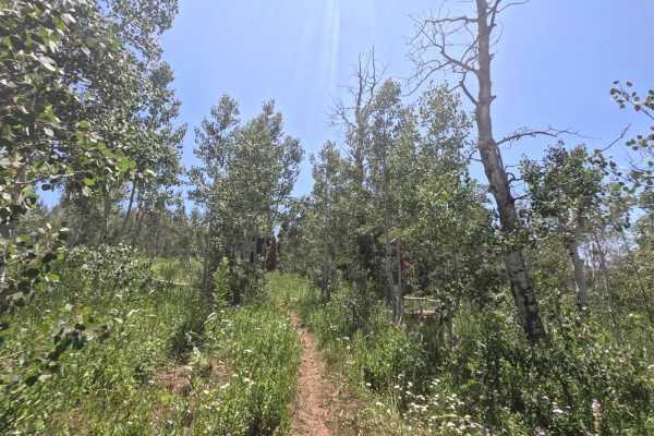
Log Canyon
This is a great easy trail. Start down a long dirt road. In the high desert. Works its way up into the beautiful canyon and is surrounded by Aspen and Big Pine Trees. If you go in fall time you won't be disappointed. The fall color in this area is breathtaking.
Learn more about Log Canyon
Skyline Drive South
Towering above the valley floor, this section of the Skyline Drive trail is around 10,000' in elevation and offers some incredible views for miles around. Gates are closed for the winter / early spring months. Still expect to find snow and muddy conditions into the early summer months. Being a high ...
Learn more about Skyline Drive South
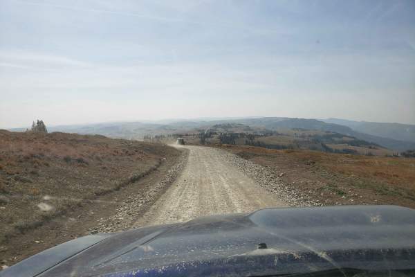
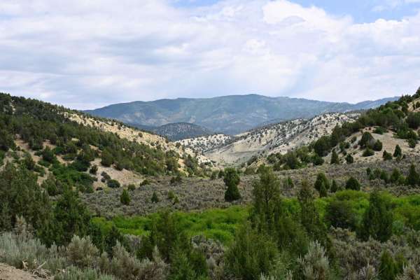
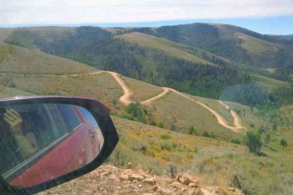
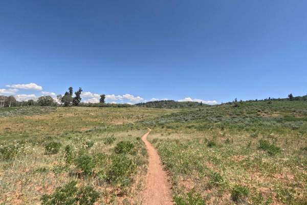
Millers Flat Road
Millers Flat Road is part of the Arapeen OHV trail system in central Utah. The trail is well maintained with just enough technical driving to keep it exciting. The road drops down from the ridge and winds through mountain hills and the scenery is breathtaking as you drive past Miller, Cleveland, and...
Learn more about Millers Flat Road
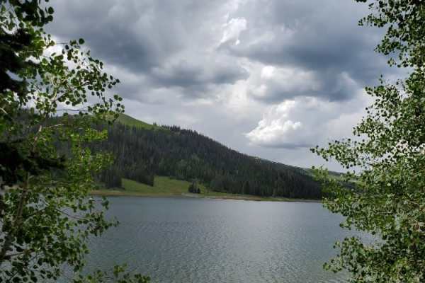
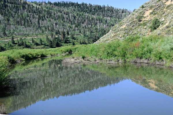
South Reeder/Littles Canyon
This trail boasts high mountain vistas with meadows, thick pines, and aspen. The trail is mostly restricted to 50-inch vehicles, with wider allowances on either end. Grassy Lake has a Forest Service pit toilet if needed and also offers some fun fishing, float tubing, and kayaking. The trail can be a...
Learn more about South Reeder/Littles Canyon
Starvation Road - FS0009
Trail travels from Utah Highway 6 at the north end, near the Skyline Drive northern terminus and trail head, and winds through Starvation Canyon to the Intersection of Bear Ridge (FS0008) at which point you can either continue to Scofield Lake/Scofield State Park, or follow Bear Ridge back to Skylin...
Learn more about Starvation Road - FS0009
Bear Ridge - FS50008
Per its name, this route follows Bear Ridge between Skyline Drive and Scofield Lake. The trail has dual character; coming east from Skyline Drive, the trail abruptly changes from a fairly smooth dirt road to a narrower rocky trail. At about the halfway point, there's a "High Clearance 4WD recommende...
Learn more about Bear Ridge - FS50008
Death Hollow - 50148
The trail is double track. Is very narrow with a mixture of open spaces and tight tree/scrub oak cover. Minimal obstacles, although there can be 12-18 inch ruts that can get muddy if wet weather has been recent. Higher clearance, four-wheelers, and motorcycles would be most ideal. This trail is an o...
Learn more about Death Hollow - 50148
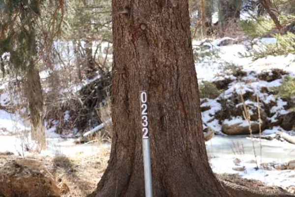
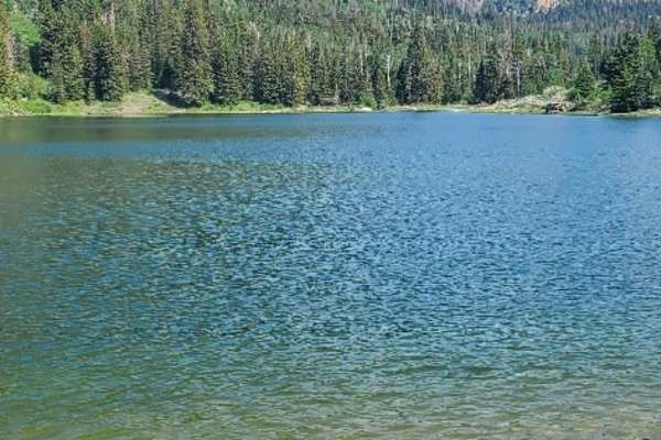
Smith Reservoir - FS 50232
This trail branches off of Lake Fork and travels to a scenic natural lake. The trail crosses the river at the beginning of the trail and crosses it one more time along the trail. It's not difficult, but good to be aware of. There are sections of off-camber rocky sections, and most of the trail is on...
Learn more about Smith Reservoir - FS 50232
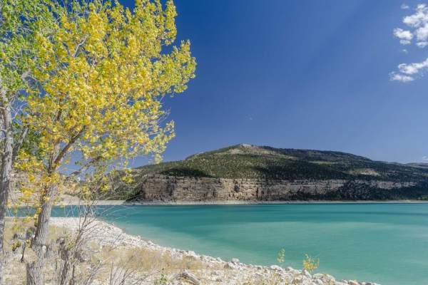
Arapeen Ephraim Canyon to Joes Valley
This trail climbs Ephraim Canyon to Skyline Drive before a few miles on Skyline. There is then a 50" trail that descends the back of the mountain to Joes Valley Reservoir before another trail climbs back to Skyline and back down Ephraim Canyon. There are amazing views the entire way.
Learn more about Arapeen Ephraim Canyon to Joes Valley
Consumers
This trail starts at Consumers Road and makes its way over Beaver Road, dropping down in between Scofield Town and Clear Creek Town. The trail starts in the cedars at about 7000 feet elevation and climbs to higher elevation pines about 9500ft. The climb is steeper with loose dirt, making it more dif...
Learn more about Consumers
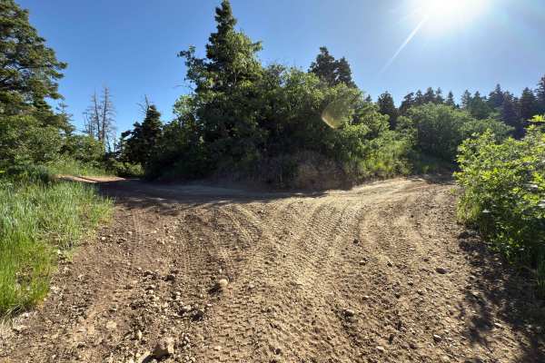
Twin Knolls/Big Swing
This is a VERY short out and back with fantastic views and an amazing swing at the trail end. Right as soon as you turn off the paved road the trail will fork. The left is a 4WD high clearance climb, the road to the right is way more mellow (think Subaru friendly) and will get you to the same dest...
Learn more about Twin Knolls/Big Swing
Mona Pole Road
This is a very fun and not too technical trail. This trail runs between the Nebo Scenic Loop and comes out just east of Mona, Utah. Mona has a gas station if needed. The trail can be driven in either direction. If you start in Mona, then you're doing more climbing and it's quite rocky for the first ...
Learn more about Mona Pole Road
Chicken Creek
This trail starts out in a little town called Levan. The trail follows a gravel road along Chicken Creek. Along the trail, there are great views with cool mountain ledges, and big Aspen and Pine trees. This trail will end in a dead end with some private property signs and gates.
Learn more about Chicken Creek
Jones Ranch South - FS 8123
Jones Ranch South is a short connecting trail in the Payson/Mount Nebo single-track system. This trail branches off from the east end of Rock Spring and continues traveling east for 0.7 miles. It finally ends in a field next to FS 015 (paved road). This field is frequently used for camping, so be aw...
Learn more about Jones Ranch South - FS 8123
Frank Young Canyon - FS 8097
Frank Young Canyon Trail is a short trail near the middle of the Payson/Mount Nebo trail system. This trail breaks off from Rock Spring and runs South, where it ends at FS 015 (paved road). The total trail length is 1.3 miles, and you gain 300 feet of elevation traveling South. The track begins in a...
Learn more about Frank Young Canyon - FS 8097
Lizard Lake - FS 8069
Lizard Lake is a short, 0.7-mile-long trail in the Payson/Mountt Nebo single track system. It travels South from Rock Spring trail and gains about 400 feet of elevation in this direction. The trail terminates in a field at FS 015 (paved road). This trail is primarily through woods, which are thick w...
Learn more about Lizard Lake - FS 8069
Shram Creek - FS 8124
Shram Creek trail is a singletrack located in the center of the Payson/Mt Nebo trail network. It begins from Sheepherder Trailhead and runs South for 2.4 miles. Along the way, you'll gain about 1,000 feet of elevation. This trail is flowy and fun to ride in either direction. It's well-maintained, wi...
Learn more about Shram Creek - FS 8124
Rock Spring - FS 8101
Rock Spring is a 4.5-mile route that connects the majority of the single-track trails in the Payson/My Nebo area. This trail runs West to East, starting at FR 70014 (dirt road) and ending at FR 015 (paved road). The beginning can be difficult to spot, since it drops downhill from the forest road. Th...
Learn more about Rock Spring - FS 8101
Beginner ATV trails near Fairview, Utah
Explore ATV-friendly trails near you. These trails are accessible for vehicles up to 50 inches wide, perfect for ATVs and smaller off-road machines.
Skyline Drive North
Towering above the valley floor, this section of the Skyline Drive trail is around 10,000' in elevation and offers some incredible views for miles around. Gates are closed for the winter/early spring months. Still expect to find snow and muddy conditions into the early summer months. Being a high mo...
Learn more about Skyline Drive North
North Skyline Drive
North Skyline Drive is a maintained trail from Fairview Canyon to US-6. Fairview Canyon is the popular entrance to this canyon and is maintained better. There are many boondocking options along the whole trail. This trail is good for all levels of off-roading vehicles as it is wide for a majority of...
Learn more about North Skyline Drive
Log Canyon
This is a great easy trail. Start down a long dirt road. In the high desert. Works its way up into the beautiful canyon and is surrounded by Aspen and Big Pine Trees. If you go in fall time you won't be disappointed. The fall color in this area is breathtaking.
Learn more about Log Canyon
Skyline Drive South
Towering above the valley floor, this section of the Skyline Drive trail is around 10,000' in elevation and offers some incredible views for miles around. Gates are closed for the winter / early spring months. Still expect to find snow and muddy conditions into the early summer months. Being a high ...
Learn more about Skyline Drive South
Beginner UTV/side-by-side trails near Fairview, Utah
Find UTV and side-by-side trails near you. These trails accommodate vehicles up to 60 inches wide, ideal for UTVs, side-by-sides, and wider off-road rigs.
Skyline Drive North
Towering above the valley floor, this section of the Skyline Drive trail is around 10,000' in elevation and offers some incredible views for miles around. Gates are closed for the winter/early spring months. Still expect to find snow and muddy conditions into the early summer months. Being a high mo...
Learn more about Skyline Drive North
North Skyline Drive
North Skyline Drive is a maintained trail from Fairview Canyon to US-6. Fairview Canyon is the popular entrance to this canyon and is maintained better. There are many boondocking options along the whole trail. This trail is good for all levels of off-roading vehicles as it is wide for a majority of...
Learn more about North Skyline Drive
Log Canyon
This is a great easy trail. Start down a long dirt road. In the high desert. Works its way up into the beautiful canyon and is surrounded by Aspen and Big Pine Trees. If you go in fall time you won't be disappointed. The fall color in this area is breathtaking.
Learn more about Log Canyon
Skyline Drive South
Towering above the valley floor, this section of the Skyline Drive trail is around 10,000' in elevation and offers some incredible views for miles around. Gates are closed for the winter / early spring months. Still expect to find snow and muddy conditions into the early summer months. Being a high ...
Learn more about Skyline Drive South
The onX Offroad Difference
onX Offroad combines trail photos, descriptions, difficulty ratings, width restrictions, seasonality, and more in a user-friendly interface. Available on all devices, with offline access and full compatibility with CarPlay and Android Auto. Discover what you're missing today!
Open Trail Map