
Beginner Off-Road Trails
Near Duncan, British Columbia
Explore All Beginner Trails Near Duncan, British Columbia
Beginner Off-Road Trails Near Duncan, British Columbia
Discover the best beginner-friendly off-road trails near you. These easier, lower-rated trails are a great place to start — browse trail maps, check difficulty ratings, and find your next adventure.
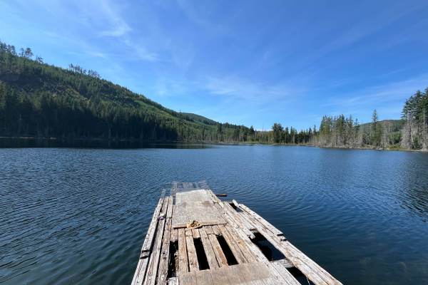
Wild Dear Lake
At nearly 1,300 feet in elevation, this lake offers a peaceful retreat with amenities like a sturdy dock for launching paddle boards or fishing. Its relatively warm waters invite refreshing summer swims. The spacious site easily accommodates several vehicles, making it an excellent destination for b...
Learn more about Wild Dear Lake
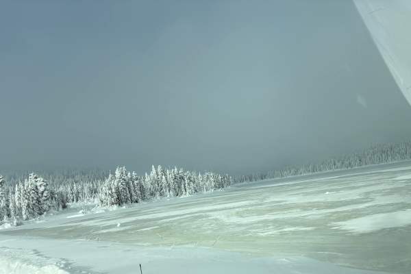
Holly Oak Lake
This trail follows a network of Forest Service roads, gradually transitioning from lower-elevation gravel corridors into steeper, narrower climbs. Expect long ascents with rutted sections, seasonal snow, and icy patches lingering well into spring. As you gain elevation toward 2,800 feet, dense everg...
Learn more about Holly Oak Lake
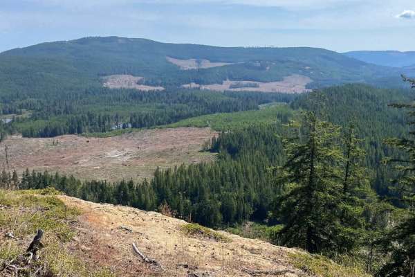
ArmDong
Once a secret playground for local buggy drivers, this trail still carries a hint of its rugged past. It climbs steadily to over 2,200 feet, rewarding you with a panoramic overlook of Cowichan River Provincial Park. The first half serves up narrow, partly washed-out single tracks that twist and dip ...
Learn more about ArmDong
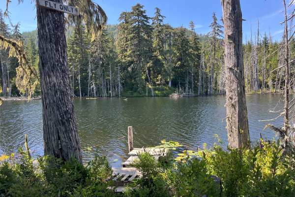
Pet's Pond
Follow the Forest Service road to a hidden local favorite pond. The origins of its name remain a mystery, adding to its quiet charm. The pond features an old, weathered wooden dock, perfect for launching a paddle board or simply relaxing while taking in the peaceful forest and mountain surroundings.
Learn more about Pet's Pond
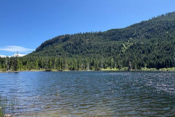
Sherk Lake
Access to this trail begins off the highway. The way to the lake is a steep uphill, almost all the way up, made mostly of loose rock. Expect snow and very slippery conditions during winter. The road up is treed and narrow with the occasional pin striping here and there.
Learn more about Sherk Lake
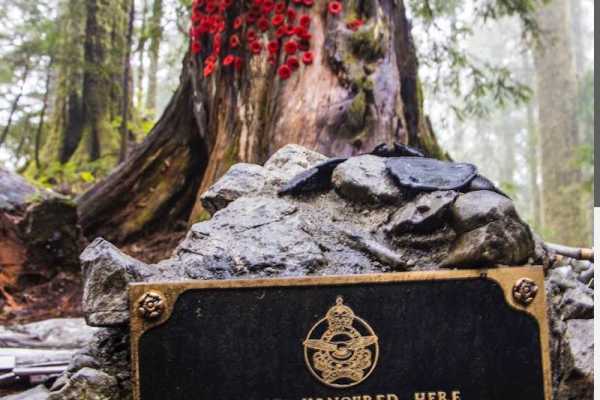
Mount Buldoc Memorial Plane Crash Site
This route ascends to Mount Bolduc via narrow old logging roads, ending at a summit viewpoint and the memorial for the 1944 plane crash. Suitable for drivers comfortable with sustained grades of around 14% and exposed conditions. The peak is around 3500 feet. Expect snowy, slippery conditions during...
Learn more about Mount Buldoc Memorial Plane Crash Site
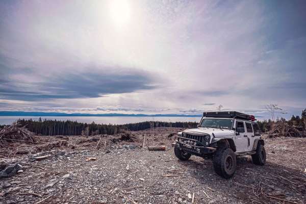
W50-A
Just off Highway 14 (West Coast Road) along the coast of Vancouver Island are a number of logging roads. One of those roads is W40 which quickly leads to W50-A. W50-A is primarily dirt and gravel, with a few very deep and narrow ditches that cross the road and require high clearance to avoid scrapin...
Learn more about W50-A
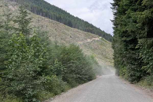
Gordon River Road North
Gordon River Road North is a wide, well-maintained logging road that follows the course of the Gordon River through a lush and varied landscape. Primarily composed of compacted gravel, the trail offers a smooth ride and is easily navigable by most vehicles, making it an ideal option for beginners or...
Learn more about Gordon River Road North
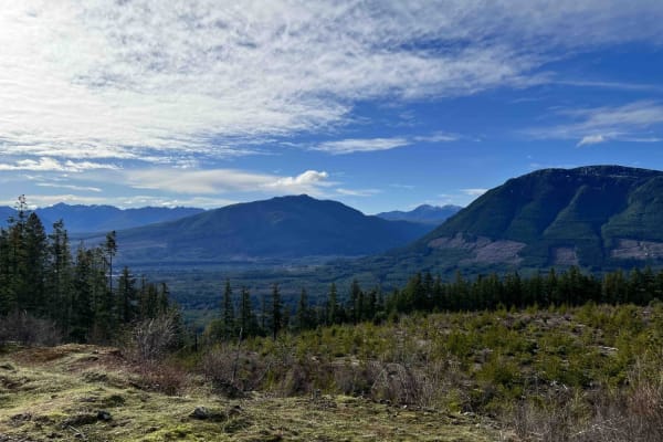
BlackJack Ridge Lookout
This route leads you along a bumpy logging road that takes you up a mountain to a beautiful campsite/viewpoint that overlooks First Lake and Mount DeCosmos. On clear days, you can see many mountains in the Beaufort range, including Mount Arrowsmith and Mount Moriarity. The last 500 or so feet of the...
Learn more about BlackJack Ridge Lookout
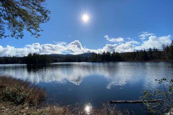
Boomerang Lake From 155 Main
This is a beautiful lake with 5 hidden campsites and a few trails to test out your modified 4X4. The route starts out at the Northwest Bay logging road gate. Once you pass through the gate you will take a left turn at the first Y intersection after the farmer's field. That will put you onto 155 Main...
Learn more about Boomerang Lake From 155 Main
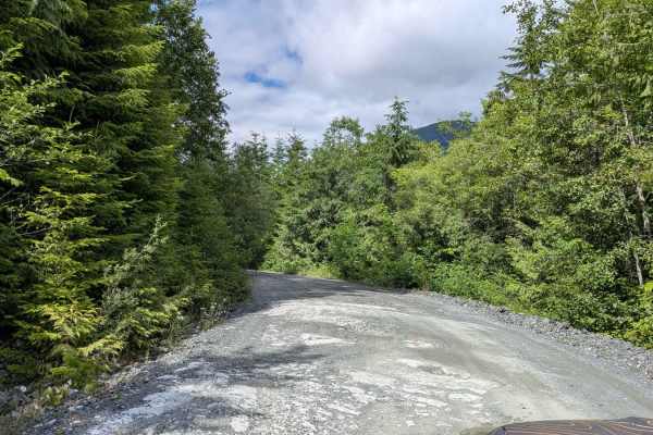
Gordon River South
Gordon River Road South is a scenic backcountry service road that begins with a mix of pavement, gravel, and frequent potholes. As you progress, the pavement disappears and the road becomes almost entirely gravel, with an increasing number of deep potholes - airing down your tires is highly recommen...
Learn more about Gordon River South
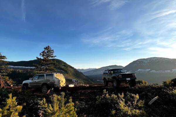
Farmers Lookout From 142 Main
This trail starts at the Boomerang Lake intersection off of 142 Main. Very shortly the road turns into a tighter trail that crosses a creek and goes along a de-activated road. Once you get onto the maintained road stay left and follow that to the very end where it turns back into a trail with a lot ...
Learn more about Farmers Lookout From 142 Main
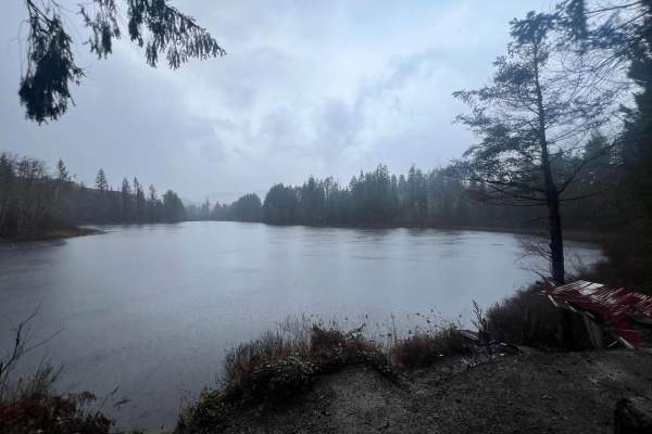
Kidney Lake
When following along this route you will be traveling active logging roads and you must give way to all logging traffic. This is a well-maintained logging road that includes views of the nanoose bay which also happens to be home to the Canadian Forces Maritime Experimental and Test Ranges. The last ...
Learn more about Kidney Lake
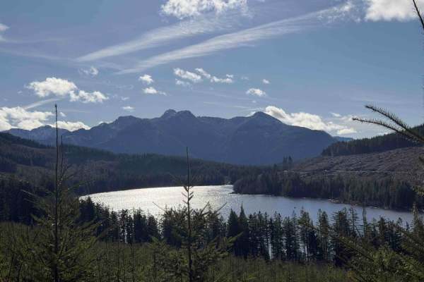
Shelton lake
The drive to Shelton Lake is one of those classic Vancouver Island logging road adventures that keeps getting better the higher you climb. The route follows a well-used forest service road that steadily gains elevation with a constant uphill grade. The road continues climbing until it finally reache...
Learn more about Shelton lake
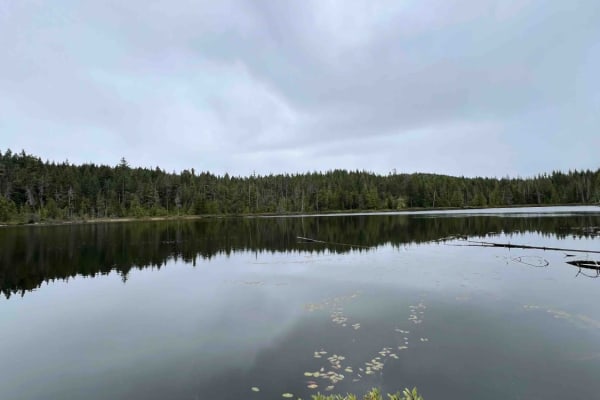
Rhododendron Lake Ecological Site
This route follows an active logging road, so use caution and give way to all bigger traffic. The road has a lot of potholes but is normally in good shape. Along this track you will be going through many clear cuts from the logging, so be sure to watch for deer, bear, elk, and grouse. Once you reach...
Learn more about Rhododendron Lake Ecological Site
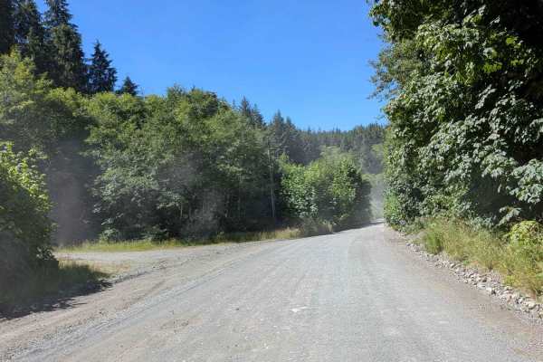
Cowichan Main
Cowichan Main is a moderately bumpy gravel road, wide enough for two vehicles to pass comfortably in most sections. Though not technically difficult, the ride is far from smooth -- expect frequent potholes and long stretches of washboard that can rattle vehicles without properly aired-down tires. Th...
Learn more about Cowichan Main
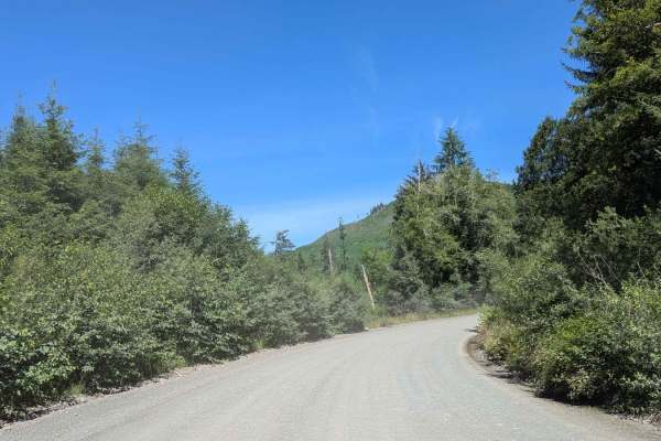
North Shore Main
North Shore Main is a wide, grated gravel logging road that offers an easy cruise through a picturesque landscape of forest and mountain views. The trail is lined with trees and thick vegetation, creating stretches of stunning canopy coverage that arch over the road, which is particularly scenic in ...
Learn more about North Shore Main
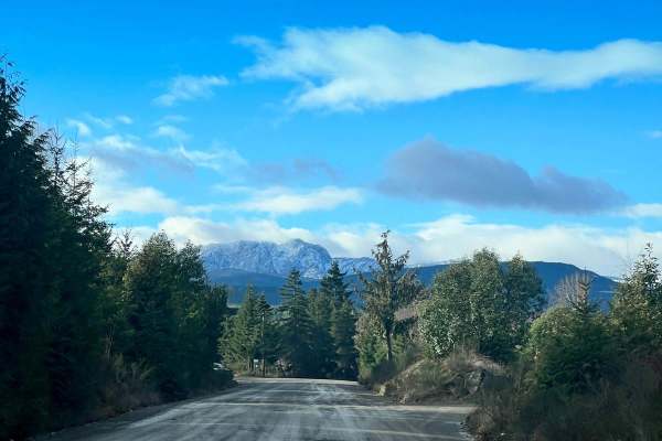
155 Main
155 Main is a very well-kept logging road mainline that follows along the beautiful Englishman River all the way to its headwaters. Along this route, you will see years of harvested trees, mountains, waterfalls, and rivers. If you are silent, you could possibly see deer, elk, and bear, and if you ar...
Learn more about 155 Main
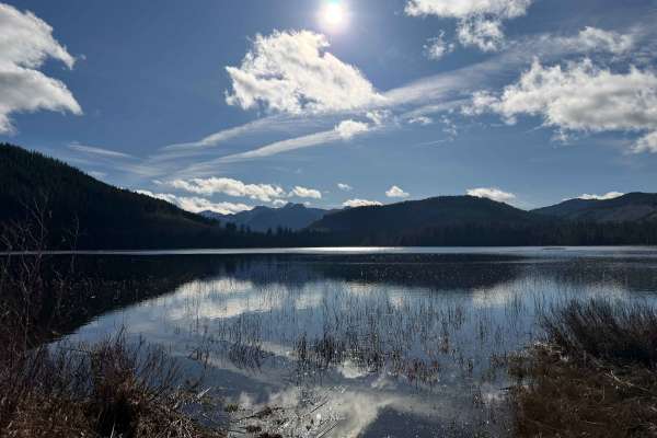
Healy lake
Healy Lake is a quiet backcountry destination tucked into the hills west of Nanaimo, reached by a network of winding logging roads through the northwest bay division or from the end of Nanaimo River Road. The drive takes you through working forest and stretches of dense Vancouver Island timber, with...
Learn more about Healy lake
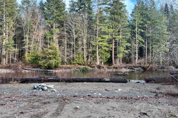
Riverside Beach Campsite
You can expect a smooth, relaxing dirt road that can be accessed any time of year no matter the conditions. You will be driving through all stages of forest life along this road. It starts in a clear cut that quickly turns into a young forest about 5-10 years old. After driving through that for a wh...
Learn more about Riverside Beach Campsite
Beginner ATV trails near Duncan, British Columbia
Explore ATV-friendly trails near you. These trails are accessible for vehicles up to 50 inches wide, perfect for ATVs and smaller off-road machines.
Wild Dear Lake
At nearly 1,300 feet in elevation, this lake offers a peaceful retreat with amenities like a sturdy dock for launching paddle boards or fishing. Its relatively warm waters invite refreshing summer swims. The spacious site easily accommodates several vehicles, making it an excellent destination for b...
Learn more about Wild Dear Lake
Holly Oak Lake
This trail follows a network of Forest Service roads, gradually transitioning from lower-elevation gravel corridors into steeper, narrower climbs. Expect long ascents with rutted sections, seasonal snow, and icy patches lingering well into spring. As you gain elevation toward 2,800 feet, dense everg...
Learn more about Holly Oak Lake
ArmDong
Once a secret playground for local buggy drivers, this trail still carries a hint of its rugged past. It climbs steadily to over 2,200 feet, rewarding you with a panoramic overlook of Cowichan River Provincial Park. The first half serves up narrow, partly washed-out single tracks that twist and dip ...
Learn more about ArmDong
Pet's Pond
Follow the Forest Service road to a hidden local favorite pond. The origins of its name remain a mystery, adding to its quiet charm. The pond features an old, weathered wooden dock, perfect for launching a paddle board or simply relaxing while taking in the peaceful forest and mountain surroundings.
Learn more about Pet's Pond
Beginner UTV/side-by-side trails near Duncan, British Columbia
Find UTV and side-by-side trails near you. These trails accommodate vehicles up to 60 inches wide, ideal for UTVs, side-by-sides, and wider off-road rigs.
Wild Dear Lake
At nearly 1,300 feet in elevation, this lake offers a peaceful retreat with amenities like a sturdy dock for launching paddle boards or fishing. Its relatively warm waters invite refreshing summer swims. The spacious site easily accommodates several vehicles, making it an excellent destination for b...
Learn more about Wild Dear Lake
Holly Oak Lake
This trail follows a network of Forest Service roads, gradually transitioning from lower-elevation gravel corridors into steeper, narrower climbs. Expect long ascents with rutted sections, seasonal snow, and icy patches lingering well into spring. As you gain elevation toward 2,800 feet, dense everg...
Learn more about Holly Oak Lake
ArmDong
Once a secret playground for local buggy drivers, this trail still carries a hint of its rugged past. It climbs steadily to over 2,200 feet, rewarding you with a panoramic overlook of Cowichan River Provincial Park. The first half serves up narrow, partly washed-out single tracks that twist and dip ...
Learn more about ArmDong
Pet's Pond
Follow the Forest Service road to a hidden local favorite pond. The origins of its name remain a mystery, adding to its quiet charm. The pond features an old, weathered wooden dock, perfect for launching a paddle board or simply relaxing while taking in the peaceful forest and mountain surroundings.
Learn more about Pet's Pond
The onX Offroad Difference
onX Offroad combines trail photos, descriptions, difficulty ratings, width restrictions, seasonality, and more in a user-friendly interface. Available on all devices, with offline access and full compatibility with CarPlay and Android Auto. Discover what you're missing today!
Open Trail Map