
Beginner Off-Road Trails
Near Dillon, Montana
Explore All Beginner Trails Near Dillon, Montana
Beginner Off-Road Trails Near Dillon, Montana
Discover the best beginner-friendly off-road trails near you. These easier, lower-rated trails are a great place to start — browse trail maps, check difficulty ratings, and find your next adventure.
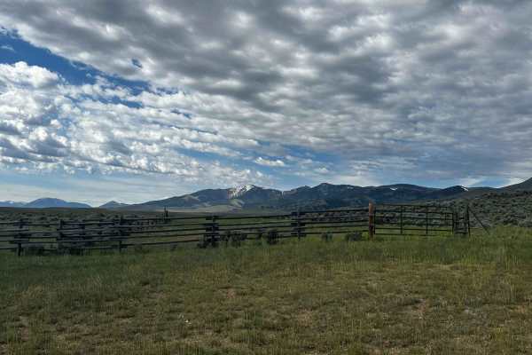
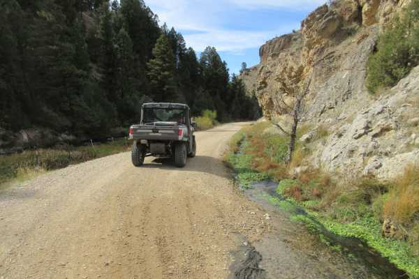
Mellow Milo
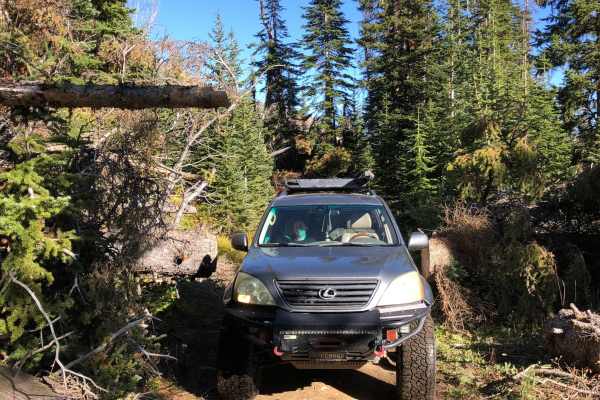
This is a mellow but scenic loop that definitely shows you why it's the "Big Sky" state. Keep your eyes out for antelope, rabbits, and wildflowers. There are lots of good campfire/picnic spots and campsites. It's not technical at all and could easily be done in a sedan. About halfway through, there ...
Learn more about Mellow Milo
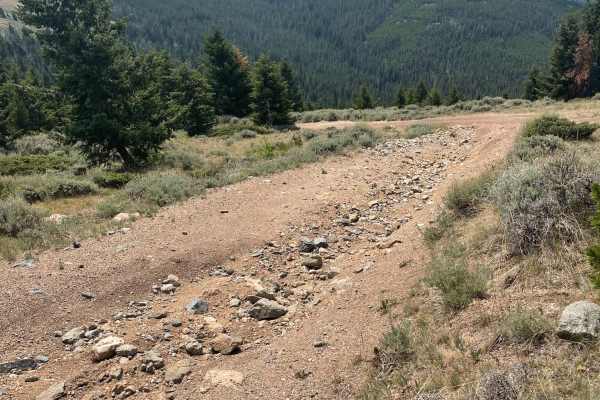
Barton Gulch and Offshoots
Beautiful trail with awesome views. Easy trail that gets narrow in spots and had some low hanging fallen trees that could be an issue if you don't want scratches in your paint. Stock 4x4s won't have a problem. Gravelly range is closed during the winter so summer time or late spring is the best time ...
Learn more about Barton Gulch and Offshoots
Canyon Creek - Quartz Hill
This route will take you through Vipond Park, a subalpine meadow. The southern approach to the meadow is a very steep single-lane road with limited turnouts, do not bring a trailer on this side. This route includes Glendale and the kilns that supplied it with charcoal.
Learn more about Canyon Creek - Quartz Hill
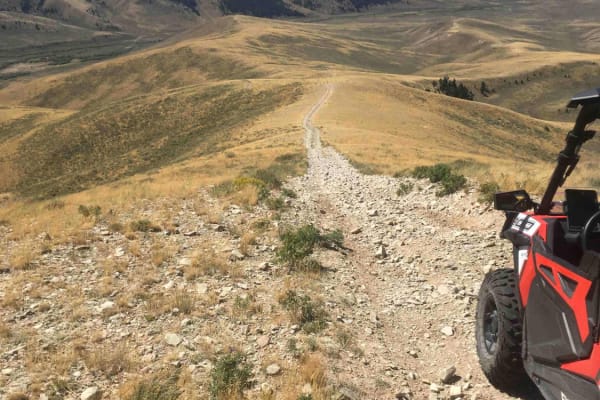
Barton Gulch
The Barton Gulch trail is a scenic drive that runs across the northern reaches of the Gravelly Range in Montana. Explore its winding two-tracks, and you'll witness abandoned cabins nestled by babbling brooks, open meadows with mountain views, and rugged ridgeline climbs towards that famous big sky. ...
Learn more about Barton Gulch
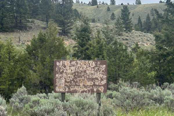
Devil's Canyon
A popular fishing spot at the beginning of the road, it passes through many private plots of land and leads into National Forest and BLM land. There are a couple of camping spots along the trail and it's popular among locals. The road starts and ends along Devils Canyon Creek. The end of the road be...
Learn more about Devil's Canyon
Big Hole - Road 181
This easy track is bookended by the Shoshone Ridge Interpretive Site to the south, and Highway 278 near Jackson MT to the north - it partially follows both the Big Hole River and the Nez Perce Trail. Along the way you'll pass numerous informal camping, established campgrounds, Reservoir Lake, and hi...
Learn more about Big Hole - Road 181
Axolotl Lakes Road
Axolotl Lakes Road is like a fine sampling of the beauty Montana has to offer. It begins in one of the state's charming towns, Virginia City, complete with weathered wooden buildings and small restaurants and bars loaded with character. It then climbs into the hills, giving you a taste of its lonely...
Learn more about Axolotl Lakes Road
Everson Creek Road
This 12-mile single-lane road connects the Black Canyon Ridge Road to the Lemhi Pass Road. It is signed as BLM Road #1882. Beginning from the intersection of the Black Canyon Road (FS 5932), the first two miles of this road traverse wooded and rugged terrain. This segment of the road treats the t...
Learn more about Everson Creek Road
Warm Springs Creek Road (FA 163)/Cow Camp Road (FS 1234)
Warm Springs Creek Road takes you from the Gravelly Range ridgeline to Continental Divide/Upper Ruby Road. Assuming you start on the upper ridge along Gravelly Range Road, you go down the road looking back on the area you just traveled if you came up from FS 237 to Gravelly Ridge Road. This offers a...
Learn more about Warm Springs Creek Road (FA 163)/Cow Camp Road (FS 1234)
Continental Divide/Upper Ruby Road (FS100) (Parital)
This road is a main traffic corridor between the N Valley Road, near the southern MT border and Alder, MT. There are numerous homes and ranch buildings in the area with additional traffic. This input includes a very short segment of that FS100 road with long sections yet to be input. The road is two...
Learn more about Continental Divide/Upper Ruby Road (FS100) (Parital)

Big Sheep Creek Road
Over the eons, the Big Sheep Creek cut a canyon through the Tendoy mountains. The road faithfully follows the creek, so the traveler is treated to a ride through a very steep canyon and an awesome display of rock formations. There is a resident herd of Bighorn Sheep and a swallow cave that are fun t...
Learn more about Big Sheep Creek Road
Cliff Lake Trail
This is a very short trail to Cliff Lake at the top of the McKelvey Lake Trail and accessed from Mine Lake. Although short, the lake is absolutely worth seeing and the fishing is great. This trail looks wide enough for a rig or SxS but is a 50" ATV or dirt bike trail only!
Learn more about Cliff Lake Trail
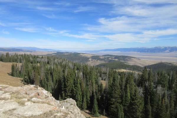
Gravelly Range Road (FS290) (Partial)
Gravelly Range Road is a very long road that runs from Red Rock Lakes Road west of the Island Park, ID to a point just east of Virginia City, MT. The section of road included herein is approximately 14.5 miles that connects FS237 to Warm Springs Road (FS163). This is a beautiful drive along the top ...
Learn more about Gravelly Range Road (FS290) (Partial)
Granite Lake
Fairly easy trail with some great views. Trail got narrow in some spots from freshly cut trees. Some quick switchbacks could be challenging in a longer wheelbase. Not a lot of traffic on the trail and obstacles were mostly the rutted dirt trail. Some loose rocks but nothing to worry about.
Learn more about Granite Lake
Deadhorse Road
This is a BLM road marked as Road 6197. The road traverses hilly open grasslands from the Continental Divide to the Cruikshank Creek drainage. The road intersects Road 6111 to the northwest at the Continental Divide. There are some side roads that look interesting for exploration opportunities.
Learn more about Deadhorse Road
Black Canyon Ridge Road
This 12-mile adventure is suitable for high-clearance 4x4 vehicles. Most typically, people access this road from the Continental Divide (CD), where it serves as an extension of the Frying Pan road that dead ends on the CD at an elevation of 9,300 feet. Starting from the CD, the road traverses thro...
Learn more about Black Canyon Ridge Road
Tobacco Gold Pass
This old mining road off Granite Lake Road features granite faces and expansive views of the Tobacco Root Mountains. The surface is dirt and stretches of loose rock, generally passable in dry conditions. A few pull-offs provide dispersed camping opportunities. The trail ends at a saddle that marks t...
Learn more about Tobacco Gold Pass
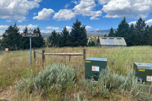
Granite Creek Road (161/49)
This is a regularly maintained Forest Service Road that takes you from the Tobacco Mountains down to Highway 287, approximately 3 miles southwest of Nevada City, Montana. The route takes you to some very interesting viewpoints. A waypoint is included with this track that you don't want to miss. It i...
Learn more about Granite Creek Road (161/49)
Johnny Ridge Road - FS324
This trail offers either an opportunity to leave the ridge on Gravelly Range Road and descend to a trailhead at McAtee Bridge near State Highway 287 or to climb up to Gravelly Range Road. This review will assume you are using this as a trailhead starting your adventure up to the spectacular views pr...
Learn more about Johnny Ridge Road - FS324
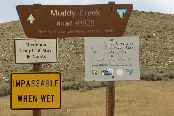
Muddy Creek Road
This is a one-lane dirt road that travels up a broad, shallow valley dominated by sagebrush on both sides. This road is signed as BLM 1829. When this road was evaluated, it had been recently maintained, so the tread was intact. It is unlikely to remain in that condition.
Learn more about Muddy Creek Road
Beginner ATV trails near Dillon, Montana
Explore ATV-friendly trails near you. These trails are accessible for vehicles up to 50 inches wide, perfect for ATVs and smaller off-road machines.
Mellow Milo
This is a mellow but scenic loop that definitely shows you why it's the "Big Sky" state. Keep your eyes out for antelope, rabbits, and wildflowers. There are lots of good campfire/picnic spots and campsites. It's not technical at all and could easily be done in a sedan. About halfway through, there ...
Learn more about Mellow Milo
Barton Gulch and Offshoots
Beautiful trail with awesome views. Easy trail that gets narrow in spots and had some low hanging fallen trees that could be an issue if you don't want scratches in your paint. Stock 4x4s won't have a problem. Gravelly range is closed during the winter so summer time or late spring is the best time ...
Learn more about Barton Gulch and Offshoots
Canyon Creek - Quartz Hill
This route will take you through Vipond Park, a subalpine meadow. The southern approach to the meadow is a very steep single-lane road with limited turnouts, do not bring a trailer on this side. This route includes Glendale and the kilns that supplied it with charcoal.
Learn more about Canyon Creek - Quartz Hill
Barton Gulch
The Barton Gulch trail is a scenic drive that runs across the northern reaches of the Gravelly Range in Montana. Explore its winding two-tracks, and you'll witness abandoned cabins nestled by babbling brooks, open meadows with mountain views, and rugged ridgeline climbs towards that famous big sky. ...
Learn more about Barton Gulch
Beginner UTV/side-by-side trails near Dillon, Montana
Find UTV and side-by-side trails near you. These trails accommodate vehicles up to 60 inches wide, ideal for UTVs, side-by-sides, and wider off-road rigs.
Mellow Milo
This is a mellow but scenic loop that definitely shows you why it's the "Big Sky" state. Keep your eyes out for antelope, rabbits, and wildflowers. There are lots of good campfire/picnic spots and campsites. It's not technical at all and could easily be done in a sedan. About halfway through, there ...
Learn more about Mellow Milo
Barton Gulch and Offshoots
Beautiful trail with awesome views. Easy trail that gets narrow in spots and had some low hanging fallen trees that could be an issue if you don't want scratches in your paint. Stock 4x4s won't have a problem. Gravelly range is closed during the winter so summer time or late spring is the best time ...
Learn more about Barton Gulch and Offshoots
Canyon Creek - Quartz Hill
This route will take you through Vipond Park, a subalpine meadow. The southern approach to the meadow is a very steep single-lane road with limited turnouts, do not bring a trailer on this side. This route includes Glendale and the kilns that supplied it with charcoal.
Learn more about Canyon Creek - Quartz Hill
Barton Gulch
The Barton Gulch trail is a scenic drive that runs across the northern reaches of the Gravelly Range in Montana. Explore its winding two-tracks, and you'll witness abandoned cabins nestled by babbling brooks, open meadows with mountain views, and rugged ridgeline climbs towards that famous big sky. ...
Learn more about Barton Gulch
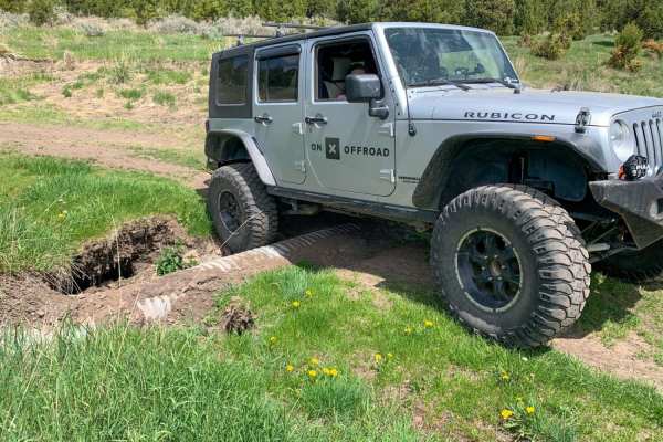
The onX Offroad Difference
onX Offroad combines trail photos, descriptions, difficulty ratings, width restrictions, seasonality, and more in a user-friendly interface. Available on all devices, with offline access and full compatibility with CarPlay and Android Auto. Discover what you're missing today!
Open Trail Map