
Beginner Off-Road Trails
Near Chenoweth, Oregon
Explore All Beginner Trails Near Chenoweth, Oregon
Beginner Off-Road Trails Near Chenoweth, Oregon
Discover the best beginner-friendly off-road trails near you. These easier, lower-rated trails are a great place to start — browse trail maps, check difficulty ratings, and find your next adventure.
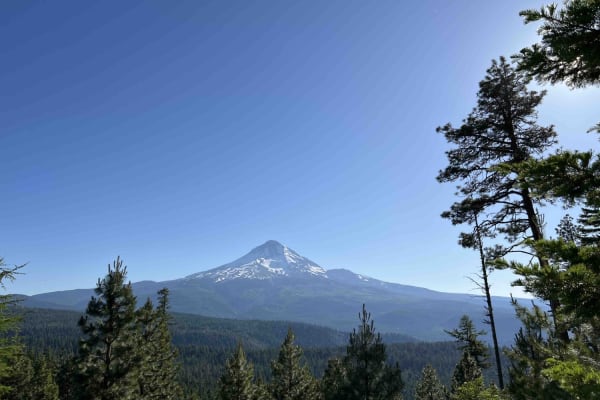
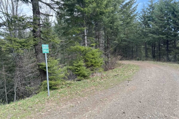
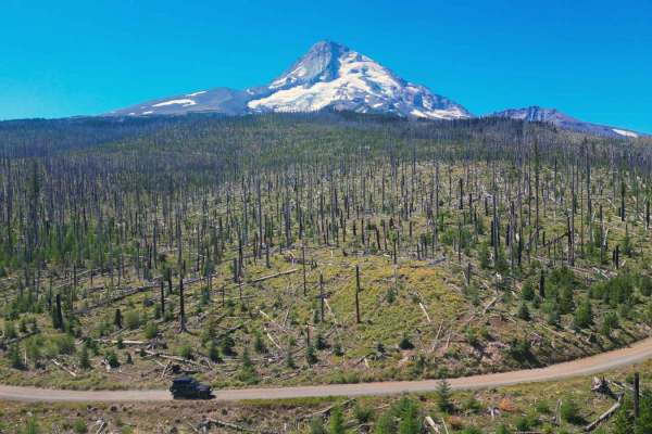
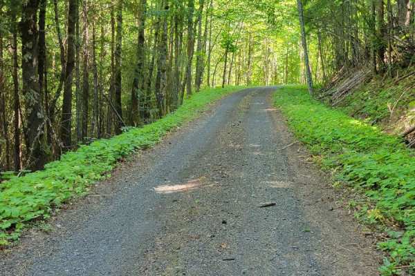
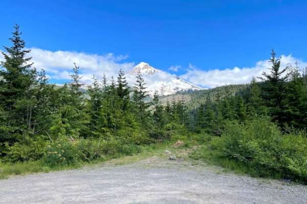
Long Prairie 17
Long Prairie 17 is a byway located in the 1.1-million-acre Mount Hood National Forest. Once you turn onto Long Prairie 17 it begins as pavement and then starts up the hill into gravel which is very bumpy with potholes. This route rides the ridge and parallels a popular hiking trail called Surveyors ...
Learn more about Long Prairie 17
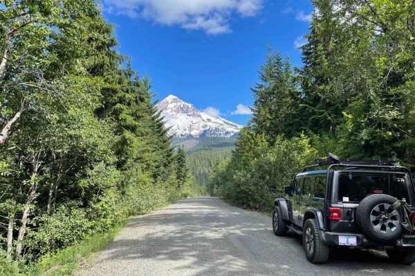
Buck Creek N-1000 to Little Baldy Peak
The journey begins with an opportunity to observe whitewater kayakers on the White Salmon River at Northwestern Park, providing a perfect spot to relax and enjoy the surroundings. Continuing west a short distance and turning left onto Nestor Peak Road/N-1000, the road ascends the ridge, passing thro...
Learn more about Buck Creek N-1000 to Little Baldy Peak
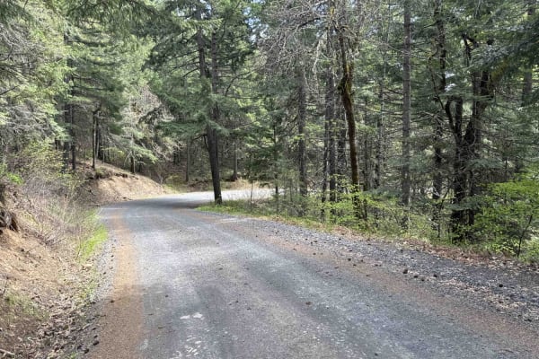
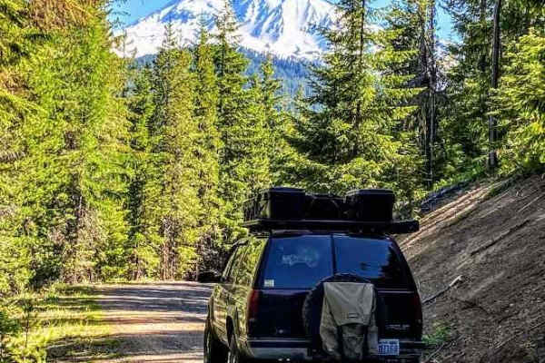
Green Point - 2810
Green Point - 2810 is a beautiful scenic drive through the Mount Hood National Forest in Northwest Oregon. This road is mainly gravel however there are areas where large boulders and rocks have come on the road and you have to swerve to avoid them as well as large trees lying over the road. Going up...
Learn more about Green Point - 2810
FS 4400620
FS 4400620 starts at the Clinger Campground. It is a single-vehicle-width trail that winds along a ridge line through a dense pine forest, eventually leading to a small turnaround area. From there, a 200-yard hike is required to reach a viewpoint of Mount Hood--a hidden gem for those willing to make...
Learn more about FS 4400620
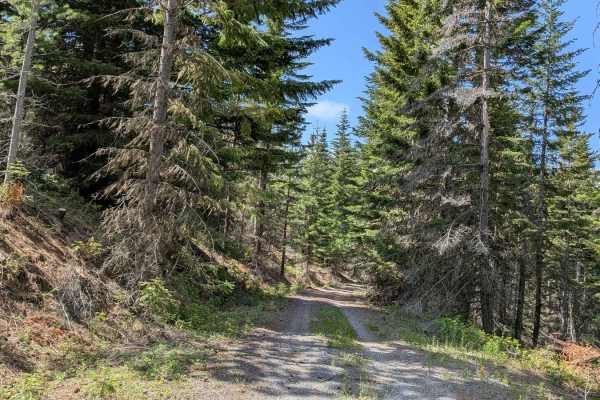
DNR N-4000 Road
Embark on an off-road journey through a conifer forest, where the towering trees guide your path. This route promises a blend of rugged terrain, panoramic vistas, and hidden gems waiting to be discovered. Your journey commences with a gentle ascent, leading you along the edge of a clear-cut. Here, t...
Learn more about DNR N-4000 Road
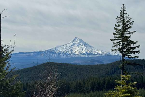
Dead Point - FS 2820
This forest road is mostly gravel and smooth surfaced. The road travels through dense forest, but in sections it opens up and you get amazing views of Mt. Hood. As you go further up the trail you will get views of Mount Defiance, which is the tallest peak on the Columbia River Gorge. The road dead e...
Learn more about Dead Point - FS 2820
Larch Mountain Road
This trail leads you into the Mount Hood National Forest near Upper Green Point Reservoir. This area has many ATV and dirt bike trails, which cross the road in some places, so drive with care. The trail is a wide and smooth gravel road with little to no wash and ruts. There is a gradual incline and ...
Learn more about Larch Mountain Road
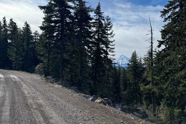
Mount Defiance - NF 2821000
Mount Defiance road scrambles 1600'+ out of the hills West of Hood River, Oregon to the summit of Mount Defiance and the edge of the Mark O Hatfield Wilderness. The summit tops out at just under 5,000'. Once the gravel forest service road passes 4,000', the road bed quickly turns to a loose shale an...
Learn more about Mount Defiance - NF 2821000
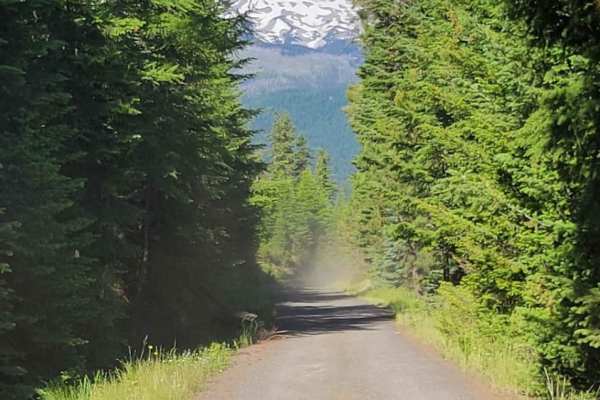
Cloud Cap Road
This trail is an irregular gravel road marked by large rocks, numerous potholes, and segments of profound dust which create the potential to get stuck. Its accessibility varies with the seasons and may be gated due to snowfall or fallen trees during winter. This route allows you to approach the Nort...
Learn more about Cloud Cap Road
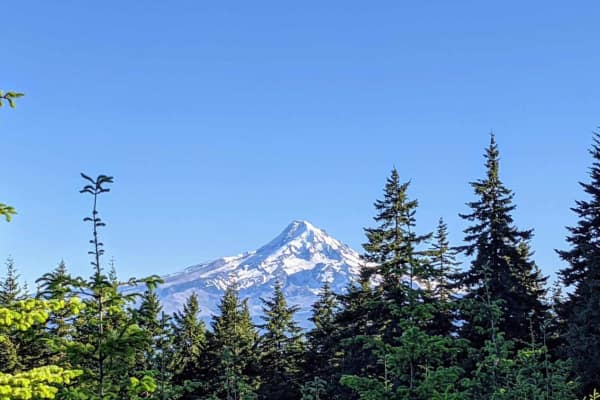
Lookout Mountain Road - FR 4410000
An easy dirt road that takes you through the Mt. Hood National Forest. It connects to several other trails in the area, and leads to a few trailheads for hiking and biking. The trail can get dusty behind other vehicles. Unmaintained in the winter months. Keep an eye open, and you'll catch glimpses o...
Learn more about Lookout Mountain Road - FR 4410000
The Monte's (NF 18)
This trail begins at the Oklahoma Campground and leads past Monte Carlo Lower Trailhead and Monte Cristo Lower Trailhead. This is a very narrow two-track that has large, deep potholes and erosion diversions to navigate. Lower clearance vehicles are not recommended. The further up the trail, the more...
Learn more about The Monte's (NF 18)
Little Badger Creek
A dusty but well-maintained dirt trail that crosses through a nature preserve and continues into the Hood National Forest ending at a lush little forest campground with a creek running through it. The trail starts in a valley and ascends up the hillside to the top of the ridge. The views out over ...
Learn more about Little Badger Creek
FR 1840 - N Holmes Creek
Forest Road 1840 could have easily been a candidate for the WABDR. It's an immensely fun, windy, two-track trail through the forest. With how dense the woods are in some places, it gives the feeling of driving through a tunnel almost. There are a couple of challenging spots that'll be encountered, i...
Learn more about FR 1840 - N Holmes Creek
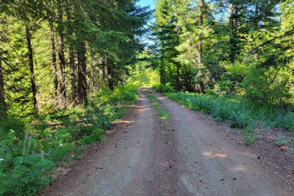
FR 86 - Cave Creek
Forest Road 86 is a wide and easy connector to several other trails in the area. The road conditions are that of a typical mountain road, complete with some washboard sections and large potholes to navigate. Safe and capable for 2WD vehicles. There is an awesome overlook point of the surrounding for...
Learn more about FR 86 - Cave Creek
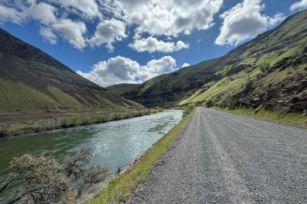
Lower Deschutes River Access Road
Take your time and enjoy the rugged beauty as you travel down this deep rimrock-lined canyon section of the Deschutes River, a designated Federal Wild and Scenic River. This road ends 17 miles down the canyon, but this trip is more about the journey than the destination. The road is mostly gravel th...
Learn more about Lower Deschutes River Access Road
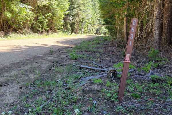
FR 8631
Forest Road 8631 connects from FR 86 to the WABDR (Section 1) trail. There are several offshoot trails that can be explored, as well as a handful of primitive camp spots that were noted along the way. The road is an easy dirt road with a few potholes that will be encountered. Safe enough for 2WD veh...
Learn more about FR 8631
McGee Creek Overlook
This short spur provides access to the McGee Creek Trailhead. Driving past the hiking trailhead, immediately ascends into a short and slightly technical climbing section. Once clear of these ruts and rocks, the road becomes smooth gravel. Ultimately the road dead ends at a very large dispersed camps...
Learn more about McGee Creek Overlook
Lolo Pass
Historic Lolo Pass is a scenic drive that connects the Sandy River area to Lost Lake and Hood River. Spectacular valley views open up to reveal the western side of Mt. Hood. The driving surface is relatively smooth for the majority of the route, with the occasional pothole. The road will sometimes g...
Learn more about Lolo Pass
Washington Backcountry Discovery Route Section 1
This route covers all of section 1 of the Washington Backcountry Discovery Route (WABDR) from Carson to Packwood. Weather and route conditions can vary significantly from one area to the next, especially in early spring or late fall. This route is mostly impassible in winter due to snow. Early sprin...
Learn more about Washington Backcountry Discovery Route Section 1
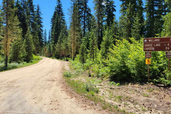
FR 66 - South Prairie Road
Forest Road 66 is one of the main connecting dirt roads that begins/ends as pavement and connects to FR 60 (Carson Guler Road). Along this route, there is the Little Huckleberry hiking trailhead, as well as a unique geological point of interest at South Prairie Meadow, near Disappearing Lake. The ro...
Learn more about FR 66 - South Prairie Road
Beginner ATV trails near Chenoweth, Oregon
Explore ATV-friendly trails near you. These trails are accessible for vehicles up to 50 inches wide, perfect for ATVs and smaller off-road machines.
Long Prairie 17
Long Prairie 17 is a byway located in the 1.1-million-acre Mount Hood National Forest. Once you turn onto Long Prairie 17 it begins as pavement and then starts up the hill into gravel which is very bumpy with potholes. This route rides the ridge and parallels a popular hiking trail called Surveyors ...
Learn more about Long Prairie 17
Buck Creek N-1000 to Little Baldy Peak
The journey begins with an opportunity to observe whitewater kayakers on the White Salmon River at Northwestern Park, providing a perfect spot to relax and enjoy the surroundings. Continuing west a short distance and turning left onto Nestor Peak Road/N-1000, the road ascends the ridge, passing thro...
Learn more about Buck Creek N-1000 to Little Baldy Peak
Green Point - 2810
Green Point - 2810 is a beautiful scenic drive through the Mount Hood National Forest in Northwest Oregon. This road is mainly gravel however there are areas where large boulders and rocks have come on the road and you have to swerve to avoid them as well as large trees lying over the road. Going up...
Learn more about Green Point - 2810
DNR N-4000 Road
Embark on an off-road journey through a conifer forest, where the towering trees guide your path. This route promises a blend of rugged terrain, panoramic vistas, and hidden gems waiting to be discovered. Your journey commences with a gentle ascent, leading you along the edge of a clear-cut. Here, t...
Learn more about DNR N-4000 Road
Beginner UTV/side-by-side trails near Chenoweth, Oregon
Find UTV and side-by-side trails near you. These trails accommodate vehicles up to 60 inches wide, ideal for UTVs, side-by-sides, and wider off-road rigs.
Long Prairie 17
Long Prairie 17 is a byway located in the 1.1-million-acre Mount Hood National Forest. Once you turn onto Long Prairie 17 it begins as pavement and then starts up the hill into gravel which is very bumpy with potholes. This route rides the ridge and parallels a popular hiking trail called Surveyors ...
Learn more about Long Prairie 17
Buck Creek N-1000 to Little Baldy Peak
The journey begins with an opportunity to observe whitewater kayakers on the White Salmon River at Northwestern Park, providing a perfect spot to relax and enjoy the surroundings. Continuing west a short distance and turning left onto Nestor Peak Road/N-1000, the road ascends the ridge, passing thro...
Learn more about Buck Creek N-1000 to Little Baldy Peak
Green Point - 2810
Green Point - 2810 is a beautiful scenic drive through the Mount Hood National Forest in Northwest Oregon. This road is mainly gravel however there are areas where large boulders and rocks have come on the road and you have to swerve to avoid them as well as large trees lying over the road. Going up...
Learn more about Green Point - 2810
DNR N-4000 Road
Embark on an off-road journey through a conifer forest, where the towering trees guide your path. This route promises a blend of rugged terrain, panoramic vistas, and hidden gems waiting to be discovered. Your journey commences with a gentle ascent, leading you along the edge of a clear-cut. Here, t...
Learn more about DNR N-4000 Road
The onX Offroad Difference
onX Offroad combines trail photos, descriptions, difficulty ratings, width restrictions, seasonality, and more in a user-friendly interface. Available on all devices, with offline access and full compatibility with CarPlay and Android Auto. Discover what you're missing today!
Open Trail Map