
Beginner Off-Road Trails
Near Chama, New Mexico
Explore All Beginner Trails Near Chama, New Mexico
Beginner Off-Road Trails Near Chama, New Mexico
Discover the best beginner-friendly off-road trails near you. These easier, lower-rated trails are a great place to start — browse trail maps, check difficulty ratings, and find your next adventure.

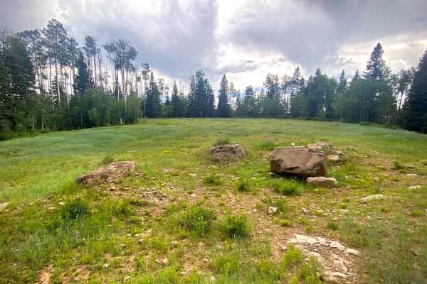
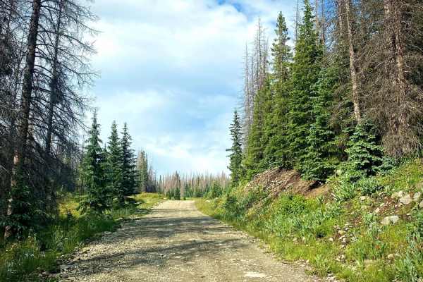
Trujillo Meadows
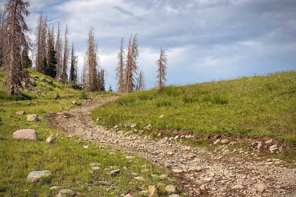
This is a short route out to a man-made alpine lake. You will want to spend some time hiking or fishing around the picturesque lake. The west end of the trail is very well graded and easy, passing through some developed camping areas. The east end is narrower and less maintained. There is primitive ...
Learn more about Trujillo Meadows
Buckles Lake-Fr Rd 663
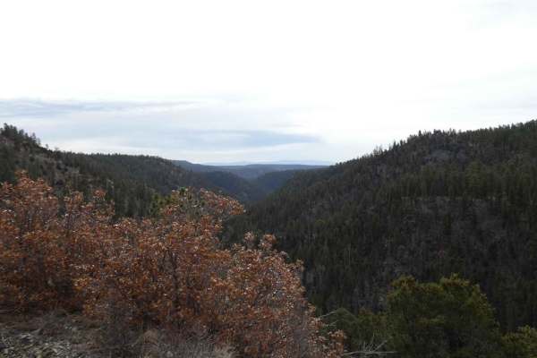
Buckles Lake road will take you to trailheads for a short hike to Buckles Lake or V-Rock. The Navajo Peak ATV trail and Big Branch road are four miles up from Hwy 84. A small area to the right as you turn on to the road is available to air up or down. There are some tremendous views with multiple di...
Learn more about Buckles Lake-Fr Rd 663
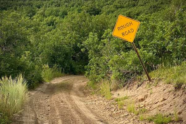
Fr Road 664
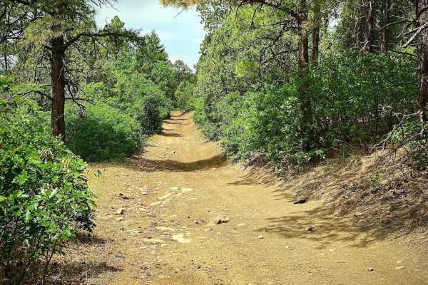
Big Branch road runs from Buckles Lake road (#663) to the Blue Creek road (#612). Right as you start the trail it warns of a rough road, following are several spots with large dips from the beginning, after that it becomes rut roads with a few rocks and possible mud holes. The trail crosses several ...
Learn more about Fr Road 664
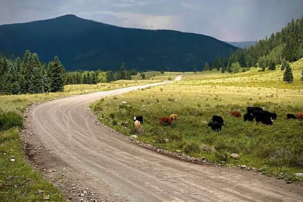
Alamosa Conjeos-Fr Rd 250
This section of Alamosa Conjeos road goes to Platoro, Colorado along the Conjeos River and to the Platoro Reservoir. It starts 28 miles north of Chama and 22 miles south of Alamosa off of Hwy 17. Turning off the road there is a large enough area to air down if inclined due to roughness from the gra...
Learn more about Alamosa Conjeos-Fr Rd 250
Blanco River Road-Fr Rd 656
The Blanco River road runs off of Hwy 64 between Pagosa Springs and Chama, NM. As you drive along the Blanco River there are four pull off spots for primitive dry camping along the river. At the end of the road is a very nice group campground which is available by reservation. It is situated along t...
Learn more about Blanco River Road-Fr Rd 656
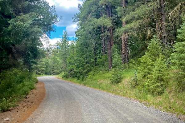
Lookout Tower & Views-USFS Rd #651A
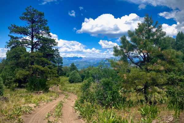
The Fork for Eight Mile Mesa A (#651A) is a short road to the right off of the main Eight Mile Mesa Road (#651). It leads you to the historic fire lookout tower site with views to the North towards Pagosa Springs and the San Juan mountains. The fire lookout tower is closed to the public, but the swe...
Learn more about Lookout Tower & Views-USFS Rd #651A
Eight Mile Mesa B-USFS Rd #651B
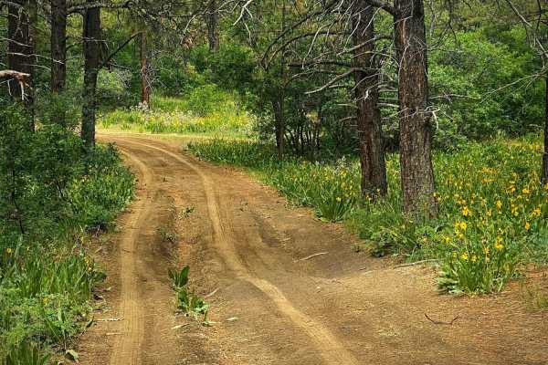
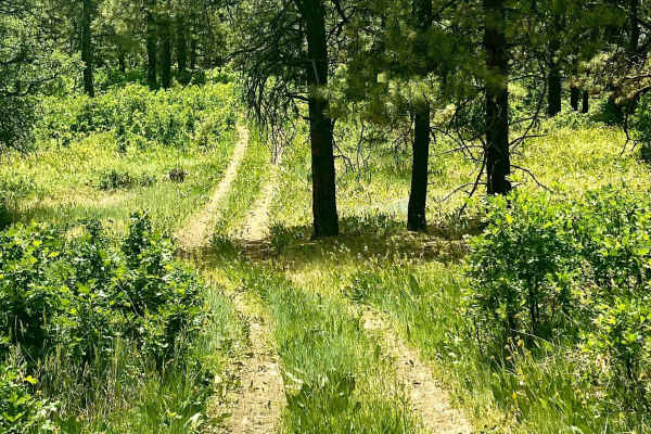
Eight Mile Mesa B (#651B) forks to the left off of the main road about half a mile from the first fork to the right for Eight Mile Mesa A. It's just under a mile long and an easy rut road with a few rocks and some dips through pine trees and meadows of wildflowers in the late spring and early summer...
Learn more about Eight Mile Mesa B-USFS Rd #651B
Eight Mile Mesa C-USFS Rd #651C
Eight Mile Mesa C (#651C) forks left off the main road about 5 miles from the beginning of the USFS road. It's about 4.5 miles to the end where there were a few disturbed primitive campsites, as well as a few sites along the way. In late spring/early summer there are often plentiful wildflowers. The...
Learn more about Eight Mile Mesa C-USFS Rd #651C
Eight Mile Mesa E-USFS Rd #651E
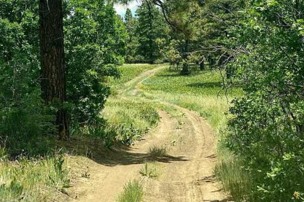
Eight Mile Mesa E (#651E) forks right with Eight Mile Mesa D (#651D) forking to the left at the end of the main Eight Mile Mesa Road, approximately 6.5 miles from the highway turnoff. This road goes through some large open meadows, which can be spectacular with wildflowers in season. At the very end...
Learn more about Eight Mile Mesa E-USFS Rd #651E
Eight Mile Mesa D-USFS Rd #651D
Eight Mile Mesa D (#651D) forks left with Eight Mile Mesa E (#651E) forking to the right at the end of the main Eight Mile Mesa road, approximately 6.5 miles from the highway turnoff. This road is a delightful drive through fields of flowers and trees to the end where you might be able to camp, but ...
Learn more about Eight Mile Mesa D-USFS Rd #651D
Eight Mile Mesa Rd-USFS Rd #651
Eight Mile Mesa Road (#651) will take you to the top of Eight Mile Mesa South of Pagosa Springs, Colorado with a network of trails leading to different points of the mesa. After turning off of Hwy 84, the road goes about a mile through a housing area with the USFS road starting at the Forest Service...
Learn more about Eight Mile Mesa Rd-USFS Rd #651
Kerr Lake Road #257
The Kerr Lake Road (#257) will lead you first to a lily pond, then farther to an alpine lake with fishing and disturbed, primitive campsites. The road branches off of the Alamosa Conjeos road (#250) just to the South of Stunner Pass. From here it is 2 miles to the Lily Pond and 4 miles to Kerr Lake ...
Learn more about Kerr Lake Road #257
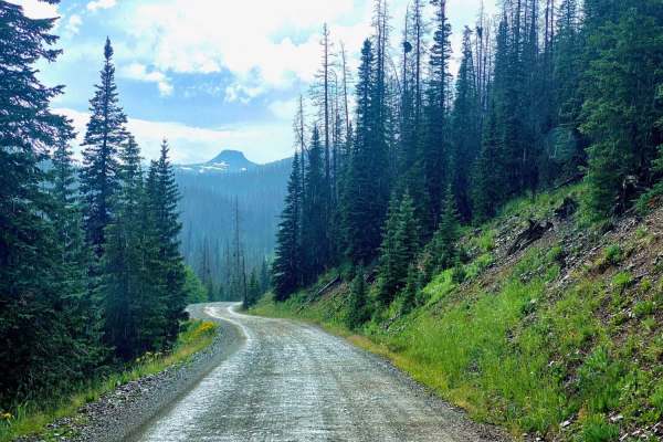
Treasure Creek - FSR 243
Treasure Creek road is a delightful drive off of Park Creek road. It has multiple pull off side roads with primitive dry camping spots. Even if not camping and in the area it's worth the short drive for the scenery. If able to camp here? Most definitely a yes! Will surely be heaven under the stars...
Learn more about Treasure Creek - FSR 243
Vallecitos Pass
Vallecitos Pass is a dispersed camper's dream, even if you only have a high clearance 2WD. This easy-to-traverse trail has no major obstacles, only showing signs of minor ruts and small grades with loose rocks. Dispersed camping is permitted from .02 miles from the south entrance coming off of CR-44...
Learn more about Vallecitos Pass

San Antonio Mountain Loop
This is an easy route around the base of the San Antonio Mountain. The ride was pretty with grand vistas, an easy trail, and some wildlife. Not recommended for passenger cars, no winter maintenance. That being said a nice stock 4x4 should have no problem on this scenic loop around the base of the mo...
Learn more about San Antonio Mountain Loop
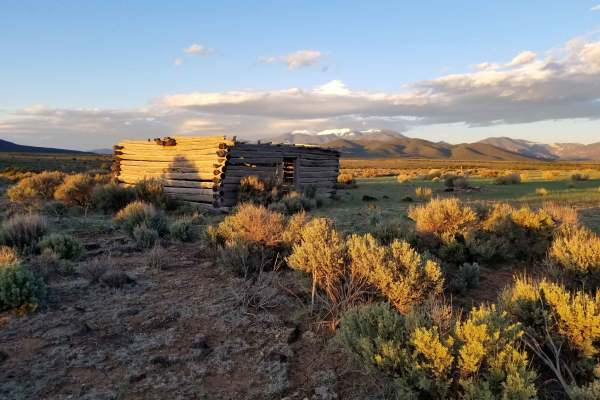
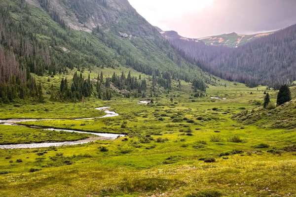
Taos Valley Road 5030 North
If quiet and solitude are what you're looking for, you've found the right trail. This is one of the most remote sections of trail in the San Luis Valley. The stunning scenery of the vast Rio Grande Del Norte National Monument, wildlife (deer, elk, antelope, bighorn sheep) viewing opportunities, and...
Learn more about Taos Valley Road 5030 North
Kerr Road #257-1A
Kerr Road branches off to the right as you reach the Lily Pond on Kerr Lake road (#257). The road leading up to this point has been a maintained gravel road, whereas this road is a rut road with less maintenance. It will take you to an alpine meadow with several disturbed primitive campsites, eventu...
Learn more about Kerr Road #257-1A
Park Creek South-Fr Rd 380
Park Creek South is the section of Park Creek road (#380) from Alamosa Conjeos road (#250) that goes to private Lake Nolda. You can drive past this lake to connect to Park Creek Road which ultimately goes to Hwy 160. This section of Park Creek road is very different in that is narrow and winding wit...
Learn more about Park Creek South-Fr Rd 380
Jacques Canyon FSR-719
Jacques Canyon is an exceptionally well-maintained and easily passable trail for most vehicles, including some high-clearance passenger cars. While dispersed camping is not permitted along this particular trail, the thick trees that line the route make it a nice day trip with multiple other trails t...
Learn more about Jacques Canyon FSR-719
Carracas Mesa/ NFS 218
This trail isn't technically challenging and is well-maintained--if the drive up American Canyon was completed, there wouldn't be any problems driving Carracas mesa. The road is generally just wide enough for two vehicles but is graded regularly. A gravel road bed has been added in most places to k...
Learn more about Carracas Mesa/ NFS 218
Beginner ATV trails near Chama, New Mexico
Explore ATV-friendly trails near you. These trails are accessible for vehicles up to 50 inches wide, perfect for ATVs and smaller off-road machines.
Buckles Lake-Fr Rd 663
Buckles Lake road will take you to trailheads for a short hike to Buckles Lake or V-Rock. The Navajo Peak ATV trail and Big Branch road are four miles up from Hwy 84. A small area to the right as you turn on to the road is available to air up or down. There are some tremendous views with multiple di...
Learn more about Buckles Lake-Fr Rd 663
Fr Road 664
Big Branch road runs from Buckles Lake road (#663) to the Blue Creek road (#612). Right as you start the trail it warns of a rough road, following are several spots with large dips from the beginning, after that it becomes rut roads with a few rocks and possible mud holes. The trail crosses several ...
Learn more about Fr Road 664
Alamosa Conjeos-Fr Rd 250
This section of Alamosa Conjeos road goes to Platoro, Colorado along the Conjeos River and to the Platoro Reservoir. It starts 28 miles north of Chama and 22 miles south of Alamosa off of Hwy 17. Turning off the road there is a large enough area to air down if inclined due to roughness from the gra...
Learn more about Alamosa Conjeos-Fr Rd 250
Lookout Tower & Views-USFS Rd #651A
The Fork for Eight Mile Mesa A (#651A) is a short road to the right off of the main Eight Mile Mesa Road (#651). It leads you to the historic fire lookout tower site with views to the North towards Pagosa Springs and the San Juan mountains. The fire lookout tower is closed to the public, but the swe...
Learn more about Lookout Tower & Views-USFS Rd #651A
Beginner UTV/side-by-side trails near Chama, New Mexico
Find UTV and side-by-side trails near you. These trails accommodate vehicles up to 60 inches wide, ideal for UTVs, side-by-sides, and wider off-road rigs.
Buckles Lake-Fr Rd 663
Buckles Lake road will take you to trailheads for a short hike to Buckles Lake or V-Rock. The Navajo Peak ATV trail and Big Branch road are four miles up from Hwy 84. A small area to the right as you turn on to the road is available to air up or down. There are some tremendous views with multiple di...
Learn more about Buckles Lake-Fr Rd 663
Fr Road 664
Big Branch road runs from Buckles Lake road (#663) to the Blue Creek road (#612). Right as you start the trail it warns of a rough road, following are several spots with large dips from the beginning, after that it becomes rut roads with a few rocks and possible mud holes. The trail crosses several ...
Learn more about Fr Road 664
Alamosa Conjeos-Fr Rd 250
This section of Alamosa Conjeos road goes to Platoro, Colorado along the Conjeos River and to the Platoro Reservoir. It starts 28 miles north of Chama and 22 miles south of Alamosa off of Hwy 17. Turning off the road there is a large enough area to air down if inclined due to roughness from the gra...
Learn more about Alamosa Conjeos-Fr Rd 250
Lookout Tower & Views-USFS Rd #651A
The Fork for Eight Mile Mesa A (#651A) is a short road to the right off of the main Eight Mile Mesa Road (#651). It leads you to the historic fire lookout tower site with views to the North towards Pagosa Springs and the San Juan mountains. The fire lookout tower is closed to the public, but the swe...
Learn more about Lookout Tower & Views-USFS Rd #651A
The onX Offroad Difference
onX Offroad combines trail photos, descriptions, difficulty ratings, width restrictions, seasonality, and more in a user-friendly interface. Available on all devices, with offline access and full compatibility with CarPlay and Android Auto. Discover what you're missing today!
Open Trail Map