
Beginner Off-Road Trails
Near Canyon Creek, Montana
Explore All Beginner Trails Near Canyon Creek, Montana
Beginner Off-Road Trails Near Canyon Creek, Montana
Discover the best beginner-friendly off-road trails near you. These easier, lower-rated trails are a great place to start — browse trail maps, check difficulty ratings, and find your next adventure.
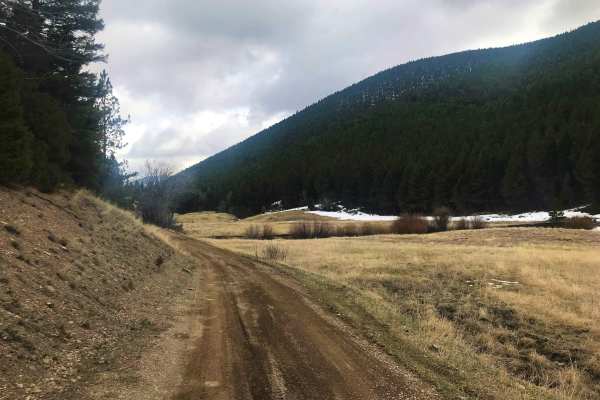
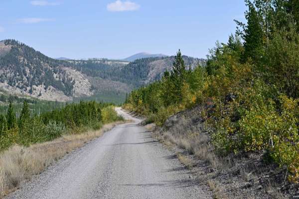
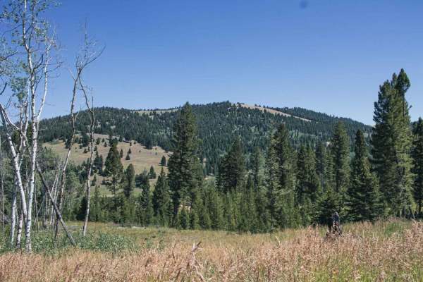
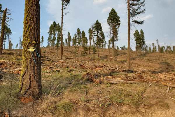
Marsh Creek
Marsh Creek Trail is a popular access point to Granite Peak Lookout in the Helena National Forest. This trail is also part of the Continental Divide Route, so in the summer be on the lookout for mountain bikers, Jeeps and adventure motorcycles. It is not uncommon to see deer and elk while on this tr...
Learn more about Marsh Creek

Birdseye-Mullan Road
This exciting trail generally follows the railroad route over the Continental Divide. Fans of train watching have six railroad crossings, a trestle bridge and multiple miles of track in view from the trail. Keep an eye out for one of the many freight or coal trains that pass along this route daily. ...
Learn more about Birdseye-Mullan Road

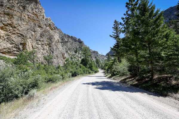
Poorman Creek
This is a reasonably rocky two-track connector trail that leads from Stemple Pass Road to Forest Service Road 485 just south of the intersection with Granite Butte Lookout. The idea was to find a bit more technical trail in the area than gravel Forest roads, and this one delivered. Fun, rocky two-tr...
Learn more about Poorman Creek
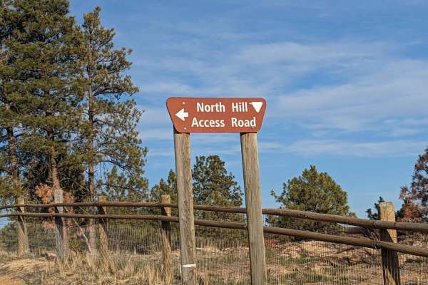
North Hills Recreation Area
The North Hills Recreation Area trail is a dirt road in overall good condition. The trail is accessible by 2WD car if you can stay out of the ruts. Along the North Hills Recreation Area trail, watch for rocks, ruts, and others out enjoying the area. You will be rewarded with lovely views of the surr...
Learn more about North Hills Recreation Area
Microwave
Beautiful road with amazing views to enjoy, there isn't much for camping, there is camp at top of the road, big cell or power towers at top? Spotty cell phone service. Offers skiing trail in winter. Dirt or rocky road, typically unmaintained after rain or snow. You may encounter shallow water crossi...
Learn more about Microwave

Little Blackfoot
The road starts off as pavement for only 4 short miles, it goes through private property, after that you will enjoy amazing views. There are a bunch of camping spots, enough space for a large group at some spots. This road also offers access to man hiking, biking and horse back riding trails.Dirt or...
Learn more about Little Blackfoot
Elliston Spotted Dog
You will enjoy this road with its amazing views. There are a few spots that look like they would be good for camping. Road can be muddy when wet, with some water puddles. Dirt or rocky road, typically unmaintained after rain or snow. You may encounter shallow water crossings and obstacles under 12" ...
Learn more about Elliston Spotted Dog
Copper Creek Road - FS 330
Copper Creek Road is an out-and-back, well-maintained Forest Service Road that leads to multiple points of interest, including the trailhead spur to Indian Meadows Trail/Indian Meadows campground and the Indian Meadows Guard station, which is available for rent in the winter months, catering mainly ...
Learn more about Copper Creek Road - FS 330
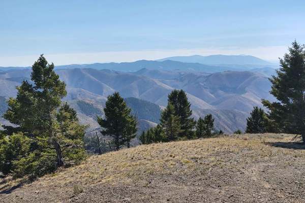
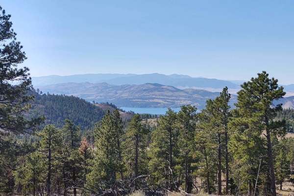
Snow Shoe Creek
The Snow Shoe Creek Road is a wonderful escape into the high alpine meadows of the Helena National Forest. The trail begins in the lush hay valleys along the Little Blackfoot River and ends near the spine of the continent, the Continental Divide. Along the way, rippling creeks and small lakes abound...
Learn more about Snow Shoe Creek
Beaver Creek - Indian Creek FS 138
This route on Forest Service Road 138 travels from Nelson, Montana, to the Indian Flats Forest Service Cabin along Indian Creek. The route has multiple dispersed camping sites along Beaver Creek and also higher up, closer to the Indian Flats Cabin. The route does pass through a parcel of private la...
Learn more about Beaver Creek - Indian Creek FS 138
Telegraph
This road has pretty views, with some camp spots, it dead ends at small camp, the road seems to go on, but it become impassible for a vehicle. It does go through private property so please be respectful.Dirt or rocky road, typically unmaintained after rain or snow. You may encounter shallow water cr...
Learn more about Telegraph
Treasure Mountain
This road has beautiful views, there seems to be no camping, it does ends at a gate, but open is to motorized under 50inchs wide, as well as bike, and hiking.Dirt or rocky road with gentle grades. Safe for most 4WD and high-clearance 2WD vehicles. Roads are typically two vehicles wide.
Learn more about Treasure Mountain
Owl Gulch Loop
This 3-mile loop connects the Favorite Gulch Trail via Owl Gulch to the Pipeline Trail and Pipeline Loop. Private property crossings are allowed if you stay on the trail. The scenery is spectacular, the forest is healthy and well-maintained, and the wildlife includes deer, elk, moose, and bears. You...
Learn more about Owl Gulch Loop
TV Tower/ Slate Creek Road
The trail begins steeply from Elliston Spotted Dog Road. It starts with a rocky section, rated a 2 on a scale of 1-10 in difficulty. During the winter, this steep portion can be slippery, but in the summer and spring, it is more manageable. The rest of the trail transitions to a flat dirt road, lead...
Learn more about TV Tower/ Slate Creek Road

Sucker Creek - FS 1800
As are most of the trails in the Lincoln, Montana area, this is a fairly smooth connector that branches into a series of other trails that traverse the Flathead Range north of Lincoln. Many of these trails evolve into snowmobile trails in the winter, which this area of Montana has no shortage of. Si...
Learn more about Sucker Creek - FS 1800
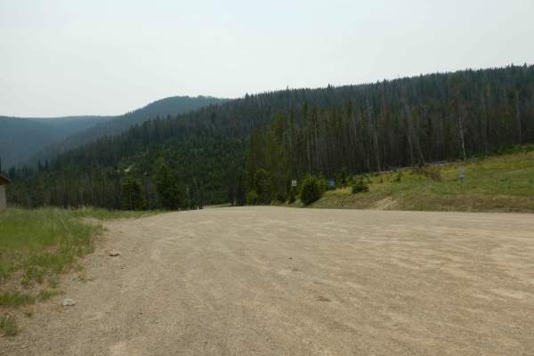
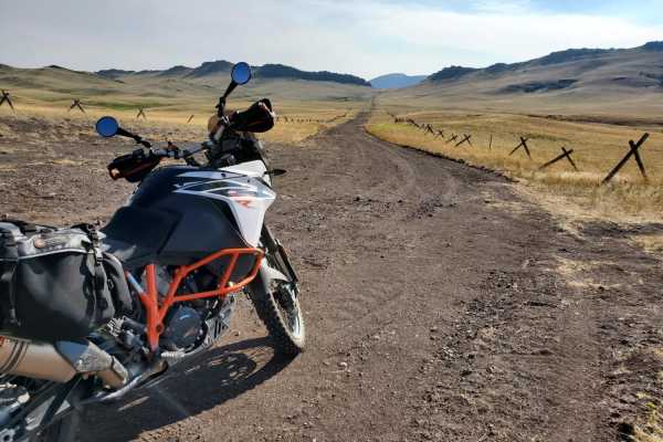
Stemple Pass
The Stemple Pass Road is a quick and scenic escape route to the small mountain town of Lincoln, Montana. The road, while well-maintained, does have things of which to be cautious. Loose gravel and numerous blind corners could be concerning to those on two wheels. In the summer months, this can be a ...
Learn more about Stemple Pass
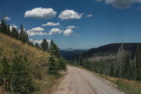
Dalton Mountain Road
The Dalton is an especially fun and scenic logging road for all modes of travel. Most fun on a large-class ADV bike. Nothing inherently difficult, just fast and flowy, depending on the season. Depending on your direction, it starts in the town of Lincoln, heads up into beautiful forest, over the mou...
Learn more about Dalton Mountain Road
Dead Man Gulch
This is a fun ranch road, typically used as a connector to avoid pavement on a large ADV bike. It's a fast and flowy road on a bike, faster now that it's been recently graded. It used to be much more rutted from erosion. Some sections of this short trail can be impassable when wet due to extremely g...
Learn more about Dead Man Gulch
Minnehaha
You will enjoy this road with its amazing views. There are a few spots that look like they would be good for camping. Road can be muddy when wet, with some water puddles. One section of this road is steep, and can be slippery when wet.Dirt or rocky road, typically unmaintained after rain or snow. Yo...
Learn more about Minnehaha
Nelson Road
This 6-mile stretch of Nelson Road goes from York Road to the Favorite Gulch/Owl Gulch Loop Trail. The scenery is spectacular, the forest is healthy and well-maintained, and the wildlife includes deer, elk, moose, and bears. All private property crossings are allowed if you stay on the trail. You ma...
Learn more about Nelson Road
Beginner ATV trails near Canyon Creek, Montana
Explore ATV-friendly trails near you. These trails are accessible for vehicles up to 50 inches wide, perfect for ATVs and smaller off-road machines.
Marsh Creek
Marsh Creek Trail is a popular access point to Granite Peak Lookout in the Helena National Forest. This trail is also part of the Continental Divide Route, so in the summer be on the lookout for mountain bikers, Jeeps and adventure motorcycles. It is not uncommon to see deer and elk while on this tr...
Learn more about Marsh Creek
Birdseye-Mullan Road
This exciting trail generally follows the railroad route over the Continental Divide. Fans of train watching have six railroad crossings, a trestle bridge and multiple miles of track in view from the trail. Keep an eye out for one of the many freight or coal trains that pass along this route daily. ...
Learn more about Birdseye-Mullan Road
Poorman Creek
This is a reasonably rocky two-track connector trail that leads from Stemple Pass Road to Forest Service Road 485 just south of the intersection with Granite Butte Lookout. The idea was to find a bit more technical trail in the area than gravel Forest roads, and this one delivered. Fun, rocky two-tr...
Learn more about Poorman Creek
North Hills Recreation Area
The North Hills Recreation Area trail is a dirt road in overall good condition. The trail is accessible by 2WD car if you can stay out of the ruts. Along the North Hills Recreation Area trail, watch for rocks, ruts, and others out enjoying the area. You will be rewarded with lovely views of the surr...
Learn more about North Hills Recreation Area
Beginner UTV/side-by-side trails near Canyon Creek, Montana
Find UTV and side-by-side trails near you. These trails accommodate vehicles up to 60 inches wide, ideal for UTVs, side-by-sides, and wider off-road rigs.
Marsh Creek
Marsh Creek Trail is a popular access point to Granite Peak Lookout in the Helena National Forest. This trail is also part of the Continental Divide Route, so in the summer be on the lookout for mountain bikers, Jeeps and adventure motorcycles. It is not uncommon to see deer and elk while on this tr...
Learn more about Marsh Creek
Birdseye-Mullan Road
This exciting trail generally follows the railroad route over the Continental Divide. Fans of train watching have six railroad crossings, a trestle bridge and multiple miles of track in view from the trail. Keep an eye out for one of the many freight or coal trains that pass along this route daily. ...
Learn more about Birdseye-Mullan Road
Poorman Creek
This is a reasonably rocky two-track connector trail that leads from Stemple Pass Road to Forest Service Road 485 just south of the intersection with Granite Butte Lookout. The idea was to find a bit more technical trail in the area than gravel Forest roads, and this one delivered. Fun, rocky two-tr...
Learn more about Poorman Creek
North Hills Recreation Area
The North Hills Recreation Area trail is a dirt road in overall good condition. The trail is accessible by 2WD car if you can stay out of the ruts. Along the North Hills Recreation Area trail, watch for rocks, ruts, and others out enjoying the area. You will be rewarded with lovely views of the surr...
Learn more about North Hills Recreation Area
The onX Offroad Difference
onX Offroad combines trail photos, descriptions, difficulty ratings, width restrictions, seasonality, and more in a user-friendly interface. Available on all devices, with offline access and full compatibility with CarPlay and Android Auto. Discover what you're missing today!
Open Trail Map