
Beginner Off-Road Trails
Near Arkoma, Oklahoma
Explore All Beginner Trails Near Arkoma, Oklahoma
Beginner Off-Road Trails Near Arkoma, Oklahoma
Discover the best beginner-friendly off-road trails near you. These easier, lower-rated trails are a great place to start — browse trail maps, check difficulty ratings, and find your next adventure.
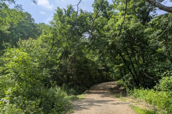
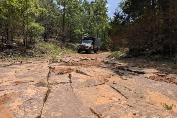
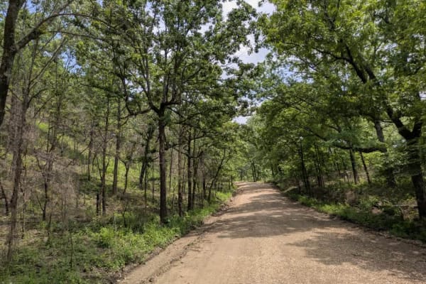
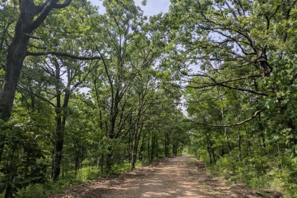
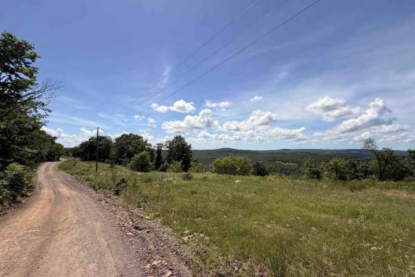
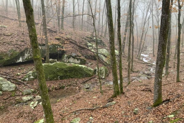
N4770
The route starts as a tidy ribbon of gravel that climbs and dips through thick timber, and it is common to spot deer slipping across the track. There is a large, well-fenced ranch called Lee Creek Ranch, which is for sale for just over 8 million dollars if you have a few spare coins. The property be...
Learn more about N4770
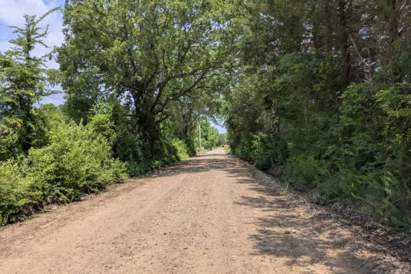
N4690
The road rolls out as loose, mostly smooth gravel with the occasional washboard stretch that rattles the suspension. Pools and ponds nearby draw plenty of wildlife, so it pays to ease off the throttle and watch for small tortoises or even hefty snapping turtles inching across the track. Scenic, yes,...
Learn more about N4690
Scratchout Road
In the hills west of Lake Tenkiller, the route rattles across loose gravel that turns briefly washboard before smoothing as it slips past hayfields and the pickups of local farmers. Groves of post oak, blackjack oak, and mockernut hickory press close to the hood, their canopy broken here and there b...
Learn more about Scratchout Road
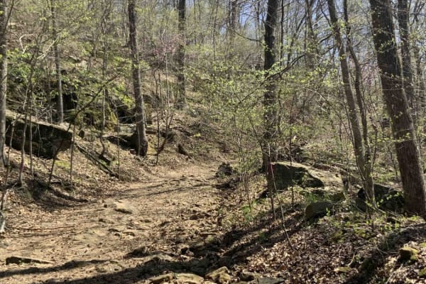
Birchfield
This trail begins as a road near private property but traverses through a wooded area of the Ozark National Forest. The south end may seem like it passes through someone's property, but it is a public road into the National Forest. The trail contains a few shallow mud holes and small rocks, but is o...
Learn more about Birchfield
Ridge Road
The first section of Ridge Road is wide, well-maintained, loose gravel, but the second half is quite the opposite. The trail narrows down the moment it branches from the main track, squeezing between a couple of country homesteads before plunging into outright neglect. Deep washouts scar the surface...
Learn more about Ridge Road
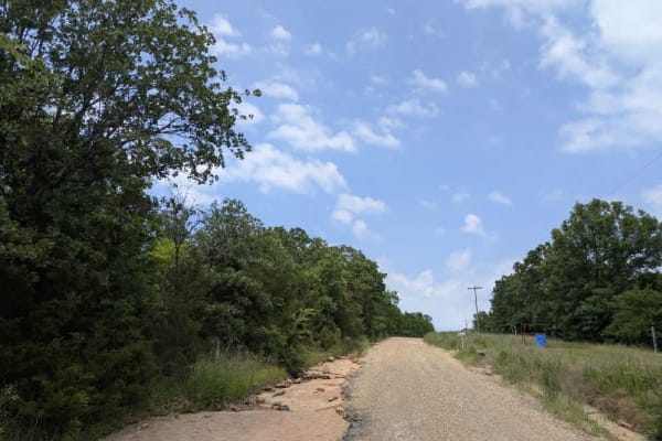
N4660
The route unrolls as a strip of well-graded gravel, smooth enough to lull you into a steady rhythm yet still lively with gentle bends that keep the steering wheel busy. It slips past neatly kept farmhouses, before opening onto sunny meadows where the air smells of cut grass. One moment you are glidi...
Learn more about N4660
D1059
The drive slips beneath a leafy canopy, crunching over tidy gravel as it skirts a postcard-worthy farmhouse and drifts downhill toward a broad river. Most days, the crossing is little more than a gentle splash, but after a hard rain, the current pushes higher and quicker, so easing in with caution i...
Learn more about D1059

E1057
The track services the local farming community and starts--or finishes, depending on your direction--beside a quiet cemetery, then rolls out as well-kept gravel that crunches beneath the tires. A small dam flashes by, the water often glassy at dawn, and a cool stream splashes under a concrete bridge...
Learn more about E1057
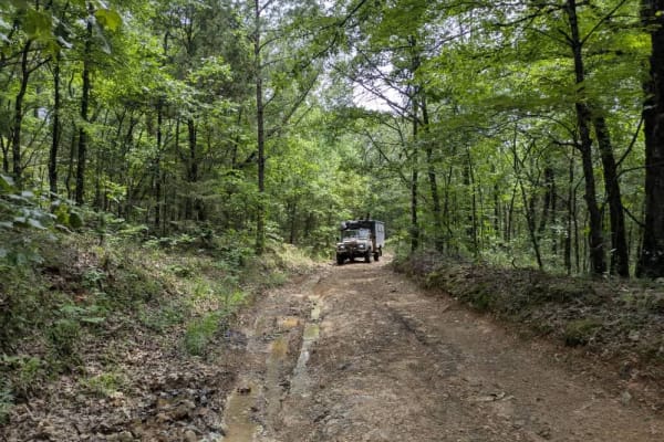
D4747
The drive begins on smooth, well-graded gravel that carries you to a broad submerged bridge, but the moment you cross the river, the trail's tone changes. It narrows, brush leans in, and the surface breaks into muddy ruts, loose rocks, and steep pitches that force a slow crawl toward the 1,700-foot ...
Learn more about D4747
E0980
The road unfolds as loose gravel, generally well graded but dotted with washboard stretches that jostle the suspension. Because farmers rely on it daily, expect the occasional pickup or tractor, and keep your speed in check. A handful of homesteads slide by before the track winds into mixed woodland...
Learn more about E0980
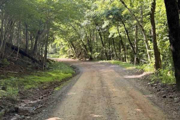
Kimes Tower Road
Kimes Tower Road is an easy gravel forest road that winds through the mountains beneath a dense tree canopy. The route is generally smooth and well-maintained, with only occasional embedded rocks less than 6 inches in height. A series of gentle curves and elevation changes keeps the drive interestin...
Learn more about Kimes Tower Road
Elmo Creek
Elmo Creek Trail is an out-and-back National Forest route that offers a mix of easy forest driving with a few moderately rough sections scattered throughout. The trail begins as a relatively smooth gravel and dirt road beneath a dense tree canopy before gradually becoming narrower and more uneven de...
Learn more about Elmo Creek
Poteau West
Leaving a fork in the road that accesses a cell tower road, this trail west ends at a pull-off with an awesome view. This trail is fairly smooth with some steep areas, sharp curves, and loose gravel. There is a nice dispersed campsite along this trail. Several wildlife ponds are along this trail. Mo...
Learn more about Poteau West
S4780 Road
The drive begins innocently enough on firm gravel, but the road soon tightens into a twisting corridor that grows muddy, rocky, and pocked with corrugations and potholes. Water pools in low spots, and the grade steepens as the lane climbs toward the Wildlife Management Area parking lot--a spot that ...
Learn more about S4780 Road
Memorial Drive
Memorial Trail shakes things up from the first turn, its loose gravel clattering under-tire and breaking into bumpy, corrugated stretches that hint at the recent storms we braved on Memorial Day. The track winds between thick stands of forest and clusters of country homesteads, rewarding patient dri...
Learn more about Memorial Drive
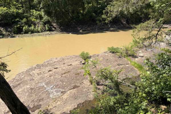
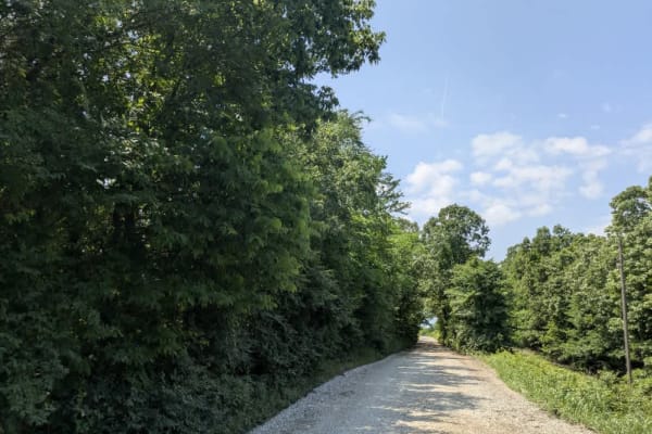
Lower Lee Creek Trail
This trail provides access to the lower portion of Lee Creek for swimming and fishing. The trail goes all the way to the water; however, there is no parking at the water allowed. Rangers patrol this area since it is a common swimming hole, so park at the designated parking area if you plan to stay. ...
Learn more about Lower Lee Creek Trail
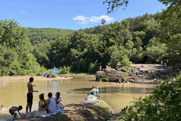
Upper Lee Creek Trail
Lower Lee Creek Trail is a short access road leading to one of the area’s most popular swimming and fishing destinations along Lee Creek. The site features a large gravel bar and beach area for lounging, along with clear water, rock bluffs commonly used for jumping, and rope swings that make it espe...
Learn more about Upper Lee Creek Trail
Rackley Mountain Road
Rackley Mountain Road is an easy dirt and gravel mountain road that winds through the forest via a series of gradual switchbacks and elevation changes. Much of the route is covered by a dense tree canopy, giving the trail a shaded and remote feel while also helping keep dust down during dry conditio...
Learn more about Rackley Mountain Road
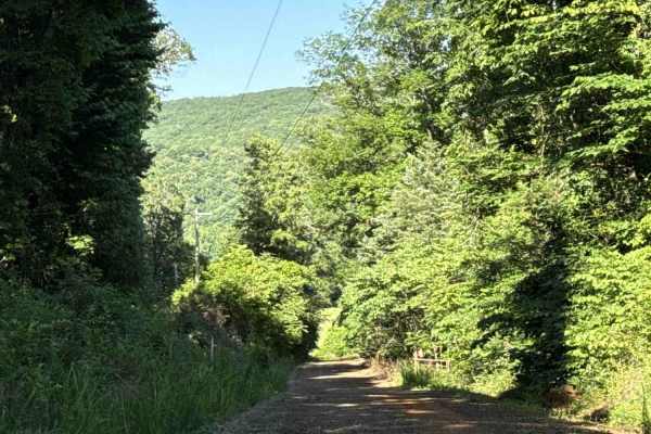
Old Cove City Road
Old Cove City Road is an easy scenic gravel road that winds through dense hardwood forest and rolling mountain terrain within the National Forest. The route is generally wide and well-maintained, making it suitable for most highway-registered vehicles in dry conditions. Long stretches of tree canopy...
Learn more about Old Cove City Road
Cove Creek Road
Cove Creek Road is an easy scenic forest road that follows Cove Creek through a narrow mountain valley beneath a dense tree canopy. The route is primarily gravel and generally well maintained, making it suitable for most highway-registered vehicles in normal conditions. The road winds through a mix ...
Learn more about Cove Creek Road
Beginner ATV trails near Arkoma, Oklahoma
Explore ATV-friendly trails near you. These trails are accessible for vehicles up to 50 inches wide, perfect for ATVs and smaller off-road machines.
Elmo Creek
Elmo Creek Trail is an out-and-back National Forest route that offers a mix of easy forest driving with a few moderately rough sections scattered throughout. The trail begins as a relatively smooth gravel and dirt road beneath a dense tree canopy before gradually becoming narrower and more uneven de...
Learn more about Elmo Creek
Old Cove City Road
Old Cove City Road is an easy scenic gravel road that winds through dense hardwood forest and rolling mountain terrain within the National Forest. The route is generally wide and well-maintained, making it suitable for most highway-registered vehicles in dry conditions. Long stretches of tree canopy...
Learn more about Old Cove City Road
Warloop Road - 1567a
This road starts out as a maintained road and then changes to an unmaintained "right of way" road through private land. It then changes back to a maintained dirt road. There is a sign where the unmaintained section starts that lists the names of the families who own land along the road. It is fairly...
Learn more about Warloop Road - 1567a
Bradford Easy Loop 1720B/2509
This is a great loop trail off Freedom Road. Along the trail, there are a few more loop and side road options that would make the path longer or more difficult. Due to narrow and tight turns, it is not currently suitable for full-size 4x4 pickups. Your 4x4 Jeep, Bronco, or midsize truck should be fi...
Learn more about Bradford Easy Loop 1720B/2509
Beginner UTV/side-by-side trails near Arkoma, Oklahoma
Find UTV and side-by-side trails near you. These trails accommodate vehicles up to 60 inches wide, ideal for UTVs, side-by-sides, and wider off-road rigs.
Elmo Creek
Elmo Creek Trail is an out-and-back National Forest route that offers a mix of easy forest driving with a few moderately rough sections scattered throughout. The trail begins as a relatively smooth gravel and dirt road beneath a dense tree canopy before gradually becoming narrower and more uneven de...
Learn more about Elmo Creek
Old Cove City Road
Old Cove City Road is an easy scenic gravel road that winds through dense hardwood forest and rolling mountain terrain within the National Forest. The route is generally wide and well-maintained, making it suitable for most highway-registered vehicles in dry conditions. Long stretches of tree canopy...
Learn more about Old Cove City Road
Warloop Road - 1567a
This road starts out as a maintained road and then changes to an unmaintained "right of way" road through private land. It then changes back to a maintained dirt road. There is a sign where the unmaintained section starts that lists the names of the families who own land along the road. It is fairly...
Learn more about Warloop Road - 1567a
Bradford Easy Loop 1720B/2509
This is a great loop trail off Freedom Road. Along the trail, there are a few more loop and side road options that would make the path longer or more difficult. Due to narrow and tight turns, it is not currently suitable for full-size 4x4 pickups. Your 4x4 Jeep, Bronco, or midsize truck should be fi...
Learn more about Bradford Easy Loop 1720B/2509
The onX Offroad Difference
onX Offroad combines trail photos, descriptions, difficulty ratings, width restrictions, seasonality, and more in a user-friendly interface. Available on all devices, with offline access and full compatibility with CarPlay and Android Auto. Discover what you're missing today!
Open Trail Map