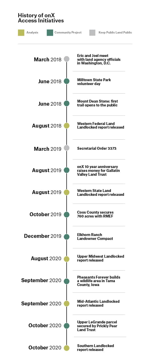
A Quick Look Back at 2018-2020
As 2020 comes to a close, we thought now was a good time to reflect on our adventures in access advocacy. Three years ago this month, a group of onX staff met to discuss the best way we could give back to our community and our customers. Since onX builds technology to help people have their best days outdoors, it seemed only fitting that our mission should be to protect the access to hunting and outdoor recreation that exists, and to advocate for more.
We went on to tackle access in three main ways:
- Working directly with land management officials to keep public land public.
- Analyzing our mapping data to provide numbers that support a national call for public land funding.
- Providing funding to improve public access in specific locations.
Through these onX efforts and thanks to the tireless dedication of our partners, we’re excited to share that hunting and outdoor recreation access was secured on 14,473 acres. And, by their proximity to other hard-to-reach public lands, these acres have facilitated easier access to an estimated 9,778 additional acres.
Keeping Public Land Public
Historically, the Bureau of Land Management (BLM) did not account for public access when they determined which parcels to prioritize for disposal (or sale, for those who don’t speak Government). As a result, parcels treasured by locals for their angling, hunting, and outdoor recreation value were being sold. To address this issue, in March 2018, onX Founder Eric Siegfried and Joel Webster of the Theodore Roosevelt Conservation Partnership (TRCP) traveled to Washington, D.C., to present to senior officials at the Department of the Interior, BLM, and White House Office of Management and Budget.
Their presentations focused on how hunters are finding access to public land using modern digital mapping technology. They explained how the days of using a paper map and compass, taking bearings and counting paces, were in the past. By having land ownership maps on a smartphone or handheld GPS, the public is empowered to find routes to public lands that are difficult to reach. For example, they can take advantage of water access where it’s legal or cross between publicly-accessible land managed by different agencies. Therefore, not every parcel needs to be developed with parking areas and signs to be utilized by the public. Their thesis: many undeveloped parcels have high value to the public and shouldn’t be sold heedlessly.
One year after Joel and Eric’s presentations in D.C., the Acting Secretary of the Interior signed Secretarial Order 3373, Evaluating Public Access in BLM Land Disposals and Exchanges, which requires the agency to formally consider the public access on all future parcels identified for disposal.
Quantifying the Case for Funding
For those same presentations in D.C., members of the onX GIS team created an analysis that determines how many acres of public land are surrounded by private land, or “landlocked,” and therefore inaccessible to the public without permission from a neighboring landowner. What began as an example survey of southeastern Montana evolved into a three-year long collaboration with TRCP in which we analyzed how many landlocked acres exist in 22 states across four regions of the country. The result? A total of 16.4 million acres of inaccessible public land discussed in five reports.
When we released the first landlocked report focused on federal lands in the West, the Land and Water Conservation Fund (LWCF) had only weeks left until expiring. After five decades of successfully using royalties from offshore oil and gas extraction to create millions of acres of new public land, secure public access, preserve ecosystems, and invest in outdoor recreation, LWCF looked like a goner. Therefore, the primary policy solution we advocated for in our reports was full and dedicated funding for LWCF, along with state-level public access and conservation programs.
After tremendous pressure from the hunting and outdoor community, on March 12, 2019, LWCF was permanently reauthorized as part of the John D. Dingell, Jr. Conservation, Management, and Recreation Act. With the passage of this act, for the first time a dedicated fund of at least $15 million annually must be used to establish access to public lands where it is currently limited or nonexistent.
Although LWCF was reauthorized in 2019, it still lacked full and dedicated funding. Thousands of individuals wrote letters and called their representatives, and the outdoor community joined forces, putting pressure on lawmakers to guarantee that money collected for LWCF would not get siphoned off for other government expenses. Finally in August 2020, the Great American Outdoors Act was signed into law, guaranteeing $900 million annually goes to LWCF as intended, and also creating a new fund to begin addressing the $12 billion backlog of maintenance projects on our public lands.
In the meantime, after each report we released with TRCP, we received data requests from all over the country from groups wanting to know where the landlocked parcels are located. So we released data to 29 agencies, land trusts, and non-profit conservation groups to incorporate into their access project priorities as they look to secure LWCF funding.
onX Access Initiatives at a Glance
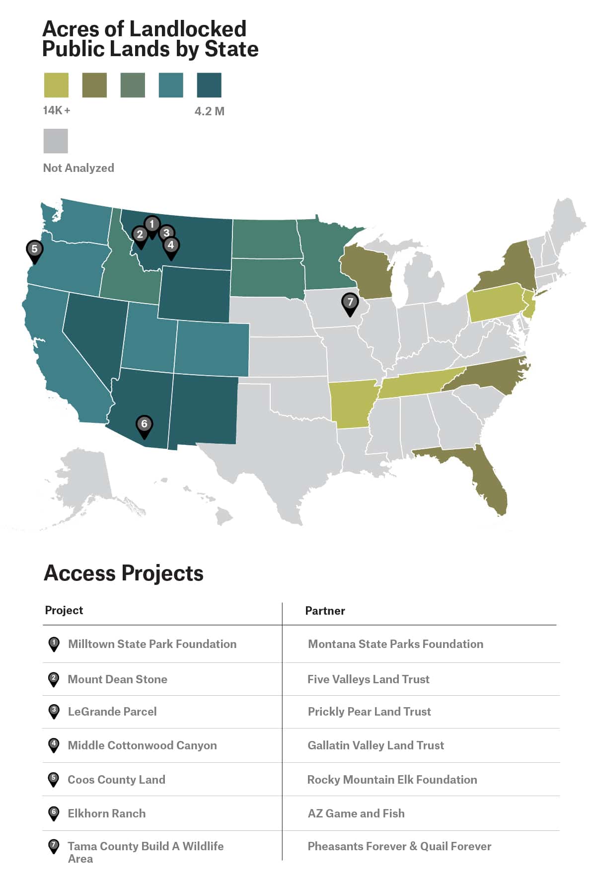
Supporting Access Projects
While much of our team’s resources were spent addressing access challenges at the national scale, we knew it was important to give back to local communities, too.
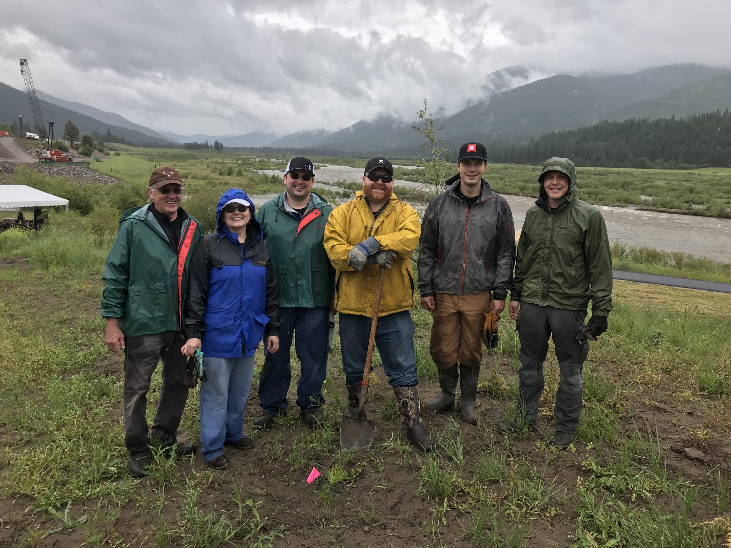
- In 2018, we sponsored projects that helped Milltown State Park near Missoula, Montana open, thanks to the Montana State Parks Foundation. On a cold and rainy day, onX volunteers planted native vegetation along the riverbanks where the Milltown Dam once stood. Just eight miles from the first onX office, the park provides trails and river access at the confluence of the Clark Fork and Blackfoot Rivers.
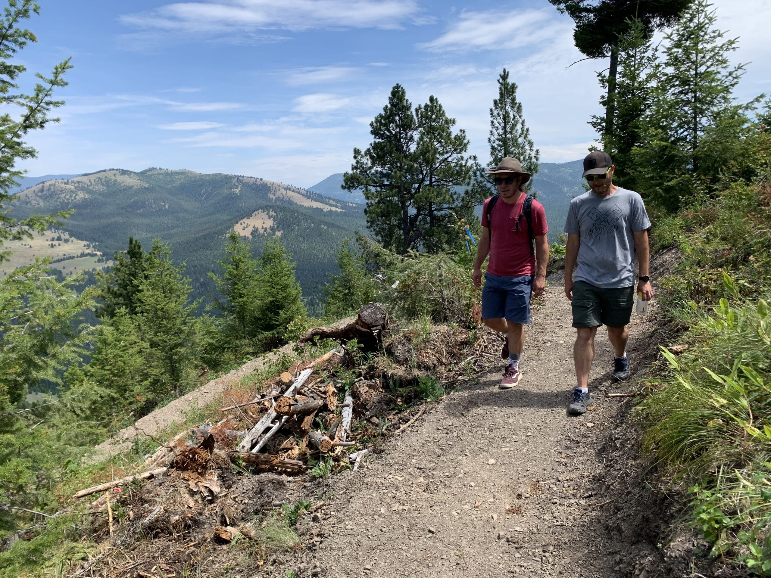
- Beginning in 2018, we provided rounds of matching funds to Five Valleys Land Trust for their Mount Dean Stone project in the foothills of Missoula, and participated in their planning committees where we learned about mitigating impacts of recreation on wildlife and balancing the needs of multiple user groups. The area now has four trailheads and in 2021, the project will be in the final phase of connecting 4,200 acres that will provide opportunities to hunt, hike, bike, and view wildlife.
- In 2019, we teamed up with Leupold, an optics company based in Oregon, to provide funds to Rocky Mountain Elk Foundation (RMEF) to award a 760-acre project in Coos County, Oregon, with the money needed for forest management projects, improving access to county forest lands, and improving Roosevelt elk habitat.
- For onX’s ten-year anniversary in 2019, Bozeman, Montana-based MAP Brewing created a limited-edition pale ale. For each beer sold, onX and Sitka each donated $1 to Gallatin Valley Land Trust which ultimately went towards securing 160 acres in Middle Cottonwood Canyon near Bozeman for public access.
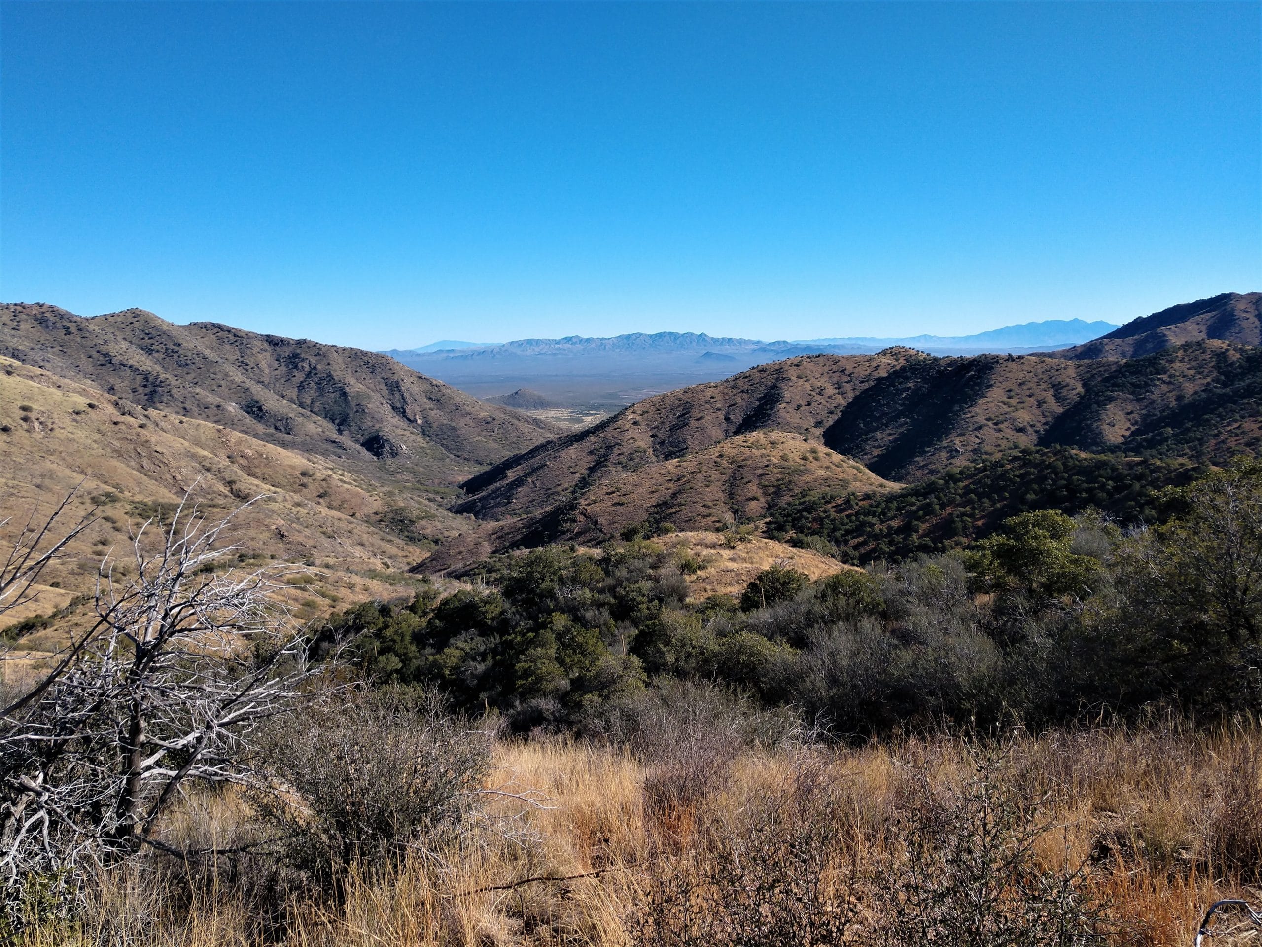
- In December 2019, we sponsored the first year of a Landowner Compact with the Arizona Game and Fish Department on Elkhorn Ranch in Arizona that will secure public access to nearly 9,000 acres until 2028.
- In 2020, we provided a donation to Prickly Pear Land Trust to help them purchase a key 55-acre property in the LeGrande area at the base of Mount Helena, Montana, which the trust then donated to the City of Helena to secure wildlife habitat and a link between existing public lands.
- Also in 2020, we donated to Pheasants Forever and Quail Forever’s Build a Wildlife Area program to help secure public access and wildlife habitat on a 281-acre parcel in Tama County, Iowa.
The onX team is incredibly grateful for all of our diligent, talented partners on these projects, as well as the landowners who wanted to see their land preserved for habitat conservation and public recreation. These folks are ensuring that there are opportunities to get outside to hunt, fish, and recreate for generations to come.
Our Access Mission is Evolving
During these first three years of access initiatives at onX, we’ve focused primarily on legally inaccessible public lands and places that have limited public access. We worked on the local scale and the national scale, and we learned a ton along the way. Going into 2021, we’ll be looking at additional barriers to accessing outdoor recreation through new partnerships and new ways of looking at mapping data.
This year in particular, we saw that public spaces, fresh air, and activities that get people out of the house are in high demand. That’s why we are inspired by and thankful for all the individuals who work behind the scenes to secure outdoor access for everyone. Landowners, the many specialists at land trusts and conservation organizations, community volunteers, grant writers, businesses, biologists, data analysts, agency staff, and people who write and call their representatives all play a part. It takes the public to have public land.
Hero photo: Kevin League Photography