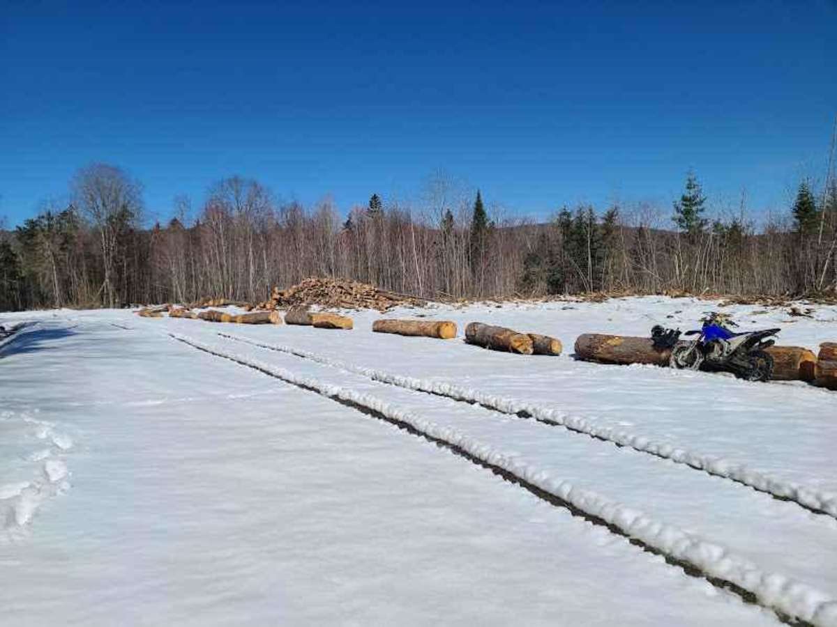
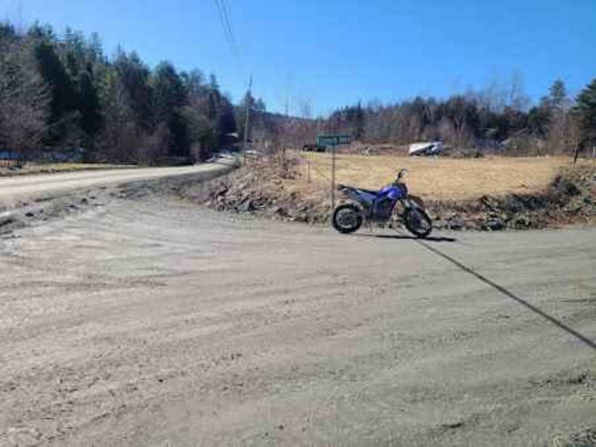
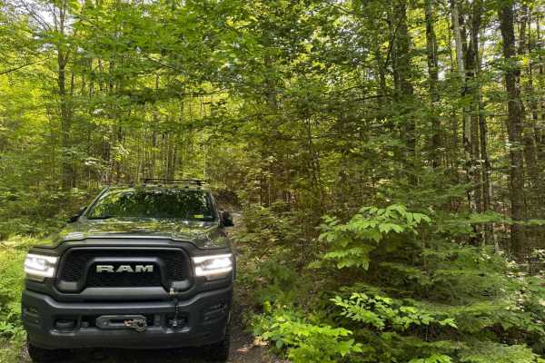
Lynch Hill Loop

Total Miles 6.3
Technical Rating
5 Moderate
Best Time Summer
Trail Type Full-Width Road
Accessible By
Open Trail Map

Trail Overview

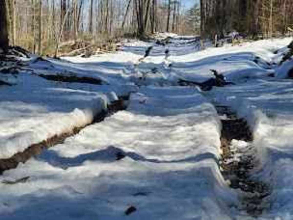
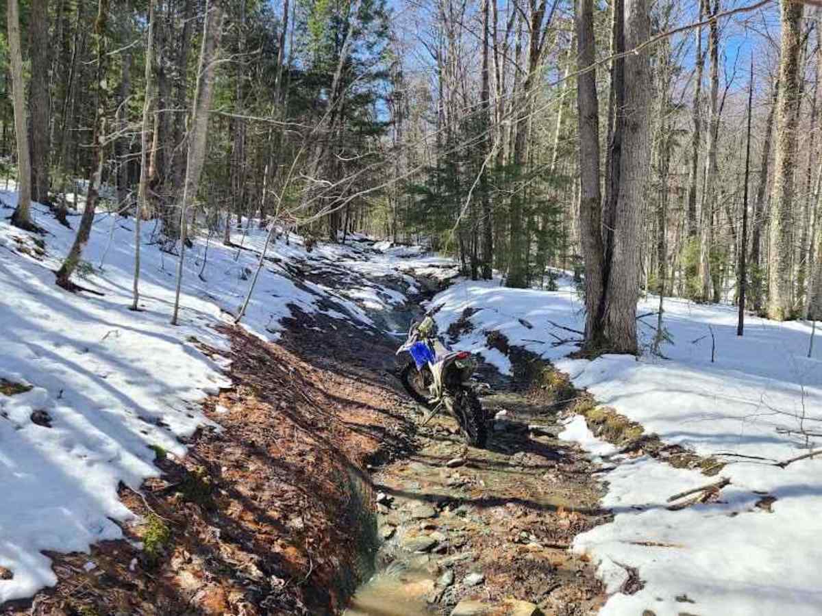
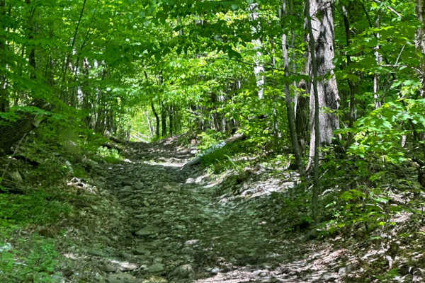
This is legally a Class 4 town road, so anything on it should technically be registered. Typically, the main loop is a fairly mild drive through the woods. There are options to get a bit more radical if you want to try the Moretown Mountain Escape Spur, Kelley Brook Road, or Lynch Trail, which are accessible from this loop. The pines up on top of the hill were logged over the winter of 2024, and as such, it's gotten a bit nastier. You can expect a mix of rocky creek beds, muddy logging roads, and several dug-out creek crossings that will require an aggressive tire and decent approach and departure angles. Typical Vermont wildlife is abundant once you are out there. Deer and birds of all kinds are regular sights;even occasionally a moose, black bear, coyote, and bobcat can be spotted if you are lucky.

Photos of Lynch Hill Loop

Difficulty

Most of the main loop is suitable for a full-width 4x4, as long as your approach and departure angles are decent and you have a fairly aggressive tire to deal with the new mud. The spur on the end is much harder and more technical, but you don't have to run it to complete the route. It does, however, dump you out onto Moretown Mountain Road. That is much better left to high-clearance 4x4s, ATVs, and dirt bikes, as it's much narrower, steeper, and chock full of slick rock ledges.

History

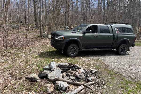
The town keeps this as a fire road and access to a number of hunting camps. People do live in the area, so please be respectful. All along the route is private property. Most of it's posted, so even if you see a mud hole that someone else has hit, if it's not clearly on the road, keep out.

Technical Rating

5

Status Reports

Add Status Report
Jonathan Cohn
May 11, 2026
Open
I entered from Moretown Mountain Road. The original entrance was heavily eroded and I was too scared to try it, but you could pull left through a little open grassy area to bypass this. Eventually after passing the CRV with it to my right, and clearing through the hard part I went left and did about half of the loop. On Herring Brook Road eventually there was a sign (facing the opposite direction) that said temporarily closed to motor vehicles for the season. It was not blocking the road, but to the side. I hopped out so I could read it. It might say closed, but nothing is stopping anyone from doing it. There was no signs where I entered from.
Michael Lackman
Sep 28, 2025
Open
The CRV is pretty easily passible in the spot it’s in by the average vehicle.
J B
Sep 11, 2025
Open
Terry King
Aug 30, 2025
Open
Fun trail. Always looking for Class IX’s like this.
Evan Jones
Aug 30, 2025
Open
Pretty technical first bit with the washouts. Was not gonna attempt it with my f150. The sketchy broke down CRV is still there but able to get around.
Rejean Robitaille
Aug 13, 2025
Open
First section to reach the loop is very technical with steep angles that require a good setup, I definitively recommend 35’ with at least a locker specially after a rain. There was also a scrap CRV that was blocking the way but you can pass beside if you are care full, it was very tight with my rig. The loop is very easy, Level 3…
Max Erik
May 24, 2025
Open
The southern portion of the loops is great. Definitely has had some rain and is pretty rutted and greasy. There is a decent sized washout right after the eastern bailout that is probably passable but since I was alone I didn’t try it. The eastern bail out also looked pretty washed out so I didn’t give it a try.
Danny Modzelewski
Oct 03, 2024
Open
The loop itself is a green besides for the washed out bridge section, the little tail peice off the loop that goes to more town gap is pretty technical, I’d rate it maybe more then a blue, it’s closer to a black.
Michael Lackman
Sep 07, 2024
Open
We entered the spur off Moretown Mountain and definitely needed lockers with a few hundred feet. Once we hit the loop we ventured left but found the large impassable wash out and finished up to the right onto Jones Brook
Karol Celmer
Aug 17, 2024
Open
Trail started off super easy, then increased to moderate with the washed out sections. Majority drove in 2wd . But half way thru had to turn around , washed out deeper than picture makes it appear.
Guy Gidalevich
Jul 11, 2024
Open
A lot of private property signs when entering the trail. Otherwise pretty good trail. The start of the trail is easy and it gets a little bit challenging when you enter further in, but nothing crazy. The trail that’s separated from the loop is pretty difficult (orange) with flowing water and steep angles. I didn’t attempt it since I was on my own. There is a big dugout (red) in the middle of the loop which I couldn’t pass (only a very narrow vehicle could pass here) and had to turn around and come out the way I came in instead of doing the full loop.
Owen Anderson
Jul 07, 2024
Open
Slyvester my 90’ YJ unfortunately doesn’t have 4wd currently. It made it part way and had to be rescued by my other 94’ YJ. Very fun and technical. Definitely will be back with 4wd.
Chris Cammack
Jul 04, 2024
Open
Solo trip, entered via Mooretown Mtn Escape Spur and took Lynch Hill Rd to Jones Brook Rd. Had to cut a 16" log off the Spur. Glad for the rock sliders and skid plate as there are many decent rocks and harsh exposed bedrock. AT tires a must due to mud and loose gravel/rock stream beds. The Spur is a 6 and showed UTV use. Max sideslope angle around 20 deg. for our full size vehicle. Lynch Hill Rd is a used logging road and more 4/5.
Who Dis
Apr 28, 2024
Open

Lynch Hill Loop Trail can be accessed by the following ride types:

  • Single Track
  • 50 Inch
  • 60 Inch
  • High Clearance
  • Full Width

Lynch Hill Loop Map

The onX Offroad Difference

onX Offroad combines trail photos, descriptions, difficulty ratings, width restrictions, seasonality, and more in a user-friendly interface. Available on all devices, with offline access and full compatibility with CarPlay and Android Auto. Discover what you're missing today!

Open Trail Map