
Off-Road Trails in Montana
Discover off-road trails in Montana
Off-Road Trails in Montana
Discover the best off-road trails in Montana. Browse trail maps, check difficulty ratings, and find your next adventure — whether you're looking for a quick ride or an all-day expedition.
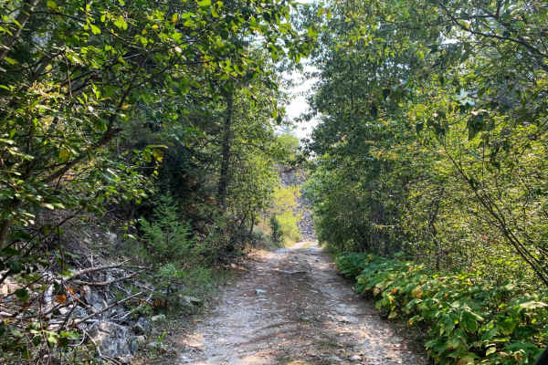
Gold Creek Trail
Easy dirt trail safe for most 4WD and 2WD vehicles all the way to the Gold Creek Campground. The trail continues past the Gold Creek campground but turns into 4WD high clearance only. The trail begins through a neighborhood and is well-maintained gravel, watch for pedestrians walking their dogs. Th...
Learn more about Gold Creek Trail
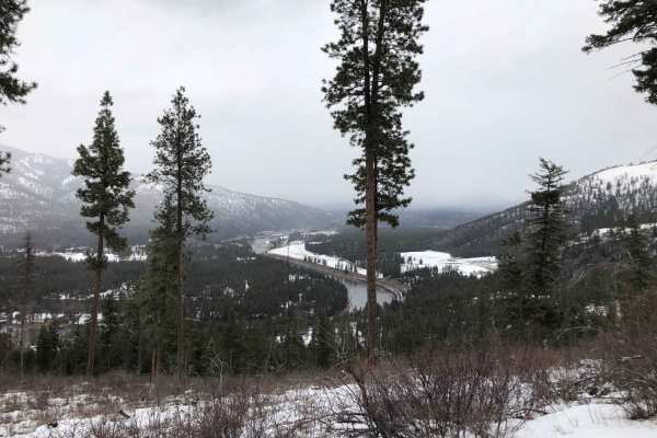
Albert Lothrop Rd 5563
Climb your way up into the hills above Alberton and enjoy the views of the Clark Fork river as well as the hills of the Lolo National Forest. This well maintained dirt road is open year-round but is inaccessible to the majority of wheeled vehicles during winter due to snow. Snow often melts by mid s...
Learn more about Albert Lothrop Rd 5563
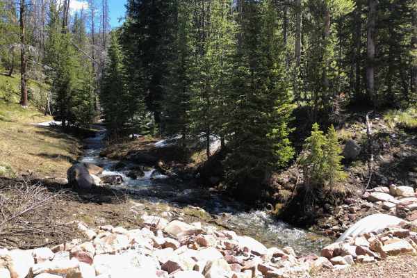
Warm Springs Creek Road 170
Follow Warm Springs Creek to find some beautiful remote campsites with the sounds of the rushing creek or nighttime critters. This road starts as a well-maintained gravel road for the first 3.5 miles before crossing over the creek and becoming rougher the further you drive. Some larger rocks and rut...
Learn more about Warm Springs Creek Road 170
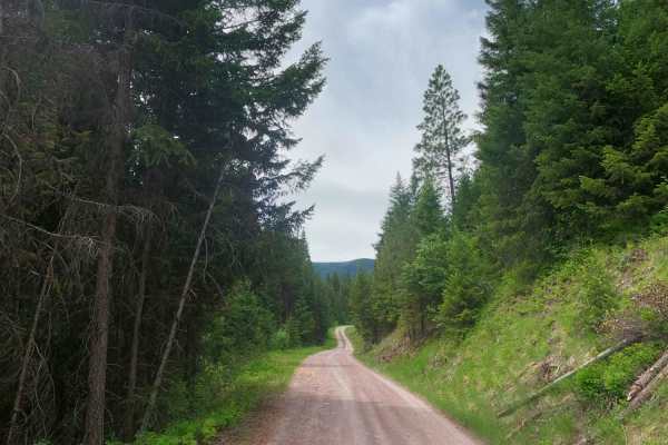
West Fork Petty Creek Road 22
If you're looking for access to deep sections of Lolo National Forest near Alberton, this is a great place to start. The road is well-maintained gravel and dirt during summer, but the snow doesn't usually melt until late spring. Make sure to keep your speed low for the first 4 miles to keep from kic...
Learn more about West Fork Petty Creek Road 22
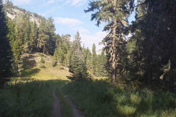
Hay Canyon Trail
Open July 1 - Oct 14. Hay Canyon Trail is in the Little Belt Mountains, located in the Lewis and Clark National Forest, Southeast of Great Falls and Northwest of Harlowton, Montana. From Hay Canyon Campground, the Eastern end of the trail goes through a canyon that has some heavily forested areas. A...
Learn more about Hay Canyon Trail
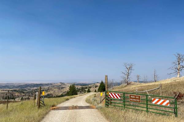
Iron Mountain Road
Iron Mountain Road is a very scenic gravel road that becomes slightly narrower the further along you drive. Once passing the entrance gate you officially enter Gallatin National Forest and dispersed campsites can be found along the road with fire rings. From the entrance is at 7.6 miles to campsite ...
Learn more about Iron Mountain Road
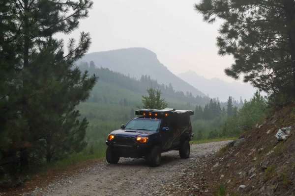
Up and Up
This route starts as an easy dirt trail, accessible to 2WD and low clearance vehicles, with sweeping views over Lake Como. The higher the elevation, the better it gets. About halfway up, the trail turns from easy dirt to rocky and uneven. Higher clearance would be recommended. The trail also begins ...
Learn more about Up and Up
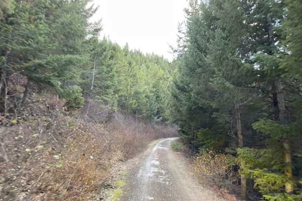
Woods Ridge Loop
An easy single-lane dirt road that is very narrow with steep shelves and drops from the side with no guard rail. The views are to die for and you are rewarded with long sweeping views of each side of the valley. No cell service. Some dispersed camping spots, but there is evidence of people camping i...
Learn more about Woods Ridge Loop
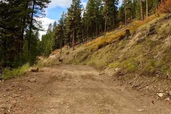
South Fork Nemote - Sheridan Ridge Loop
This route is controlled by two gates that are opened only from 05/16-10/14. The route passes thru both the Lolo National Forest and Fish Creek Wildlife Area. It is a single gravel, loose rock road that climbs up to 4600' through a burnt-out area of Government Lands. The majority of the route is mad...
Learn more about South Fork Nemote - Sheridan Ridge Loop
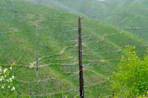
South Fork Nemote Creek - Sheridan Ridge Loop
South Fork Nemote Creek (FSR 9915)-Sheridan Ridge (FSR 9914-9912) Loop is a route that makes a big loop thru this section of Lolo National Forest. The route climbs to 5500' on a gravel one-lane road with steep banks and turns on the route. The route is only open from 05/16-10/14 or is impassible due...
Learn more about South Fork Nemote Creek - Sheridan Ridge Loop
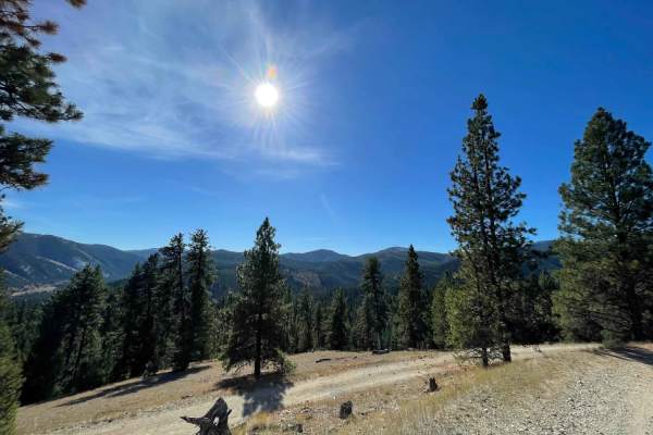
Coal Creek to Blue Joint
Great crossover trail from Coal Creek to Blue Joint. The trail heads up into the hills with great views of the surrounding mountains and valleys. Not very many pullouts for oncoming traffic and not a lot of dispersed camping spots. There are a few other trails in the area that may work well for find...
Learn more about Coal Creek to Blue Joint
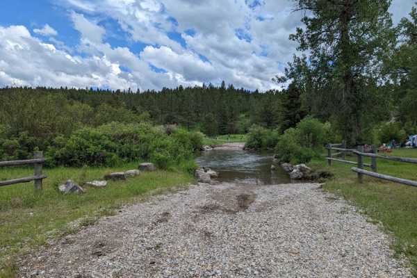
Ettien Ridge
Open May 16 - Nov 30. The 2020 Helena-Lewis and Clark National Forest MVUM indicates the East portion of the trail is open May 16 - Nov 30, and the West portion of the trail is open year-round. I did not notice signage at any point indicating where the open dates change. The East end of the trail st...
Learn more about Ettien Ridge
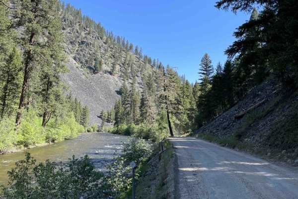
Rock Creek
This dirt road follows Rock Creek and connects I-90 near Clinton, MT, to Highway 1, leading to Philipsburg. This area is busy with anglers and rafters in the Spring, Summer, and Fall but experiences less traffic in the winter. The trail is very well graded and smooth for the most part. There are no ...
Learn more about Rock Creek
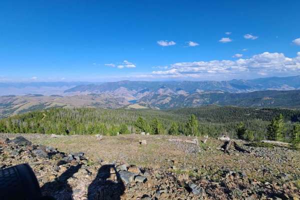
Lake Mountain
The road to Lake Mountain in Idaho is well traveled and in good condition. It can be accessed by any 4WD vehicle. It starts on Williams Creek Road, a few miles south of Salmon, ID. At the Williams Creek summit, turn south on Ridge Road. Take the offshoot to Lake Mountain, which will take you to the ...
Learn more about Lake Mountain
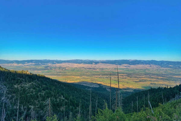
Smith Ridge Glen Lake
This is a stunning drive into the Bitterroots from the Bell Crossing area. You start in a residential area and ascend to the trailhead for the Glen Lake hike. Along the way are a few hidden waterfalls, some dispersed camping spots, and a few breathtaking corners as you climb above the Bitterroot Val...
Learn more about Smith Ridge Glen Lake
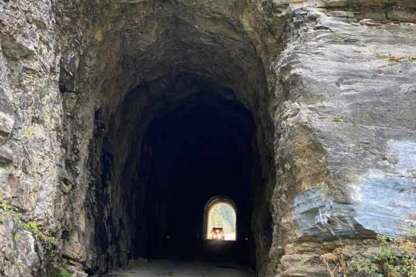
Moon Pass
This route takes you along the North Fork of the St. Joe River via the old Milwaukee Road Rail Grade. You'll pass through several old train tunnels and over a couple of old train trestles along the way and be treated to stunning views. This is a full-width road that is well-maintained for vehicle tr...
Learn more about Moon Pass
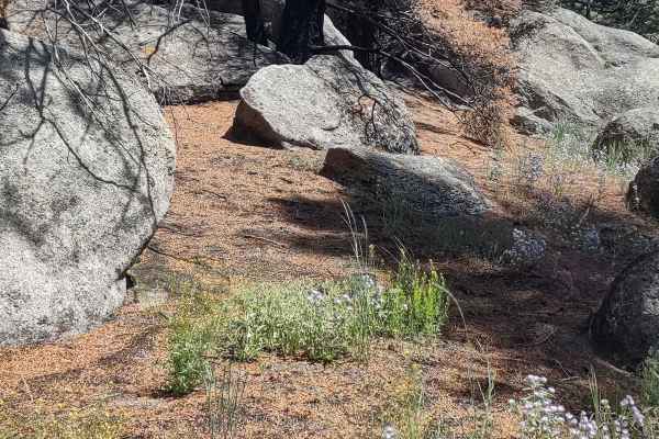
Boulder Alley Spur
This track exits the Bigfoot Creek to Hay Creek Trail, goes west for just over a mile, connects with Boulder Alley Trail, and gets into an area of large boulders and pine trees. If you're on a quad or a dirt bike, you will be able to go through boulder alley further than we could in our SXS. The sce...
Learn more about Boulder Alley Spur
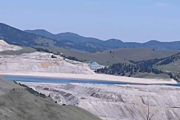
Bluebird Mine Road
This 1.68-mile trail takes you from Bluebird Mine Loop to Wood Chute Cr to Bluebird Mine Trail. All private property crossings are allowed if you stay on the trail. The scenery is beautiful. The views are amazing. This forest is home to deer, elk, and bears. If you are here in the early springtime, ...
Learn more about Bluebird Mine Road
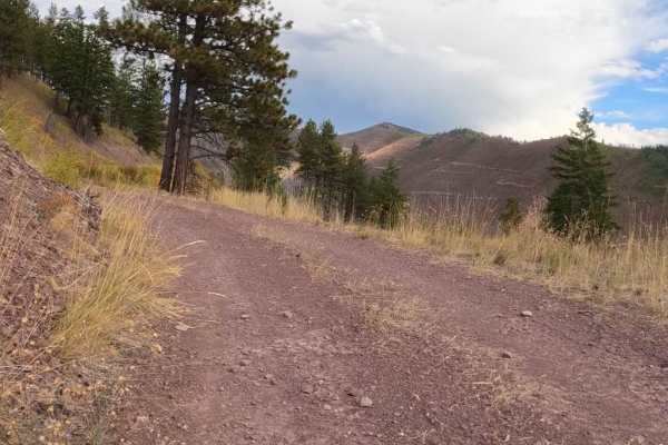
Second Creek 283 - East Fork Johnson 7882
The route begins on a two-lane gravel road that turns into an area of forest that has been logged off for several miles. There is still an active part of the route that is being logged, which is only passable from 05/16-10/14. Logging trucks could be on the route with little room to pass. The route ...
Learn more about Second Creek 283 - East Fork Johnson 7882
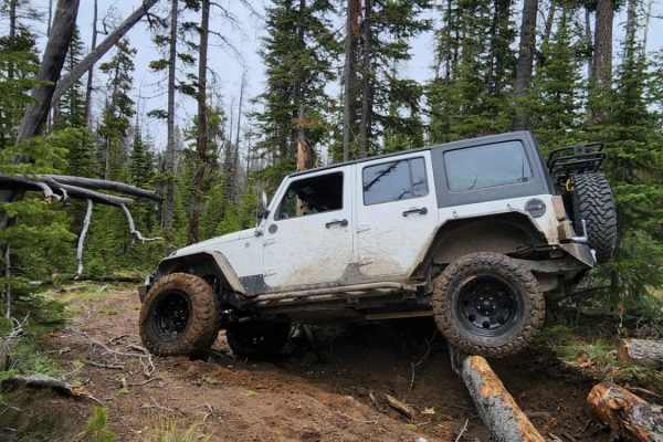
Lava Mountain Loop
This trail can be driven in a loop or as a one-way between the towns of Boulder, Clancy, or Rimini. The road from Clancy gets very rutted and is not very scenic. The loop is very entertaining; there are many tight trees and fallen log obstacles. There aren't many rocks except for one short but techn...
Learn more about Lava Mountain Loop
ATV trails in Montana
Explore ATV-friendly trails in Montana. These trails are accessible for vehicles up to 50 inches wide, perfect for ATVs and smaller off-road machines.
Gold Creek Trail
Easy dirt trail safe for most 4WD and 2WD vehicles all the way to the Gold Creek Campground. The trail continues past the Gold Creek campground but turns into 4WD high clearance only. The trail begins through a neighborhood and is well-maintained gravel, watch for pedestrians walking their dogs. Th...
Learn more about Gold Creek Trail
Albert Lothrop Rd 5563
Climb your way up into the hills above Alberton and enjoy the views of the Clark Fork river as well as the hills of the Lolo National Forest. This well maintained dirt road is open year-round but is inaccessible to the majority of wheeled vehicles during winter due to snow. Snow often melts by mid s...
Learn more about Albert Lothrop Rd 5563
Warm Springs Creek Road 170
Follow Warm Springs Creek to find some beautiful remote campsites with the sounds of the rushing creek or nighttime critters. This road starts as a well-maintained gravel road for the first 3.5 miles before crossing over the creek and becoming rougher the further you drive. Some larger rocks and rut...
Learn more about Warm Springs Creek Road 170
West Fork Petty Creek Road 22
If you're looking for access to deep sections of Lolo National Forest near Alberton, this is a great place to start. The road is well-maintained gravel and dirt during summer, but the snow doesn't usually melt until late spring. Make sure to keep your speed low for the first 4 miles to keep from kic...
Learn more about West Fork Petty Creek Road 22
UTV/side-by-side trails in Montana
Find UTV and side-by-side trails in Montana. These trails accommodate vehicles up to 60 inches wide, ideal for UTVs, side-by-sides, and wider off-road rigs.
Gold Creek Trail
Easy dirt trail safe for most 4WD and 2WD vehicles all the way to the Gold Creek Campground. The trail continues past the Gold Creek campground but turns into 4WD high clearance only. The trail begins through a neighborhood and is well-maintained gravel, watch for pedestrians walking their dogs. Th...
Learn more about Gold Creek Trail
Albert Lothrop Rd 5563
Climb your way up into the hills above Alberton and enjoy the views of the Clark Fork river as well as the hills of the Lolo National Forest. This well maintained dirt road is open year-round but is inaccessible to the majority of wheeled vehicles during winter due to snow. Snow often melts by mid s...
Learn more about Albert Lothrop Rd 5563
Warm Springs Creek Road 170
Follow Warm Springs Creek to find some beautiful remote campsites with the sounds of the rushing creek or nighttime critters. This road starts as a well-maintained gravel road for the first 3.5 miles before crossing over the creek and becoming rougher the further you drive. Some larger rocks and rut...
Learn more about Warm Springs Creek Road 170
West Fork Petty Creek Road 22
If you're looking for access to deep sections of Lolo National Forest near Alberton, this is a great place to start. The road is well-maintained gravel and dirt during summer, but the snow doesn't usually melt until late spring. Make sure to keep your speed low for the first 4 miles to keep from kic...
Learn more about West Fork Petty Creek Road 22
The onX Offroad Difference
onX Offroad combines trail photos, descriptions, difficulty ratings, width restrictions, seasonality, and more in a user-friendly interface. Available on all devices, with offline access and full compatibility with CarPlay and Android Auto. Discover what you're missing today!
Open Trail Map