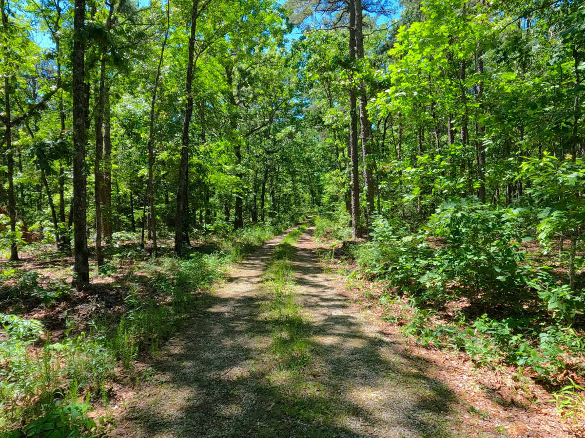
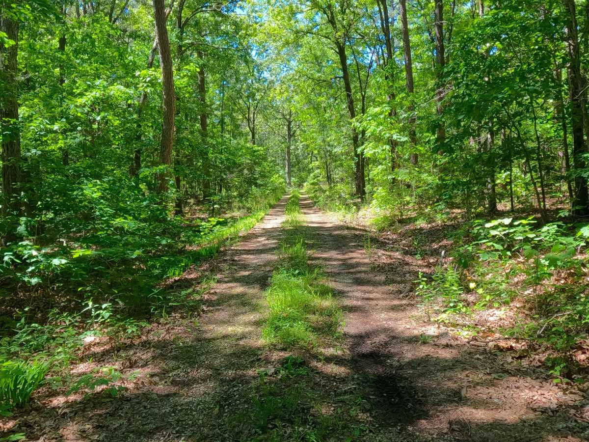
Trail Overview
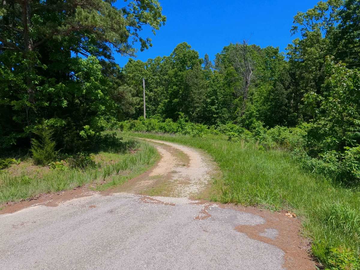
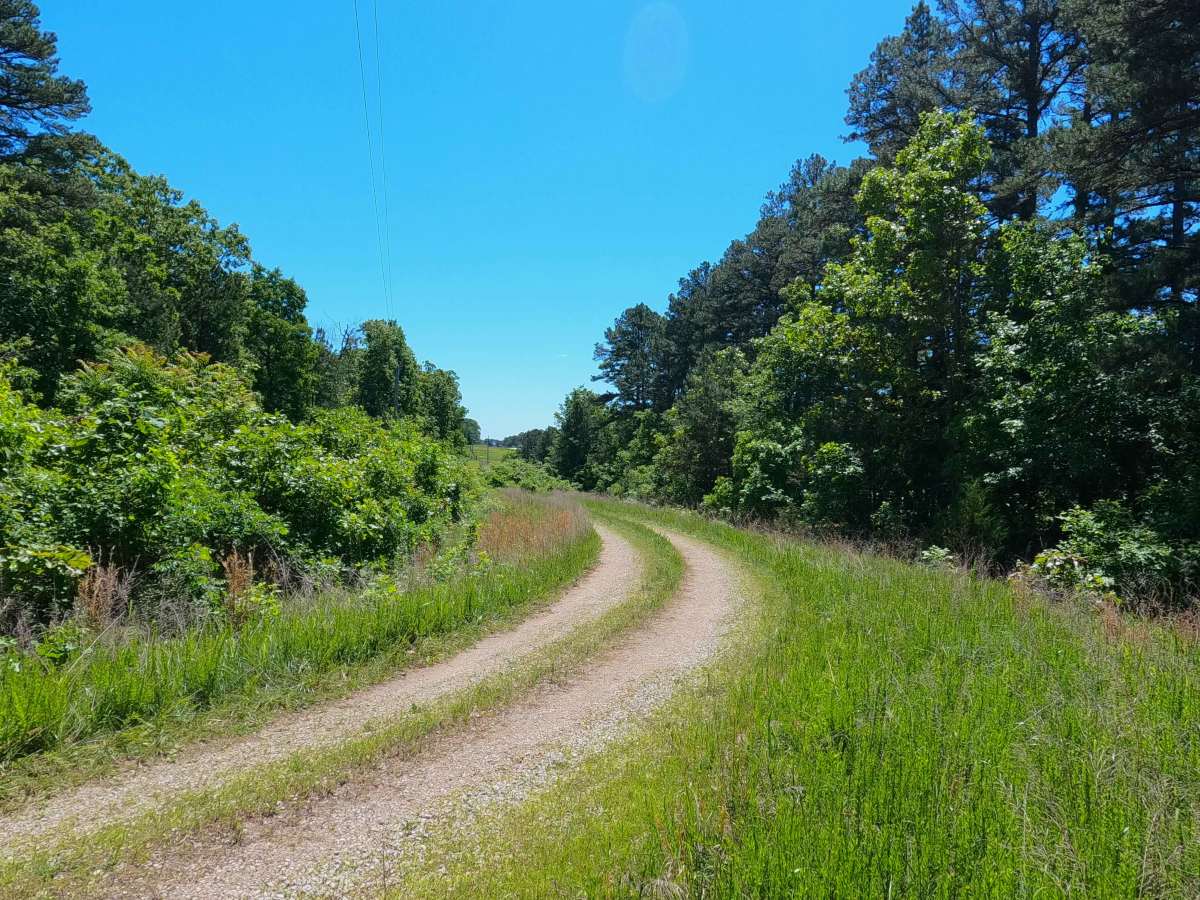
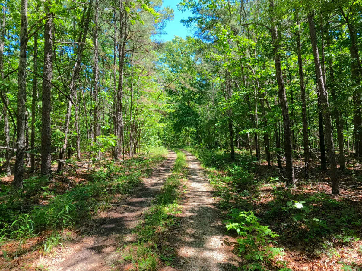
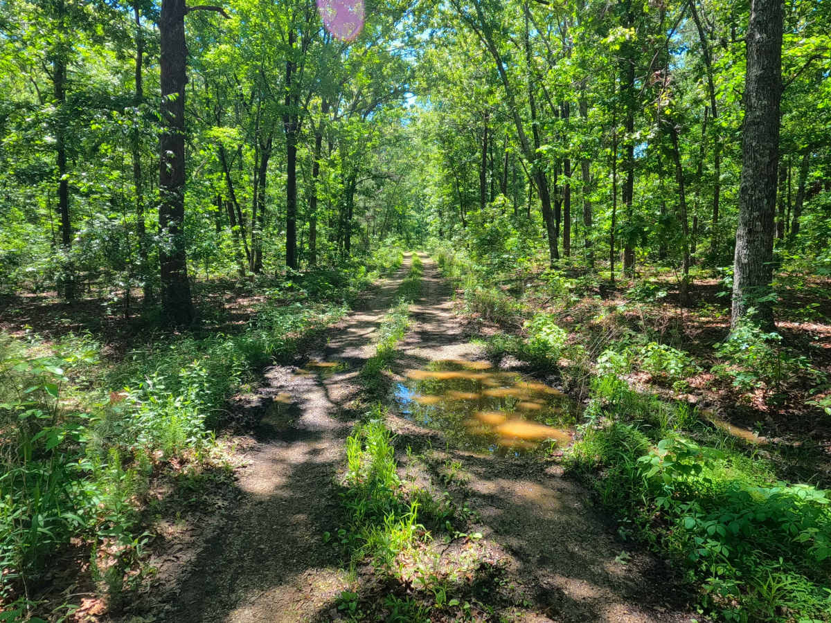
Kearney Cemetery (FS 3702), named (though misspelled) after the nearby Kearbey Cemetery, is a natural gravel and dirt road within the Poplar Bluff Unit of Mark Twain National Forest. Starting from the westbound lanes of US-60, the road first crosses the powerline tract that parallels the highway, then dives into the dense foliage of the forest, only having mild elevation changes along the raised ridge the road is placed on, with a few small water collection spots, over a well wore gravel road, passing the midway FS 3702A spur road, to cross a few more water runoff channels with small cobble bottoms before ending at a opening with enough room to loop to get turned back around, this being the ending of the MVUM-Sanctioned road, from which users must head back out the way they entered.
Difficulty
Kearney Cemetery is given a 2/10 base rating for having a splash depth water collection spot and featuring mild erosion, natural rock poking out at the surface, coarse natural gravel, and rare loose 6-10 inch cobbles, potential surface mud when wet along the sections of gravel that fade to dirt. It is also safe to expect all the gravel road complications, such as potholes, washboarding, and mounding of the gravel. Difficulty can increase in times of wet conditions, rainy seasons, and through a lack of maintenance or heavy use.
History
Strangely enough, the name spelled Kearney is incorrect as there is no Cemetery of that name nearby; however, there is a Kearbey Cemetery 0.8 mile to the northwest. After doing some research on older and modern topos, this Cemetery has always been labeled as Kearney incorrectly, of which the Forest Service just followed suit and named its nearby roads FS 3702 and 3702A after. This is another example of an interesting trend of the Forest Service naming things after real historic places, but having slight errors/variations in the spelling, in this case likely just not verifying the true spelling of the Kearbey name and trusting the topos spelling to be correct, a mistake that has persisted for at least 90-plus years on available historic topo maps. The FS 3702 road itself started appearing on the 1980 Williamsville topo, but only the length of the powerline tract entry section, and showed the full length of the current-day road for the first time in the 2011 Williamsville topo, with the later addition of the FS 3702A spur road in the 2021 edition. --- As for the real Kearbey Cemetery (also known as Cane Creek Cemetery) located on Carter County Road 367, it is the final resting place of over 70 souls, with burials dating back to 1877, continuing all the way up to 2023. Please respect those who came before us by leaving the cemetery as it is or better than it was found. Documented by Christopher Menz in 6/2026.