FSR 1409

Total Miles 3.7
Technical Rating
2 Easy
Best Time Spring, Summer, Fall
Trail Type Full-Width Road
Accessible By
Open Trail Map

Trail Overview

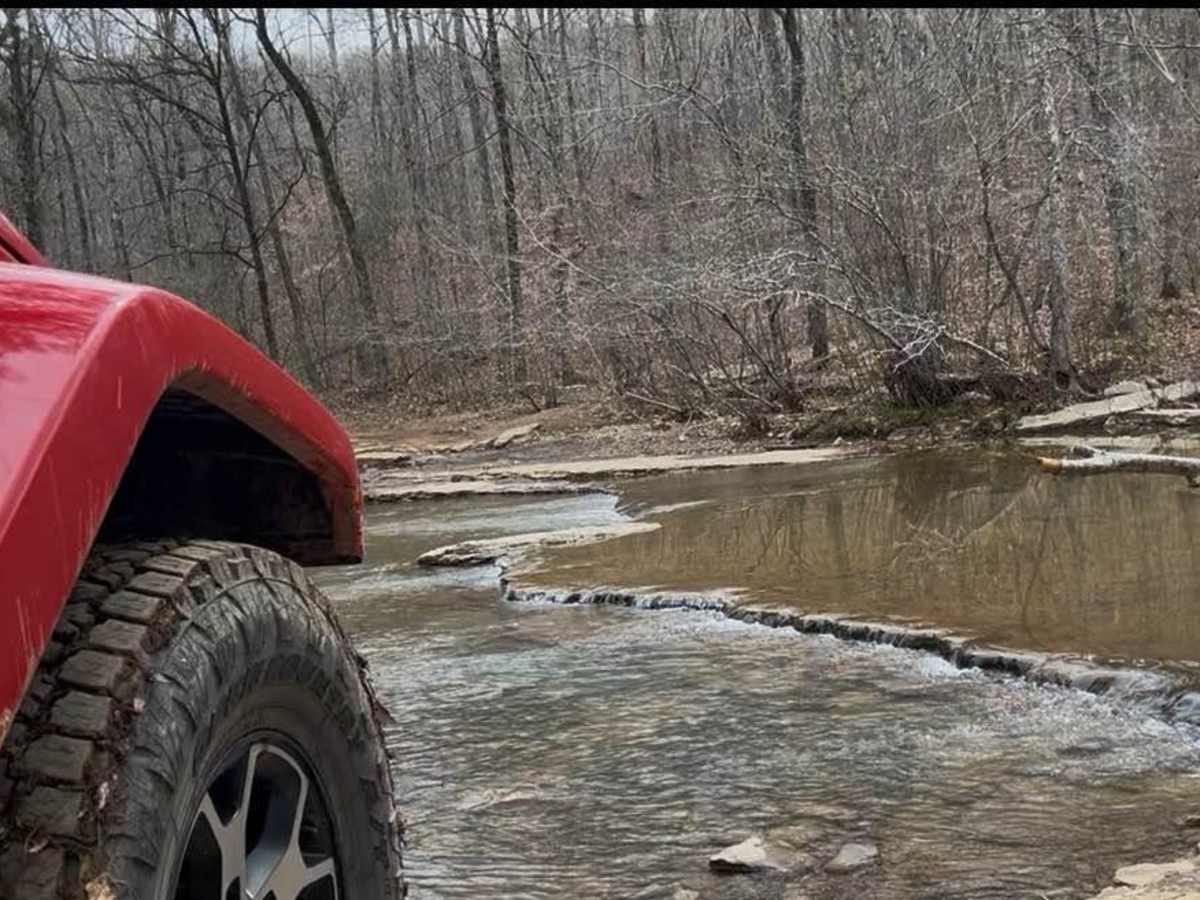
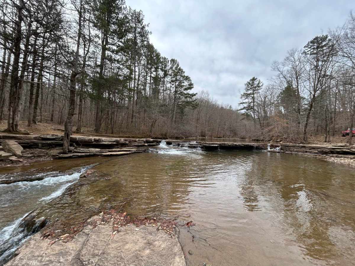
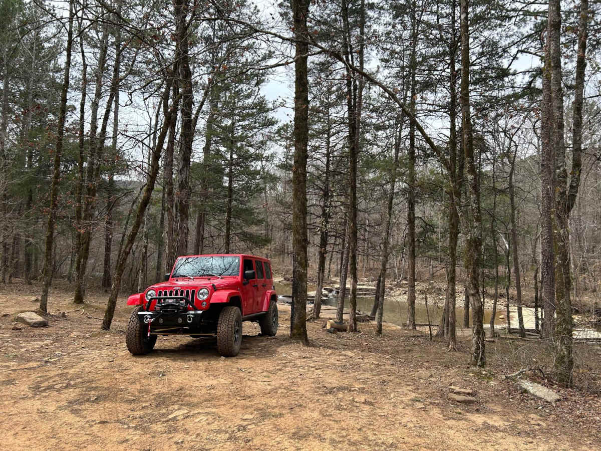
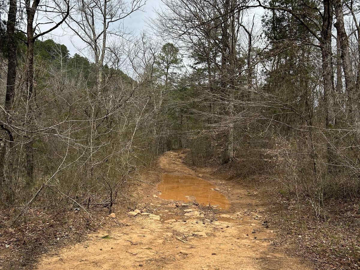
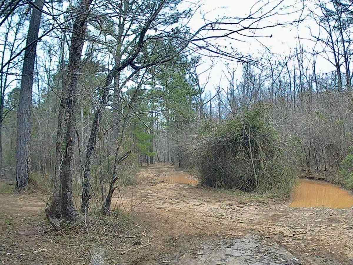
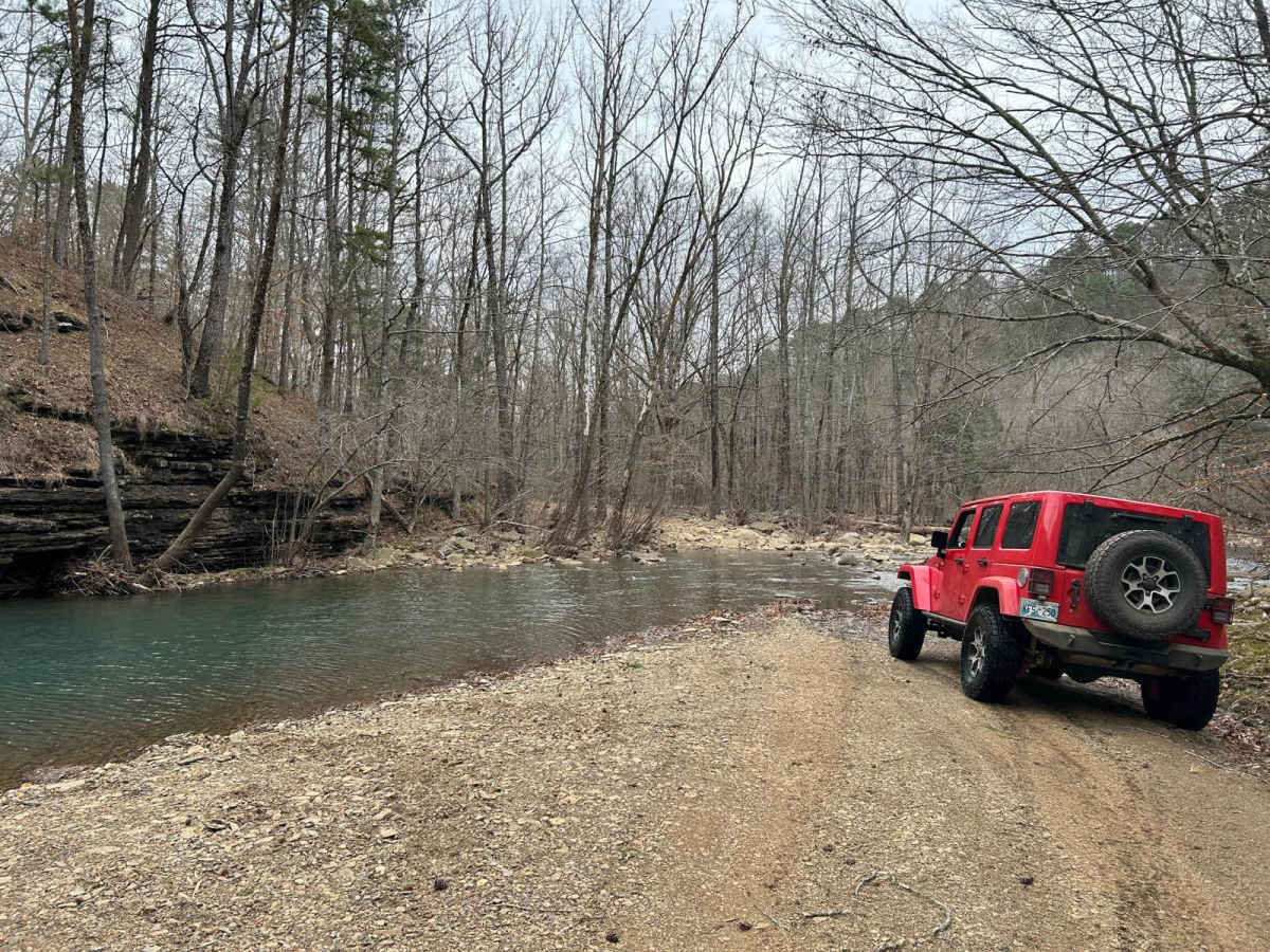
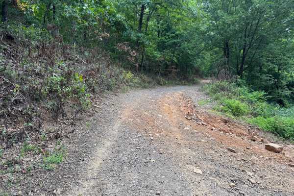
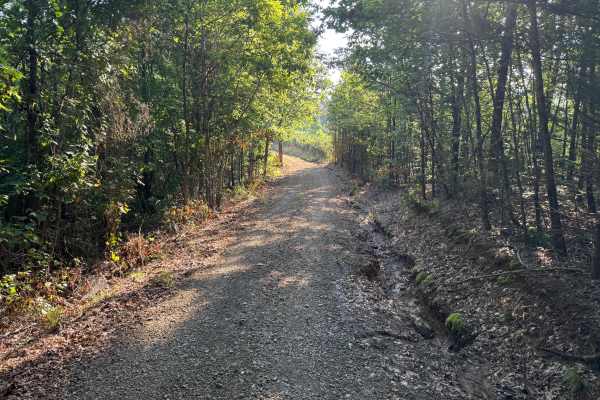
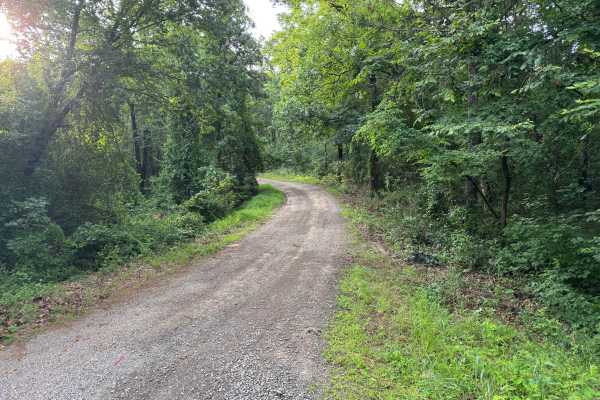
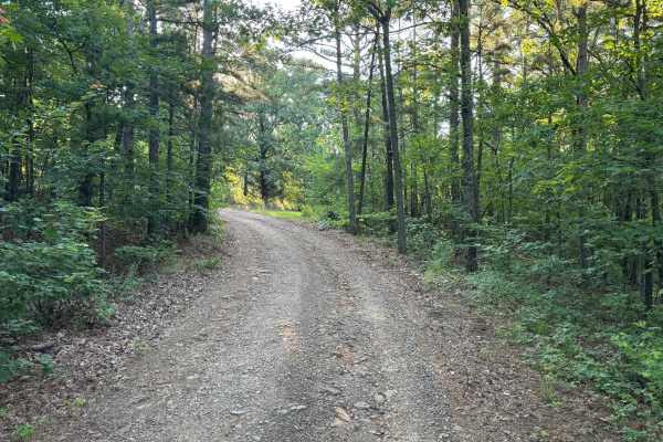
This trail starts with a water crossing at Murray Creek. The creek bottom is all rocks. After crossing, there is a large camp area with a view of Murray Creek's waterfalls. Back on the trail are dirt and rocks with several large, long pools of water to drive through. There are some workarounds if needed. The bottoms are mostly rocks. The width is extended for one vehicle only; however, there are places to pull to the side to let others pass. You will cross Murray Creek again at a scenic spot. The trail continues with rocks and various pools of water until you cross the creek again one last time. There is a stretch where you navigate rocks of different sizes as if in a creek bed, including some as large as 6" tall. The last part of the trail is easy and more expansive and appears more maintained. You will come to the old Union School at the end.

Photos of FSR 1409

Difficulty

Dirt and rock road with shallow water crossings. Rock obstacles as much as 6" tall. Road is mostly one vehicle wide.

History

This trail ends with the old Union School. You are able to go inside and tour the building. This schoolhouse was originally built in 1886, but burned in 1928. It was rebuilt in 1929. Over the years, it deteriorated as the community declined. In 2009, volunteers restored the building and opened it for others to view.

Technical Rating

2

Status Reports

Add Status Report
Sam Mayberger
May 08, 2026
Open
Trail was fun and scenic, the school house was fun too check out too. Wish I had some cash to donate to the museum. I totally underestimated one of the mud holes though and we barely made it out. That section had three different paths through the mud but only the one on the right was safe to pass (after the big water crossing and coming from the school house schoolhouse). We sank in 1/4th up our doors and only by the grace of God we made it out. Thankfully lockers and Atrac were just enough. We’d been stuck without the A trac because rear lockers weren’t enough.
Stephen Ware
May 06, 2026
Open
FS MVUM map shows FS1409 is restricted from county road JO-4670 to FS1424. Full-size rigs, highway-legal motorcycles, horses, bikes, and hikers. No OHVs allowed. Also, no motorized vehicles across the private property.
Trevor
Feb 17, 2026
Open
Note: We ran this in late December of 2025. We ran this trail coming FROM the schoolhouse, going east to west. I'll say right off the bat, this trail totaled our truck. The depth of the waterholes is no joke. If you have a full-size rig, are only slightly modified, or don't have a snorkel, I would 100 percent take the bypass to the mudhole that the other reviewer who ran this in a full-size rig mentioned. It was dark when we ran the trail and I didn't see the bypass and went for it. The spot is deceptive. Coming FROM the schoolhouse, it's only a few inches deep and has a rocky bottom for the first half, but the second half has a clay bottom with ruts that had water above my hip, and I'm 6'2. There's also a spot just before the bypassable hole with a choice of 3 mudholes and no bypass. All 3 are deep, and only one has a hard bottom. Since running this trail, I've seen multiple youtubers with fully modified rigs either have to recover or take note of the surprising depth of the pits on this trail.
David Newton
Nov 05, 2025
Open
Jon Shinneman
Oct 16, 2025
Open
Does this trail go thru? Other sources say it's closed at private property. Worked our way out of 1424. Great trail seems crazy to be marked as a "green" trail I think.
Tommy A
Sep 22, 2025
Open
Trail was rutted with rocks up 12in and mud pit much deeper than that. No recent rain.
Joseph Kieffer
Jun 28, 2025
Open
Rob Hallmark
Jun 21, 2025
Open
Water flowing well through Murray creek but no issues with any of the crossings in our group of broncos

FSR 1409 Trail can be accessed by the following ride types:

  • Single Track
  • 50 Inch
  • 60 Inch
  • High Clearance
  • Full Width

FSR 1409 Map

The onX Offroad Difference

onX Offroad combines trail photos, descriptions, difficulty ratings, width restrictions, seasonality, and more in a user-friendly interface. Available on all devices, with offline access and full compatibility with CarPlay and Android Auto. Discover what you're missing today!

Open Trail Map