Devil's Canyon

Total Miles 18.9
Technical Rating
6 Moderate
Best Time Spring, Summer, Fall, Winter
Trail Type High-Clearance 4x4 Trail
Accessible By
Open Trail Map

Trail Overview

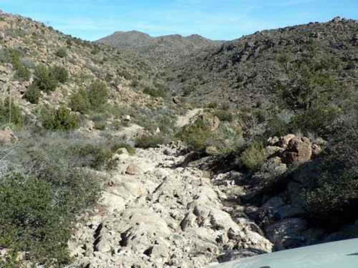
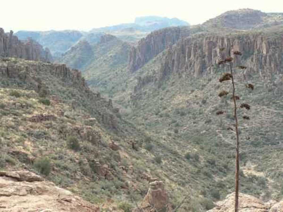
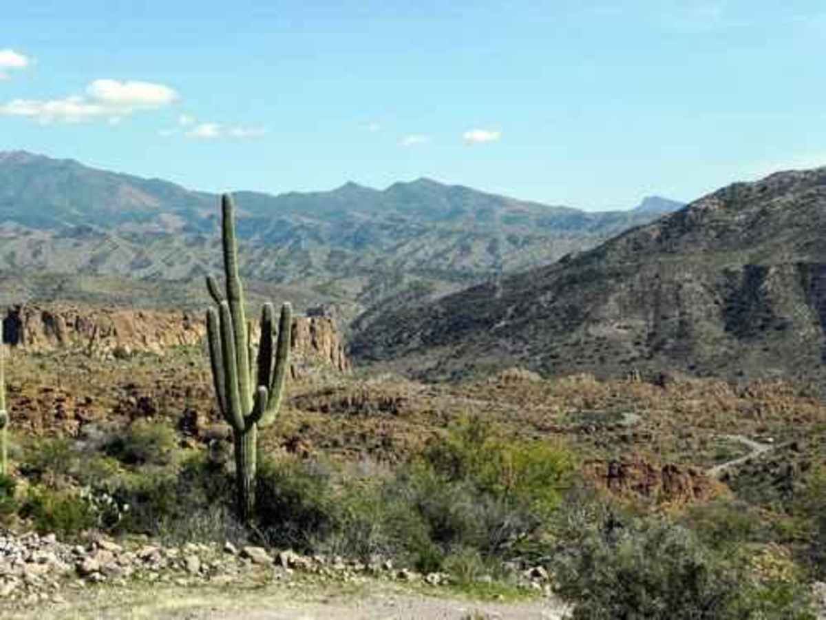
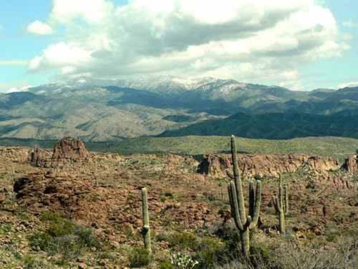
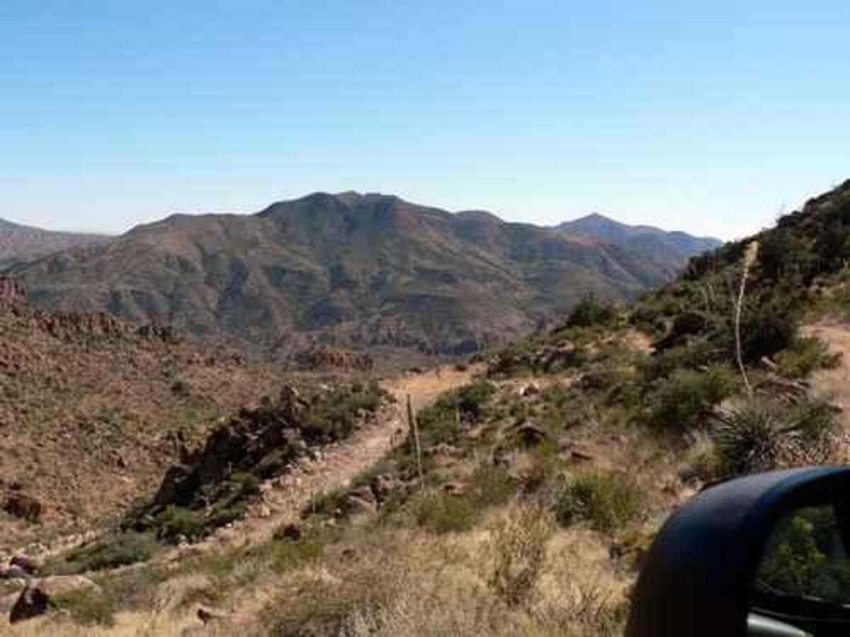
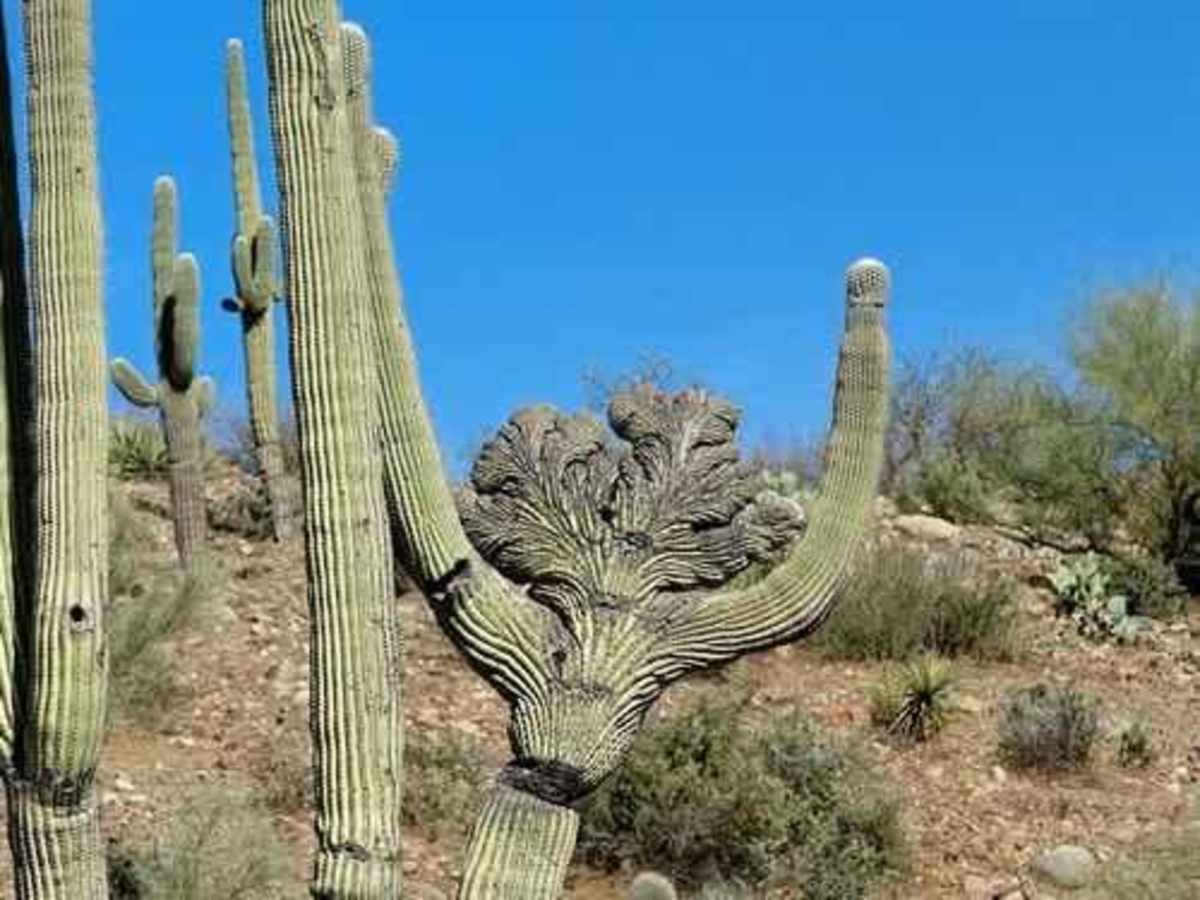
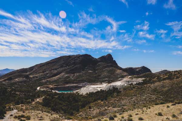
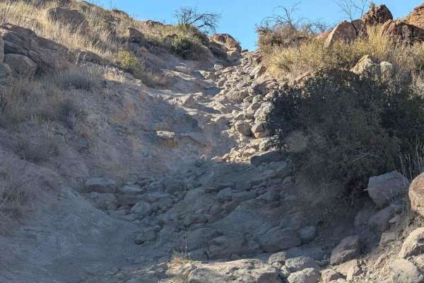
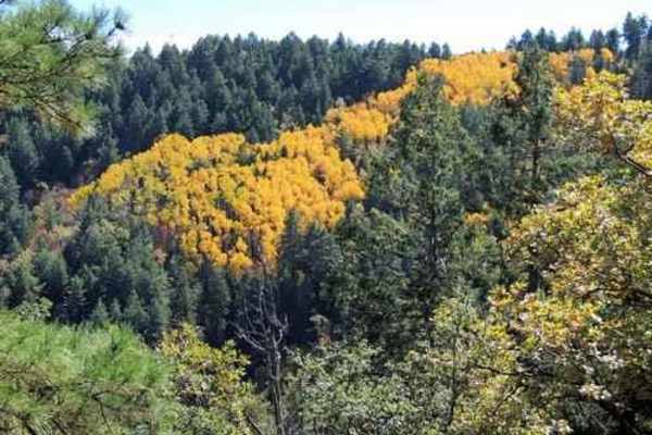
This remote, scenic trail should be done at least once by everyone with a well-equipped vehicle. It is probably moderate in most places but is very rough through the center portion. It is a long bumpy day, but you will take away good photos and great memories. Pinal Peak (right) is a nice vista at about 8,000 feet in elevation. The trail can be run either way, but west to east is recommended; it seems to be more scenic. The trail's western end was graded circa 2010 for exploratory drilling associated with the Resolution Copper Mine on the other side of Devil's Canyon. It is beginning to deteriorate, but as of 2015 is not too bad. There is a nice overlook into Devil's Canyon not too far into the trail. Shortly after that, the road gets bumpy. The trail drops down into Mineral Creek at its southernmost point. There are great views as you wind down the switchbacks. Almost as soon as you reach Mineral Creek, you will turn left up Lyons Creek. At this point, you are at about 2,900 feet in elevation. Follow Lyons Creek a short distance, then turn right and head for higher ground. Watch for a crested saguaro on the way up. At 6,000 feet in elevation, turn downhill and head for Globe. It is possible to turn left when you reach Pinto to Pinal 2.0 and go to US 60 that way, but it is quicker and easier to turn right and go through Globe. Government Springs Ranch has grazing rights along this trail and owns some of the land outright. The trail across this privately owned land can be closed at any time. Please respect the ranch and do not give them a reason to close the trail. Leave gates the way you find them. The ranch is not gated from this trail, but the manager does not want traffic through the ranch. Stay away.

Photos of Devil's Canyon

Difficulty

It's very rough and rocky through the center of the trail.

Technical Rating

6

Status Reports

Add Status Report
Clayton Henson
Sep 01, 2025
Open
trail is very scenic and enjoyable. there are a couple spots you need to take care due to larger rocks but not difficult by any means. make sure you plot your route out carefully, there are a few areas with electronically gated private property signs, we had to go around these and lost some time. still very enjoyable!
G Griff
Feb 17, 2025
Open
Amazing scenery, super fun trail , took about 6 1/2 hours pavement to pavement
AJ Carr
Aug 10, 2024
Open
This is not a run to explore alone. it is very remote and there are plenty of technical sections where trouble can occur. Make absolutely sure you have good tires and bring plenty of extra water and some food. This is a long and bumpy day. It took us and our 2 vehicles a full 8 hours to make it out. Without question, one of the most beautiful trail runs I've done. Just go very prepared.
Dalton Nadeau
Mar 15, 2024
Open
Ran trail west to east, trail starts very easy and gets progressively harder towards the Center, multiple uphill climbs on loose rock with medium sized boulders, a couple steep off camber down hill sections on slick rock, lots of sections which can cause body damage if you don’t have a lift and big tires, multiple ranch gates you need to open, remember to close them behind you. Lots of cattle, sometimes in the middle of the road. After you pass through the spring ranch and on to the second half you will encounter some heavily off camber tight section that are extremely slick when wet with a hazard of sliding off the cliff face (up to 25 degrees) as you ascend the mountains, reached a total altitude of 6400ft, into the clouds as we drove a ridge along the top of the mountains. Road will eventually come out into a forest with a campground and its smooth sailing from there to the end on graded road
ian sauter
Dec 09, 2023
Open
Andrew Riggs
Nov 18, 2023
Open
Eric Tomaszewski
May 04, 2023
Open

Devil's Canyon Trail can be accessed by the following ride types:

  • Single Track
  • 50 Inch
  • 60 Inch
  • High Clearance

Devil's Canyon Map

The onX Offroad Difference

onX Offroad combines trail photos, descriptions, difficulty ratings, width restrictions, seasonality, and more in a user-friendly interface. Available on all devices, with offline access and full compatibility with CarPlay and Android Auto. Discover what you're missing today!

Open Trail Map