
Off-Road Trails
Near Willow Creek, Montana
Off-Road Trails Near Willow Creek, Montana
Discover the best offroad trails near you. Browse trail maps, check difficulty ratings, and find your next adventure — whether you're looking for a quick ride or an all-day expedition.
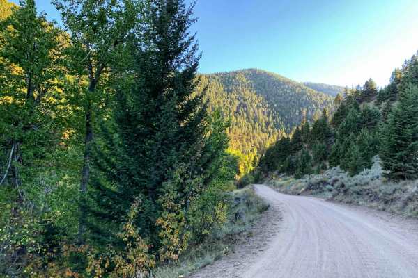
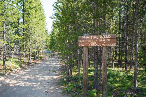
Potosi Willow Creek
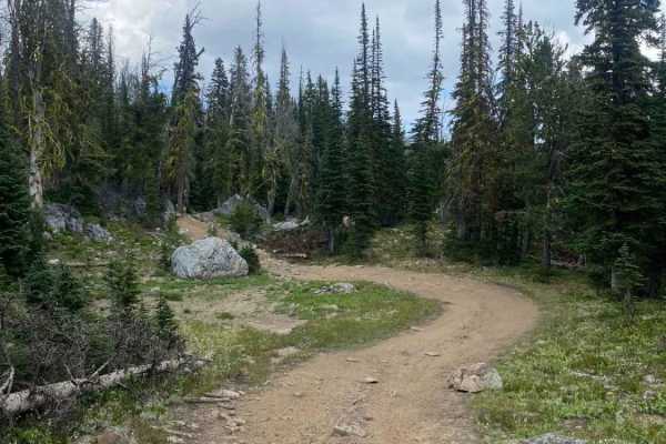
This is an easy grated out and back dirt road begins through some open range before turning up into the mountains. Watch for range cattle on the road early in the trail. Once the trail starts heading up into the mountains a creek appears along the left side of the trail. There are a couple of areas ...
Learn more about Potosi Willow Creek
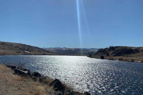
Buffalo Jump - Black Fords Fish Access
This is an easy trail with plenty of incredible scenery. Consisting of mostly dirt and gravel, the trail is typically maintained fairly well year-round. Depending on the time of year, you can expect to see bison roaming, a phenomenal view of the Madison River, and beautiful buttes and mountains. Alo...
Learn more about Buffalo Jump - Black Fords Fish Access
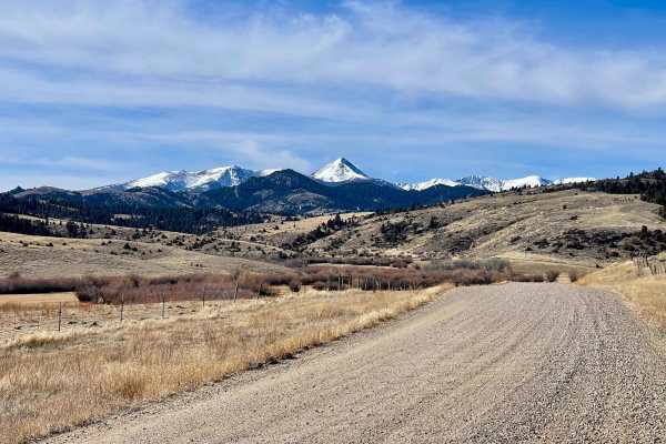
Revenue Flats BLM
Tucked into the Madison Valley just west of Norris, Revenue Flats is one of southwestern Montana's best-kept secrets — a sprawling BLM playground offering free dispersed camping, rock climbing, mountain biking, and wide-open riding just 36 miles from Bozeman. Sweeping views of the Tobacco Root and M...
Learn more about Revenue Flats BLM
Axtell Anceney Road
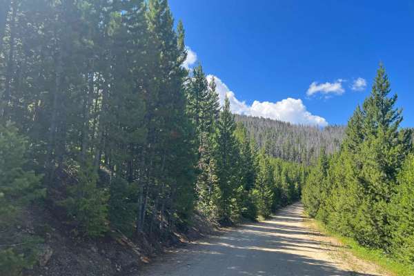
This point-to-point dirt and gravel two-lane road connects Highway 191 south of Four Corners to Norris Road west of Four Corners, offering a scenic alternative to the main highway. Portions of the road are unmaintained, and following recent snowmelt or rain, the surface can become very muddy and rut...
Learn more about Axtell Anceney Road
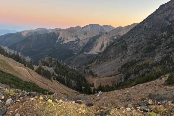
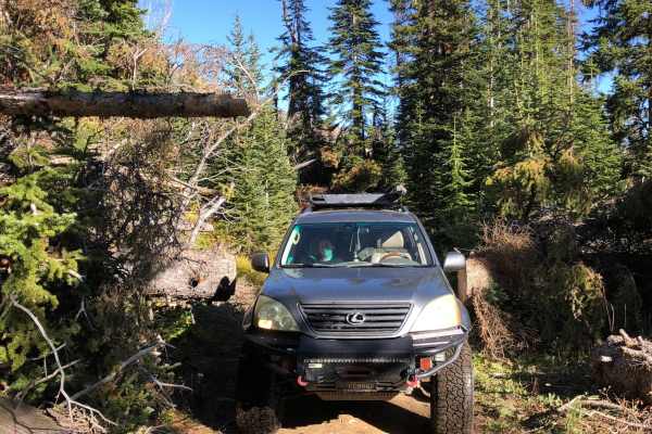
Falling Down The Mountain
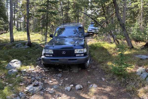
The trail steeply descends a narrow, windy, and rocky path through a dense pine forest towards the South Willow Creek drainage, Potosi Campground, and hot springs. The trail is narrow, windy, and rocky, with almost no opportunities to turn around or pass other vehicles. A saw is recommended for clea...
Learn more about Falling Down The Mountain
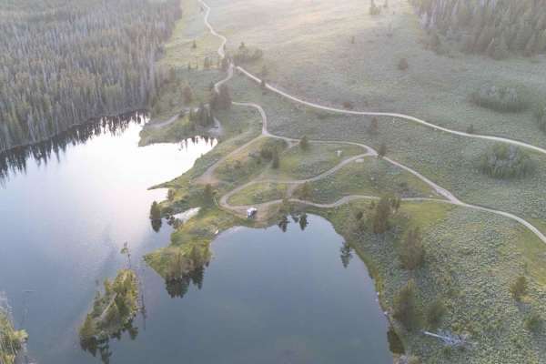
Sureshot Lakes
The trail travels to Sureshot and Upper Sureshot Lakes before climbing up and down a mountain saddle via a series of switchbacks. The trail travels in and out of pine forest with great views along the way. A mix of offroad and OHV vehicles use the trail. Stay on designated trails. Pack out trash. Dr...
Learn more about Sureshot Lakes
North Meadow - Twin Lakes
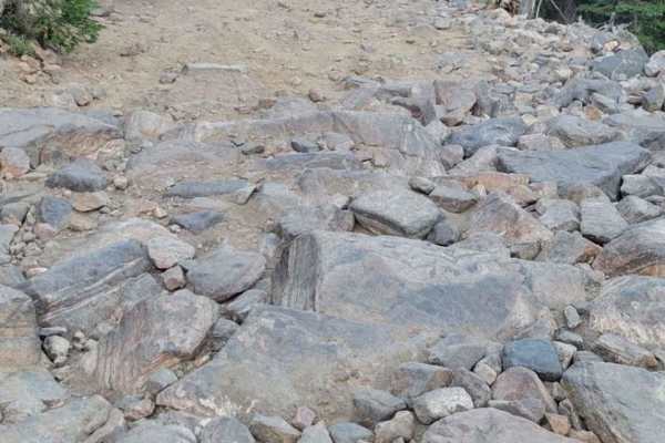
North Meadows is a rocky, boulder-filled trail with the beautiful Twin Lakes at the top that provide great fishing and beautiful campsites. Sliders are heavily recommended for this trail, as you'll be crawling over boulders nearly the entire way, and there aren't bypasses for the long rocky sections...
Learn more about North Meadow - Twin Lakes
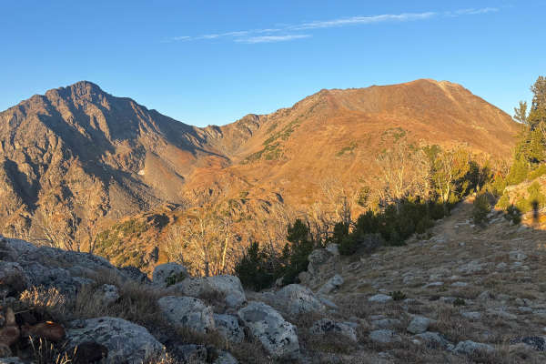
Blaine Mountain Road
This rocky road branches off the main Sureshot Lakes Road and climbs toward Mount Bradley. Expect steep off-camber rutted sections, boulder fields, tight hairpin switchbacks, and exposed straightaways. Several technical cruxes add challenge, especially near the top, where rock sliders are recommende...
Learn more about Blaine Mountain Road
Tobacco Gold Pass
This old mining road off Granite Lake Road features granite faces and expansive views of the Tobacco Root Mountains. The surface is dirt and stretches of loose rock, generally passable in dry conditions. A few pull-offs provide dispersed camping opportunities. The trail ends at a saddle that marks t...
Learn more about Tobacco Gold Pass
Dry Creek Road
Point-to-point, moderately traveled road north of Belgrade in the Gallatin Valley. Maintained dirt and gravel surface, typically two vehicles wide. Should not require 4WD in dry conditions. Expect muddy conditions when wet, and some drifting snow over the road in winter. If starting from the south, ...
Learn more about Dry Creek Road
Granite Lake
Fairly easy trail with some great views. Trail got narrow in some spots from freshly cut trees. Some quick switchbacks could be challenging in a longer wheelbase. Not a lot of traffic on the trail and obstacles were mostly the rutted dirt trail. Some loose rocks but nothing to worry about.
Learn more about Granite Lake
North Meadow - McKelvey
Progressively harder trail that winds along North Meadow Creek for the first 2 miles before climbing to over 9,000 feet to access McKelvy Lake, Mine Lake, and Cliff Lake (Note the final segment to Cliff is designated as a 50"). Obstacles of note are the gatekeeper 50 yards in as a preview of what yo...
Learn more about North Meadow - McKelvey
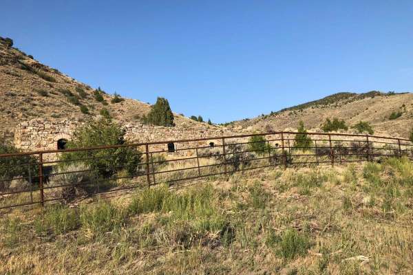
Lombard Coke Ovens
Traveling this rough clay-based gravel road between Toston and Lombard, you can expect to see range cattle, prickly pear cacti, plenty of sagebrush, and rattlesnakes. Use extreme caution on this road in the rain. Numerous washouts could make it dangerous. As you gain more than 1,300 feet in elevatio...
Learn more about Lombard Coke Ovens
Cliff Lake Trail
This is a very short trail to Cliff Lake at the top of the McKelvey Lake Trail and accessed from Mine Lake. Although short, the lake is absolutely worth seeing and the fishing is great. This trail looks wide enough for a rig or SxS but is a 50" ATV or dirt bike trail only!
Learn more about Cliff Lake Trail

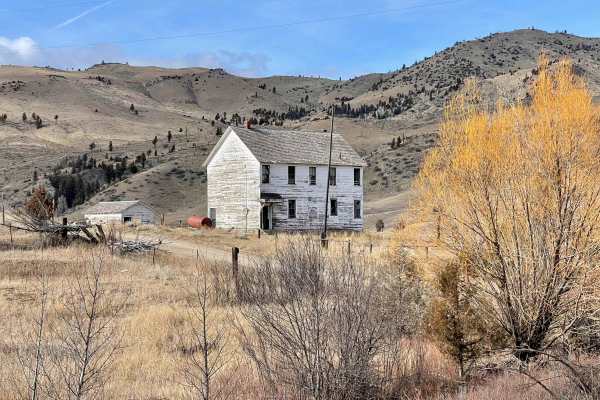
Point of Jefferson River Loop
This mostly dirt loop trail takes you from the downtown of Whitehall into the countryside and drives along the Jefferson River. There are several spots along the trail that have excellent views of the river from above. Most of the land along this trail is private, but there is a small square of BLM ...
Learn more about Point of Jefferson River Loop
Virginia Creek (1249)
The Tobacco Mountains are a fun day of exploring lots of shorter side trails. The amount of time here really depends on how much exploring you want to do. There is nothing extremely difficult here from a trail perspective; in fact, this is a great area for the less experienced driver to get some whe...
Learn more about Virginia Creek (1249)
South Baldy Loop
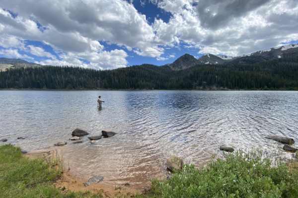
South Meadow Creek Lake
The South Meadow Creek Lake Trail is an out and back in Beaverhead National Forest, Montana. The trail has beautiful views throughout, especially at the mountain lake. The first half is very easy and then gets increasingly difficult during the climb. The obstacles in the final stretch will likely be...
Learn more about South Meadow Creek Lake
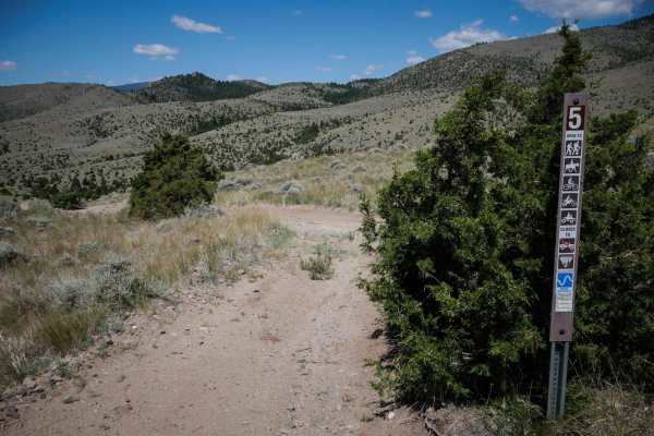
BLM 5 (Ringing Rocks)
BLM 5 is an ATV trail in the Pipestone OHV area that is closed to full-width vehicles. It starts off at BLM 4 and winds down a hillside to the intersection with BLM 3. It's mostly a smooth and easy dirt trail, but the surface is uneven with little whoops. It's super easy for ATVs and dirt bikes. The...
Learn more about BLM 5 (Ringing Rocks)
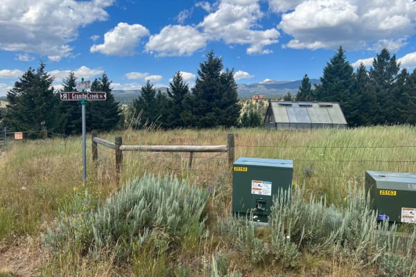
Granite Creek Road (161/49)
This is a regularly maintained Forest Service Road that takes you from the Tobacco Mountains down to Highway 287, approximately 3 miles southwest of Nevada City, Montana. The route takes you to some very interesting viewpoints. A waypoint is included with this track that you don't want to miss. It i...
Learn more about Granite Creek Road (161/49)
ATV trails near Willow Creek, Montana
Explore ATV-friendly trails near you. These trails are accessible for vehicles up to 50 inches wide, perfect for ATVs and smaller off-road machines.
Buffalo Jump - Black Fords Fish Access
This is an easy trail with plenty of incredible scenery. Consisting of mostly dirt and gravel, the trail is typically maintained fairly well year-round. Depending on the time of year, you can expect to see bison roaming, a phenomenal view of the Madison River, and beautiful buttes and mountains. Alo...
Learn more about Buffalo Jump - Black Fords Fish Access
Revenue Flats BLM
Tucked into the Madison Valley just west of Norris, Revenue Flats is one of southwestern Montana's best-kept secrets — a sprawling BLM playground offering free dispersed camping, rock climbing, mountain biking, and wide-open riding just 36 miles from Bozeman. Sweeping views of the Tobacco Root and M...
Learn more about Revenue Flats BLM
Axtell Anceney Road
This point-to-point dirt and gravel two-lane road connects Highway 191 south of Four Corners to Norris Road west of Four Corners, offering a scenic alternative to the main highway. Portions of the road are unmaintained, and following recent snowmelt or rain, the surface can become very muddy and rut...
Learn more about Axtell Anceney Road
Falling Down The Mountain
The trail steeply descends a narrow, windy, and rocky path through a dense pine forest towards the South Willow Creek drainage, Potosi Campground, and hot springs. The trail is narrow, windy, and rocky, with almost no opportunities to turn around or pass other vehicles. A saw is recommended for clea...
Learn more about Falling Down The Mountain
UTV/side-by-side trails near Willow Creek, Montana
Find UTV and side-by-side trails near you. These trails accommodate vehicles up to 60 inches wide, ideal for UTVs, side-by-sides, and wider off-road rigs.
Buffalo Jump - Black Fords Fish Access
This is an easy trail with plenty of incredible scenery. Consisting of mostly dirt and gravel, the trail is typically maintained fairly well year-round. Depending on the time of year, you can expect to see bison roaming, a phenomenal view of the Madison River, and beautiful buttes and mountains. Alo...
Learn more about Buffalo Jump - Black Fords Fish Access
Revenue Flats BLM
Tucked into the Madison Valley just west of Norris, Revenue Flats is one of southwestern Montana's best-kept secrets — a sprawling BLM playground offering free dispersed camping, rock climbing, mountain biking, and wide-open riding just 36 miles from Bozeman. Sweeping views of the Tobacco Root and M...
Learn more about Revenue Flats BLM
Axtell Anceney Road
This point-to-point dirt and gravel two-lane road connects Highway 191 south of Four Corners to Norris Road west of Four Corners, offering a scenic alternative to the main highway. Portions of the road are unmaintained, and following recent snowmelt or rain, the surface can become very muddy and rut...
Learn more about Axtell Anceney Road
Falling Down The Mountain
The trail steeply descends a narrow, windy, and rocky path through a dense pine forest towards the South Willow Creek drainage, Potosi Campground, and hot springs. The trail is narrow, windy, and rocky, with almost no opportunities to turn around or pass other vehicles. A saw is recommended for clea...
Learn more about Falling Down The Mountain
The onX Offroad Difference
onX Offroad combines trail photos, descriptions, difficulty ratings, width restrictions, seasonality, and more in a user-friendly interface. Available on all devices, with offline access and full compatibility with CarPlay and Android Auto. Discover what you're missing today!
Open Trail Map