
Off-Road Trails
Near Cashion Community, Texas
Off-Road Trails Near Cashion Community, Texas
Discover the best offroad trails near you. Browse trail maps, check difficulty ratings, and find your next adventure — whether you're looking for a quick ride or an all-day expedition.
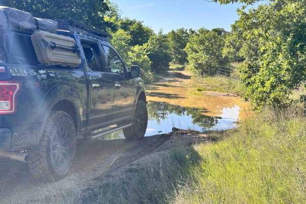
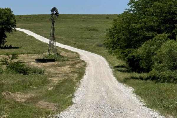
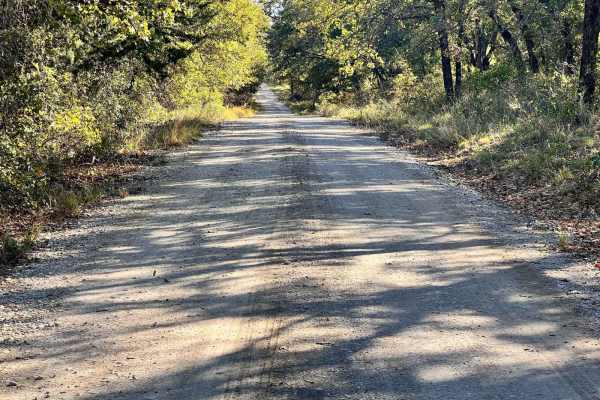
Lake Bryson Road
Lake Bryson Road is a public road giving access to Lake Bryson. The dirt starts as soon as you turn off the pavement in the town of Bryson. Lake Bryson Road is hardly maintained. You will experience small rocks sticking up through the caliche road base. You will quickly run into the gatekeeper obsta...
Learn more about Lake Bryson Road
Miller Access Trail
This is a short scenic drive on gravel that takes you through the Lyndon B. Johnson National Grassland. There are some ponds in the area that can be accessed by using some offshoots. The trail can be accessed by 1655 County Road and Gossett-Foster Road. This is an easy road that can be completed wit...
Learn more about Miller Access Trail
E-101 Minos Loop
E-101 Minos Loop is a moderately difficult trail that is challenging without being overly technical. It’s a great option for drivers who are ready to start tackling harder obstacles while keeping the risk of vehicle damage relatively low.
The trail is primarily made up of boulders and rock ledges, ...
Learn more about E-101 Minos Loop
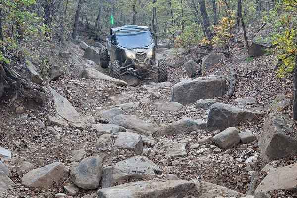
The Twins B-27a
The Twins is a Level 5 rock crawling trail located in Northwest OHV Park. This trail starts as a small to medium loose boulder field, and as you begin the climb, the boulders become larger, with multiple large ledges of over 3 feet, loose dirt, slick rocks, and large holes, making this climb very ch...
Learn more about The Twins B-27a
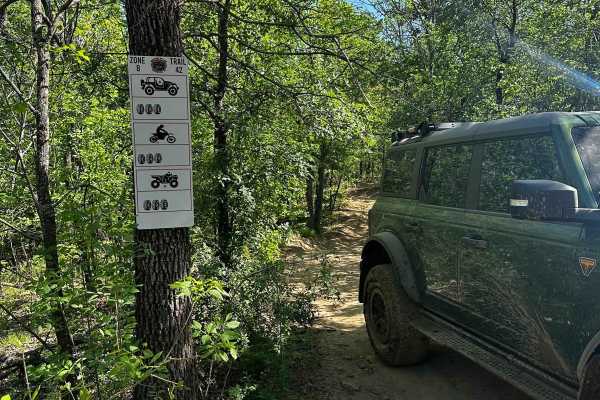
B-45
B-45 is a short intermediate trail that branches off of B-26D Spider Web Loop. This trail has a small, rocky, and narrow feature at the entry, which is the most difficult part of the trail. It then leads to a winding, off-camber climb that reconnects to Spider Web Loop Trail B-26E.
Learn more about B-45
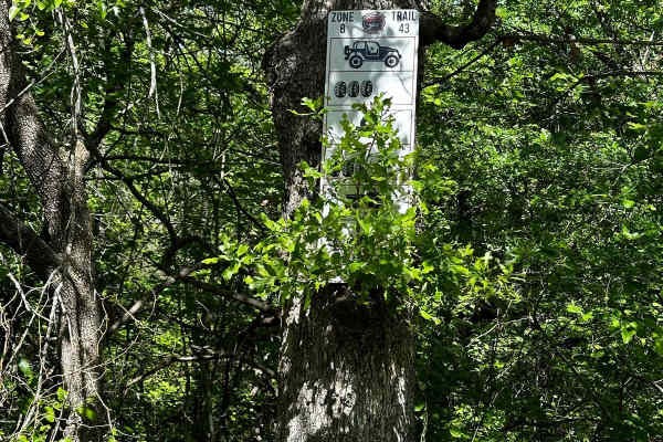
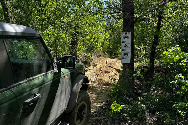
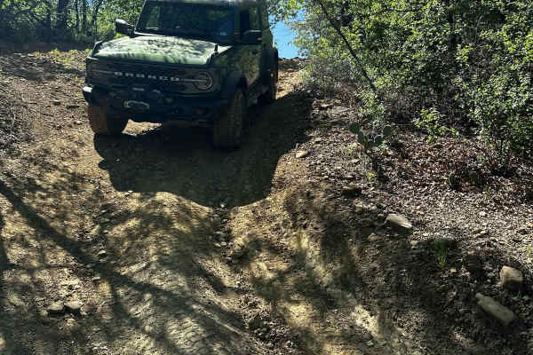
B-43
B-43 starts as an easy trail through the trees and leads down to a tight wash area with dirt rock ledges and trees on each side, which could make navigation difficult in a longer vehicle. After that section, the trail takes you to a section with large, deep ruts that are very difficult to pass due t...
Learn more about B-43
B-44
B-44 is a short, easy trail that branches off of B-26E Spider Web Loop. This trail starts with a loose, rocky, and slightly rutted descent that runs parallel to B-26 Spider Web Loop. After the descent, the trail winds through trees and leads to an intersection of B-26D Spider Web Loop and B-43 trail...
Learn more about B-44
B-42
B-42 is a trail that connects north to south through the middle of B-26 Spider Web Loop and also provides access to B-43 trail. Along this trail, deep ruts have formed which can make passage difficult, especially during wet weather. Additionally, there are optional very deep mud holes on the trail, ...
Learn more about B-42
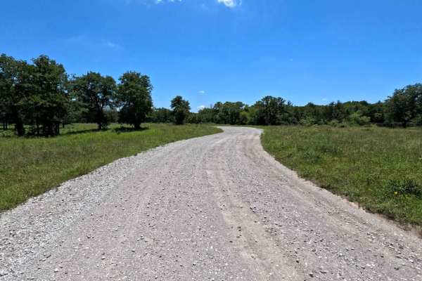
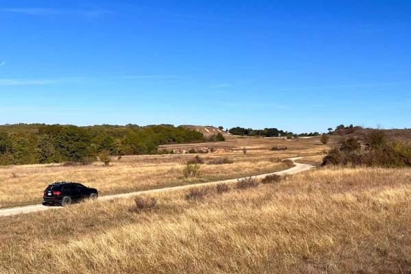
Mesa - 900
This is a well-maintained gravel road through the scenic LBJ Grasslands. There are no major obstacles or water crossings, but lots of campsites and photo ops. Find somewhere to pull off and have a picnic, or use one of the pavilions near the trailhead. This is the perfect trail for people looking fo...
Learn more about Mesa - 900
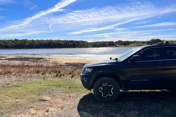
Hopewell Road
Hopewell Road is a Forest Service Road for the LBJ National Grasslands. This road is maintained all year long. this gravel road has many campsites littered along the route. The trail ends at Clear Lake. This side of Clear Lake is more for camping as the other side has a dock and a boat ramp for day ...
Learn more about Hopewell Road
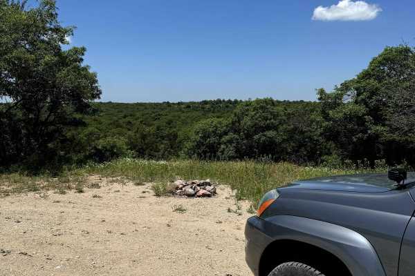
Scenic Overlook - 900H
This trail has a beautiful view with multiple campsites. It is a branch off the Mesa - 900 trail and connects back to it on both sides. The campsites have stone fire pits and the entire trail is surrounded by flowers overlooking a scenic view to the north. Be sure to check for campsite availability ...
Learn more about Scenic Overlook - 900H
Gravel Pit - 904
This is an access point to the LBJ Grasslands system of trails. There is a lot of room to air down and secure gear just inside the gate if needed. Be aware of horseback riders coming in from the farms in the area, as these are mixed-use trails. You can expect two-way traffic on this road, so drive c...
Learn more about Gravel Pit - 904
Overloop Bluff
Overlook Bluff Road is a maintained forest service road that runs up a steep incline to a beautiful lookout with some dispersed camping. The views are exceptional but there is a lot of traffic in this area too. Several locations along Overlook Bluff have difficult obstacles to test your vehicle on b...
Learn more about Overloop Bluff
920B Spur
920B is a Forest Service Road that branches off and returns to Overlook Bluff. This there-and-back road has unique sights to see as you traverse through a beautiful landscape just below the overlook. There is no camping on this road but just above the bluff, you can find ample campsites. The road is...
Learn more about 920B Spur
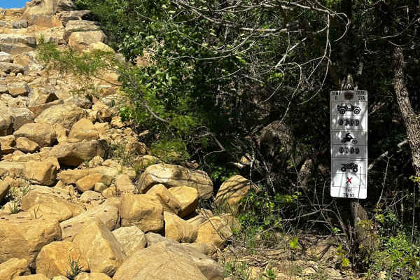
ATV trails near Cashion Community, Texas
Explore ATV-friendly trails near you. These trails are accessible for vehicles up to 50 inches wide, perfect for ATVs and smaller off-road machines.
Lake Bryson Road
Lake Bryson Road is a public road giving access to Lake Bryson. The dirt starts as soon as you turn off the pavement in the town of Bryson. Lake Bryson Road is hardly maintained. You will experience small rocks sticking up through the caliche road base. You will quickly run into the gatekeeper obsta...
Learn more about Lake Bryson Road
E-101 Minos Loop
E-101 Minos Loop is a moderately difficult trail that is challenging without being overly technical. It’s a great option for drivers who are ready to start tackling harder obstacles while keeping the risk of vehicle damage relatively low.
The trail is primarily made up of boulders and rock ledges, ...
Learn more about E-101 Minos Loop
B-45
B-45 is a short intermediate trail that branches off of B-26D Spider Web Loop. This trail has a small, rocky, and narrow feature at the entry, which is the most difficult part of the trail. It then leads to a winding, off-camber climb that reconnects to Spider Web Loop Trail B-26E.
Learn more about B-45
B-43
B-43 starts as an easy trail through the trees and leads down to a tight wash area with dirt rock ledges and trees on each side, which could make navigation difficult in a longer vehicle. After that section, the trail takes you to a section with large, deep ruts that are very difficult to pass due t...
Learn more about B-43
UTV/side-by-side trails near Cashion Community, Texas
Find UTV and side-by-side trails near you. These trails accommodate vehicles up to 60 inches wide, ideal for UTVs, side-by-sides, and wider off-road rigs.
Lake Bryson Road
Lake Bryson Road is a public road giving access to Lake Bryson. The dirt starts as soon as you turn off the pavement in the town of Bryson. Lake Bryson Road is hardly maintained. You will experience small rocks sticking up through the caliche road base. You will quickly run into the gatekeeper obsta...
Learn more about Lake Bryson Road
E-101 Minos Loop
E-101 Minos Loop is a moderately difficult trail that is challenging without being overly technical. It’s a great option for drivers who are ready to start tackling harder obstacles while keeping the risk of vehicle damage relatively low.
The trail is primarily made up of boulders and rock ledges, ...
Learn more about E-101 Minos Loop
The Twins B-27a
The Twins is a Level 5 rock crawling trail located in Northwest OHV Park. This trail starts as a small to medium loose boulder field, and as you begin the climb, the boulders become larger, with multiple large ledges of over 3 feet, loose dirt, slick rocks, and large holes, making this climb very ch...
Learn more about The Twins B-27a
B-45
B-45 is a short intermediate trail that branches off of B-26D Spider Web Loop. This trail has a small, rocky, and narrow feature at the entry, which is the most difficult part of the trail. It then leads to a winding, off-camber climb that reconnects to Spider Web Loop Trail B-26E.
Learn more about B-45
The onX Offroad Difference
onX Offroad combines trail photos, descriptions, difficulty ratings, width restrictions, seasonality, and more in a user-friendly interface. Available on all devices, with offline access and full compatibility with CarPlay and Android Auto. Discover what you're missing today!
Open Trail Map