
Off-Road Trails
Near Blue River, Colorado
Off-Road Trails Near Blue River, Colorado
Discover the best offroad trails near you. Browse trail maps, check difficulty ratings, and find your next adventure — whether you're looking for a quick ride or an all-day expedition.
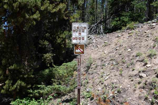
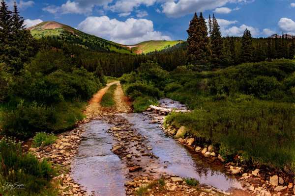
Pennsylvania/Indiana Creek- FR 611
This trail is rocky with some deep ruts for about the first Mile then it gets easier. There are a few sections at the beginning that are rocky after that and some areas that are narrow and hard to pass oncoming traffic. Some of the switchbacks are tight and will require some maneuvering to get aroun...
Learn more about Pennsylvania/Indiana Creek- FR 611
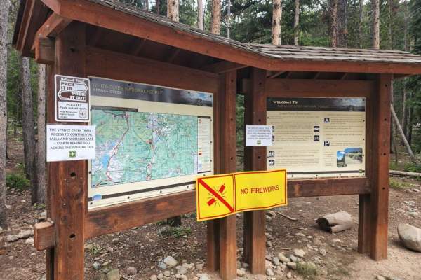
Crystal Road - Spruce Creek Road
If you have done Peak 10, this is the little road and Lake you are staring down at. Crystal Road is usually combined with Spruce Creek Road, although the connector between them is no longer open. Spruce Creek is a popular hiking area on weekends to the Mayflower and Mohawk Lakes, but few people use...
Learn more about Crystal Road - Spruce Creek Road
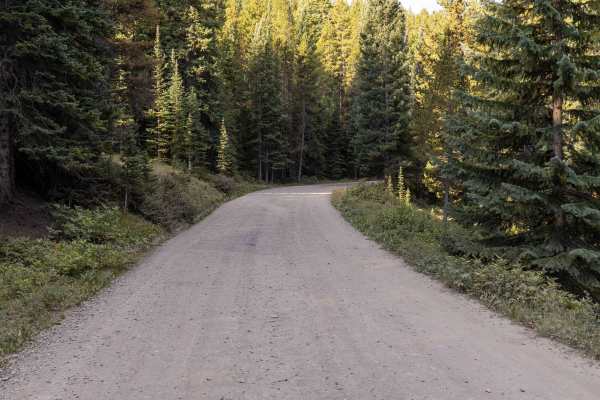
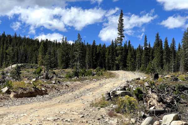
Boreas Pass
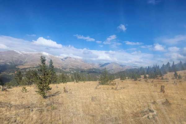
Boreas Pass is a wide, well-graded gravel road that makes for an easy and scenic drive across the Continental Divide. Suitable for 2WD vehicles throughout, the road poses no obstacles and is one of the more accessible high passes in Colorado. Wildlife sightings are common—particularly moose in the w...
Learn more about Boreas Pass
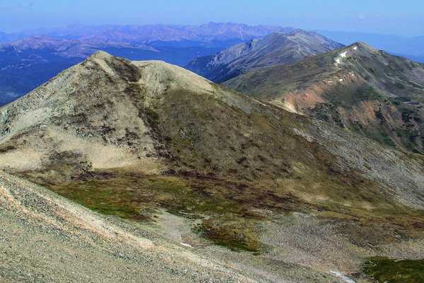
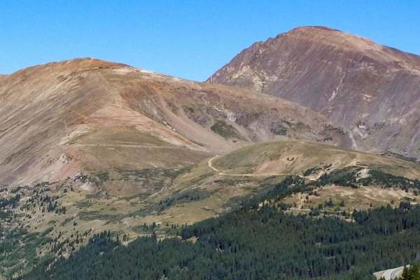
Peak 10 Breckenridge
You can go up Peak 9 through the ski area and traverse over to Peak 10. It's a great little adventure with some of the best scenery in the area. This trail is not open to unlicensed vehicles and is closed in the wintertime.
Learn more about Peak 10 Breckenridge
Mt. Baldy Road
This is a street legal only spur off of Boreas Pass to the summit (almost) of Mt Blady, to the east of Breckenridge offering excellent views of the town of Breckenridge, the ski area, as well as many of the trails outside of Montezuma (Deer Creek, St. John's, Webster, Red Cone, etc). The road is re...
Learn more about Mt. Baldy Road
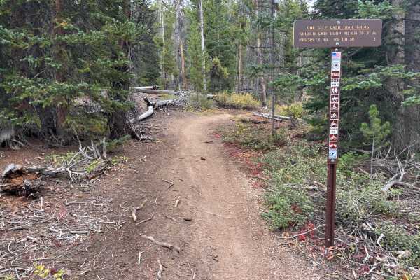
One Step Over
The west side of the trail is accessed from GH-25. The first 1.5 miles are fast and flowy, with fun turns and very few technical features. This western stretch also offers a great view of Breckenridge and the ski slopes across the valley.
The eastern side, accessed from GH-38, has a different charac...
Learn more about One Step Over
Ling Road
This trail is easy except for two areas where the road has two washouts that have deep ruts to negotiate. The first one can be straddled, and the second area can be passed on the uphill side. The road ends at a locked gate. Near the end, there is a side road that will take you to a scenic overlook.
Learn more about Ling Road
Silver Lake Road
The trail is easy for the most part. There is one rutted spot at the beginning that is deep and would be difficult for most SUVs. Past that point, there are a few muddy spots and the bushes are close to the trail, causing scratches to your vehicle.
Learn more about Silver Lake Road
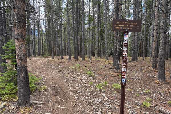
Fuller Trail
Fuller Trail is likely the most challenging trail in the Summit County Trail System. It features a few longer and steeper grades with a lot of softball-sized rocks. Some tighter switchbacks are mildly steep and fairly loose. The trail is also notably rutted in areas. Rock and root obstacles up to 12...
Learn more about Fuller Trail
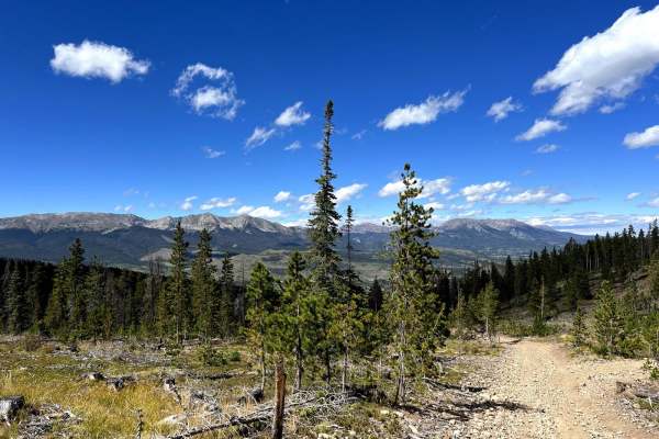
Prospect Hill Rd (GH-38) to Sidewinder Rd (GH-35)
Prospect Hill Road (GH-38) is a rocky trail that connects Rock Island Road to Summit Gulch via Sidewinder Road (GH-35). It sits on top a small mountain that opens to a 360-degree view of the mountains around Breckenridge, CO. The trail has several scenic pull-offs where off-roaders stop to take brea...
Learn more about Prospect Hill Rd (GH-38) to Sidewinder Rd (GH-35)
Summit Gulch (GH-74)
Summit Gulch (GH-74) is a scenic, narrow, rocky trail that is frequented by off-highway vehicles such as dirt bikes and SxSs in Breckenridge, Colorado. The trail has several rollers that are exciting to drive over on dirt bikes and short-wheel-base vehicles. This may not be suitable for longer wheel...
Learn more about Summit Gulch (GH-74)
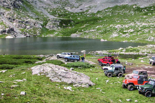
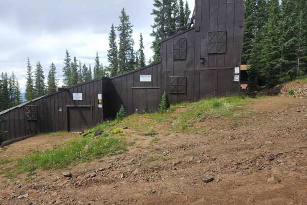
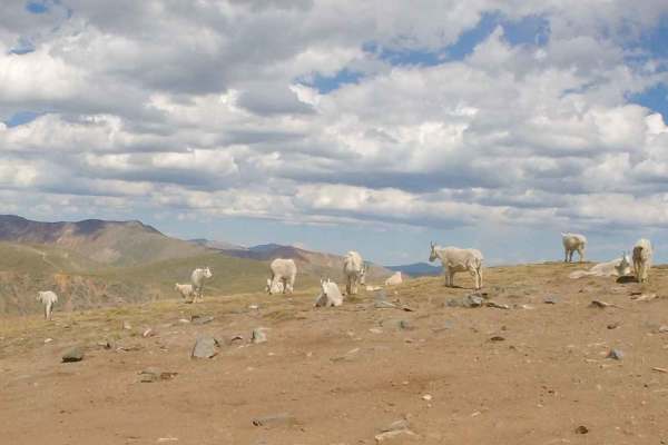
Wheeler Lake
Be sure to bring your camera on this beautiful climb through a valley and to an alpine lake with a waterfall. Enjoy the wildflowers and some great fishing. This trail will also take you directly under Magnolia Mill.
Learn more about Wheeler Lake
Golden Rule
Golden Rule is a fun trail with some small roots and mildly steep grades that are loose. The trail is faster and more open than many others in the area. There are two trail crossings. The north end intersects with the east end of Fuller Trail. The south end is accessed from GH-66.
Learn more about Golden Rule
West Beaver Creek Road
A gentle but scenic maintained dirt/gravel road underneath Mount Silver Heels ending just before the Iron Mine across Beaver Creek. There are spectacular views of Quandary to the West and Silverheels to the East. Along the way are several historic cabins as well as the remnants of a mining dredge, c...
Learn more about West Beaver Creek Road
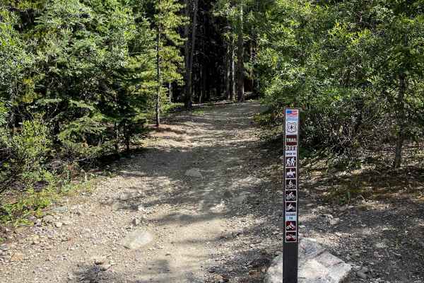
Governor King Trail #GH67
Governor King is 1.5 miles of easy and flowy dirt bike trail through the White River National Forest near Breckenridge, Colorado. Most of the trail is pretty wide through a pine forest, with narrower single track sections as well. It’s well-marked at both entrances and easy to follow. There are smal...
Learn more about Governor King Trail #GH67
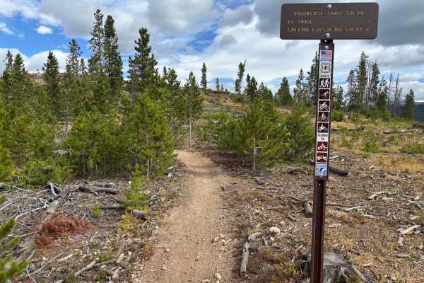
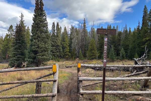
Book Case
Book Case is a fast and fun trail with some slight exposure. The Eastern end features a fun wash section with some back-to-back berms. There are some cool built-up ramp sections as well. The trail crosses with one non-motorized MTB trail, so make sure to read the signs.
Learn more about Book Case
Forest Road 801
Trail is easy that follows stream most of the way, on lower section travels thru mostly private property. Once you reach the Forest Campground, trail becomes a little more difficult. Past this campground the trail continues along the stream with a lot dispersed camping. Most side trails are closed ...
Learn more about Forest Road 801
South Fork Swan Trail #9088
This is a 2.1-mile-long forested dirt bike trail that is really wide, more like an old road, paralleling the South Fork Swan River. The wide dirt path is covered in small, loose, and embedded rocks, and some bigger embedded rock faces. The rocks are pretty spread out and flat, so it’s not difficult ...
Learn more about South Fork Swan Trail #9088
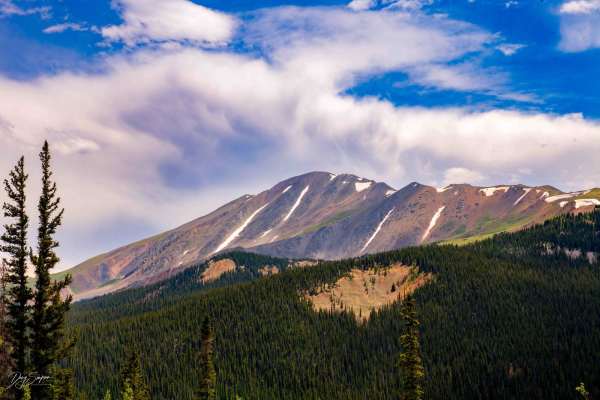
Middle Swan Road - FS 6.2
Middle Swan Road is the southern and more difficult of the two Swan Roads, which lead from Tiger Road in Breckenridge up the divide between Breckenridge and Keystone (Montezuma). At the top, you will have excellent views of many other trails in the area, including Upper Hall Valley (and the mine)...
Learn more about Middle Swan Road - FS 6.2
American Gulch Road - FR 567
The road travels up through the forest past some old mines, with a lot of twists and turns. The road is rocky in some areas, narrow most of the way but with places to pass other vehicles. At the top, the road drops down into French Gulch. This section is a shelf road that is rocky and narrow without...
Learn more about American Gulch Road - FR 567
ATV trails near Blue River, Colorado
Explore ATV-friendly trails near you. These trails are accessible for vehicles up to 50 inches wide, perfect for ATVs and smaller off-road machines.
Pennsylvania/Indiana Creek- FR 611
This trail is rocky with some deep ruts for about the first Mile then it gets easier. There are a few sections at the beginning that are rocky after that and some areas that are narrow and hard to pass oncoming traffic. Some of the switchbacks are tight and will require some maneuvering to get aroun...
Learn more about Pennsylvania/Indiana Creek- FR 611
Prospect Hill Rd (GH-38) to Sidewinder Rd (GH-35)
Prospect Hill Road (GH-38) is a rocky trail that connects Rock Island Road to Summit Gulch via Sidewinder Road (GH-35). It sits on top a small mountain that opens to a 360-degree view of the mountains around Breckenridge, CO. The trail has several scenic pull-offs where off-roaders stop to take brea...
Learn more about Prospect Hill Rd (GH-38) to Sidewinder Rd (GH-35)
Summit Gulch (GH-74)
Summit Gulch (GH-74) is a scenic, narrow, rocky trail that is frequented by off-highway vehicles such as dirt bikes and SxSs in Breckenridge, Colorado. The trail has several rollers that are exciting to drive over on dirt bikes and short-wheel-base vehicles. This may not be suitable for longer wheel...
Learn more about Summit Gulch (GH-74)
Wheeler Lake
Be sure to bring your camera on this beautiful climb through a valley and to an alpine lake with a waterfall. Enjoy the wildflowers and some great fishing. This trail will also take you directly under Magnolia Mill.
Learn more about Wheeler Lake
UTV/side-by-side trails near Blue River, Colorado
Find UTV and side-by-side trails near you. These trails accommodate vehicles up to 60 inches wide, ideal for UTVs, side-by-sides, and wider off-road rigs.
Pennsylvania/Indiana Creek- FR 611
This trail is rocky with some deep ruts for about the first Mile then it gets easier. There are a few sections at the beginning that are rocky after that and some areas that are narrow and hard to pass oncoming traffic. Some of the switchbacks are tight and will require some maneuvering to get aroun...
Learn more about Pennsylvania/Indiana Creek- FR 611
Prospect Hill Rd (GH-38) to Sidewinder Rd (GH-35)
Prospect Hill Road (GH-38) is a rocky trail that connects Rock Island Road to Summit Gulch via Sidewinder Road (GH-35). It sits on top a small mountain that opens to a 360-degree view of the mountains around Breckenridge, CO. The trail has several scenic pull-offs where off-roaders stop to take brea...
Learn more about Prospect Hill Rd (GH-38) to Sidewinder Rd (GH-35)
Summit Gulch (GH-74)
Summit Gulch (GH-74) is a scenic, narrow, rocky trail that is frequented by off-highway vehicles such as dirt bikes and SxSs in Breckenridge, Colorado. The trail has several rollers that are exciting to drive over on dirt bikes and short-wheel-base vehicles. This may not be suitable for longer wheel...
Learn more about Summit Gulch (GH-74)
Wheeler Lake
Be sure to bring your camera on this beautiful climb through a valley and to an alpine lake with a waterfall. Enjoy the wildflowers and some great fishing. This trail will also take you directly under Magnolia Mill.
Learn more about Wheeler Lake
The onX Offroad Difference
onX Offroad combines trail photos, descriptions, difficulty ratings, width restrictions, seasonality, and more in a user-friendly interface. Available on all devices, with offline access and full compatibility with CarPlay and Android Auto. Discover what you're missing today!
Open Trail Map