
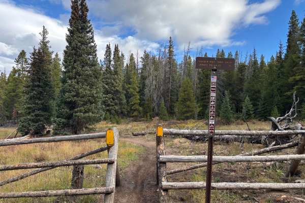
Off-Road Trails
Near Copper Mountain, Colorado
Off-Road Trails Near Copper Mountain, Colorado
Discover the best offroad trails near you. Browse trail maps, check difficulty ratings, and find your next adventure — whether you're looking for a quick ride or an all-day expedition.
Old Highway Road
This is just a nice, easy, scenic backway from Camp Hale to Highway 24, offering nice views of the Camp Hale valley. Most vehicles should do fine. If there's snow, it could get a little slick and there could be some deep puddles or rough washboards with a lot of traffic.
Learn more about Old Highway Road
McAllister Gulch
This is a fun climb through the mountains, starting at Camp Hale. Climb to the top of Resolution Mountain with incredible views of Mt. Holy Cross. Then, descend Shrine Pass Road by way of Wearyman Creek. There is an option to make this trip a loop if you turn right at Wearyman Creek and travel up to...
Learn more about McAllister Gulch
Ptarmigan Pass
We like to do this Jeep trail clockwise with McAllister Pass starting over on Shrine Pass. The first half mile is in Wearyman Creek. Be careful if the water is high. Ptarmigan Pass spends a lot of time in the trees, with a short section of open views at the pass. There are a few minor challenges n...
Learn more about Ptarmigan Pass
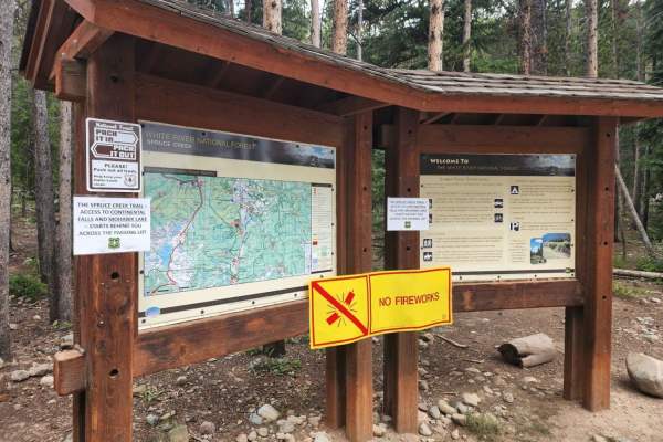
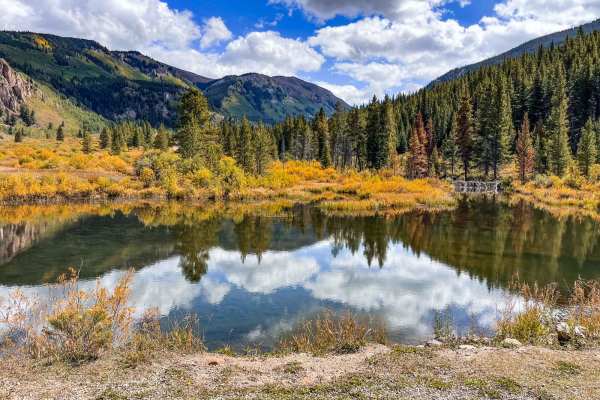
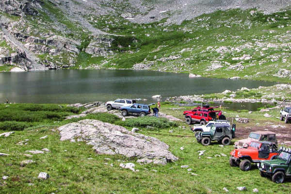
Crystal Road - Spruce Creek Road
If you have done Peak 10, this is the little road and Lake you are staring down at. Crystal Road is usually combined with Spruce Creek Road, although the connector between them is no longer open. Spruce Creek is a popular hiking area on weekends to the Mayflower and Mohawk Lakes, but few people use...
Learn more about Crystal Road - Spruce Creek Road
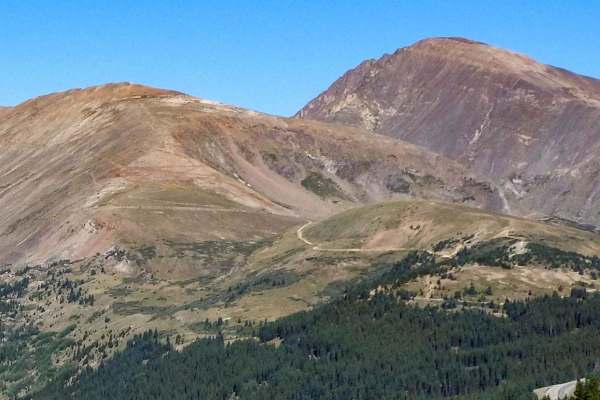
Peak 10 Breckenridge
You can go up Peak 9 through the ski area and traverse over to Peak 10. It's a great little adventure with some of the best scenery in the area. This trail is not open to unlicensed vehicles and is closed in the wintertime.
Learn more about Peak 10 Breckenridge
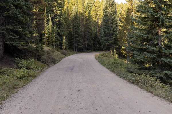
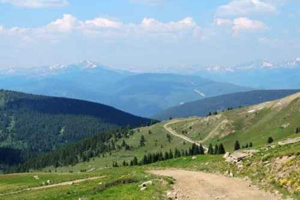
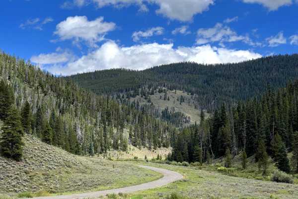
Boreas Pass
Boreas Pass is a wide, well-graded gravel road that makes for an easy and scenic drive across the Continental Divide. Suitable for 2WD vehicles throughout, the road poses no obstacles and is one of the more accessible high passes in Colorado. Wildlife sightings are common—particularly moose in the w...
Learn more about Boreas Pass
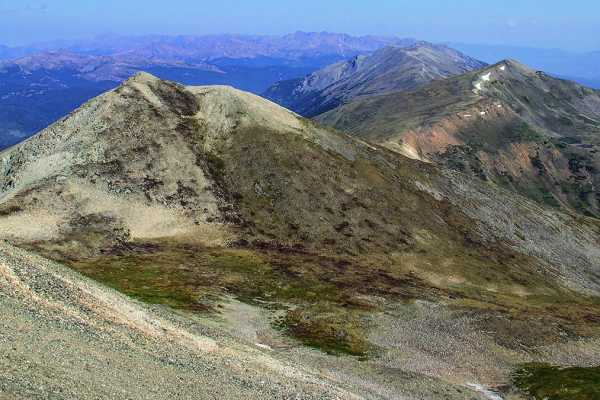
Chalk Mountain
Breathe in the high mountain air on this short but fun ride that starts above 10,000 feet. The top is a flat tundra above the treeline, great for picnics and taking pictures. Please always stay on the designated trail. No road closures, but expect snow through early summer and starting early fall.
Learn more about Chalk Mountain
Miners Creek Road
Miners Creek Road is a convenient off-road trail right on the outskirts of Frisco, Colorado, making it an easy and rewarding exploration while visiting the area. The route begins as a paved multi-use path in town and gradually transitions into a rugged backcountry road as it climbs into the White Ri...
Learn more about Miners Creek Road
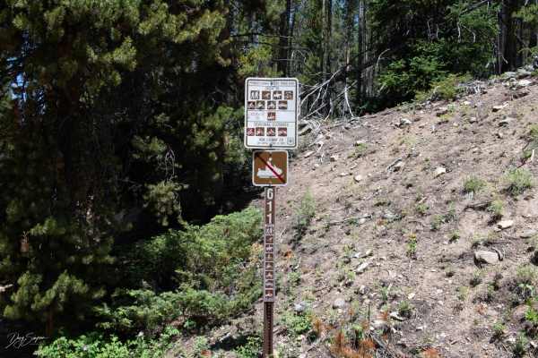
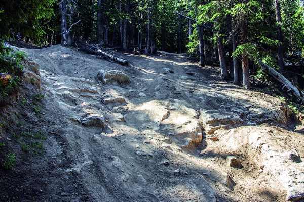
Pennsylvania/Indiana Creek- FR 611
This trail is rocky with some deep ruts for about the first Mile then it gets easier. There are a few sections at the beginning that are rocky after that and some areas that are narrow and hard to pass oncoming traffic. Some of the switchbacks are tight and will require some maneuvering to get aroun...
Learn more about Pennsylvania/Indiana Creek- FR 611
Tiger Road to Greenhorn Gulch
Tiger Road is a rock and gravel, relatively flat road that traverses down a small valley towards Green Horn Gulch in Breckenridge, Colorado. This road is surrounded by gently sloping hills that lead to an opening meadow full of wildflowers around Green Horn Gulch. This is the entrance to several dir...
Learn more about Tiger Road to Greenhorn Gulch
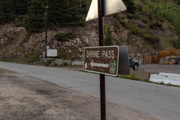
Shrine Pass
Shrine Pass Road offers an approachable backcountry drive with no major obstacles, making it a favorite for those seeking high-alpine scenery without technical challenges. The road includes some rocky sections, but the route mellows as you approach the summit, providing a comfortable ride for most h...
Learn more about Shrine Pass
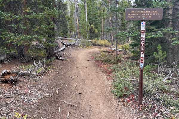
One Step Over
The west side of the trail is accessed from GH-25. The first 1.5 miles are fast and flowy, with fun turns and very few technical features. This western stretch also offers a great view of Breckenridge and the ski slopes across the valley.
The eastern side, accessed from GH-38, has a different charac...
Learn more about One Step Over
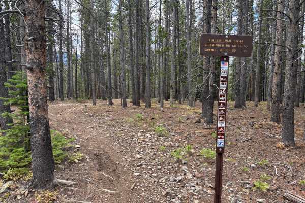
Fuller Trail
Fuller Trail is likely the most challenging trail in the Summit County Trail System. It features a few longer and steeper grades with a lot of softball-sized rocks. Some tighter switchbacks are mildly steep and fairly loose. The trail is also notably rutted in areas. Rock and root obstacles up to 12...
Learn more about Fuller Trail
Wheeler Lake
Be sure to bring your camera on this beautiful climb through a valley and to an alpine lake with a waterfall. Enjoy the wildflowers and some great fishing. This trail will also take you directly under Magnolia Mill.
Learn more about Wheeler Lake
Silver Lake Road
The trail is easy for the most part. There is one rutted spot at the beginning that is deep and would be difficult for most SUVs. Past that point, there are a few muddy spots and the bushes are close to the trail, causing scratches to your vehicle.
Learn more about Silver Lake Road
Summit Gulch (GH-74)
Summit Gulch (GH-74) is a scenic, narrow, rocky trail that is frequented by off-highway vehicles such as dirt bikes and SxSs in Breckenridge, Colorado. The trail has several rollers that are exciting to drive over on dirt bikes and short-wheel-base vehicles. This may not be suitable for longer wheel...
Learn more about Summit Gulch (GH-74)
Ling Road
This trail is easy except for two areas where the road has two washouts that have deep ruts to negotiate. The first one can be straddled, and the second area can be passed on the uphill side. The road ends at a locked gate. Near the end, there is a side road that will take you to a scenic overlook.
Learn more about Ling Road
Golden Rule
Golden Rule is a fun trail with some small roots and mildly steep grades that are loose. The trail is faster and more open than many others in the area. There are two trail crossings. The north end intersects with the east end of Fuller Trail. The south end is accessed from GH-66.
Learn more about Golden Rule
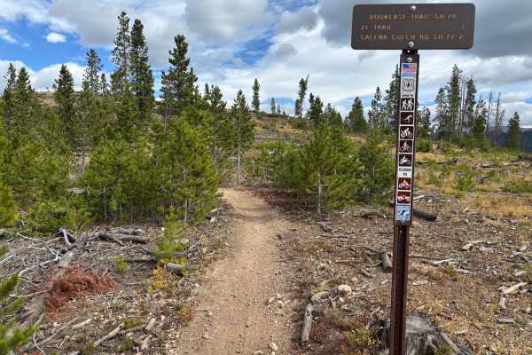
Book Case
Book Case is a fast and fun trail with some slight exposure. The Eastern end features a fun wash section with some back-to-back berms. There are some cool built-up ramp sections as well. The trail crosses with one non-motorized MTB trail, so make sure to read the signs.
Learn more about Book Case
Prospect Hill Rd (GH-38) to Sidewinder Rd (GH-35)
Prospect Hill Road (GH-38) is a rocky trail that connects Rock Island Road to Summit Gulch via Sidewinder Road (GH-35). It sits on top a small mountain that opens to a 360-degree view of the mountains around Breckenridge, CO. The trail has several scenic pull-offs where off-roaders stop to take brea...
Learn more about Prospect Hill Rd (GH-38) to Sidewinder Rd (GH-35)
ATV trails near Copper Mountain, Colorado
Explore ATV-friendly trails near you. These trails are accessible for vehicles up to 50 inches wide, perfect for ATVs and smaller off-road machines.
Old Highway Road
This is just a nice, easy, scenic backway from Camp Hale to Highway 24, offering nice views of the Camp Hale valley. Most vehicles should do fine. If there's snow, it could get a little slick and there could be some deep puddles or rough washboards with a lot of traffic.
Learn more about Old Highway Road
McAllister Gulch
This is a fun climb through the mountains, starting at Camp Hale. Climb to the top of Resolution Mountain with incredible views of Mt. Holy Cross. Then, descend Shrine Pass Road by way of Wearyman Creek. There is an option to make this trip a loop if you turn right at Wearyman Creek and travel up to...
Learn more about McAllister Gulch
Ptarmigan Pass
We like to do this Jeep trail clockwise with McAllister Pass starting over on Shrine Pass. The first half mile is in Wearyman Creek. Be careful if the water is high. Ptarmigan Pass spends a lot of time in the trees, with a short section of open views at the pass. There are a few minor challenges n...
Learn more about Ptarmigan Pass
Chalk Mountain
Breathe in the high mountain air on this short but fun ride that starts above 10,000 feet. The top is a flat tundra above the treeline, great for picnics and taking pictures. Please always stay on the designated trail. No road closures, but expect snow through early summer and starting early fall.
Learn more about Chalk Mountain
UTV/side-by-side trails near Copper Mountain, Colorado
Find UTV and side-by-side trails near you. These trails accommodate vehicles up to 60 inches wide, ideal for UTVs, side-by-sides, and wider off-road rigs.
Old Highway Road
This is just a nice, easy, scenic backway from Camp Hale to Highway 24, offering nice views of the Camp Hale valley. Most vehicles should do fine. If there's snow, it could get a little slick and there could be some deep puddles or rough washboards with a lot of traffic.
Learn more about Old Highway Road
McAllister Gulch
This is a fun climb through the mountains, starting at Camp Hale. Climb to the top of Resolution Mountain with incredible views of Mt. Holy Cross. Then, descend Shrine Pass Road by way of Wearyman Creek. There is an option to make this trip a loop if you turn right at Wearyman Creek and travel up to...
Learn more about McAllister Gulch
Ptarmigan Pass
We like to do this Jeep trail clockwise with McAllister Pass starting over on Shrine Pass. The first half mile is in Wearyman Creek. Be careful if the water is high. Ptarmigan Pass spends a lot of time in the trees, with a short section of open views at the pass. There are a few minor challenges n...
Learn more about Ptarmigan Pass
Chalk Mountain
Breathe in the high mountain air on this short but fun ride that starts above 10,000 feet. The top is a flat tundra above the treeline, great for picnics and taking pictures. Please always stay on the designated trail. No road closures, but expect snow through early summer and starting early fall.
Learn more about Chalk Mountain
The onX Offroad Difference
onX Offroad combines trail photos, descriptions, difficulty ratings, width restrictions, seasonality, and more in a user-friendly interface. Available on all devices, with offline access and full compatibility with CarPlay and Android Auto. Discover what you're missing today!
Open Trail Map