
Dirt Bike Trails
Near Yarnell, Arizona
Explore All Dirt Bike Trails Near Yarnell, Arizona
Dirt Bike Trails Near Yarnell, Arizona
Discover the best dirt bike trails near you. Browse trail maps, check difficulty ratings, and find your next adventure — whether you're looking for a quick ride or an all-day expedition.
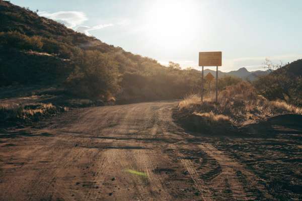
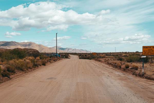
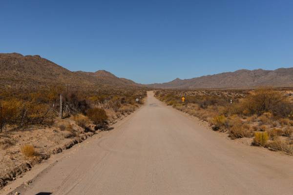
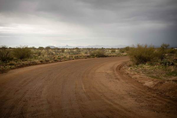
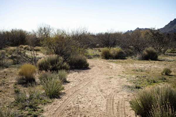
Mina Road
Mina Road is a wide gravel and rock road with no obstacles on it. This road can serve as an alternative to Arizona Highway 89, avoiding the long, steep, and curvy highway that leads from Yarnell to Congress, Arizona. There are no obstacles along this road, though at times it does narrow to one and a...
Learn more about Mina Road
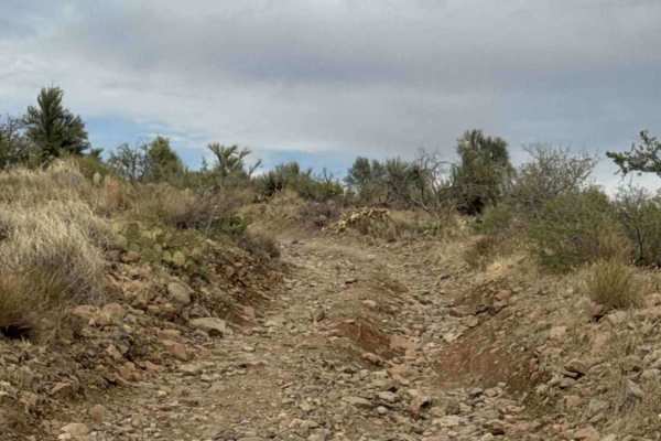
V Notch Pass
This trail begins off Mina Road and starts as a shelf road for the first 0.5 mile, consisting of loose gravel and rocks up to 6 inches in diameter. The route then turns right and descends a steep hill to the south before making a hard left down another steep, sandy hill. A high-clearance 4WD vehicle...
Learn more about V Notch Pass
BLM 36046
BLM 36046 begins at the end of Trail 36043 Connector and follows a natural full-width two-track through mountainous terrain. Expect scattered loose gravel and embedded rocks up to 12 inches in diameter, with grasses growing along the center of the trail. The route winds from hillside to hillside, wh...
Learn more about BLM 36046

Spurline Mine
This trail is a spur section off the adjacent trail, "The Uphill." Mellower than "The Uphill", this trail is rock and has minimal challenge. There are no major obstacles on this trail. There is also no cell service, so offline maps are recommended. The trail has an area to camp near the end of it, b...
Learn more about Spurline Mine

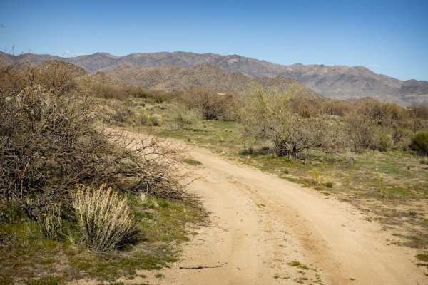
Grand Wash
Grand Wash is a pleasant deviation from the typical washes in this area. On the north end, you'll start on a wide plateau with plenty of room to pass and a few sporadic areas for camping. There is some erosion along this section of the trail, but the real treat is dropping into the wash. With little...
Learn more about Grand Wash

Center of Mass
Center of Mass is a relatively easy trail with only 2 main obstacles on it. The first is a wash crossing with a steep exit up a loose and rocky hill. The approach angle here might be especially challenging for lower-clearance vehicles. The second, an off-camber washout crossing up against a fencelin...
Learn more about Center of Mass

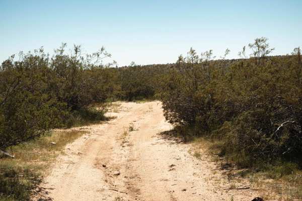
The Uphill
The Uphill is a rough trail filled with spots of erosion. This area is riddled with mines. Evidence of scraped earth and rock piles are present, as well as signage. Some of the erosion crossings are deep with off-camber entrances and exits. There are points on this trail that are narrow. Many types ...
Learn more about The Uphill
Multi-Mine Road
Multi-Mine Road is a rough dirt and rock track in the hills below Yarnell, Arizona. Evidence and scrapes of exploratory mines and large rock and scree piles dot this road. The two-track is narrow with limited places to pass. There are random sporadic campsites along this trail, some with primitive r...
Learn more about Multi-Mine Road
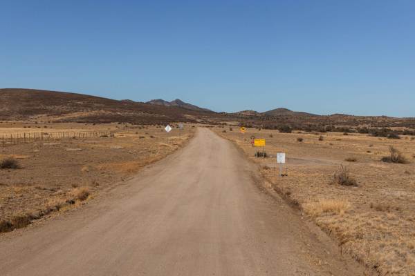
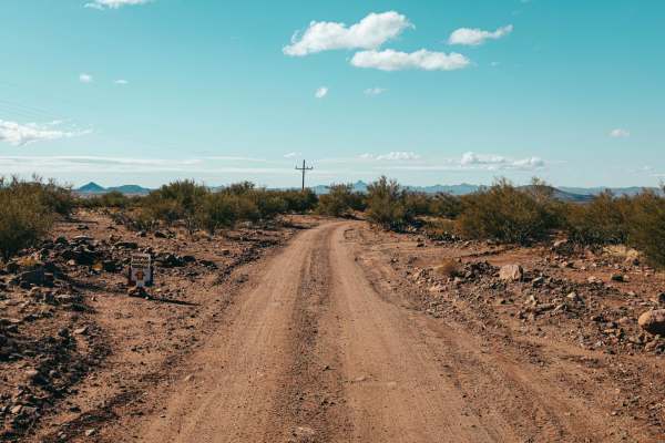
Stanton Road - CR109
Stanton Road is the gravel road that leads to the village of Stanton. This road is wide, with washboard sections. It's a main artery for this area, with both recreational and residential traffic, so don't be surprised to see other vehicles of various sizes out and about on this road. There are no ob...
Learn more about Stanton Road - CR109
Date Creek Road
Date Creek Road is a washboarded and scenic trail that's great for all skill levels. The wide path makes for an easy drive, with no obstacles to slow you down. Along the way, you'll navigate through a few washes and experience stretches of washboard terrain--just enough to keep things interesting wi...
Learn more about Date Creek Road

Octave Trail
Octave Trail is little more than a mining road, which are typical in this area of Arizona. Rocky, and at times narrow, this trail has erosion and water damage along it. There are wash crossings with some sections of washed-out road as well. Don't be surprised to see other vehicles along this trail a...
Learn more about Octave Trail
Rincon Mine Road
The Rincon Mine Road is a one-lane dirt road that heads uphill with its final destination at the Rincon Mine. Parts of this road are on a rock shelf and the majority of it is rocky. There is one major obstacle on this road, aside from the erosion and possible growing washouts. A double-shelf set mak...
Learn more about Rincon Mine Road
Happy's Runoff
Happy's Runoff is a mixed dirt and rock trail. It's a fun technical driving trail with multiple washouts and wash crossings, some of them off-camber. One even has a railroad tie in it to make the crossing easier. Speckled with creosote and cactus, this area is ruggedly beautiful. This land requires ...
Learn more about Happy's Runoff
Sprikler's Choice
Sprinkler's Choice is a single-wide trail lined with creosote and trees. You'll see all types of cactus along this trail, even the odd saguaro. There is erosion present, as well as several rock sections, two that are steep and downhill and loose that are a bit tricky. The southern end of the trail d...
Learn more about Sprikler's Choice
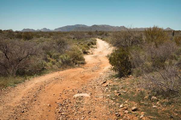
Sorrels Ranch Offshoot
The Sorrels Ranch Offshoot is a short and fun route that starts wide at the bottom, easing you into the journey before narrowing as you climb. As the trail tightens, you'll encounter erosion in the narrow sections, adding a bit of character to the ride. There are sections of erosion and water damage...
Learn more about Sorrels Ranch Offshoot
Cinch's Cutoff
Cinch's Cutoff is a dirt two-track that winds and rolls between the washes and creosote outcroppings that form this area. Mostly open, this has narrow spots, but nothing too gnarly. There are no obstacles on this trail and at the south end, it dumps out onto a wide dirt road that leads up to the bac...
Learn more about Cinch's Cutoff
Power Pull
What seems like just another Powerline Road, isn't. The highlight of this trail is a steep hill toward the western end. This hill has a combination of off-camber, loose rock, and erosion that might make it challenging after a rain or snow event. Along the way, there are wash crossings with steep ent...
Learn more about Power Pull
Date Creek Foothill
This trail has many steep wash crossings and erosion that are typical of the trails in this area. Because it is nearer to the mountains to the north, there are a bit more than usual. At the east end of this trail, there is a locked gate into a residential area, so it's best to approach from the west...
Learn more about Date Creek Foothill
Gold Claim
The Gold Claim trail is a rocky, one-lane trail of which there are numerous in the area. There is a large area toward the North end that is popular with miners and has a large flat area for camping that can accommodate vehicles of all different shapes and sizes. This trail is one lane, so please rem...
Learn more about Gold Claim
Sullivan Tank
Sullivan Tank is a typical desert trail in this area of Arizona. Molded by water, there is erosion on this trail, carving channels across the trail. Because of this, it's a slow mellow trail with no obstacles on it. There are tons of jackrabbits and quail in the area, as well as cattle, who are not ...
Learn more about Sullivan Tank
ATV trails near Yarnell, Arizona
Explore ATV-friendly trails near you. These trails are accessible for vehicles up to 50 inches wide, perfect for ATVs and smaller off-road machines.
Mina Road
Mina Road is a wide gravel and rock road with no obstacles on it. This road can serve as an alternative to Arizona Highway 89, avoiding the long, steep, and curvy highway that leads from Yarnell to Congress, Arizona. There are no obstacles along this road, though at times it does narrow to one and a...
Learn more about Mina Road
BLM 36046
BLM 36046 begins at the end of Trail 36043 Connector and follows a natural full-width two-track through mountainous terrain. Expect scattered loose gravel and embedded rocks up to 12 inches in diameter, with grasses growing along the center of the trail. The route winds from hillside to hillside, wh...
Learn more about BLM 36046
Spurline Mine
This trail is a spur section off the adjacent trail, "The Uphill." Mellower than "The Uphill", this trail is rock and has minimal challenge. There are no major obstacles on this trail. There is also no cell service, so offline maps are recommended. The trail has an area to camp near the end of it, b...
Learn more about Spurline Mine
Grand Wash
Grand Wash is a pleasant deviation from the typical washes in this area. On the north end, you'll start on a wide plateau with plenty of room to pass and a few sporadic areas for camping. There is some erosion along this section of the trail, but the real treat is dropping into the wash. With little...
Learn more about Grand Wash
UTV/side-by-side trails near Yarnell, Arizona
Find UTV and side-by-side trails near you. These trails accommodate vehicles up to 60 inches wide, ideal for UTVs, side-by-sides, and wider off-road rigs.
Mina Road
Mina Road is a wide gravel and rock road with no obstacles on it. This road can serve as an alternative to Arizona Highway 89, avoiding the long, steep, and curvy highway that leads from Yarnell to Congress, Arizona. There are no obstacles along this road, though at times it does narrow to one and a...
Learn more about Mina Road
V Notch Pass
This trail begins off Mina Road and starts as a shelf road for the first 0.5 mile, consisting of loose gravel and rocks up to 6 inches in diameter. The route then turns right and descends a steep hill to the south before making a hard left down another steep, sandy hill. A high-clearance 4WD vehicle...
Learn more about V Notch Pass
BLM 36046
BLM 36046 begins at the end of Trail 36043 Connector and follows a natural full-width two-track through mountainous terrain. Expect scattered loose gravel and embedded rocks up to 12 inches in diameter, with grasses growing along the center of the trail. The route winds from hillside to hillside, wh...
Learn more about BLM 36046
Spurline Mine
This trail is a spur section off the adjacent trail, "The Uphill." Mellower than "The Uphill", this trail is rock and has minimal challenge. There are no major obstacles on this trail. There is also no cell service, so offline maps are recommended. The trail has an area to camp near the end of it, b...
Learn more about Spurline Mine
The onX Offroad Difference
onX Offroad combines trail photos, descriptions, difficulty ratings, width restrictions, seasonality, and more in a user-friendly interface. Available on all devices, with offline access and full compatibility with CarPlay and Android Auto. Discover what you're missing today!
Open Trail Map