
Dirt Bike Trails
Near Whitesville, West Virginia
Explore All Dirt Bike Trails Near Whitesville, West Virginia
Dirt Bike Trails Near Whitesville, West Virginia
Discover the best dirt bike trails near you. Browse trail maps, check difficulty ratings, and find your next adventure — whether you're looking for a quick ride or an all-day expedition.
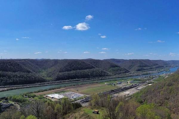
Q38
Trail Q38 is a narrow, relatively flat ride along a ridge and pipeline right of way in the Quincy Sector of AOT. The trail may be overgrown with briers and other vegetation. The very end opens up to a grassy knob with an overlook facing west, which offers views down to the Quincy Coal Company and th...
Learn more about Q38
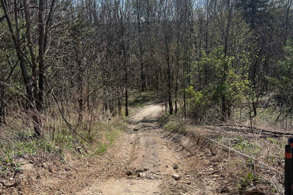
Q36
Trail Q36 in the Quincy Sector of AOT is a long, steep, winding shelf road. The lower portion of this road was used for a recent power line project. In the grassy area towards the bottom are some optional mud holes. The area in the middle may have minor washouts and ruts, while towards the top of th...
Learn more about Q36
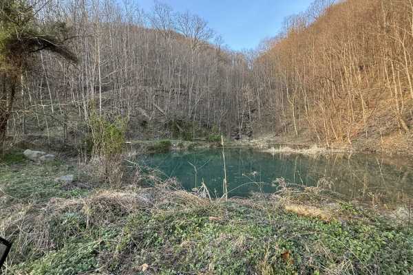
Q35
Q35 is a short spur trail branching from the AOT paved road, leading to a scenic pond area. This trail is ideal for riders looking for a quick stop, a lunch break, or a quiet spot to relax. The trail consists of a smooth gravel surface with an easy, direct path to the pond. The destination offers a ...
Learn more about Q35
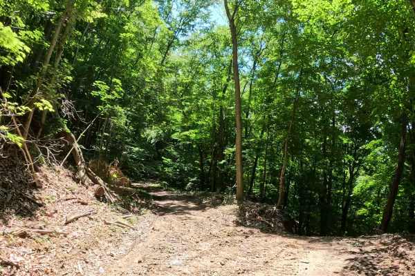
Q10B
Q10B is an easy alternate route branching from Q10 before reconnecting with the main trail. It provides riders with an optional variation while traveling through the upper Quincy trail system. The trail consists of a loose dirt surface with gentle grades and minimal obstacles. Its short length makes...
Learn more about Q10B
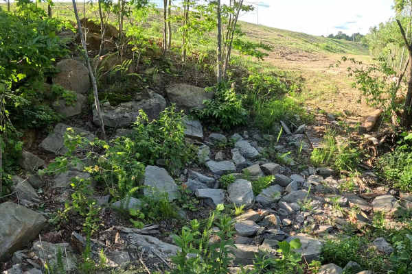
Q25A
Q25A is a moderate alternate route branching from Q25 and reconnecting with the main trail farther along. It provides an optional technical section featuring a small rock obstacle and ledge. The trail consists of dirt and rock with a small ditch crossing and a rock ledge obstacle. Depending on the d...
Learn more about Q25A
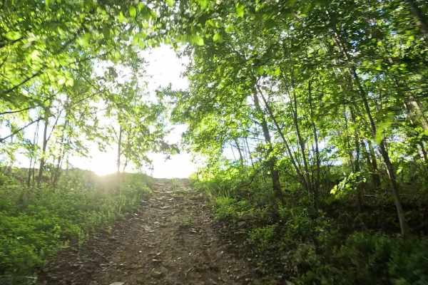
Q19
Q19 is a difficult connector trail linking Q10 at the bottom of the hill to Q25 at the top. The trail features a sustained seven-tier hill climb (or descent, depending on direction of travel) and is intended for experienced drivers. The trail consists of loose gravel, exposed rocks, and dirt with st...
Learn more about Q19
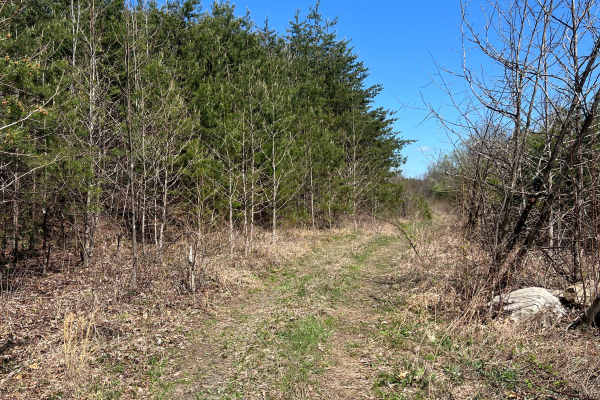
Q37A
Trail Q37A is an easy, flat ride which is primarily dirt with some grass. There is a small mud hole, and some ruts in somewhat of a wetland area which may become softer or muddy when the ground is wet. A portion of this trail was used for a powerline project and as such a lot of crushed stone was ad...
Learn more about Q37A
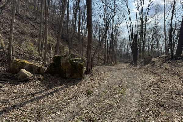
Q20
Q20 is a primary access and scenic route connecting the main paved entrance of AOT to the western edge of the property. This trail provides a smooth, easy ride while linking to multiple trail options and external access points. The trail consists of dirt and gravel surfaces with a steady, easy flow....
Learn more about Q20
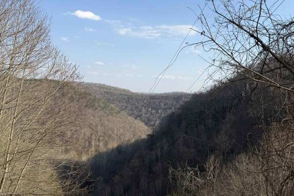
Q25
Q25 begins at the AOT Welcome Center and meanders up to the mid-shelf of the Quincy sector, running alongside the main Q1 corridor. This trail offers a relaxed, scenic route for riders looking to ease into the system while staying connected to the main artery. The trail features a mix of gravel and ...
Learn more about Q25
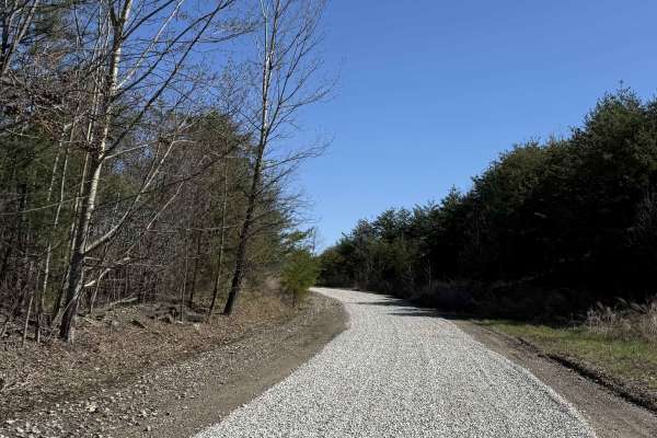
Q1
Q1 serves as the primary access corridor out of the Welcome Center, guiding riders from the Quincy staging area and into the heart of the Appalachian Outlaw Trails system. This is the gateway trail that sets you up to explore other areas of the AOT park. Expect a mix of packed dirt, light elevation ...
Learn more about Q1
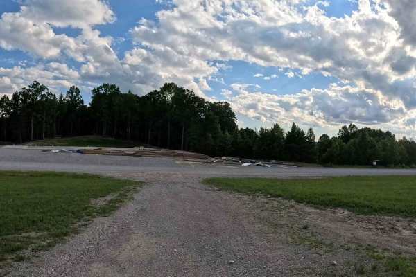
Q1A
Q1A is an easy connector trail branching from Q1 near the Welcome Center. It provides access to the camping area and serves as the primary route into the western Quincy sector by connecting riders to Q31 and Q5. The trail consists of a hard-packed gravel surface with gentle grades and minimal obstac...
Learn more about Q1A
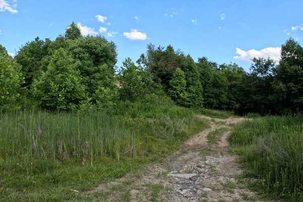
Q25B
Q25B is an easy access trail connecting Q1 with Q25. It provides riders with the option to join Q25 at its midpoint or exit the trail early without traveling the entire route. The trail consists of a hard-packed gravel surface with gentle grades and no obstacles. Its short length makes it a convenie...
Learn more about Q25B
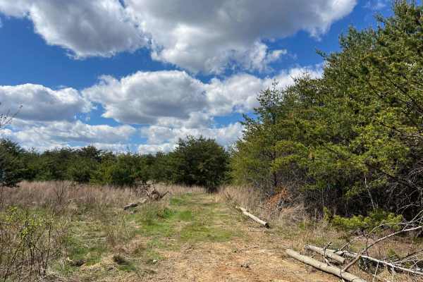
Q25A
Quincy Trail 25A is an easy shortcut connector for Q25, which can be used to more quickly access Q1, Q26, or Q27. The track is very smooth and flat, with minimal ruts/mud and no obstacles to consider. Vegetation in the area is grassy along the sides with young pine and sapling growth.
Learn more about Q25A
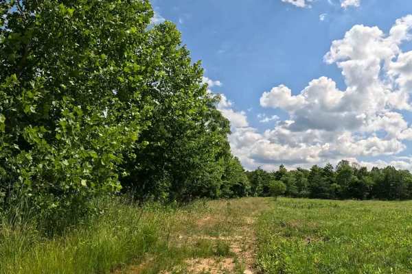
Q11A
Q11A is an easy connector trail linking the parking and camping area with Q11. Similar to Q11 but shorter in length, it provides convenient access between the staging area and the upper Quincy trail network. The trail consists of a hard-packed dirt surface with gentle grades and minimal obstacles. I...
Learn more about Q11A
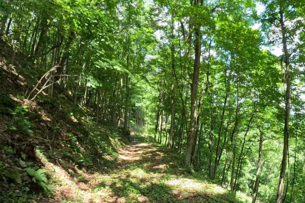
Q73A
Q73A is an easy connector trail branching from Q73. The trail follows the contour of the hillside and connects riders to either Q73B or Q12A. The trail consists of a narrow bench-cut corridor with a mix of grass and dirt. It follows the natural contour of the hillside with gentle grades and minimal ...
Learn more about Q73A
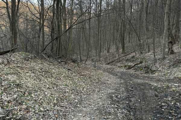
Q20A
Q20A is an easy bypass trail branching off Q20, providing an alternate route along an upper shelf before reconnecting with the main trail. The trail follows an elevated shelf line with a mix of dirt and light gravel surfaces. It offers a slightly different perspective from Q20 while maintaining a sm...
Learn more about Q20A
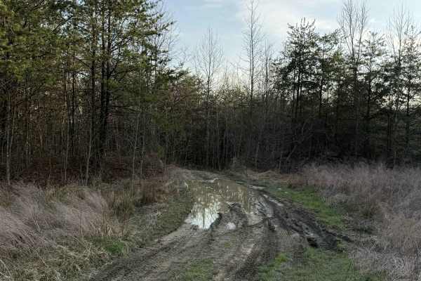
Q27
Q27 is a short spur trail branching off Q25 that leads to a peaceful dispersed camping area. This route offers a secluded escape from the main trail system, ideal for overnight stays or a quiet break. The trail transitions from the gravel surface of Q25 into softer dirt conditions as it approaches t...
Learn more about Q27
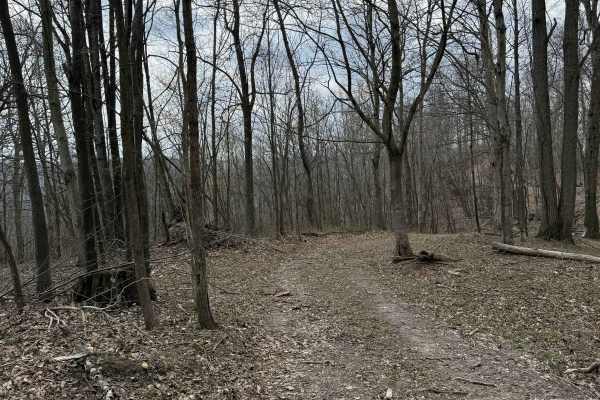
Q5
Q5 is an easy loop trail starting from the parking lot at the AOT Welcome Center, guiding riders into the lower Quincy sector. This route serves as a central access loop, connecting to multiple trails and key points of interest within the system. The trail consists of a dirt base with sections of gr...
Learn more about Q5
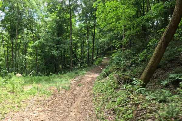
Q73B
Q73B is a moderate connector trail linking Q73A to the lower bench section of Q12. The trail provides an alternate route between the upper and lower portions of this area while incorporating a steeper descent than neighboring trails. The trail consists of a mix of dirt and grass with a steep downhil...
Learn more about Q73B
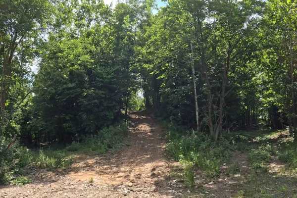
Q11
Q11 is an easy perimeter trail that connects many of the trails in upper Quincy. Located near the entrance and parking area, it serves as one of the primary travel corridors for accessing the upper trail network. The trail consists of a well-maintained gravel surface with gentle grades and minimal o...
Learn more about Q11
ATV trails near Whitesville, West Virginia
Explore ATV-friendly trails near you. These trails are accessible for vehicles up to 50 inches wide, perfect for ATVs and smaller off-road machines.
Q38
Trail Q38 is a narrow, relatively flat ride along a ridge and pipeline right of way in the Quincy Sector of AOT. The trail may be overgrown with briers and other vegetation. The very end opens up to a grassy knob with an overlook facing west, which offers views down to the Quincy Coal Company and th...
Learn more about Q38
Q36
Trail Q36 in the Quincy Sector of AOT is a long, steep, winding shelf road. The lower portion of this road was used for a recent power line project. In the grassy area towards the bottom are some optional mud holes. The area in the middle may have minor washouts and ruts, while towards the top of th...
Learn more about Q36
Q35
Q35 is a short spur trail branching from the AOT paved road, leading to a scenic pond area. This trail is ideal for riders looking for a quick stop, a lunch break, or a quiet spot to relax. The trail consists of a smooth gravel surface with an easy, direct path to the pond. The destination offers a ...
Learn more about Q35
Q10B
Q10B is an easy alternate route branching from Q10 before reconnecting with the main trail. It provides riders with an optional variation while traveling through the upper Quincy trail system. The trail consists of a loose dirt surface with gentle grades and minimal obstacles. Its short length makes...
Learn more about Q10B
UTV/side-by-side trails near Whitesville, West Virginia
Find UTV and side-by-side trails near you. These trails accommodate vehicles up to 60 inches wide, ideal for UTVs, side-by-sides, and wider off-road rigs.
Q38
Trail Q38 is a narrow, relatively flat ride along a ridge and pipeline right of way in the Quincy Sector of AOT. The trail may be overgrown with briers and other vegetation. The very end opens up to a grassy knob with an overlook facing west, which offers views down to the Quincy Coal Company and th...
Learn more about Q38
Q36
Trail Q36 in the Quincy Sector of AOT is a long, steep, winding shelf road. The lower portion of this road was used for a recent power line project. In the grassy area towards the bottom are some optional mud holes. The area in the middle may have minor washouts and ruts, while towards the top of th...
Learn more about Q36
Q35
Q35 is a short spur trail branching from the AOT paved road, leading to a scenic pond area. This trail is ideal for riders looking for a quick stop, a lunch break, or a quiet spot to relax. The trail consists of a smooth gravel surface with an easy, direct path to the pond. The destination offers a ...
Learn more about Q35
Q10B
Q10B is an easy alternate route branching from Q10 before reconnecting with the main trail. It provides riders with an optional variation while traveling through the upper Quincy trail system. The trail consists of a loose dirt surface with gentle grades and minimal obstacles. Its short length makes...
Learn more about Q10B
The onX Offroad Difference
onX Offroad combines trail photos, descriptions, difficulty ratings, width restrictions, seasonality, and more in a user-friendly interface. Available on all devices, with offline access and full compatibility with CarPlay and Android Auto. Discover what you're missing today!
Open Trail Map