
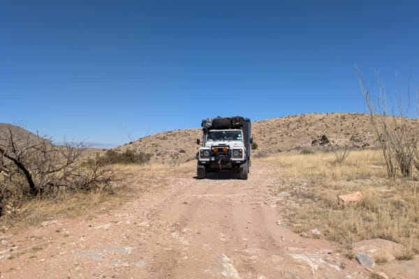
Dirt Bike Trails
Near Whetstone, Arizona
Explore All Dirt Bike Trails Near Whetstone, Arizona
Dirt Bike Trails Near Whetstone, Arizona
Discover the best dirt bike trails near you. Browse trail maps, check difficulty ratings, and find your next adventure — whether you're looking for a quick ride or an all-day expedition.
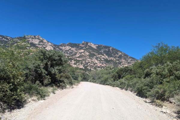
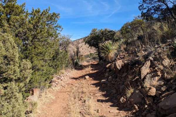
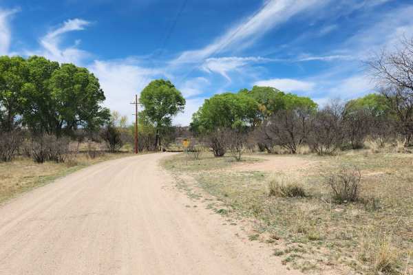
Happy Valley FR 35
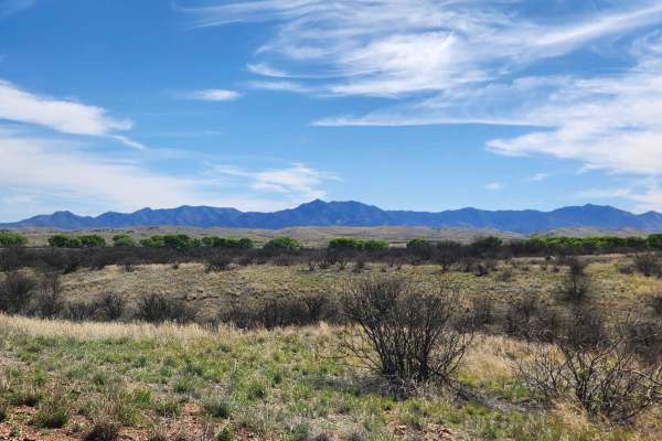
The Happy Valley Road winds past the charming historic movie town of Mescal. It travels through verdant riparian zones and expansive grasslands of the surrounding ranches. Along the way, you can find several idyllic dispersed campsites suitable for travel trailers or smaller RVs, as well as many oth...
Learn more about Happy Valley FR 35
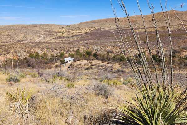
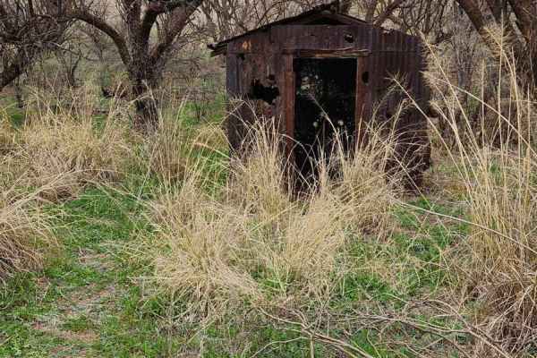
Wakefield Cabin
This trail will guide you through historic ranch land. As you descend into a small canyon near the end, you'll spot an abandoned Buddhist cabin on your left.This trail dips into a wash for about a quarter mile. Riders need to closely follow the trail maps, as there's a part where the trail exits the...
Learn more about Wakefield Cabin
Lower Wakefield Canyon
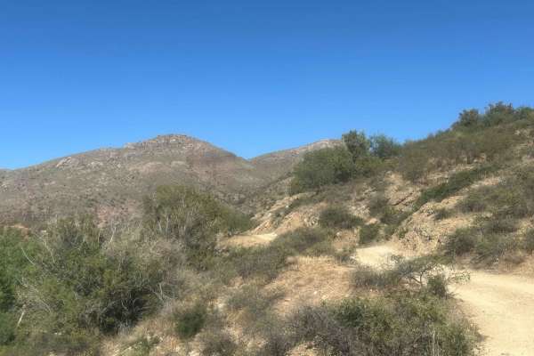
This trail follows ridge lines, offering stunning views of the sprawling desert landscapes below. This trail's many sections are overgrown, making pinstriping nearly inevitable, particularly for larger vehicles. Just a wa ning if you plan on taking a bigger rig. Cell service in this area can be unr...
Learn more about Lower Wakefield Canyon
The Narrows
The Narrows is a nice combination of technical terrain and narrow sections;expect to get desert pinstriping. The trail features rutted sections and hill climbs through Cienega Creek. Bring plenty of water and enjoy the ride. Check the weather conditions before heading out, as rain or snow could affe...
Learn more about The Narrows
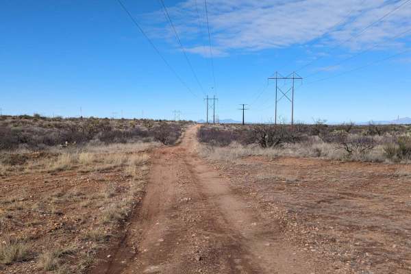
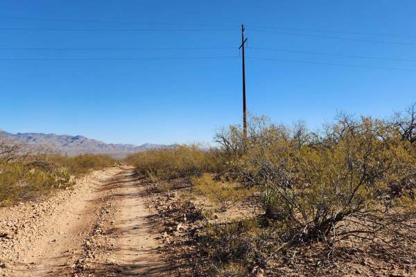
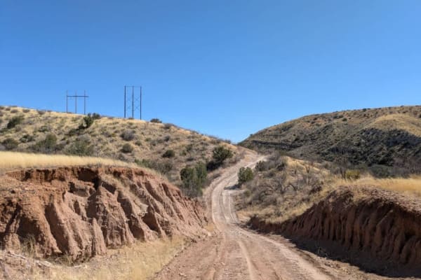
Powerline Road
The Powerline Road is a rugged trail that begins just off of Old Sonoita Highway and runs eastward along I-10 towards the Whetstone Mountains. The Powerline trail is popular with ATVs, dirt bikes, SxSs, and other off-road vehicles. Back-road travel can be hazardous, so be aware of weather and road c...
Learn more about Powerline Road
Old Happy Valley Road FR 4406
This route offers amazing scenery and a more challenging alternative to Happy Valley. It used to be the main road to Happy Valley but was bypassed to make the ascent over the pass at Paige Creek smoother. Today, the trail follows the powerline to the ranches in Miller Flat and Turkey Creek, providin...
Learn more about Old Happy Valley Road FR 4406
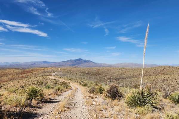
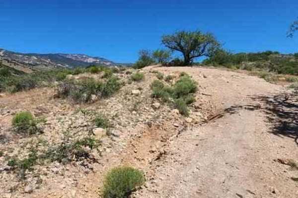
Mine Road
This trail is comprised of a bunch of different two-track roads. This trail is reasonably fun, but not too difficult. Some of these roads are well maintained, while others are old mining roads that would only be suited for off-road machines, like dirt bikes, Jeeps, or side x side. Most of the other ...
Learn more about Mine Road
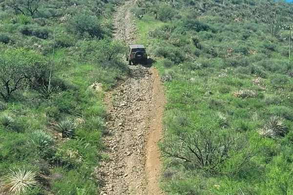
Total Wreck Mine
The Total Wreck Mine Trail is perfect for off-road enthusiasts seeking an exhilarating adventure. The trail features challenging terrain with rocky, rutted, off-camber areas, and steep inclines that will test your skills and your vehicle's capabilities. You can start the trail from the Power Line Tr...
Learn more about Total Wreck Mine
Coal Mine Road FR-4859
Enjoy incredible mountain views and scattered cacti along this road. Pronghorns, mule deer, and bobcats are also prevalent in the area, as are black-tailed prairie dogs. Most of the trail is hard-packed dirt road. Be aware of open-range cattle that line the ditches and occasionally cross the road. I...
Learn more about Coal Mine Road FR-4859
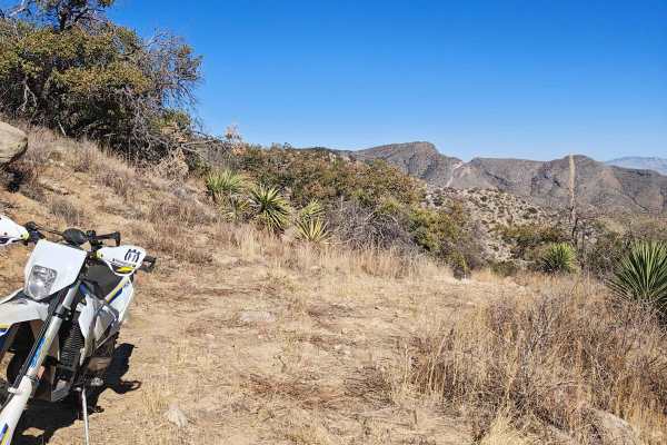
Eagle Peak
This route extends from Happy Valley Road, offering a more challenging experience with uneven turns, ledges, and rocky sections on steep inclines. As you navigate, you'll encounter various obstacles that elevate the difficulty compared to Happy Valley Road. The trail culminates at a locked gate, mar...
Learn more about Eagle Peak
Turkey Creek Springs FR 4408
The Turkey Creek Trail in the Coronado National Forest runs along a ridge that separates Turkey Creek and Mesquite Canyons. This part of the trail is located within the Rincon Mountain Wilderness boundary. The landscape it traverses resembles that of the Saguaro National Park, with abundant saguaros...
Learn more about Turkey Creek Springs FR 4408
Bear Springs Canyon
Bear Springs Canyon is a scenic and enjoyable trail that was recently maintained as of 3/12/25, though conditions can change quickly, especially with rain in the forecast. The route winds through open grasslands before narrowing into a single-track path that follows the edge of a canyon. Along the w...
Learn more about Bear Springs Canyon
East Empire Ranch Road
This road is a simple dirt road that is typically graded with occasional washboarding and is a gateway to much of the Cienega Creek and the Las Cienegas National Conservation Areas. Along the landscape, you will see rolling grasslands, a verdant riparian area, towering cottonwood trees, and mesquite...
Learn more about East Empire Ranch Road
Forty Nine Wash Trail
Nestled in Arizona's expanse, a slice of "Big Sky" country unfolds along Cienega Creek. Just 45 miles southeast of Tucson, this landscape boasts wide-open grasslands, panoramic mountain views, and meandering waters that transport you to another realm. Here, cattle still graze amidst a tapestry of pr...
Learn more about Forty Nine Wash Trail

Oak Tree Canyon
Oak Tree Canyon is on the historic Empire Ranch, which is now known as the Las Cienegas National Conservation Area. This section features expansive mountain views, craggy peaks, and a visit to a historical site. The conservation area hosts a working ranch, so you might encounter a few cows. Thus, it...
Learn more about Oak Tree Canyon
FR 6914
Trail 6914 begins as a maintained road, offering an easy start before transitioning into more challenging terrain. At the trailhead, there is a dispersed group campsite, though camping is not permitted near water sources. After passing through the second gate, the route becomes more technical, featu...
Learn more about FR 6914
Canyon Road
Canyon Road begins as a relatively well-maintained dirt road running parallel to a wash, offering scenic views and easy driving. At the start of the trail, you'll find a handful of designated campsites nestled beneath mesquite trees--these are popular with both weekend campers and overlanders. As yo...
Learn more about Canyon Road
Andrada Tank Loop FR 6905
The Andrada Tank Loop is a scenic trail that offers breathtaking views of the Sonoran Desert landscape and the nearby Whetstone Mountains. The trail winds through desert terrain featuring prickly pear cacti, ocotillo plants, and rocky outcrops. When driving from the south end of the trail, about one...
Learn more about Andrada Tank Loop FR 6905
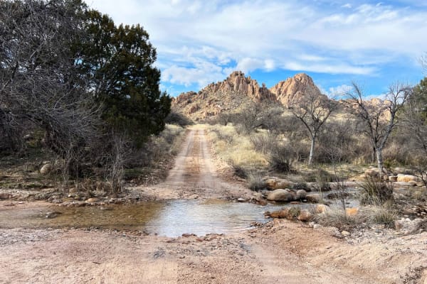
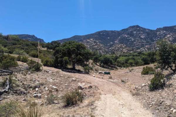
Slavin to West Stronghold
Slavin Forest Road 687 lies within Coronado National Forest. Most of the trail is smooth sandy gravel with incredible views of Council Rocks. Once reaching the gate at Corazon Ranch and turning onto West Stronghold FR 688 the road becomes more technical and narrow with washouts and many creek crossi...
Learn more about Slavin to West Stronghold
Blacktail Hill
As soon as you pass through the gate onto BLM land, the road improves significantly. Although there are a few washes and mildly off-camber sections, the trail is easy to drive and generally not challenging. It offers sweeping views of the valleys and salt flats, with dispersed camping available alon...
Learn more about Blacktail Hill
ATV trails near Whetstone, Arizona
Explore ATV-friendly trails near you. These trails are accessible for vehicles up to 50 inches wide, perfect for ATVs and smaller off-road machines.
Happy Valley FR 35
The Happy Valley Road winds past the charming historic movie town of Mescal. It travels through verdant riparian zones and expansive grasslands of the surrounding ranches. Along the way, you can find several idyllic dispersed campsites suitable for travel trailers or smaller RVs, as well as many oth...
Learn more about Happy Valley FR 35
Wakefield Cabin
This trail will guide you through historic ranch land. As you descend into a small canyon near the end, you'll spot an abandoned Buddhist cabin on your left.This trail dips into a wash for about a quarter mile. Riders need to closely follow the trail maps, as there's a part where the trail exits the...
Learn more about Wakefield Cabin
Lower Wakefield Canyon
This trail follows ridge lines, offering stunning views of the sprawling desert landscapes below. This trail's many sections are overgrown, making pinstriping nearly inevitable, particularly for larger vehicles. Just a wa ning if you plan on taking a bigger rig. Cell service in this area can be unr...
Learn more about Lower Wakefield Canyon
The Narrows
The Narrows is a nice combination of technical terrain and narrow sections;expect to get desert pinstriping. The trail features rutted sections and hill climbs through Cienega Creek. Bring plenty of water and enjoy the ride. Check the weather conditions before heading out, as rain or snow could affe...
Learn more about The Narrows
UTV/side-by-side trails near Whetstone, Arizona
Find UTV and side-by-side trails near you. These trails accommodate vehicles up to 60 inches wide, ideal for UTVs, side-by-sides, and wider off-road rigs.
Happy Valley FR 35
The Happy Valley Road winds past the charming historic movie town of Mescal. It travels through verdant riparian zones and expansive grasslands of the surrounding ranches. Along the way, you can find several idyllic dispersed campsites suitable for travel trailers or smaller RVs, as well as many oth...
Learn more about Happy Valley FR 35
Wakefield Cabin
This trail will guide you through historic ranch land. As you descend into a small canyon near the end, you'll spot an abandoned Buddhist cabin on your left.This trail dips into a wash for about a quarter mile. Riders need to closely follow the trail maps, as there's a part where the trail exits the...
Learn more about Wakefield Cabin
Lower Wakefield Canyon
This trail follows ridge lines, offering stunning views of the sprawling desert landscapes below. This trail's many sections are overgrown, making pinstriping nearly inevitable, particularly for larger vehicles. Just a wa ning if you plan on taking a bigger rig. Cell service in this area can be unr...
Learn more about Lower Wakefield Canyon
The Narrows
The Narrows is a nice combination of technical terrain and narrow sections;expect to get desert pinstriping. The trail features rutted sections and hill climbs through Cienega Creek. Bring plenty of water and enjoy the ride. Check the weather conditions before heading out, as rain or snow could affe...
Learn more about The Narrows
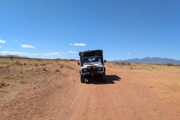
The onX Offroad Difference
onX Offroad combines trail photos, descriptions, difficulty ratings, width restrictions, seasonality, and more in a user-friendly interface. Available on all devices, with offline access and full compatibility with CarPlay and Android Auto. Discover what you're missing today!
Open Trail Map