
Dirt Bike Trails
Near Wesley, Arkansas
Explore All Dirt Bike Trails Near Wesley, Arkansas
Dirt Bike Trails Near Wesley, Arkansas
Discover the best dirt bike trails near you. Browse trail maps, check difficulty ratings, and find your next adventure — whether you're looking for a quick ride or an all-day expedition.
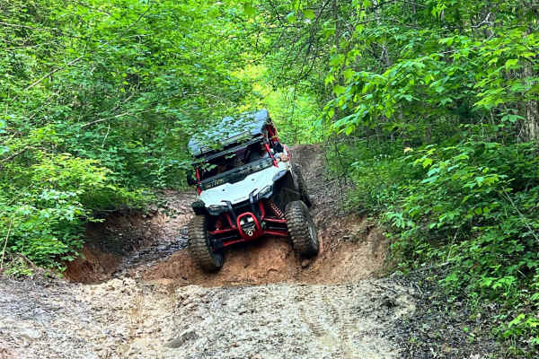
Delaney Creek Trail FS1517
Delaney Creek trail FS1517 is located in the Boston Mountains. The trail is filled with a few off-camber spots with mud and creek crossings. It also has a couple of narrow spots with low-hanging trees that you should be able to get under with ATVs, SxSs, and vehicles that are not lifted too high. Th...
Learn more about Delaney Creek Trail FS1517
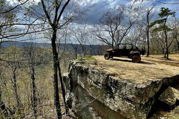
Mill Creek Blue Loop
Mill Creek Blue Loop is a 25-mile offroad trail in the Ozark National Forest, winding through the rugged Boston Mountains. Climbing over 3,380 feet, the route traverses a mix of gravel and unsurfaced terrain, ranging from easy sections to steep, rocky climbs and muddy areas requiring high-clearance ...
Learn more about Mill Creek Blue Loop
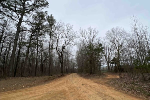
White Rock Mountain East
White Rock Mountain is an amazing place to explore in the Ozarks because it's absolutely magnificent. Sitting at an elevation of 2,309 feet, it provides some of the most breathtaking views in Arkansas. It's also one of the highest elevations in the state. The road to get there is an easy gravel road...
Learn more about White Rock Mountain East
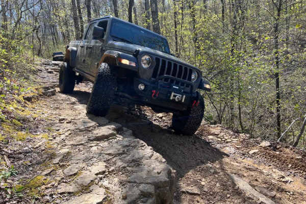
Eureka Springs Hollow 95472B
This is a fun challenging trail that can be used to connect to other nearby trails. Traveling from west to east, it is mostly downhill. It starts as an easy trail with a few large mud holes that are about 2 feet deep. You will find that it will soon turn to an off-camber descent with a 3-foot ledge ...
Learn more about Eureka Springs Hollow 95472B

Lindsey Ridge - 1547
Lindsey Ridge Trail has a lot to offer, from mud pits to rock crawling. Starting from the north end of the trail it is bumpy and easy to navigate. But soon turns into a challenging trail as it descends down the ridge with off-camber sections, many boulders, and ledges up to 2ft in places. As you get...
Learn more about Lindsey Ridge - 1547
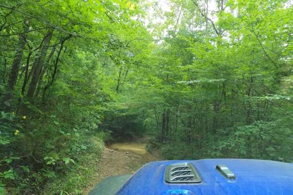
Frog Bayou
The west end of this trail has recently been rerouted to ensure that it avoids private property. This trail follows FS1705/Kenney Road and runs along Frog Bayou, the main tributary for Lake Fort Smith, and features Frog Bayou Falls. Frog Bayou can be traveled either from Bidville Rd on the west side...
Learn more about Frog Bayou
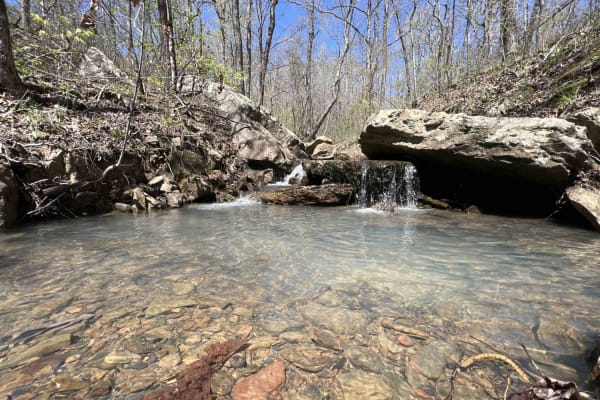
Fanes Creek 1520
Fanes Creek is a really beautiful area to explore with several areas to play in the water, it's a great way to cool off during the summer. It's an easy gravel road with both Fanes Creek and Cove Creek passing alongside this route. There are dispersed campsites right next to these creeks along with w...
Learn more about Fanes Creek 1520
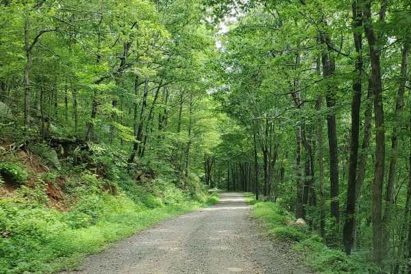
Prison Fence Trail
This is an easy scenic trail with various terrain types, including gravel, dirt, mud holes, rock ledges, and shallow water crossings. The elevation varies from around 1100' to just over 2400' as it follows along the Little Mulberry River. This trail runs north and south between Highway 16 and Highwa...
Learn more about Prison Fence Trail

Hanging Rock Hollow Falls Trail
This trail is a good test of your off-road skills. It has many elevation changes and obstacles that will test your equipment. The lower areas have several water crossings and some very deep mud bog areas. Choose your line carefully. The trail is prone to wash-outs and has plenty of deep gutters. The...
Learn more about Hanging Rock Hollow Falls Trail
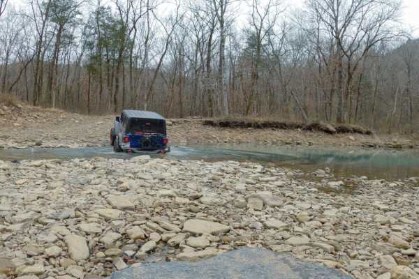
Alexander Mountain
Alexander Mountain, or Forest Service Road 1703, runs between Locke, on the southwest end near Devil's Canyon, to Hurricane Creek Rd, near White Rock on the northeast end. It can be run either direction. This trail offers beautiful scenery with a mix of challenging and easy trail sections. The road ...
Learn more about Alexander Mountain

Hanging Rock Hollow Spur - FS 94669
This short but technical spur off Hanging Rock Falls Hollow Trail delivers a surprising challenge for those seeking more after completing the main route. Accessed 1.2 miles from the Hanging Rock trailhead, FS 94669 begins deceptively easy before revealing its true character through a series of tight...
Learn more about Hanging Rock Hollow Spur - FS 94669

Mountain Creek Trail
Mountain Creek Trail has fun and varied terrain from top to bottom. The original designated trail has changed significantly as the forest service has moved the trail from the original map coordinates. The designated trail at the southern end is in a creek bottom and is very muddy. Several paths have...
Learn more about Mountain Creek Trail
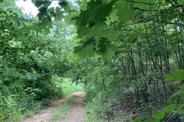
Deer Trap - FS 1776
This trail (FS 1776) is near White Rock Mountain. Many of the harder trails around White Rock are currently closed, so this is a challenging trail that takes you south and allows you to hook up with a trail that eventually ends up at Shores Lake. This road currently will only take narrow vehicles be...
Learn more about Deer Trap - FS 1776
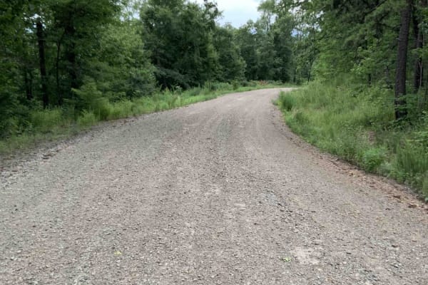
Bliss Ridge / 1505-1
This is a wide, well-maintained, dirt road from the White Rock Mountain Area to Shores Lake. Shores Lake is an 82-acre lake and has hiking, camping, swim areas, restrooms, and a boat ramp. It is a clear lake and has good fishing. ATVs are not allowed in the lake area. There are also a few campsites...
Learn more about Bliss Ridge / 1505-1

White Rock Mountain - East
Mostly maintained Gravel rd. Some washouts and rough rocky terrain. This trail starts at the intersection of Highway 23 and CO Road. 1003 and heads west towards white rock mountain. Has some self-rads that wine through the mountains. there are a few streams to cross with concrete culverts. There are...
Learn more about White Rock Mountain - East
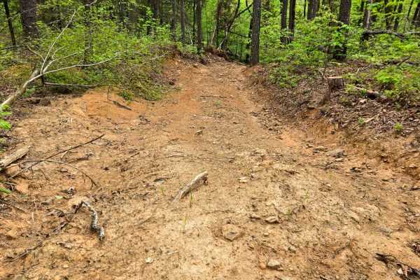
Perry Curve
Perry Curve trail is an easy dirt trail that leads to a neat, standing old chimney. At the chimney, there is a sweet campsite with a fire pit and a pond. The trail itself has some steep climbs with loose rocks. Past the campsite, the trail becomes less maintained. A very scenic trail, especially in ...
Learn more about Perry Curve
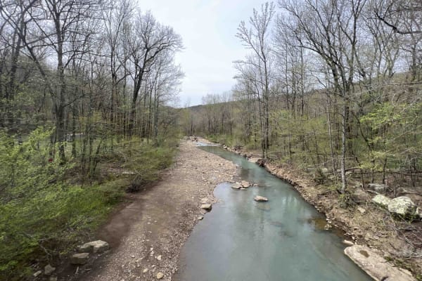
White Rock Mountain West
White Rock Mountain is magnificent. Sitting at an elevation of 2,309 feet the hiking trails with their views and caves to explore are a sight to see. There are three ways to get to White Rock Mountain, however one of which (Road 1003 in certain sections) is closed due to a landslide. This route is t...
Learn more about White Rock Mountain West
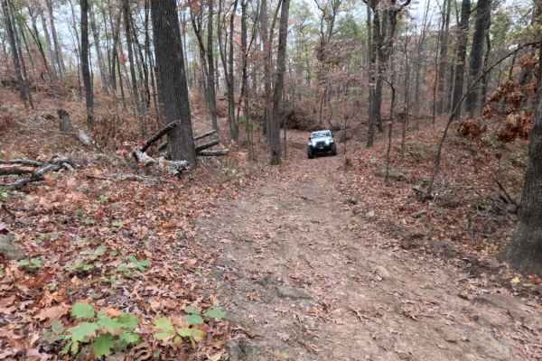
Logging Bank Trail (FSR #94449B)
Logging Bank Trail (FS#94449B)**Difficulty: 5 (Moderate)**This 2-mile trail in the Ozark St. Francis National Forest offers increasingly challenging terrain as drivers progress from north to south. Accessible via Beech Grove trail, FS#94449B typically requires about 1.5 hours, providing a satisfying...
Learn more about Logging Bank Trail (FSR #94449B)
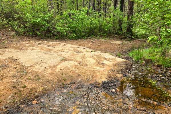
Firebreak Hunterwell
This trail is mostly an easy dirt trail. If you are coming from the north, you will hit a rocky section around mile 2.3 with some rock step downs. This is a pretty trail to drive down, especially as it gets closer towards Shores Lake. There are some campsites at the south side entrance. There are a ...
Learn more about Firebreak Hunterwell
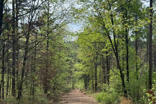
Stephens Road
Starting from the north side of Road 1551 off of 1514. This trail has a nice campsite on the west side about 1000 feet from the start. Going down the hill, there is a bigger rock terrain. About 1.5 miles in, you will see two more campsites on the east and west sides. After the two campsites, you wil...
Learn more about Stephens Road
ATV trails near Wesley, Arkansas
Explore ATV-friendly trails near you. These trails are accessible for vehicles up to 50 inches wide, perfect for ATVs and smaller off-road machines.
Delaney Creek Trail FS1517
Delaney Creek trail FS1517 is located in the Boston Mountains. The trail is filled with a few off-camber spots with mud and creek crossings. It also has a couple of narrow spots with low-hanging trees that you should be able to get under with ATVs, SxSs, and vehicles that are not lifted too high. Th...
Learn more about Delaney Creek Trail FS1517
Mill Creek Blue Loop
Mill Creek Blue Loop is a 25-mile offroad trail in the Ozark National Forest, winding through the rugged Boston Mountains. Climbing over 3,380 feet, the route traverses a mix of gravel and unsurfaced terrain, ranging from easy sections to steep, rocky climbs and muddy areas requiring high-clearance ...
Learn more about Mill Creek Blue Loop
White Rock Mountain East
White Rock Mountain is an amazing place to explore in the Ozarks because it's absolutely magnificent. Sitting at an elevation of 2,309 feet, it provides some of the most breathtaking views in Arkansas. It's also one of the highest elevations in the state. The road to get there is an easy gravel road...
Learn more about White Rock Mountain East
Eureka Springs Hollow 95472B
This is a fun challenging trail that can be used to connect to other nearby trails. Traveling from west to east, it is mostly downhill. It starts as an easy trail with a few large mud holes that are about 2 feet deep. You will find that it will soon turn to an off-camber descent with a 3-foot ledge ...
Learn more about Eureka Springs Hollow 95472B
UTV/side-by-side trails near Wesley, Arkansas
Find UTV and side-by-side trails near you. These trails accommodate vehicles up to 60 inches wide, ideal for UTVs, side-by-sides, and wider off-road rigs.
Delaney Creek Trail FS1517
Delaney Creek trail FS1517 is located in the Boston Mountains. The trail is filled with a few off-camber spots with mud and creek crossings. It also has a couple of narrow spots with low-hanging trees that you should be able to get under with ATVs, SxSs, and vehicles that are not lifted too high. Th...
Learn more about Delaney Creek Trail FS1517
Mill Creek Blue Loop
Mill Creek Blue Loop is a 25-mile offroad trail in the Ozark National Forest, winding through the rugged Boston Mountains. Climbing over 3,380 feet, the route traverses a mix of gravel and unsurfaced terrain, ranging from easy sections to steep, rocky climbs and muddy areas requiring high-clearance ...
Learn more about Mill Creek Blue Loop
White Rock Mountain East
White Rock Mountain is an amazing place to explore in the Ozarks because it's absolutely magnificent. Sitting at an elevation of 2,309 feet, it provides some of the most breathtaking views in Arkansas. It's also one of the highest elevations in the state. The road to get there is an easy gravel road...
Learn more about White Rock Mountain East
Eureka Springs Hollow 95472B
This is a fun challenging trail that can be used to connect to other nearby trails. Traveling from west to east, it is mostly downhill. It starts as an easy trail with a few large mud holes that are about 2 feet deep. You will find that it will soon turn to an off-camber descent with a 3-foot ledge ...
Learn more about Eureka Springs Hollow 95472B
The onX Offroad Difference
onX Offroad combines trail photos, descriptions, difficulty ratings, width restrictions, seasonality, and more in a user-friendly interface. Available on all devices, with offline access and full compatibility with CarPlay and Android Auto. Discover what you're missing today!
Open Trail Map