
Dirt Bike Trails
Near Waverly, Washington
Explore All Dirt Bike Trails Near Waverly, Washington
Dirt Bike Trails Near Waverly, Washington
Discover the best dirt bike trails near you. Browse trail maps, check difficulty ratings, and find your next adventure — whether you're looking for a quick ride or an all-day expedition.
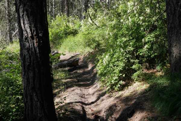
Rocky
This trail begins at the southern boundary with a wide, easy, and flowy path that weaves through open meadows, grassy hillsides, and sparse pine forest. It quickly narrows in places between trees, making it more of a dirt bike trail, and includes some flat embedded rock faces and light rutting. Afte...
Learn more about Rocky
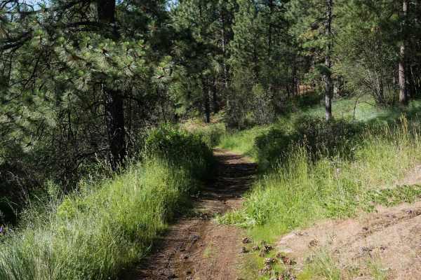
Straight Shot
This is a gradual and easy ATV route running north from the southern boundary of the ORV park. It begins as a wide, dry, and dusty path that traverses grassy slopes and sparse pine forest, maintaining a fairly straight and level course with only minor elevation changes. The trail is well-suited for ...
Learn more about Straight Shot
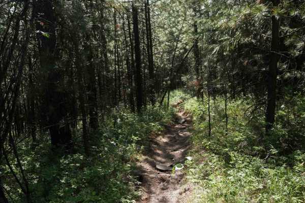
Trough Line
This trail feels more like single-track and is best suited for dirt bikes, though narrow ATVs may still get through. It's deeply troughed with uneven terrain and natural little drop-offs scattered throughout. Some loose rocks are present, and grassy sections are crisscrossed with rutted split lines....
Learn more about Trough Line
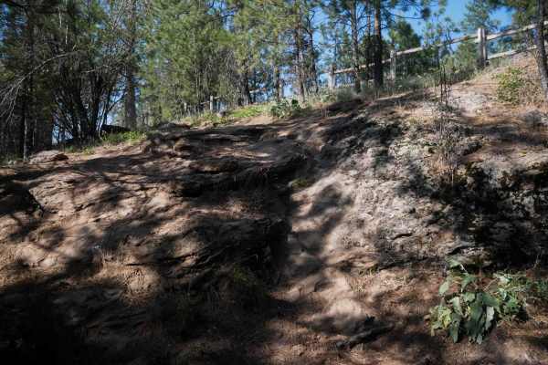
East Boundary (More Difficult)
This is a steep and challenging half-mile-long route that begins with a loose, steep climb full of rock faces and split lines that are narrow and rutted, leading up to the park's fence line on the eastern boundary of the ORV park. The trail goes south along the fence line, with a big optional rock o...
Learn more about East Boundary (More Difficult)
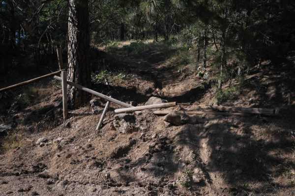
Fence Run
This trail runs across the ORV park from the west to east boundary, fenced in on both sides. Starting on the west side, the trail follows a moderately challenging path through forested terrain with embedded rock, a few steep sections, and occasional narrow spots, along with views of the lake. In the...
Learn more about Fence Run
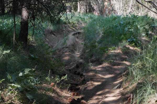
Center
This trail is a short, under half-mile-long route that crosses the center of the ORV park with a mix of terrain and moderate technical features. It begins with a faint, grassy two-track entrance on the west end, drops into the trees, then climbs back up through a rutted and root-filled section. A de...
Learn more about Center
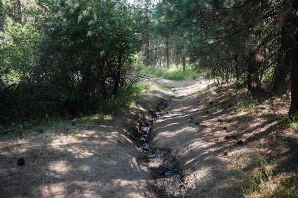
Staging Loop
This trail is a moderately easy 1-mile OHV loop that begins near the staging area and winds through a dry pine forest. The wide path is dry and dusty with uneven terrain, featuring embedded rock faces, loose rock, and mild downhill sections. While not particularly steep, riders must navigate deep ru...
Learn more about Staging Loop
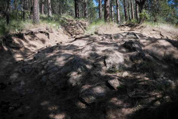
Rock Climb
This trail is a short but demanding quarter-mile OHV route that begins at the "Moderate" sign with a steep hill climb over loose, dusty dirt and deep ruts. Riders must navigate a large rock face, tight split lines between trees, and lots of root bands crossing the trail, all while managing consisten...
Learn more about Rock Climb
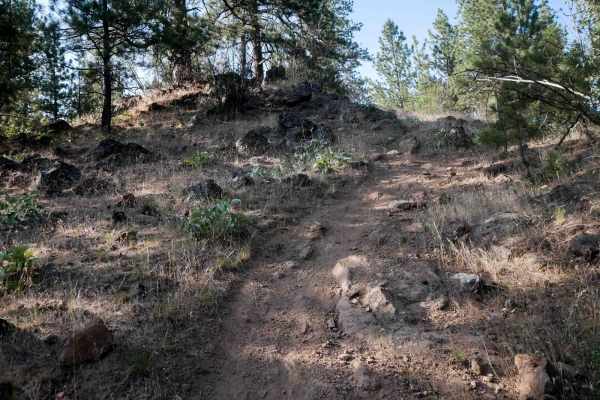
Lake View
This is a 0.7-mile route that offers a wide path with scenic views of the lake and a mix of moderately challenging terrain. It begins on the east side of the ORV park with a steep descent away from the fence line, featuring embedded rock, root bands, and a few unmarked intersections. It is consisten...
Learn more about Lake View
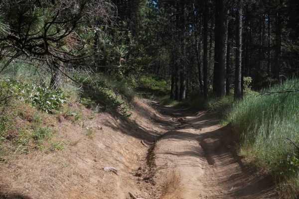
Easy Going
This trail is a 1-mile easy OHV route that runs north to south through the center of the ORV park. It travels through a mix of grassy meadows and pine forest, with a wide and open layout that narrows slightly in places but remains suitable for ATVs. The trail is dry and dusty with light rutting alon...
Learn more about Easy Going
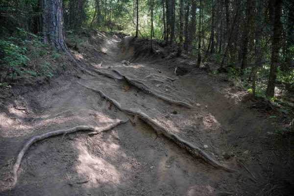
East Boundary
This is about a mile long and offers a moderately challenging ride with a mix of ruts, roots, and narrow passages. It starts as a tight, bushy path along the ORV park boundary and heads south along a fence line. From the north end, it quickly turns uphill into a steep climb over embedded and diagona...
Learn more about East Boundary
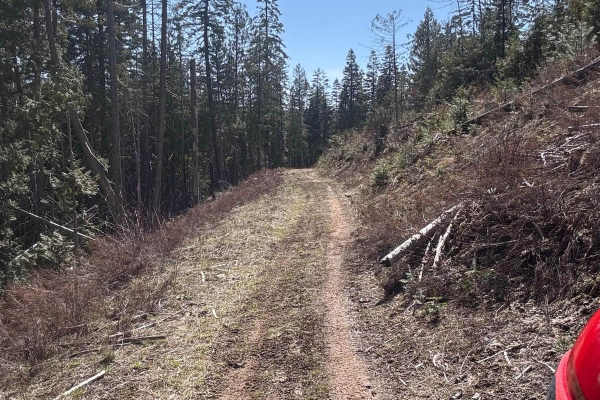
Korth Trail
The Korth trail is a 50" trail at McCroskey State Park. Both ends start out pretty wide like a logging road, but you'll drop into the timber where the trail narrows. This is where you'll find more winding and flow on the trail. There are a handful of creek crossings that would likely be pretty seaso...
Learn more about Korth Trail
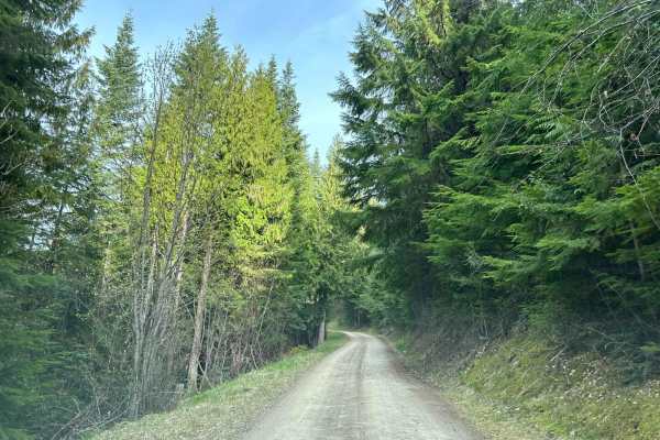
Carlin Creek/Carrill Ridge
This is a very nice easy drive through some beautiful thick forest. The road is mostly wide enough for easy passing and is mostly smooth. There are good views of the valleys and the rest of the mountain range. This is a great alternate route from Harrison to Carlin Bay for 4-wheel vehicles as well a...
Learn more about Carlin Creek/Carrill Ridge
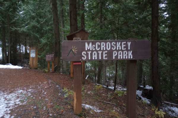
Skyline Drive
This route starts on Highway 95 near De Smet, Idaho and travels through McCroskey State Park. This is a well maintained road that any vehicle should be able to take on. Signs along the way will teach you some of the history of the area. Just over 6 miles in, you'll come across a day use area with a...
Learn more about Skyline Drive
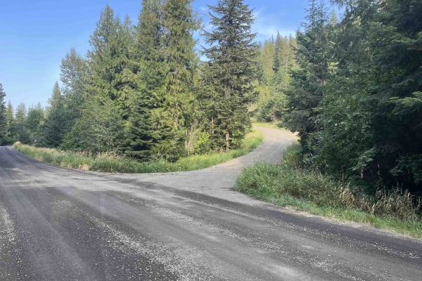
Crane Point/FS 1273
Crane Point is a 3.7-mile out-and-back gravel road that climbs from US95 to Crane Point. The gravel road is well maintained and ranges from one to two vehicles wide. Crane Point serves as the main access point to the Crane Point trail network. There is logging activity, so watch for logging trucks a...
Learn more about Crane Point/FS 1273
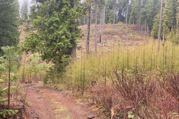
Waterhole Creek
Waterhole Creek Trail (Trail 15) is an engaging off-road route in the Palouse Trail System of the Hoodoo Mountains, perfect for drivers of high-clearance four-wheel-drive vehicles and SxSs seeking scenic ridge views and dense forest shade. Spanning approximately 4.8 miles, this trail links Gold Hill...
Learn more about Waterhole Creek
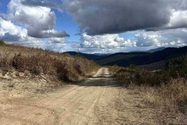
Palouse Divide West - FS 377
Palouse Divide West (FS 377) is a 15.3 point-to-point trail that, when starting from the west side, begins at the end of Big Creek Road. It winds down into the backside of Prospect Peak into a valley and continues along Meadow Creek for several miles before making a sharp left shown in the second pi...
Learn more about Palouse Divide West - FS 377
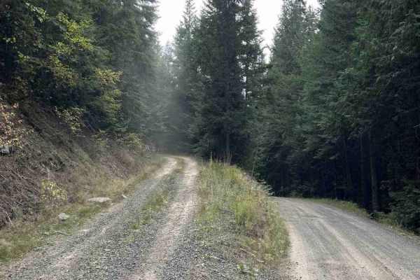
Treasure Gulch - FS 1418
1418 Treasure Gulch is a 3-mile out-and-back trail that breaks off from 770 Gold Hill. FS 1418 climbs up and along the west side of the geographical feature by the same name, Treasure Gulch, before cresting the ridge at an intersection with Waterhole Creek, a 50" and under trail. Before the intersec...
Learn more about Treasure Gulch - FS 1418
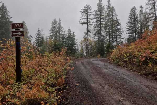
Hill Creek - FS 1976
1976 Hill Creek is a 1.9-mile out-and-back trail that starts at 377 Palouse Divide West, climbing around the west and north side of West Dennis, before ending at the border of PotlachDeltic timberland, where the trail becomes restricted to 50-inch and under OHVs. Hill Creek has recently had logging ...
Learn more about Hill Creek - FS 1976
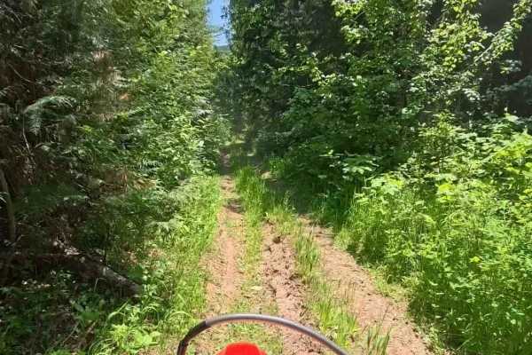
Coon Creek Trail (FDR 3300)
Coon Creek Trail was once a jeep trail that is now only accessible to ATVs and Dirtbikes. It is a short but tight, sometimes intense, and fun trail. There are a few sections with some deeper ruts and tight brush. The trail begins at Meadow Creek Road and follows the coon creek drainage up towards Pa...
Learn more about Coon Creek Trail (FDR 3300)
ATV trails near Waverly, Washington
Explore ATV-friendly trails near you. These trails are accessible for vehicles up to 50 inches wide, perfect for ATVs and smaller off-road machines.
Rocky
This trail begins at the southern boundary with a wide, easy, and flowy path that weaves through open meadows, grassy hillsides, and sparse pine forest. It quickly narrows in places between trees, making it more of a dirt bike trail, and includes some flat embedded rock faces and light rutting. Afte...
Learn more about Rocky
Straight Shot
This is a gradual and easy ATV route running north from the southern boundary of the ORV park. It begins as a wide, dry, and dusty path that traverses grassy slopes and sparse pine forest, maintaining a fairly straight and level course with only minor elevation changes. The trail is well-suited for ...
Learn more about Straight Shot
Trough Line
This trail feels more like single-track and is best suited for dirt bikes, though narrow ATVs may still get through. It's deeply troughed with uneven terrain and natural little drop-offs scattered throughout. Some loose rocks are present, and grassy sections are crisscrossed with rutted split lines....
Learn more about Trough Line
East Boundary (More Difficult)
This is a steep and challenging half-mile-long route that begins with a loose, steep climb full of rock faces and split lines that are narrow and rutted, leading up to the park's fence line on the eastern boundary of the ORV park. The trail goes south along the fence line, with a big optional rock o...
Learn more about East Boundary (More Difficult)
UTV/side-by-side trails near Waverly, Washington
Find UTV and side-by-side trails near you. These trails accommodate vehicles up to 60 inches wide, ideal for UTVs, side-by-sides, and wider off-road rigs.
Carlin Creek/Carrill Ridge
This is a very nice easy drive through some beautiful thick forest. The road is mostly wide enough for easy passing and is mostly smooth. There are good views of the valleys and the rest of the mountain range. This is a great alternate route from Harrison to Carlin Bay for 4-wheel vehicles as well a...
Learn more about Carlin Creek/Carrill Ridge
Skyline Drive
This route starts on Highway 95 near De Smet, Idaho and travels through McCroskey State Park. This is a well maintained road that any vehicle should be able to take on. Signs along the way will teach you some of the history of the area. Just over 6 miles in, you'll come across a day use area with a...
Learn more about Skyline Drive
Crane Point/FS 1273
Crane Point is a 3.7-mile out-and-back gravel road that climbs from US95 to Crane Point. The gravel road is well maintained and ranges from one to two vehicles wide. Crane Point serves as the main access point to the Crane Point trail network. There is logging activity, so watch for logging trucks a...
Learn more about Crane Point/FS 1273
Palouse Divide West - FS 377
Palouse Divide West (FS 377) is a 15.3 point-to-point trail that, when starting from the west side, begins at the end of Big Creek Road. It winds down into the backside of Prospect Peak into a valley and continues along Meadow Creek for several miles before making a sharp left shown in the second pi...
Learn more about Palouse Divide West - FS 377
The onX Offroad Difference
onX Offroad combines trail photos, descriptions, difficulty ratings, width restrictions, seasonality, and more in a user-friendly interface. Available on all devices, with offline access and full compatibility with CarPlay and Android Auto. Discover what you're missing today!
Open Trail Map