
Dirt Bike Trails
Near Washington, Utah
Explore All Dirt Bike Trails Near Washington, Utah
Dirt Bike Trails Near Washington, Utah
Discover the best dirt bike trails near you. Browse trail maps, check difficulty ratings, and find your next adventure — whether you're looking for a quick ride or an all-day expedition.
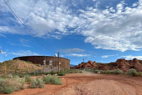
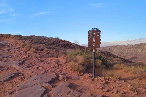
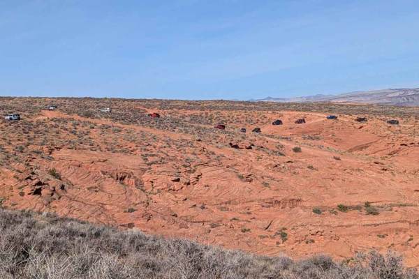
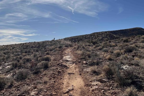
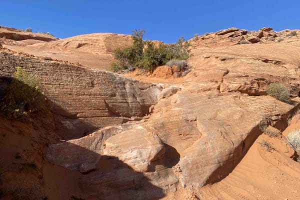
Water Tower Overlook
This is an easy trail right out of the city. 4WD is not required, but it may be useful to climb some sand hills. This trail leads to mountain biking and hiking areas in the Turtle Reserve.
Learn more about Water Tower Overlook
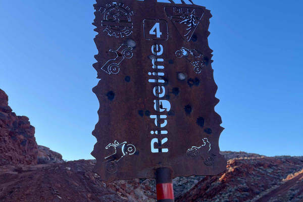
Ridgeline Trail
This short 1-mile trail gives access to the main section of Sand Hollow from the Warner Valley Wash and Campground area. It also passes the trail Razorback (rated 8) which would be an optional trail. Sand Hollow rates this as a 4, but there are 3 obstacles that change that, as they are steep, tall, ...
Learn more about Ridgeline Trail
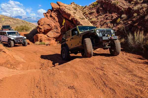
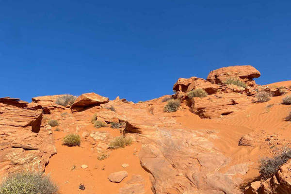
Fault Line
Fault line is named for the outcropping it traverses along a fault line, made mostly of solid sandstone fins and just a bit of sand mixed in. This trail is typically finished out with West Rim Trail, but is a nice one to pair with many options here at Sand Hollow. It starts heading up a steep red c...
Learn more about Fault Line
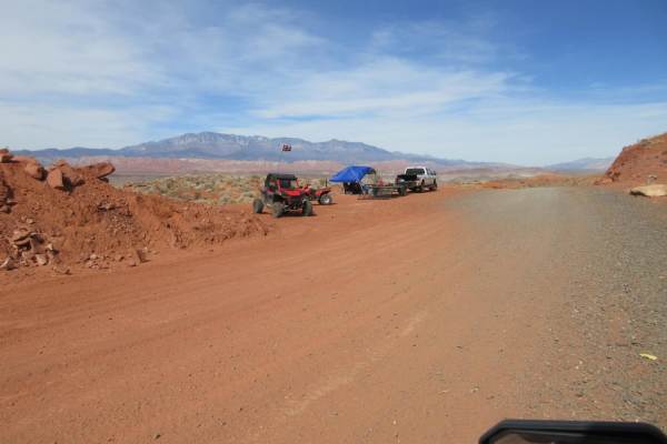
Warner Valley Wash
This desert wash is a 5-mile trail south of Sand Hollow/Hurricane, UT, in the shadow of the West Rim of Sand Hollow. You get a good view of Punchbowl Dome, and the trail connects to Warner Valley Road, where you can continue on and see the dinosaur tracks or the petroglyphs. Our SXS is a 4-seater, 7...
Learn more about Warner Valley Wash
West Rim
West Rim is a 3.9-mile point-to-point trail rated 5 of 10 located within the Sand Mountain Open Riding OHV Area. West Rim trailhead starts just south of the Pipeline Road where there is an available restroom facility and is marked by a trailhead sign. This is a 5-rated trail that has several named o...
Learn more about West Rim
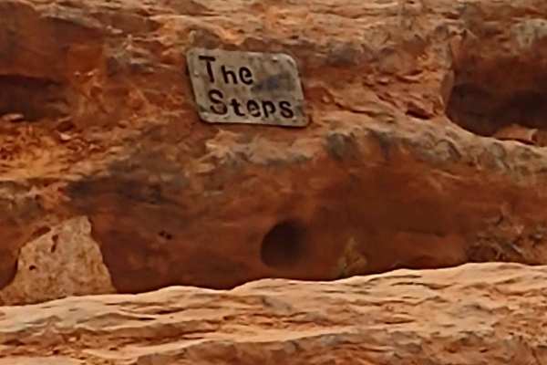
Steps - Funnel - West Rim
This track starts at the north end of Lower Dune Road and West Frontage Road. The sandy whoops are easy and fun. This area can be crowded at peak times/seasons, so be aware of others. It's not unusual to see cattle grazing around this area during the winter months. When you turn uphill to go to the ...
Learn more about Steps - Funnel - West Rim
Bobsled Loop
If ever a trail should be "one way," it's this one! To enjoy it the most, have someone in your group go down and ensure no one is coming up, and then you can fly down through this bobsled trail. It's got high corners and tight turns, and it's all banked perfectly for a quick run. Beware, people some...
Learn more about Bobsled Loop
Resurrection
Resurrection Trail, rated 5 out of 10, combines sand washes and multi-stepped rock climbs with a few exciting off-camber blind turns to keep the ride thrilling. The trail is broken into four distinct sections. The first wash has multiple off-camber turns and a nice 30-degree sand wash slope that wil...
Learn more about Resurrection
Eze Peezy
Eze Peezy is a 10-mile point-to-point trail rated 3 of 10 located within the Sand Mountain Open Off-Highway Vehicle Area. This 3-rated trail offers very mild versions of every type of terrain offered on Sand Mountain. The trail offers sand track, short stretches on the sand dunes, ra ocky connector ...
Learn more about Eze Peezy
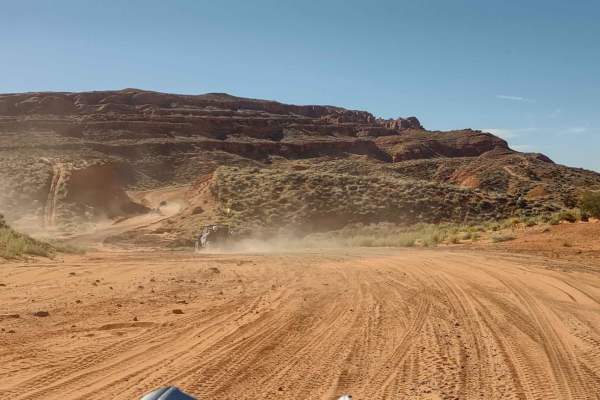
Sand Mountain via Warner Valley
Upgrades to Route 7, which cuts between the state park and Sand Mountain, as well as recently installed gates and fences, have changed the accesses to Sand Mountain. In Utah, OHVs are limited to roads posted at 45 mph or less. The new Route 7 will be a divided road with 65 mph speeds. This is not sa...
Learn more about Sand Mountain via Warner Valley
Upper Warner Ridge
Upper Warner Ridge begins South of the Pipeline Road parking lot and runs 7.5 miles southeast. The trail terminates near the intersection of Warner Valley and East Mesa Overlook roads, near the Fort Pearce ruins. The ground surface is a mix of hard-packed dirt, large boulders, and embedded rock slab...
Learn more about Upper Warner Ridge
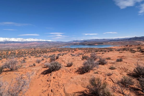
West Fenceline Whoops Central
Almost in the center of Sand Hollow State Park, the West Fenceline runs east and west, and if you like whoops, this is the trail for you! The views to the north of Sand Hollow Reservoir, Hurricane, Zion National Park and Trail, Signal, and Burger Peaks are fantastic. The Fenceline continues further...
Learn more about West Fenceline Whoops Central
Lower Warner Ridge
Lower Warner Ridge breaks off from the Upper Warner Ridge trail and runs parallel to it for 1.6 miles before rejoining. This trail is very similar to Upper Warner Ridge and contains rock slabs, several small ledges, and a large 4- to 5-foot obstacle. There is no cliff exposure found on the Lower tra...
Learn more about Lower Warner Ridge
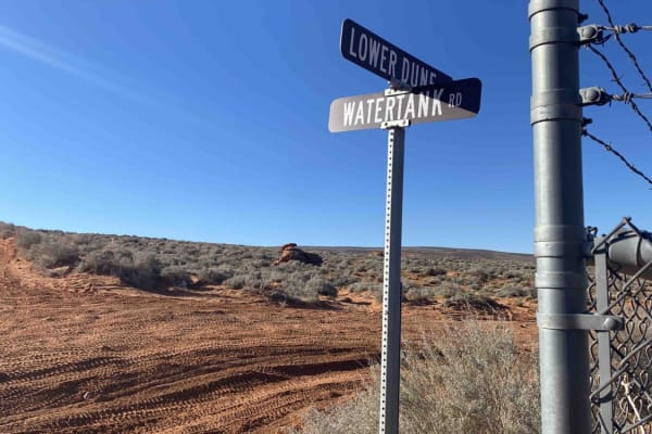
Lower Dunes Road
Lower Dunes Road is a connector trail between Water Tank Road and West Frontage Road along the Lower Dunes Road. You can access John's Trail, Sliplock Gultch, and Dixie Springs Cutoff. The surface is primarily soft sand, and there are opportunities for views of Sand Hollow Reservoirs and red rock fo...
Learn more about Lower Dunes Road
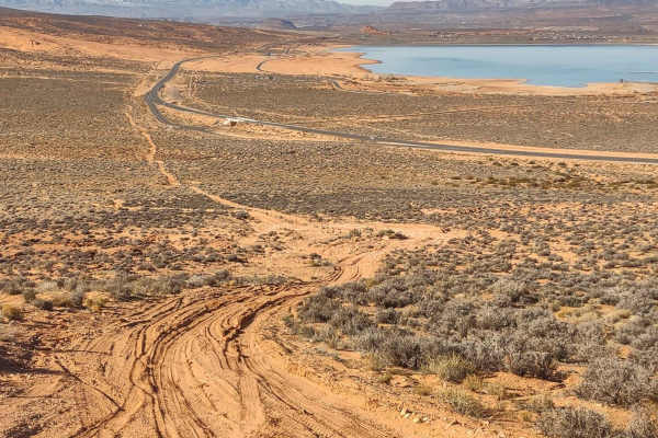
Lakeside
If you are looking for a good way to get clear to the east side of Sand Hollow, or from the east side to the west side, to meet up with friends or to catch a new trail, this route will take you clear across the north edge of the park, along the road, and give you access to the reservoir. It's just o...
Learn more about Lakeside
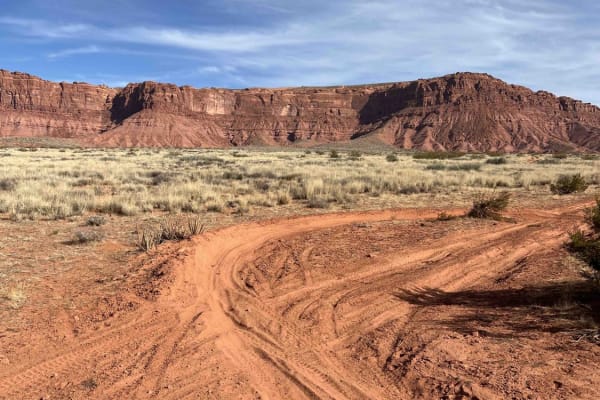
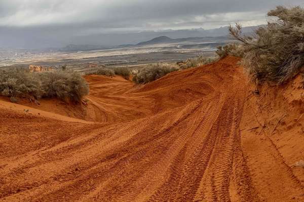
Valley Turn Track
The Valley Turn Track is located midway between Warner Valley Road and the Sand Mountain ridge. The track features multiple rutted turns and can be run clockwise or counterclockwise. The ground surface is hard-packed dirt in some areas but mostly sand in others. There's some water erosion in several...
Learn more about Valley Turn Track
Turtle 2
Turtle 2 is accessed partway through Turtle 1 and comes back into T1, so doing both trails together is recommended. T2 is a loop and comes back into itself at the halfway point, so most of the obstacles are run in reverse coming back around, making them a lot of fun and requiring different line sele...
Learn more about Turtle 2
Turtle 1
Turtle 1 is a short but fun trail. Combined with Turtle 2, it makes a loop that starts and ends midway through T1, so doing both back-to-back is best. Although short, T1 has a lot of fun obstacles. This trail is also a quick shortcut from the Ledges back to the Top of the World.
Learn more about Turtle 1
Milt's Mile Lite
Milt's Mile Lite Trail follows along the edge of the more difficult Milt's Mile Trail. This trail is rated 4 out of 10 based upon a couple of the obstacles along the route. This trail can be run by a stock high clearance 4x4. At almost any point on this trail, a driver can drop into Milt's Mile and ...
Learn more about Milt's Mile Lite
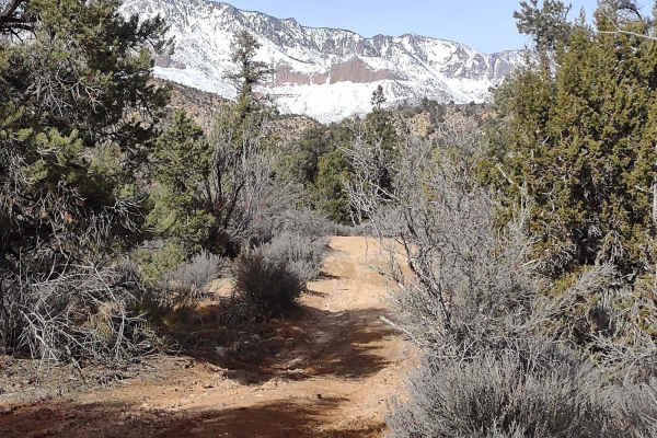
Leeds Cr-Cottonwood North Spur #30903
This trail takes you further north into the mountains, closer to Trail Peak. From the end of our track is a hiking trail to continue exploring this area of the Dixie National Forest. It rises to about 4700 feet. We rode the trail in early February, and in areas there was mud, but most of the trail w...
Learn more about Leeds Cr-Cottonwood North Spur #30903
ATV trails near Washington, Utah
Explore ATV-friendly trails near you. These trails are accessible for vehicles up to 50 inches wide, perfect for ATVs and smaller off-road machines.
Water Tower Overlook
This is an easy trail right out of the city. 4WD is not required, but it may be useful to climb some sand hills. This trail leads to mountain biking and hiking areas in the Turtle Reserve.
Learn more about Water Tower Overlook
Ridgeline Trail
This short 1-mile trail gives access to the main section of Sand Hollow from the Warner Valley Wash and Campground area. It also passes the trail Razorback (rated 8) which would be an optional trail. Sand Hollow rates this as a 4, but there are 3 obstacles that change that, as they are steep, tall, ...
Learn more about Ridgeline Trail
Warner Valley Wash
This desert wash is a 5-mile trail south of Sand Hollow/Hurricane, UT, in the shadow of the West Rim of Sand Hollow. You get a good view of Punchbowl Dome, and the trail connects to Warner Valley Road, where you can continue on and see the dinosaur tracks or the petroglyphs. Our SXS is a 4-seater, 7...
Learn more about Warner Valley Wash
West Rim
West Rim is a 3.9-mile point-to-point trail rated 5 of 10 located within the Sand Mountain Open Riding OHV Area. West Rim trailhead starts just south of the Pipeline Road where there is an available restroom facility and is marked by a trailhead sign. This is a 5-rated trail that has several named o...
Learn more about West Rim
UTV/side-by-side trails near Washington, Utah
Find UTV and side-by-side trails near you. These trails accommodate vehicles up to 60 inches wide, ideal for UTVs, side-by-sides, and wider off-road rigs.
Water Tower Overlook
This is an easy trail right out of the city. 4WD is not required, but it may be useful to climb some sand hills. This trail leads to mountain biking and hiking areas in the Turtle Reserve.
Learn more about Water Tower Overlook
Ridgeline Trail
This short 1-mile trail gives access to the main section of Sand Hollow from the Warner Valley Wash and Campground area. It also passes the trail Razorback (rated 8) which would be an optional trail. Sand Hollow rates this as a 4, but there are 3 obstacles that change that, as they are steep, tall, ...
Learn more about Ridgeline Trail
Fault Line
Fault line is named for the outcropping it traverses along a fault line, made mostly of solid sandstone fins and just a bit of sand mixed in. This trail is typically finished out with West Rim Trail, but is a nice one to pair with many options here at Sand Hollow. It starts heading up a steep red c...
Learn more about Fault Line
Warner Valley Wash
This desert wash is a 5-mile trail south of Sand Hollow/Hurricane, UT, in the shadow of the West Rim of Sand Hollow. You get a good view of Punchbowl Dome, and the trail connects to Warner Valley Road, where you can continue on and see the dinosaur tracks or the petroglyphs. Our SXS is a 4-seater, 7...
Learn more about Warner Valley Wash
The onX Offroad Difference
onX Offroad combines trail photos, descriptions, difficulty ratings, width restrictions, seasonality, and more in a user-friendly interface. Available on all devices, with offline access and full compatibility with CarPlay and Android Auto. Discover what you're missing today!
Open Trail Map