
Dirt Bike Trails
Near Waleska, Georgia
Explore All Dirt Bike Trails Near Waleska, Georgia
Dirt Bike Trails Near Waleska, Georgia
Discover the best dirt bike trails near you. Browse trail maps, check difficulty ratings, and find your next adventure — whether you're looking for a quick ride or an all-day expedition.
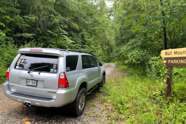
FS 83 (Bull Mountain Rd.)
Bull Mountain Road is in the Chattahoochee-Oconee National Forest. The trail branches off Winding Stair Gap Road, and, like many north Georgia Forest Service routes, the surface is mostly gravel with patches and brief stretches of dirt (red clay). 4WD is recommended, especially during or after rainf...
Learn more about FS 83 (Bull Mountain Rd.)
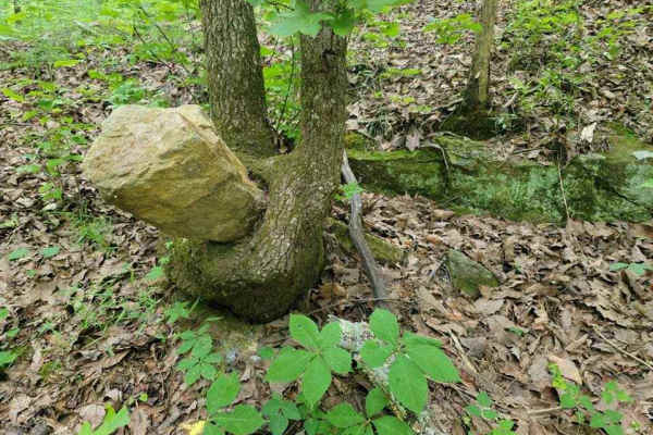
3 - Peeples Lake
Peeple's Lake begins in the heart of the city of Chatsworth. It is a dirt trail from beginning to the end, starting inside of a small residential area, and ending in the parking area of Rock Creek OHV trail (Less than 50" trails). The trail has heavy traffic with other vehicles pulling trailers, so ...
Learn more about 3 - Peeples Lake
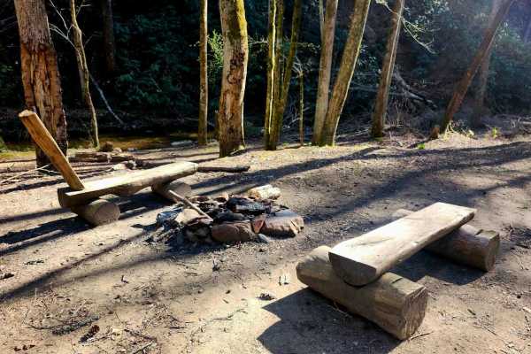
Branchwater Trail
This one-mile in-and-back single-lane trail within the Chattahoochee National Forest begins with a downhill of packed dirt and gravel with occasional rock ledges, ruts, washouts, and dips that have the potential to hold several inches of water after rain. There are three water crossings over Bearpen...
Learn more about Branchwater Trail
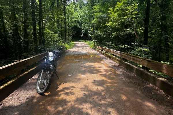
Nimblewill Branch 1
Branching off from Winding Stair Mountain Trail, this beginner-friendly path leads you through the North Georgia mountains on hard-packed dirt and gravel. At the northern end of this branch, you will find an Army Ranger base marking the transition to the next trail. Along the route, there are option...
Learn more about Nimblewill Branch 1
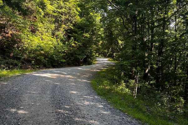
Springer Mountain Trail
Welcome to the Southern Terminus of the Appalachian Trail! This route takes you through the North Georgia mountains, passing right by the beginning of the historic AT. The trail is mostly dirt and gravel, with much of it wide enough for two cars. Along the way, you'll find small spurs that lead to d...
Learn more about Springer Mountain Trail
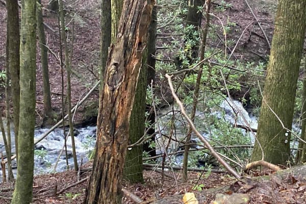
Jones Creek Road - FS 77A
This deceptively fun out-and-back drive branches west from Winding Stair Gap Road in the Chattahoochee-Oconee National Forest. The surface is gravel, rock, and red Georgia clay and runs through dense forest along its namesake Jones Creek. The rushing water can be heard with the windows down. 4WD is ...
Learn more about Jones Creek Road - FS 77A
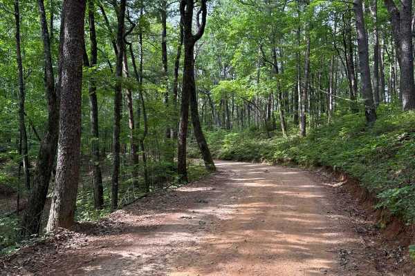
Winding Stair Gap - FS 77
The Winding Stair Gap, also known as FS 77, connects FS 28-1 at the south end with FS 42 at the north end of the trail. That trail takes you to the Winding Stair Trailhead. It is a gravel forestry road with some soft sand spots that can turn into mud holes after heavy rain. The road is not always w...
Learn more about Winding Stair Gap - FS 77
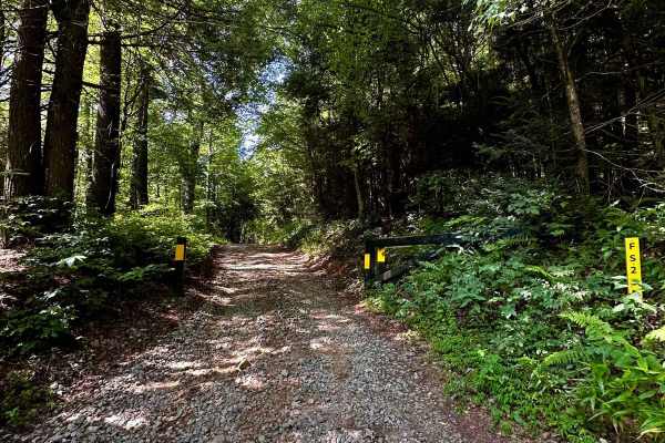
Long Creek Trail
This out-and-back trail consists mostly of hard-packed gravel and dirt. As you veer onto the section at (34.65449, -84.17772), be mindful of seasonal gate closures. This trail features a few deeper ruts and narrower passages, making it difficult to find turn-around points. At the end of the trail, t...
Learn more about Long Creek Trail
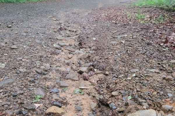
631- Tatum Lead
Tatum Lead Road begins in the Northern end of the Chattahoochee National Forest. The access road is given right of way through private property. It starts out on Georgia's scenic byway on Highway 52. There is an abundance of signs on the private property with no trespassing and no parking signs. The...
Learn more about 631- Tatum Lead
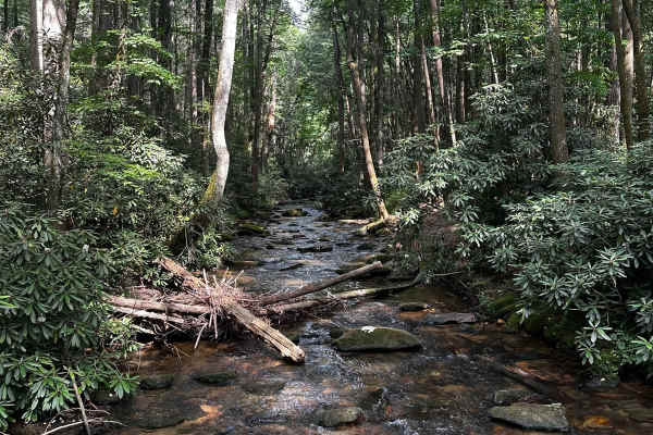
Noontootla
If you are looking for group camping opportunities alongside a rushing creek, this is your trail! This route is very beginner-friendly, consisting mostly of loose gravel and dirt. Many families and larger groups car camp in designated areas along the creek on the west side of the road. Be sure to ar...
Learn more about Noontootla
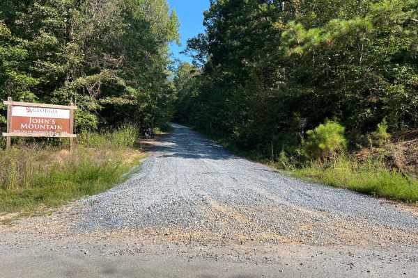
Blue Springs Branch A - FS 955A
This track spurs off of FS 955F, also known as Bow Creek. It is structured as a full out-and-back route along a freshly graveled forest road with a steady, consistent elevation gain throughout the journey. The trail gets quite tight in several places, but fortunately, there are pull-off areas scatte...
Learn more about Blue Springs Branch A - FS 955A
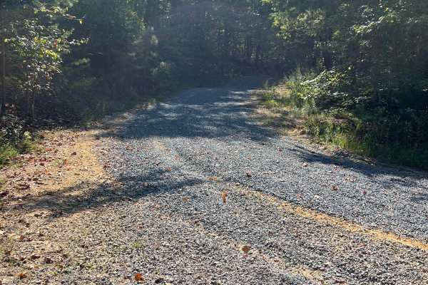
Blue Springs Branch D - FS 955D
This track branches off from FS 955F, also known as Bow Creek, and offers a unique driving experience. Recently, it has been freshly graveled, resulting in a thick and loose gravel surface that adds a bit of challenge to the journey. As you navigate the track, you’ll encounter a steady elevation gai...
Learn more about Blue Springs Branch D - FS 955D
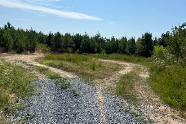
Calbeck - FS 955E
Calebck spurs off of FS 955B, also known as Hidden Creek Road. This freshly graveled track is thick and loose, so please ride with caution if you are on two wheels. The journey begins with a steady elevation gain for the first 2.7 miles. After this ascent, the track drops in elevation by roughly 150...
Learn more about Calbeck - FS 955E
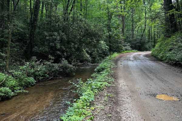
Cooper's Gap
This trail begins at the intersection near the Army Ranger Base, across from Mt. Zion Baptist Church (34.62794, -84.10149). The church parking lot offers some parking opportunities for loading and offloading vehicles. There are a few switchbacks along the trail, and most of the terrain consists of d...
Learn more about Cooper's Gap
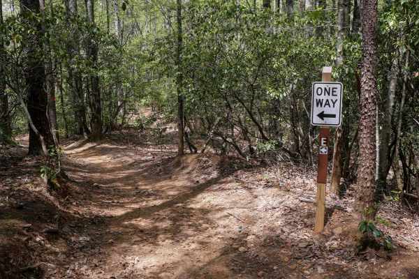
Hightower Loop Trail E
Trail E is a 1.6-mile clockwise ATV loop and one of the longer routes in the area, a great spot to do a couple laps to tack on mileage before your ride is over. Starting at the end of Trail D, it features more pronounced elevation changes, including a mix of steeper climbs and descents, sharper corn...
Learn more about Hightower Loop Trail E
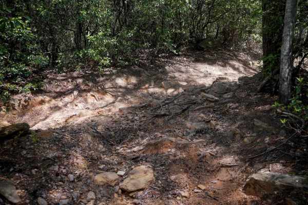
Ridge Top Trail C
Ridge Top is a short but technical half-mile segment running directionally south to north between Trails D and B. Considered one of the more challenging trails in the system, it features several embedded rock obstacles--ramped, foot-and-a-half-high boulders--that require riding up their faces. While...
Learn more about Ridge Top Trail C
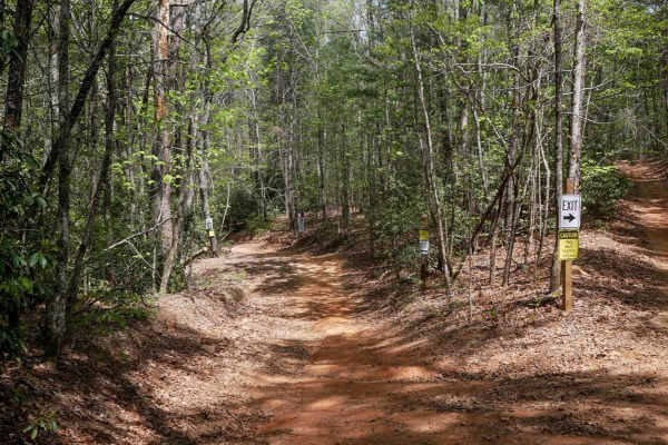
Hightower Loop Connector Trail D
Trail D is a 1.3-mile two-way access route that connects the main ATV Trail 192 to the more challenging trails C and E on the western side of the trail system. Beginning at its southern junction with 192, the trail is wide with gently curving sections--some of which are blind corners, but designed t...
Learn more about Hightower Loop Connector Trail D
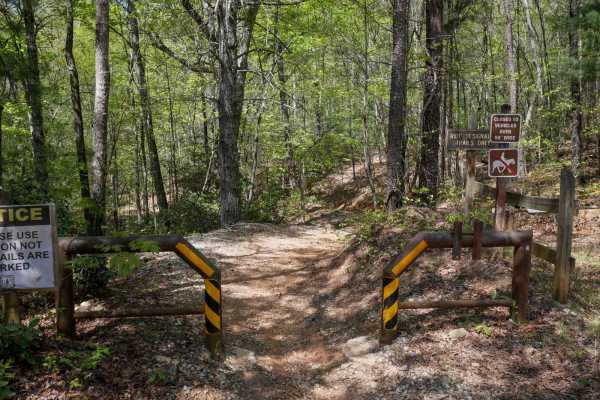
Parking Lot Trail 192
ATV Trail 192 serves as the main two-way corridor providing access from the parking area to the southern entry point of Trail D. It begins at a 50-inch pinch point and is designated for ATV/dirt bike use only--horses are not permitted. The trail is relatively wide to accommodate two-way traffic and ...
Learn more about Parking Lot Trail 192
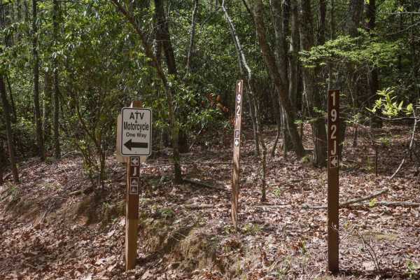
Sally Free Trail J
Trail J is a two-mile, directional ATV loop ridden clockwise, offering an easy and enjoyable ride through forested terrain. The trail features gentle rollers, minor ruts, roots, and rocks, with occasional springtime mud puddles. Riders will encounter a few tighter turns, including one notable switch...
Learn more about Sally Free Trail J
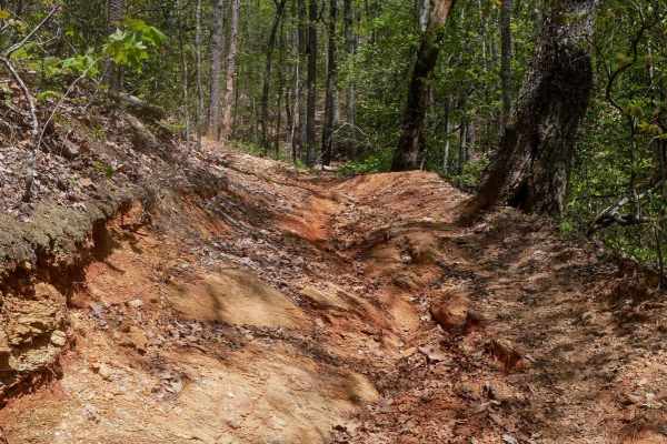
Whoop De Dos
This directional trail runs south to north in a clockwise loop and is one of the more challenging routes in the system. It opens with a sharp switchback featuring rocks and roots on the inside line, then continues climbing with additional embedded rock sections. After passing the intersection with t...
Learn more about Whoop De Dos
ATV trails near Waleska, Georgia
Explore ATV-friendly trails near you. These trails are accessible for vehicles up to 50 inches wide, perfect for ATVs and smaller off-road machines.
FS 83 (Bull Mountain Rd.)
Bull Mountain Road is in the Chattahoochee-Oconee National Forest. The trail branches off Winding Stair Gap Road, and, like many north Georgia Forest Service routes, the surface is mostly gravel with patches and brief stretches of dirt (red clay). 4WD is recommended, especially during or after rainf...
Learn more about FS 83 (Bull Mountain Rd.)
3 - Peeples Lake
Peeple's Lake begins in the heart of the city of Chatsworth. It is a dirt trail from beginning to the end, starting inside of a small residential area, and ending in the parking area of Rock Creek OHV trail (Less than 50" trails). The trail has heavy traffic with other vehicles pulling trailers, so ...
Learn more about 3 - Peeples Lake
Nimblewill Branch 1
Branching off from Winding Stair Mountain Trail, this beginner-friendly path leads you through the North Georgia mountains on hard-packed dirt and gravel. At the northern end of this branch, you will find an Army Ranger base marking the transition to the next trail. Along the route, there are option...
Learn more about Nimblewill Branch 1
Springer Mountain Trail
Welcome to the Southern Terminus of the Appalachian Trail! This route takes you through the North Georgia mountains, passing right by the beginning of the historic AT. The trail is mostly dirt and gravel, with much of it wide enough for two cars. Along the way, you'll find small spurs that lead to d...
Learn more about Springer Mountain Trail
UTV/side-by-side trails near Waleska, Georgia
Find UTV and side-by-side trails near you. These trails accommodate vehicles up to 60 inches wide, ideal for UTVs, side-by-sides, and wider off-road rigs.
FS 83 (Bull Mountain Rd.)
Bull Mountain Road is in the Chattahoochee-Oconee National Forest. The trail branches off Winding Stair Gap Road, and, like many north Georgia Forest Service routes, the surface is mostly gravel with patches and brief stretches of dirt (red clay). 4WD is recommended, especially during or after rainf...
Learn more about FS 83 (Bull Mountain Rd.)
3 - Peeples Lake
Peeple's Lake begins in the heart of the city of Chatsworth. It is a dirt trail from beginning to the end, starting inside of a small residential area, and ending in the parking area of Rock Creek OHV trail (Less than 50" trails). The trail has heavy traffic with other vehicles pulling trailers, so ...
Learn more about 3 - Peeples Lake
Nimblewill Branch 1
Branching off from Winding Stair Mountain Trail, this beginner-friendly path leads you through the North Georgia mountains on hard-packed dirt and gravel. At the northern end of this branch, you will find an Army Ranger base marking the transition to the next trail. Along the route, there are option...
Learn more about Nimblewill Branch 1
Springer Mountain Trail
Welcome to the Southern Terminus of the Appalachian Trail! This route takes you through the North Georgia mountains, passing right by the beginning of the historic AT. The trail is mostly dirt and gravel, with much of it wide enough for two cars. Along the way, you'll find small spurs that lead to d...
Learn more about Springer Mountain Trail
The onX Offroad Difference
onX Offroad combines trail photos, descriptions, difficulty ratings, width restrictions, seasonality, and more in a user-friendly interface. Available on all devices, with offline access and full compatibility with CarPlay and Android Auto. Discover what you're missing today!
Open Trail Map