
Dirt Bike Trails
Near Volcano, California
Explore All Dirt Bike Trails Near Volcano, California
Dirt Bike Trails Near Volcano, California
Discover the best dirt bike trails near you. Browse trail maps, check difficulty ratings, and find your next adventure — whether you're looking for a quick ride or an all-day expedition.
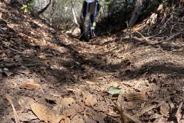
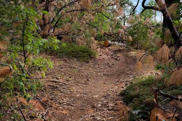
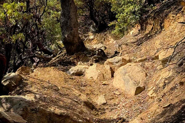
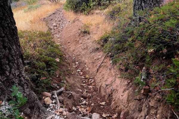
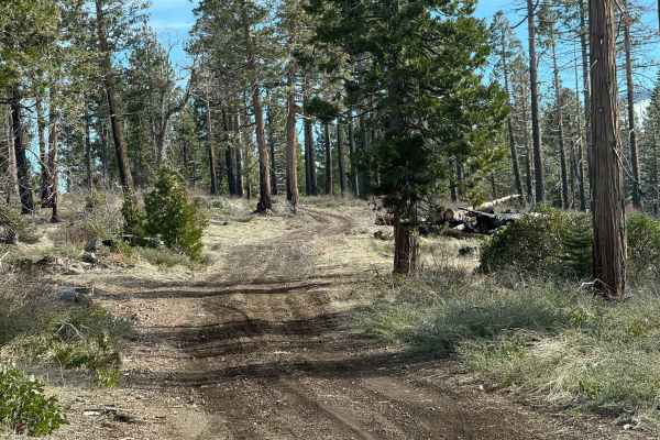
Ditch Digger
This is an area of BLM land on the North Fork of the Mokelumne River off Highway 26, just outside of Red Corral, California. Parts of the trail are un-maintained dirt roads, sections of which are rocky and washed out. The other part of the trail is in the abandoned flume or up on the levee alongside...
Learn more about Ditch Digger
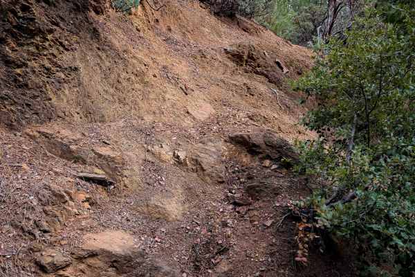
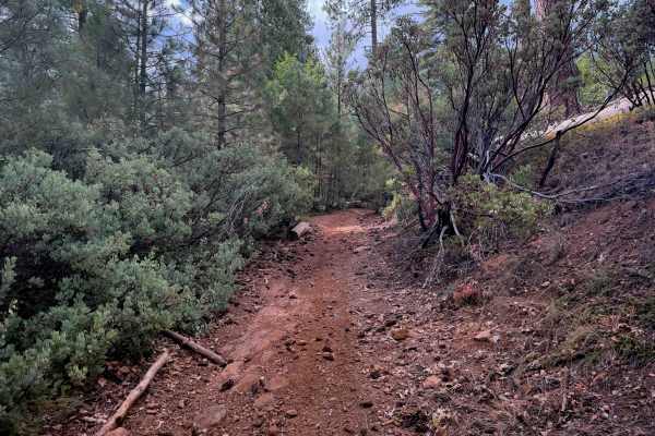
Gold Note 4WD
Gold Note 4WD (FS 8N91) is a moderately challenging Gold Note trail system segment. The trail is single-vehicle width and features areas of overgrown brush, adding to the difficulty. Riders will encounter deep ruts and tight sections, with some spots where fallen trees have been cleared just enough ...
Learn more about Gold Note 4WD

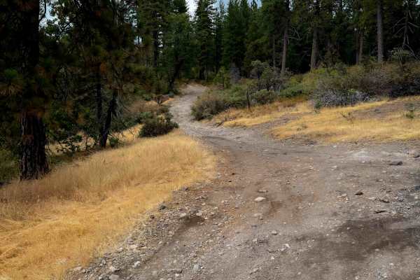
Five Corners
Five Corners (FS 8N54) is an easy trail that connects multiple trail systems in the area. Located at an elevation of approximately 4,100 feet, it offers several dispersed camping spots along its route, making it a convenient option for outdoor enthusiasts. During summer, riders should anticipate dus...
Learn more about Five Corners

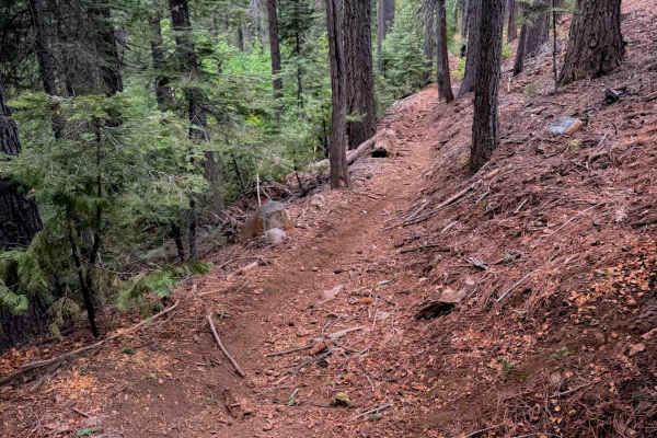
Gold Note
Gold Note (FS 8N55) is an easy trail in the Eldorado National Forest, sitting at approximately 4,400 feet. It acts as a critical connector, linking various trails within the Gold Note trail system and providing access to large dispersed camping sites and OHV staging areas. A restroom facility is ava...
Learn more about Gold Note
15EV55
The east end of this trail starts at the intersection with 15EV56 and 15EV106, and goes across a sun-exposed and grassy hilltop with some flat layers of embedded rock in the trail, covered in small loose rock and some minor roots. It descends off the hilltop into the trees, on a narrow path lined wi...
Learn more about 15EV55
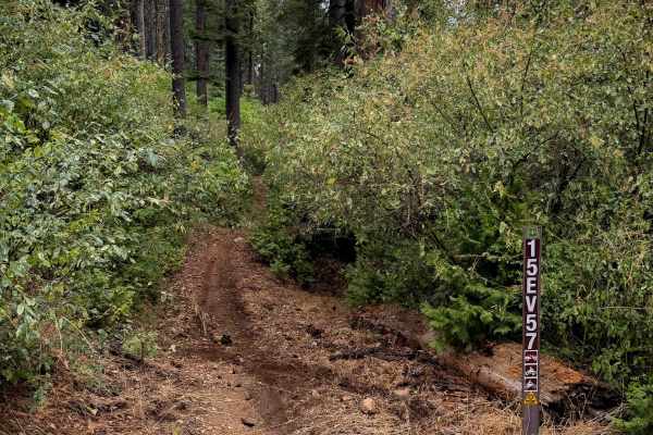
15EV57
This is a 1.2-mile-long easy ATV loop in the northern area of the Interface Trail System. It’s quite narrow for an ATV trail, with a lot of segments between the bushes that feel more like a dirt bike trail. It’s fast and flowy with some big whoops, meandering through flat grassy meadows, and gradual...
Learn more about 15EV57
15EV58
This short dirt bike trail weaves between a tight corridor of oaks and shrubs, with towering pine trees. It meanders along the hillside through the tight bushes, often overgrown and whacking you in the face and blocking visibility. Several downed logs have been cut, keeping the trail clear, but ther...
Learn more about 15EV58

15EV105
This is a wide and easy ATV trail that cuts through the middle of the Interface OHV trail system, acting as an easy access route to access several other trails. It has minor loose rock and shallow ruts, but mostly is smooth dirt. It’s lined with bear clover, and goes through a sparse forest of tower...
Learn more about 15EV105
15EV73
This is a wide and easy ATV trail that starts out on the south end lined with small manzanita shrubs and under towering pine trees. It has small loose rocks and shallow ruts, gradually ascending up a hillside, but is mostly a smooth dirt path. It gets a bit narrow in a couple spots between the shrub...
Learn more about 15EV73

15EV61
The south end of this trail starts at an intersection with 15EV60, and it steeply climbs up for less than half a mile until it connects with the ATV trail 15EV73. The entire route is a narrow and shelfy trail cut into the hillside, lined with pines and manzanitas. It hugs the hillside, with small lo...
Learn more about 15EV61
15EV56
This ATV trail starts out on the west end between the bushes, creating a tighter feeling path for ATVs, although still wide for dirt bikes. It winds down through the tall pine trees, cutting across the side of the hill, on a narrower path with big whoops. It goes underneath a canopy of bigleaf maple...
Learn more about 15EV56
15EV60
This is one of the longer and more difficult trails within the Interface Trail System. The east entrance spurs off of 15EV62, and it starts steeply descending down a deeply rutted path with small loose rocks. Some of the ruts are at least a foot deep, and it side-hills down an exposed hillside lined...
Learn more about 15EV60
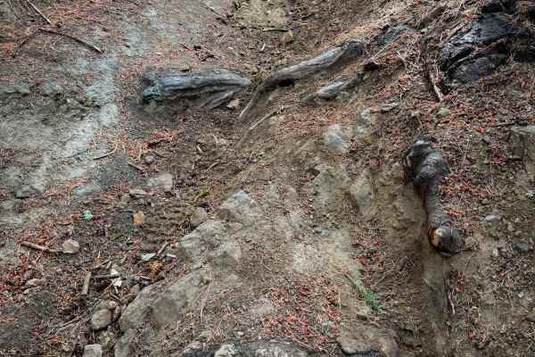
15EV62
This single track starts at the end of 15EV109, and keeps going west for about a half mile. It’s a relatively easy dirt bike trail, but with a few more embedded rock sections that make it somewhat more technical. It’s a narrow trail cut into a shelf and following the curvature of the hillside, with ...
Learn more about 15EV62
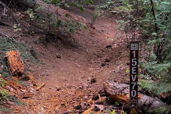
15EV70
This is a quarter-mile-long singletrack connector trail between the 4 way intersection of 15EV69, 15EV109, and 15EV68 on the south end, and the ATV trail 15EV105 on the north end. From south to north, it leaves the O’Neil Creek bottom, and climbs straight up a steep hill with lots of roots and loose...
Learn more about 15EV70
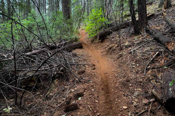
15EV71
15EV71 is a .6 mile long ATV trail, gaining almost 500 feet elevation from south to north. It starts out as a wide dirt path between young pine trees, curving up the hillside. It goes through a lot of previously cut logs, and goes through segments that are more rutted and narrow and covered in a lay...
Learn more about 15EV71
15EV111
This is a wide and easy ATV trail that goes through the southwest corner of the Interface OHV trail system for 1.7 miles. This one is mostly just a wide access corridor that accesses several other trails, and then you can take this to return to the beginning or staging area instead of having to take...
Learn more about 15EV111
15EV72
This is one of the more difficult dirt bike trails in the Interface Trail System. The entrance from the north end is rutted, with overgrown grass, a few rocks, and embedded root bands across the trail creating small drop-offs. It starts descending down a rutted slope, with lots of loose rock filling...
Learn more about 15EV72
15EV109
This is a short and easy ATV trail that doesn’t have any major obstacles, but is a bit tighter in the trees. From the east end, it goes through a narrow tree corridor tightly lined with fir trees. The trail itself is smooth dirt, with a few shallow ruts and loose sticks and loose rocks, but nothing ...
Learn more about 15EV109
15EV59
This is a 0.6 mile long dirt bike trail that has some deeper rutted sections making it slightly more technical. The east end starts out pretty rutted, dropping off of the ATV trail 15EV111, and going down a couple small and uneven rut and root ledges. It descends pretty steeply through the forest fo...
Learn more about 15EV59
15EV69
15EV69 is a short and moderately easy dirt bike trail that connects the ATV trail 15EV105, to the 4 way intersection with 15EV70, 15EV109, and 15EV68. It weaves through towering trees typical of northern California including ponderosa and sugar pines, and white cedars, on a simple dirt single track ...
Learn more about 15EV69
ATV trails near Volcano, California
Explore ATV-friendly trails near you. These trails are accessible for vehicles up to 50 inches wide, perfect for ATVs and smaller off-road machines.
Gold Note 4WD
Gold Note 4WD (FS 8N91) is a moderately challenging Gold Note trail system segment. The trail is single-vehicle width and features areas of overgrown brush, adding to the difficulty. Riders will encounter deep ruts and tight sections, with some spots where fallen trees have been cleared just enough ...
Learn more about Gold Note 4WD
Five Corners
Five Corners (FS 8N54) is an easy trail that connects multiple trail systems in the area. Located at an elevation of approximately 4,100 feet, it offers several dispersed camping spots along its route, making it a convenient option for outdoor enthusiasts. During summer, riders should anticipate dus...
Learn more about Five Corners
Gold Note
Gold Note (FS 8N55) is an easy trail in the Eldorado National Forest, sitting at approximately 4,400 feet. It acts as a critical connector, linking various trails within the Gold Note trail system and providing access to large dispersed camping sites and OHV staging areas. A restroom facility is ava...
Learn more about Gold Note
15EV55
The east end of this trail starts at the intersection with 15EV56 and 15EV106, and goes across a sun-exposed and grassy hilltop with some flat layers of embedded rock in the trail, covered in small loose rock and some minor roots. It descends off the hilltop into the trees, on a narrow path lined wi...
Learn more about 15EV55
UTV/side-by-side trails near Volcano, California
Find UTV and side-by-side trails near you. These trails accommodate vehicles up to 60 inches wide, ideal for UTVs, side-by-sides, and wider off-road rigs.
Gold Note 4WD
Gold Note 4WD (FS 8N91) is a moderately challenging Gold Note trail system segment. The trail is single-vehicle width and features areas of overgrown brush, adding to the difficulty. Riders will encounter deep ruts and tight sections, with some spots where fallen trees have been cleared just enough ...
Learn more about Gold Note 4WD
Five Corners
Five Corners (FS 8N54) is an easy trail that connects multiple trail systems in the area. Located at an elevation of approximately 4,100 feet, it offers several dispersed camping spots along its route, making it a convenient option for outdoor enthusiasts. During summer, riders should anticipate dus...
Learn more about Five Corners
Gold Note
Gold Note (FS 8N55) is an easy trail in the Eldorado National Forest, sitting at approximately 4,400 feet. It acts as a critical connector, linking various trails within the Gold Note trail system and providing access to large dispersed camping sites and OHV staging areas. A restroom facility is ava...
Learn more about Gold Note
FS N967
This trail starts out as a pretty easy dirt road and makes for a nice cruise through the forest. It only gets more challenging toward the end when you reach the final climb. That section has some bigger rocks, a few ledges, and some tighter, winding spots where you’ll need to pick your line a bit mo...
Learn more about FS N967
The onX Offroad Difference
onX Offroad combines trail photos, descriptions, difficulty ratings, width restrictions, seasonality, and more in a user-friendly interface. Available on all devices, with offline access and full compatibility with CarPlay and Android Auto. Discover what you're missing today!
Open Trail Map