
Dirt Bike Trails
Near Tillamook, Oregon
Explore All Dirt Bike Trails Near Tillamook, Oregon
Dirt Bike Trails Near Tillamook, Oregon
Discover the best dirt bike trails near you. Browse trail maps, check difficulty ratings, and find your next adventure — whether you're looking for a quick ride or an all-day expedition.
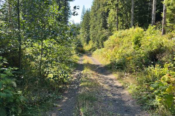
Foiled Road
Foiled Road is a deviation from how well-maintained and wide Wildcat Ridge is. This road is narrow, contains ruts approximately 10 - 15" deep, and will likely leave pin stripes in some spots. Further – plenty of logs sticking out waiting to slice a tire. Nonetheless, the trail is worth it for a grou...
Learn more about Foiled Road
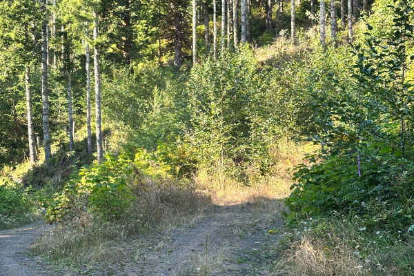
Coyote
Lush, tight, and moody even on a bright summer day. Coyote is clearly a low-trafficked trail that's not only open to all vehicles per the Forest Service map, but also a fun ride. We encountered a lot of wildlife, including deer and hawks. This is also likely the trail that loaded my rig up with spid...
Learn more about Coyote
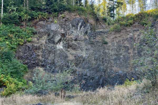
Wildcat Ridge
This route starts at the second fork off E. Beaver Creek Road and passes through an easement at the beginning. The road is well-travelled and maintained; watch for people speeding around corners. Approximately the first 4 miles are open to highway vehicles only – while the last mile is open to all v...
Learn more about Wildcat Ridge
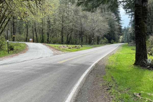
North Fork Trask Road
This is one of the main arteries leading deep into the Tillamook State Forest from the Trask River Road. Follow it up the North Fork Trask River and on to Yamhill if you wish, passing Barney Reservoir along the way. As you leave the pavement behind, you'll soon be traveling along the riverbank where...
Learn more about North Fork Trask Road
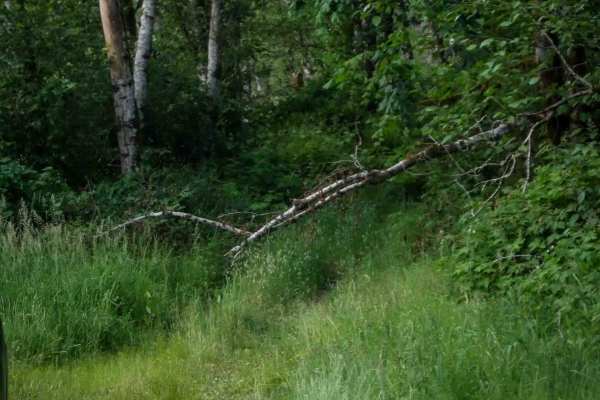
Fox Creek Ridge
Fox Creek Ridge is a challenging 2-mile trail that gains nearly 1,500 feet of elevation, with a super faint and overgrown entrance off Fox Creek Ridge Road that's easy to miss. Riders have to plow through a grassy, brushy corridor lined with thorny brambles and overhanging vines and branches. The tr...
Learn more about Fox Creek Ridge
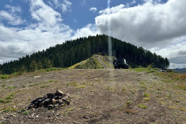
Wolf Point to Jones Creek
This trail connects Cedar Butte Road with Jones Creek Road with an optional stop at Wolf Point. An open area just below Wolf Point offers great views to the north of Triangulation Point along with views of the Cedar Creek Valley below. The top of Wolf Point is accessible via a single track trail, al...
Learn more about Wolf Point to Jones Creek
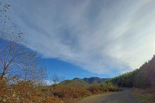
Foland Creek
Foland Creek road is an easy gravel road with sections that turn into a more natural surface. A couple of spots clear out for a pretty view of the valleys. The road runs through the Siuslaw National Forest, with a few sections of private property, so be mindful. There are a couple of small spots you...
Learn more about Foland Creek
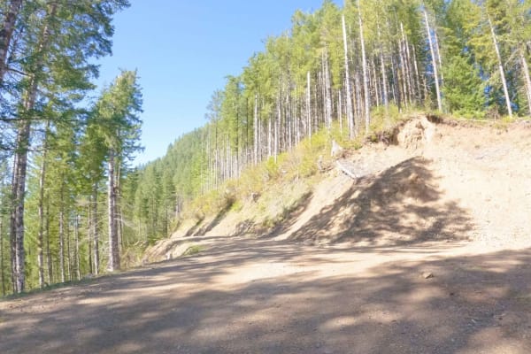
Cedar Butte Road
Cedar Butte Road crosses the Wilson River as it begins at Highway 6 and climbs over 2,500' over 6.5 miles up into the Tillamook Range to a saddle just below Cedar Butte where it meets up with Cedar Creek Road, Kilchis River Road, and Wolf Point Road. It is one of the main access roads into this sect...
Learn more about Cedar Butte Road
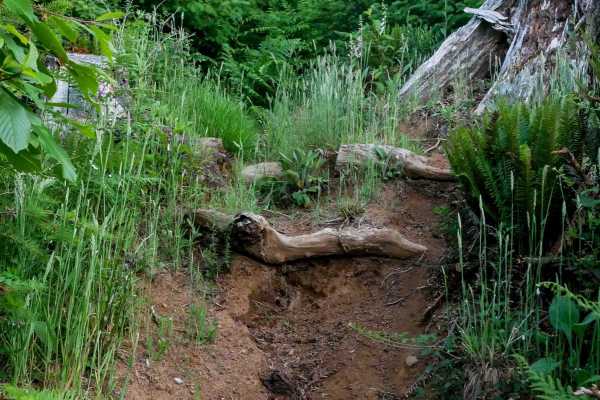
Rogers #36
Rogers is an advanced directional singletrack from south to north, primarily due to its route-finding difficulty and extreme overgrowth. The entrance is nearly invisible, tucked into a wide grassy corridor with no signage, and quickly drops into a dense, brushy forest. The trail is narrow, faint, an...
Learn more about Rogers #36
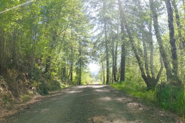
Jordan Creek Road
Jordan Creek Road is a five-mile gravel FS road that follows along Jordan Creek before connecting to Hembre Ridge Road and then eventually ending at the Jordan Creek 003 Moto/ATV trail. It accesses numerous other OHV trails and the Jordan Creek OHV Staging Area so there is often a good amount of mix...
Learn more about Jordan Creek Road
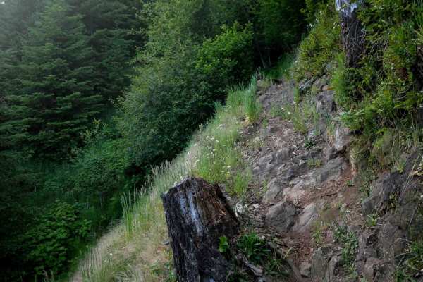
Maddogs Pumpkin Patch #38 (Extreme)
This is a highly technical and extreme trail, starting on the east side from a faint, overgrown entrance that immediately signals the difficulty ahead. The trail drops steeply with a deeply troughed and choppy surface, lined with root drop-offs and narrow side-hilling with significant exposure. Ride...
Learn more about Maddogs Pumpkin Patch #38 (Extreme)

Kilchis Falls Spur
This two-mile portion of Kilchis River Forest Road is used as a spur to access a nearby waterfall while exploring the area. Kilchis Falls is a tall, misty waterfall, found on the winding back roads of the Tillamook State Forest. While it stands at an impressive 100 feet tall, it's not a particularly...
Learn more about Kilchis Falls Spur
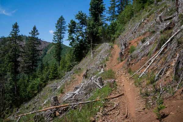
Jordan Creek #84 (Part 2)
This 0.9-mile ATV trail gains over 900 feet of elevation in a steep, rugged climb that becomes increasingly technical as it ascends. The route begins under dense forest canopy with tight switchbacks, deeply troughed segments, and a mix of loose and embedded rocks. As it climbs, the trail traverses a...
Learn more about Jordan Creek #84 (Part 2)
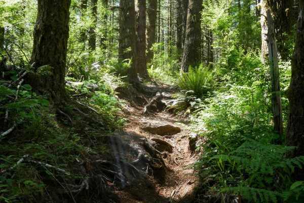
#127 (Part 2)
This segment of Trail 127 is a directional descent from west to east, losing nearly 800 feet of elevation over .7 miles. The narrow single track follows a steep, forested hillside, featuring tight side-hilling and a continuous descent, with embedded roots and rocks, making small drop-offs, deep trou...
Learn more about #127 (Part 2)
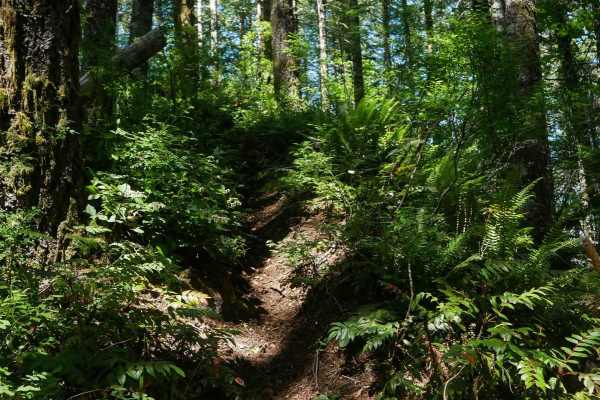
#106
Trail 106 is a directional black diamond trail dropping nearly 900 feet over just 0.7 miles from north to south. Starting with a big climb onto a spine with technical roots and rocks, the trail then descends steeply with loose dirt, ruts, and root drop-offs. Tight turns and extreme side-hilling with...
Learn more about #106
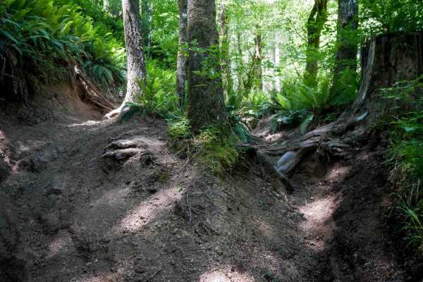
Outback #99
Outback #99 is a flowy, moderately challenging single track running through dense forest. The trail is wider than most black diamond trails in the system, but still features deep troughs, big roots, and minor ruts. Compared to nearby technical trails, this one offers more relaxed riding with gentler...
Learn more about Outback #99
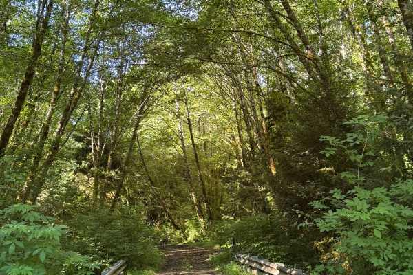
Round Top - FS 1024
This is a dirt-based trail in the National Forest that begins by crossing 3 bridges. The trail gradually climbs over 800 feet of elevation and ends where a split-off trail used to be before becoming overgrown. The trail is narrow and one lane wide, with two-track in most areas, and no room to pass ...
Learn more about Round Top - FS 1024
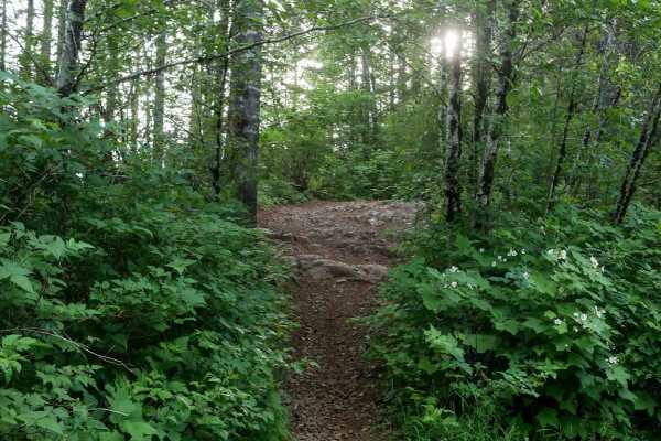
#41H
Trail 41H is a short but dynamic dirt bike route under half a mile long, offering both a steep climb and descent regardless of direction of travel. The eastern entrance begins with a moderate rock face obstacle, followed by a steep, loose ascent through dense vegetation with roots, ruts, and embedde...
Learn more about #41H
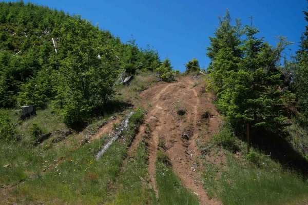
#127 (Part 1)
This segment of Trail 127 begins on the north end with a steep hill climb up a dirt mound with split lines, followed by fast, flowy single track through logged areas with full sun exposure. The surface is dry and loose, with exposed roots, ruts, and cut stumps requiring constant vigilance. After a b...
Learn more about #127 (Part 1)
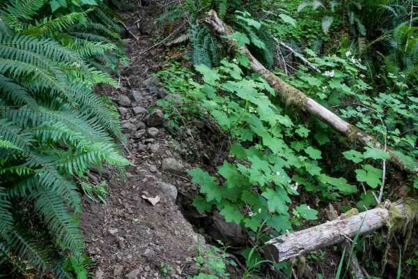
Maddogs Pumpkin Patch #38 (Difficult)
This is a 1.1-mile singletrack rated black diamond in the system,it but rides more like an upper intermediate route because it is less steep than most of the black diamond trails. Starting from the east, it descends steeply on a narrow path with several downed logs--including an elevated one you ha...
Learn more about Maddogs Pumpkin Patch #38 (Difficult)
ATV trails near Tillamook, Oregon
Explore ATV-friendly trails near you. These trails are accessible for vehicles up to 50 inches wide, perfect for ATVs and smaller off-road machines.
Foiled Road
Foiled Road is a deviation from how well-maintained and wide Wildcat Ridge is. This road is narrow, contains ruts approximately 10 - 15" deep, and will likely leave pin stripes in some spots. Further – plenty of logs sticking out waiting to slice a tire. Nonetheless, the trail is worth it for a grou...
Learn more about Foiled Road
Coyote
Lush, tight, and moody even on a bright summer day. Coyote is clearly a low-trafficked trail that's not only open to all vehicles per the Forest Service map, but also a fun ride. We encountered a lot of wildlife, including deer and hawks. This is also likely the trail that loaded my rig up with spid...
Learn more about Coyote
North Fork Trask Road
This is one of the main arteries leading deep into the Tillamook State Forest from the Trask River Road. Follow it up the North Fork Trask River and on to Yamhill if you wish, passing Barney Reservoir along the way. As you leave the pavement behind, you'll soon be traveling along the riverbank where...
Learn more about North Fork Trask Road
Wolf Point to Jones Creek
This trail connects Cedar Butte Road with Jones Creek Road with an optional stop at Wolf Point. An open area just below Wolf Point offers great views to the north of Triangulation Point along with views of the Cedar Creek Valley below. The top of Wolf Point is accessible via a single track trail, al...
Learn more about Wolf Point to Jones Creek
UTV/side-by-side trails near Tillamook, Oregon
Find UTV and side-by-side trails near you. These trails accommodate vehicles up to 60 inches wide, ideal for UTVs, side-by-sides, and wider off-road rigs.
Foiled Road
Foiled Road is a deviation from how well-maintained and wide Wildcat Ridge is. This road is narrow, contains ruts approximately 10 - 15" deep, and will likely leave pin stripes in some spots. Further – plenty of logs sticking out waiting to slice a tire. Nonetheless, the trail is worth it for a grou...
Learn more about Foiled Road
Coyote
Lush, tight, and moody even on a bright summer day. Coyote is clearly a low-trafficked trail that's not only open to all vehicles per the Forest Service map, but also a fun ride. We encountered a lot of wildlife, including deer and hawks. This is also likely the trail that loaded my rig up with spid...
Learn more about Coyote
North Fork Trask Road
This is one of the main arteries leading deep into the Tillamook State Forest from the Trask River Road. Follow it up the North Fork Trask River and on to Yamhill if you wish, passing Barney Reservoir along the way. As you leave the pavement behind, you'll soon be traveling along the riverbank where...
Learn more about North Fork Trask Road
Wolf Point to Jones Creek
This trail connects Cedar Butte Road with Jones Creek Road with an optional stop at Wolf Point. An open area just below Wolf Point offers great views to the north of Triangulation Point along with views of the Cedar Creek Valley below. The top of Wolf Point is accessible via a single track trail, al...
Learn more about Wolf Point to Jones Creek
The onX Offroad Difference
onX Offroad combines trail photos, descriptions, difficulty ratings, width restrictions, seasonality, and more in a user-friendly interface. Available on all devices, with offline access and full compatibility with CarPlay and Android Auto. Discover what you're missing today!
Open Trail Map