
Dirt Bike Trails
Near Stotonic Village, Arizona
Explore All Dirt Bike Trails Near Stotonic Village, Arizona
Dirt Bike Trails Near Stotonic Village, Arizona
Discover the best dirt bike trails near you. Browse trail maps, check difficulty ratings, and find your next adventure — whether you're looking for a quick ride or an all-day expedition.
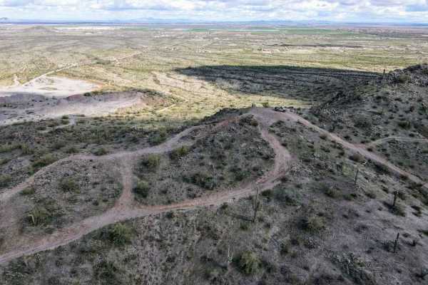
Top Of The World
This is a short leisurely cruise through the desert. It is great for beginners, sightseeing, or testing out new parts. Parts of this trail pass through Arizona Trust Land, so a pass is required. The vast majority of this trail is a single-lane dirt road, with a few wash crossings. The highlight of t...
Learn more about Top Of The World
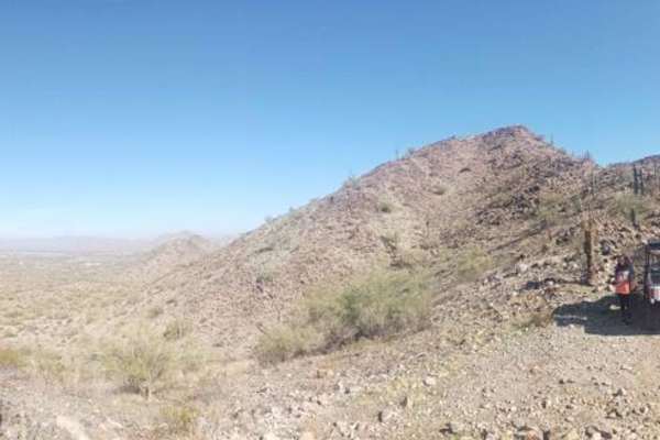
Haley Hills Overlook
This trail leads from the Vekol Wash to one of the crests of the Haley Hills. You can stand on top and see over both sides of the hill, north and south. Beware of lots of cholla cactus in the northern portion. This trail also connects with 2 other minor trails shortly after it leaves the wash.
Learn more about Haley Hills Overlook
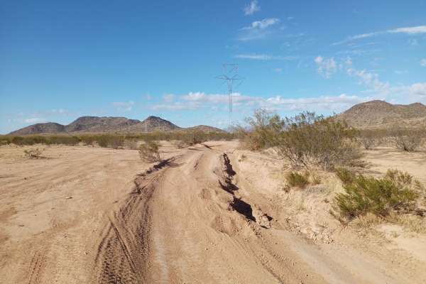
Haley Hills West Leg
This is a connection that links the Upland BLM Inlet Trail, Booth Hills Trail, and several nearby dirt roads. This makes it possible to get to the Booth Hills trail from Upland Street and vice versa, and saves going around the back of the mountain pass, needlessly wasting time.
Learn more about Haley Hills West Leg
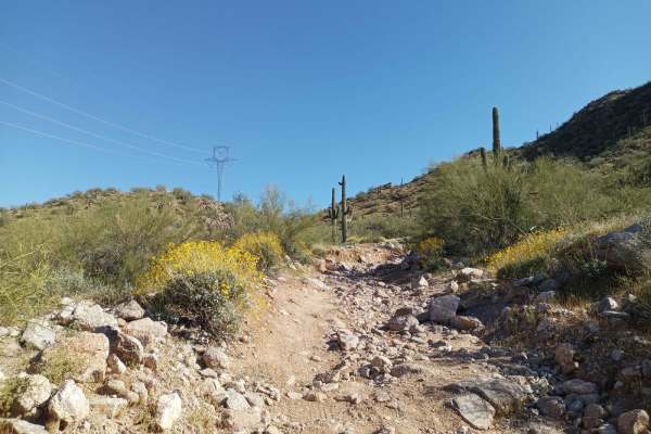
Power Line Road | Hidden Valley South
This trail has varying difficulty. There is an expert-level rock garden a couple of hundred feet long at the big hill climb, but otherwise, it's a level 4 difficulty. The rock garden has off-camber obstacles;higher clearance is recommended, as stock-height vehicles will likely get rocker damage. The...
Learn more about Power Line Road | Hidden Valley South
Upland BLM Inlet | Vekol Wash Access
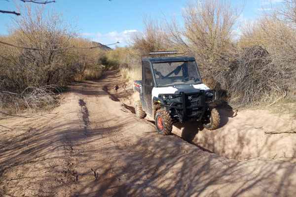
This trail connects Upland Street to the Vekol Wash and the larger BLM Trail System. It's fairly beginner-level, however, there is very soft and deep sand at the crossing of the Vekol Wash, and it should not be attempted by most 2WD vehicles. Numerous low spots fill up with deceptively deep water af...
Learn more about Upland BLM Inlet | Vekol Wash Access
Desert Valley BLM Inlet
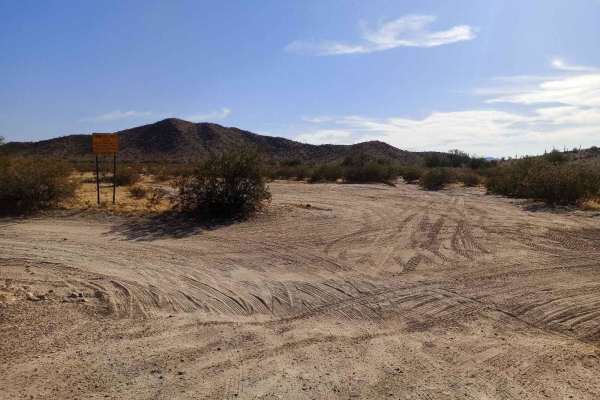
This trail connects Desert Valley Road to numerous BLM trails and to the Vekol Wash, which are popular 4x4, SxS, and horse riding areas. One of the southern forks also leads to The Waterfalls Trail through some very winding and picturesque terrain. There is good cellular coverage throughout most of ...
Learn more about Desert Valley BLM Inlet
Booth Hills Trail
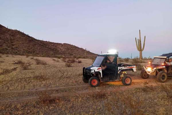
This trail takes you from Haley Hills west to the northwest face of the Booth Hills, overlooking Mobile, Arizona. This trail starts at beginner level but advances to intermediate level around the halfway point. It reaches an advanced level as you get closer to the end with washes. There are very ste...
Learn more about Booth Hills Trail
Barnes BLM Inlet
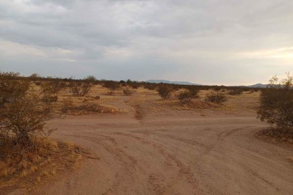
Barnes Rd Entrance to BLM Lands and Trails, Barnes Rd Staging area also here on the right and left side of the trail, lots of room for truck/trailer and unloading. There is a nice view from the top of Barnes Hill overlooking all directions that is a good spot for doing Panoramic Photos.
Learn more about Barnes BLM Inlet
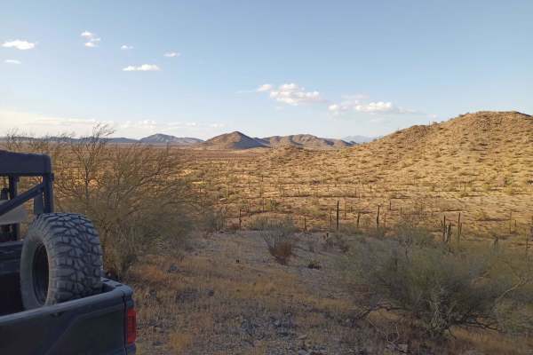
Hawk Hills Northern Hilltop
This is a rough trail but it is a good one for newbies to learn on a more moderate skill level. The Hill Climb at the end is very steep towards the top, low gear required on the climb even on an Polaris XP 1000, traction sketchy even in 4x4 in a few places, very good place for a beginner who is read...
Learn more about Hawk Hills Northern Hilltop
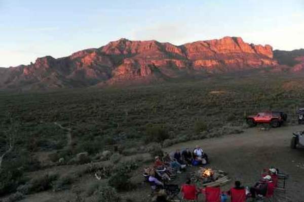
Superstition Backroads
The Superstition Backroads are easy Jeep trails, close to town, that take you on a short day trip to an abandoned gypsum mine. The western end of the trail is close to the Superstition Mountains. The main trail is 4, while a short optional climb and the Gypsum Overlook Loop are 5. There is a picnic ...
Learn more about Superstition Backroads
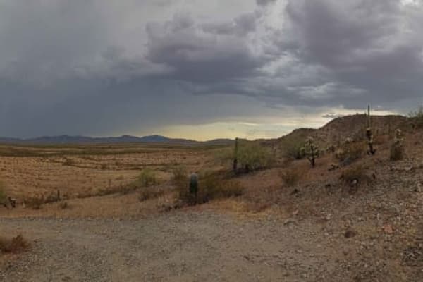
Desert Valley Mountain Overlook
This is a leg of the Desert Valley BLM Inlet trail that leads to an overlook on top of the mountain, with views for 60-100 miles from the overlook. It is a beginner-level rock crawling experience, forcing some vehicles to hunt for traction through some slick rocks and shale, but nothing extreme. It ...
Learn more about Desert Valley Mountain Overlook
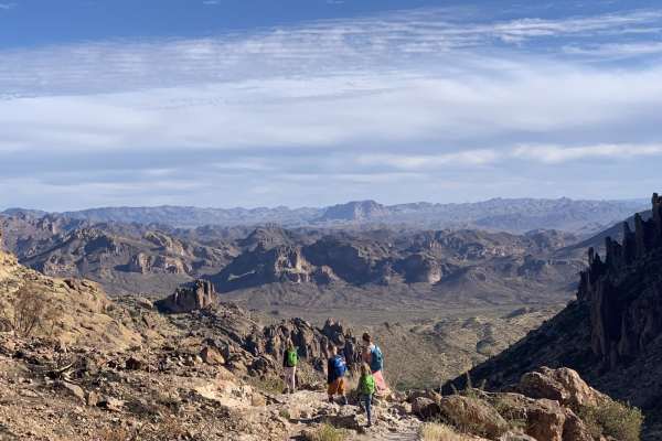
Peralta road
Peralta road is an easy, graded dirt road. Although the road is not challenging, it still leads to great views and has plenty of turn-offs for dispersed camping. If you are into hiking, this road ends at a trailhead for miles of great hiking. The trailhead has a restroom, but it can be crowded.
Learn more about Peralta road
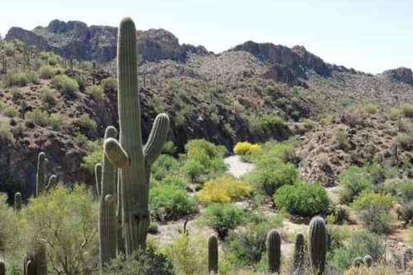
WhoopDeDo Roller Coaster
WhoopDeDo Roller Coaster is an exhilarating 21-mile desert trek designed for experienced four-wheel-drive drivers seeking scenic ridgelines, steep climbs, and a roller-coaster-style ride through Arizona’s rugged Mineral Mountains. Branching off State Route 79 near Florence, this route serves as a le...
Learn more about WhoopDeDo Roller Coaster
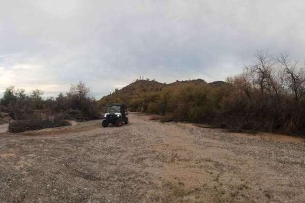
Vekol Wash Southern Leg
On this trail, there's very deep sand, sections of rough river rock and gravel, and some narrow points requiring caution. There are also numerous long flat sandy stretches where you can really pick up some speed. Watch for dips in the sand created by the water current that can be hard to see until y...
Learn more about Vekol Wash Southern Leg

Upper Woodpecker to Ajax Mine
This trail follows the difficult wash known as Upper Woodpecker. At the eastern end of the wash, the trail climbs up a narrow winding trail to join Ajax Mine Road. The wash is very difficult. Lockers and 33 inch or larger tires are recommended. The trail following the wash is intermediate and does n...
Learn more about Upper Woodpecker to Ajax Mine
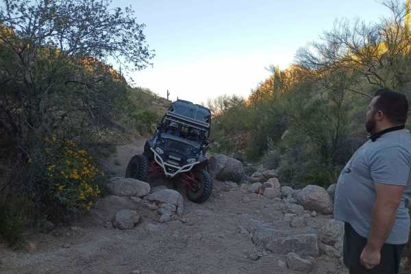
Hawk Hills Canyon
This is a serious rock garden and rock climb. Though not super steep, it's very technical due to the quantity and size of the rocks. Rock sliders and skid plates are strongly advised. You have to go significantly off-camber to get around the side of several large boulders, and it's not uncommon for ...
Learn more about Hawk Hills Canyon
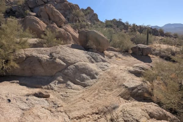
Chasing Waterfalls
This is a short but challenging offshoot of The Waterfall trail. It's a loop that has several significant obstacles and areas to play. After the obstacles, you're treated to an awesome view of the entire city of Maricopa and other parts of the valley. This trail is on Arizona State Trust land, so a ...
Learn more about Chasing Waterfalls
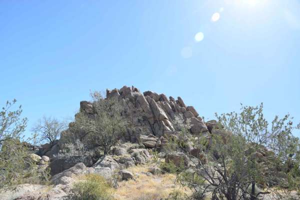
Backway to Waterfall
This easy backway to the waterfall trail makes for a fun drive with plenty of stops throughout. Along the way, you will find small and large rock features that will be great for stops for groups as well as for picture taking. It is suggested to have 4WD and high clearance for some areas and the Wate...
Learn more about Backway to Waterfall
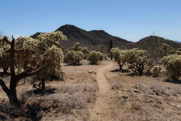
Bh1278 Singletrack
This dirt bike trail is a true singletrack through the BLM land north of Interstate 8, compared to the many wide wash trails. It goes through a flat desert terrain for 0.8 miles, on a skinny trail through cholla gardens and next to towering saguaro cactus. The trail weaves through the cactus with ge...
Learn more about Bh1278 Singletrack
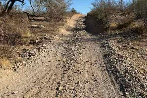
Nw2014
Nw2014 is located to the East of Arizona State Route 79 and South of the Box Canyon trail. It connects Box Canyon to the main North/South Nw2006 trail. The trail consists of dirt, small loose rocks, and minor ruts. Full-size vehicles are susceptible to pinstriping. One bar of Verizon LTE service was...
Learn more about Nw2014
ATV trails near Stotonic Village, Arizona
Explore ATV-friendly trails near you. These trails are accessible for vehicles up to 50 inches wide, perfect for ATVs and smaller off-road machines.
Top Of The World
This is a short leisurely cruise through the desert. It is great for beginners, sightseeing, or testing out new parts. Parts of this trail pass through Arizona Trust Land, so a pass is required. The vast majority of this trail is a single-lane dirt road, with a few wash crossings. The highlight of t...
Learn more about Top Of The World
Haley Hills Overlook
This trail leads from the Vekol Wash to one of the crests of the Haley Hills. You can stand on top and see over both sides of the hill, north and south. Beware of lots of cholla cactus in the northern portion. This trail also connects with 2 other minor trails shortly after it leaves the wash.
Learn more about Haley Hills Overlook
Haley Hills West Leg
This is a connection that links the Upland BLM Inlet Trail, Booth Hills Trail, and several nearby dirt roads. This makes it possible to get to the Booth Hills trail from Upland Street and vice versa, and saves going around the back of the mountain pass, needlessly wasting time.
Learn more about Haley Hills West Leg
Power Line Road | Hidden Valley South
This trail has varying difficulty. There is an expert-level rock garden a couple of hundred feet long at the big hill climb, but otherwise, it's a level 4 difficulty. The rock garden has off-camber obstacles;higher clearance is recommended, as stock-height vehicles will likely get rocker damage. The...
Learn more about Power Line Road | Hidden Valley South
UTV/side-by-side trails near Stotonic Village, Arizona
Find UTV and side-by-side trails near you. These trails accommodate vehicles up to 60 inches wide, ideal for UTVs, side-by-sides, and wider off-road rigs.
Top Of The World
This is a short leisurely cruise through the desert. It is great for beginners, sightseeing, or testing out new parts. Parts of this trail pass through Arizona Trust Land, so a pass is required. The vast majority of this trail is a single-lane dirt road, with a few wash crossings. The highlight of t...
Learn more about Top Of The World
Haley Hills Overlook
This trail leads from the Vekol Wash to one of the crests of the Haley Hills. You can stand on top and see over both sides of the hill, north and south. Beware of lots of cholla cactus in the northern portion. This trail also connects with 2 other minor trails shortly after it leaves the wash.
Learn more about Haley Hills Overlook
Haley Hills West Leg
This is a connection that links the Upland BLM Inlet Trail, Booth Hills Trail, and several nearby dirt roads. This makes it possible to get to the Booth Hills trail from Upland Street and vice versa, and saves going around the back of the mountain pass, needlessly wasting time.
Learn more about Haley Hills West Leg
Power Line Road | Hidden Valley South
This trail has varying difficulty. There is an expert-level rock garden a couple of hundred feet long at the big hill climb, but otherwise, it's a level 4 difficulty. The rock garden has off-camber obstacles;higher clearance is recommended, as stock-height vehicles will likely get rocker damage. The...
Learn more about Power Line Road | Hidden Valley South
The onX Offroad Difference
onX Offroad combines trail photos, descriptions, difficulty ratings, width restrictions, seasonality, and more in a user-friendly interface. Available on all devices, with offline access and full compatibility with CarPlay and Android Auto. Discover what you're missing today!
Open Trail Map